Dalkeith

Settlement in Midlothian

Scotland

Dalkeith

Tesco Superstore, Eskbank
Tesco Superstore, Eskbank Credit: Mike Pennington

Dalkeith is a historic town located in Midlothian, Scotland. Situated about eight miles southeast of Edinburgh, it lies on the River Esk and is the administrative center for the Midlothian Council. The town has a population of approximately 12,000 people.

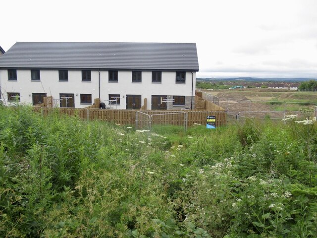
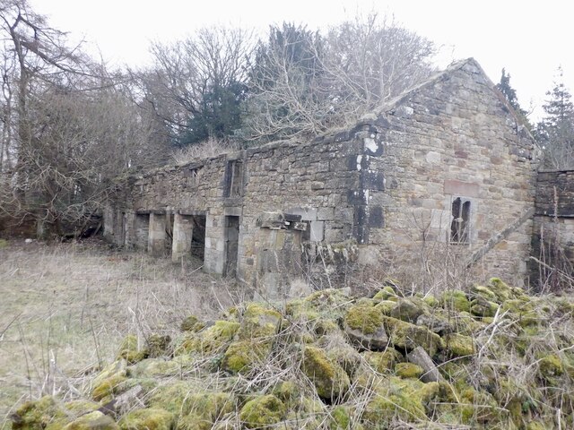
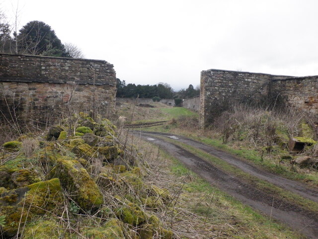
Dalkeith has a rich history that dates back to Roman times, as evidenced by the remains of a Roman fort nearby. The town grew significantly during the 18th and 19th centuries due to the coal mining industry in the area. Many of the original buildings from this era can still be seen today, including the grand Dalkeith Palace, which is now part of the Dalkeith Country Park.

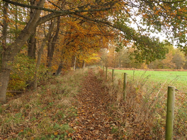
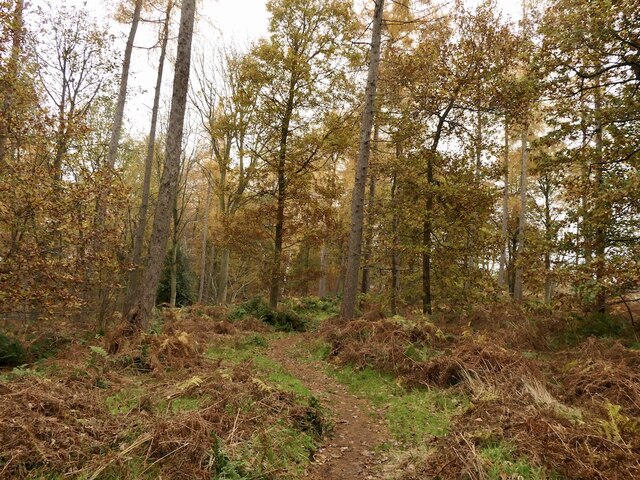
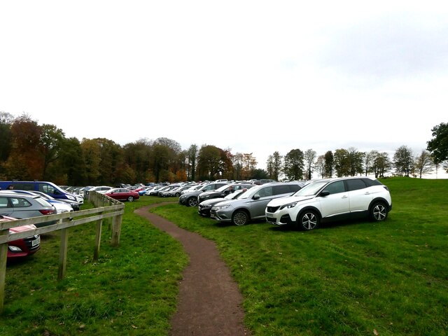
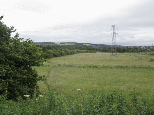
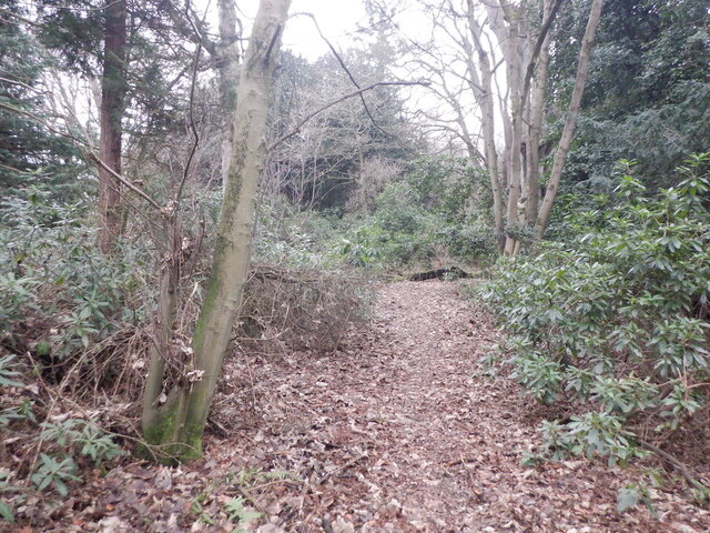
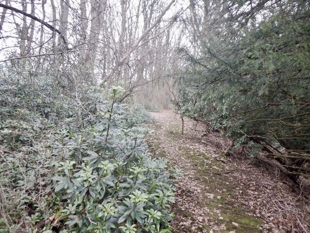
Speaking of the Dalkeith Country Park, it is one of the town's main attractions, offering beautiful scenery, nature trails, and a wide range of recreational activities. The park also hosts various events and festivals throughout the year.

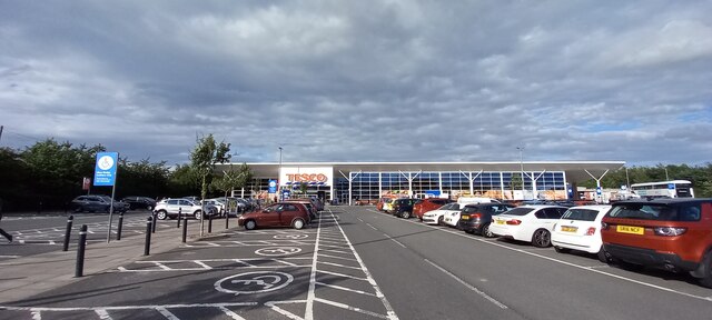
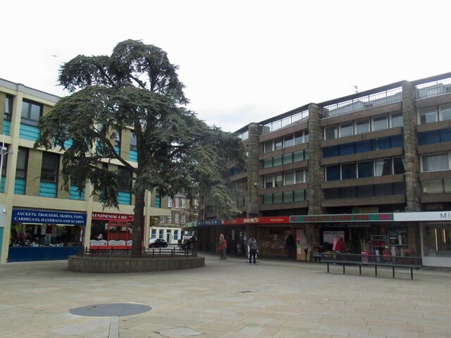
In addition to its historical charm, Dalkeith has a bustling town center with a good selection of shops, restaurants, and cafes. It is also home to several schools, making it an ideal place for families.

Transport links are excellent in Dalkeith, with regular bus services connecting the town to Edinburgh and other nearby towns. The A68 road also runs through the town, providing easy access to the wider region.

Overall, Dalkeith is a vibrant town that seamlessly combines its rich history with modern amenities, making it an appealing place to live or visit.

If you have any feedback on the listing, please let us know in the comments section below.
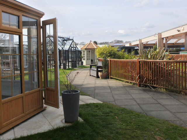
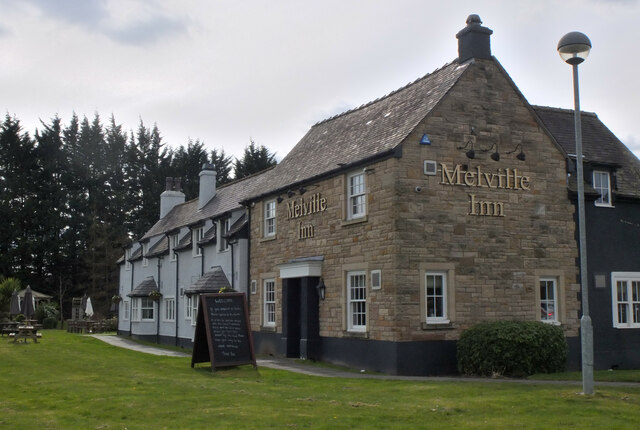
Dalkeith Images

Images are sourced within 2km of 55.888623/-3.080717 or Grid Reference NT3266. Thanks to Geograph Open Source API. All images are credited.

Tesco Superstore, Eskbank
Path, Dalkeith Park Between the woodland along the North Esk and a field.
Path, Dalkeith Park
Between the woodland along the North Esk and a field.
Path, Dalkeith Park
Path, Dalkeith Park
Car park, Dalkeith Park With so many commercial activities taking place here the park has become very busy. As a result attempts have been made to close off parts of the woodland. This is part of a very pronounced trend in the area with constructive methods being used to keep people off land yet staying within the law. Tactics elsewhere have included closing off historic monuments due to crimes that may not have actually happened, closing car parks as well as just pushing your luck with non compliant signage.
Car park, Dalkeith Park
With so many commercial activities taking place here the park has become very busy. As a result attempts have been made to close off parts of the woodland. This is part of a very pronounced trend in the area with constructive methods being used to keep people off land yet staying within the law. Tactics elsewhere have included closing off historic monuments due to crimes that may not have actually happened, closing car parks as well as just pushing your luck with non compliant signage.
Shed display area, Dobbies Garden Centre Lasswade A range of outbuildings from small sheds and greenhouses to opulent summerhouses and home offices.
Shed display area, Dobbies Garden Centre Lasswade
A range of outbuildings from small sheds and greenhouses to opulent summerhouses and home offices.
The Melville Inn near Lasswade Next to Dobbies Garden Centre and close to the A7.
The Melville Inn near Lasswade
Next to Dobbies Garden Centre and close to the A7.
Penicuik to Musselburgh Path Passing the hospital with a building site ahead.
Penicuik to Musselburgh Path
Passing the hospital with a building site ahead.
Building site Ground between Eskbank and Bonnyrigg is being filled in.
Building site
Ground between Eskbank and Bonnyrigg is being filled in.
Empty field It will soon be built upon.
Empty field
It will soon be built upon.
New houses, Bonnyrigg Ground between Eskbank and Bonnyrigg is being filled in.
New houses, Bonnyrigg
Ground between Eskbank and Bonnyrigg is being filled in.
Building site, Bonnyrigg Ground between Eskbank and Bonnyrigg is being filled in.
Building site, Bonnyrigg
Ground between Eskbank and Bonnyrigg is being filled in.
Penicuik to Musselburgh Path Building site on the left.
Penicuik to Musselburgh Path
Building site on the left.
St Johns Church, Dalkeith
Jarnac Court, Dalkeith
Ruin near Melville Castle Beside the site of the gardens, now King's Acre golf.
Ruin near Melville Castle
Beside the site of the gardens, now King's Acre golf.
Former Melville Castle garden Walls near the King's Acre Driving Range on the plateau above Melville Castle.
Former Melville Castle garden
Walls near the King's Acre Driving Range on the plateau above Melville Castle.
Woodland above Melville Castle The usual rhododendrons near a large house.
Woodland above Melville Castle
The usual rhododendrons near a large house.
Woodland above Melville Castle
Show me another place!

Dalkeith is located at Grid Ref: NT3266 (Lat: 55.888623, Lng: -3.080717)

Unitary Authority: Midlothian

Police Authority: The Lothians and Scottish Borders

What 3 Words

///walkway.videos.served. Near Dalkeith, Midlothian

Nearby Locations

Eskbank Dalkeith

Related Wikis

Glenesk railway station

Glenesk railway station served the village of Glenesk, Midothian, Scotland, from 1855 to 1874 on the Dalkeith branch of the Waverley Route. == History... ==

Lasswade Road railway station

Lasswade Road railway station served the village of Lasswade, Midlothian, Scotland from 1843 to 1849 on the Edinburgh and Dalkeith Railway. == History... ==

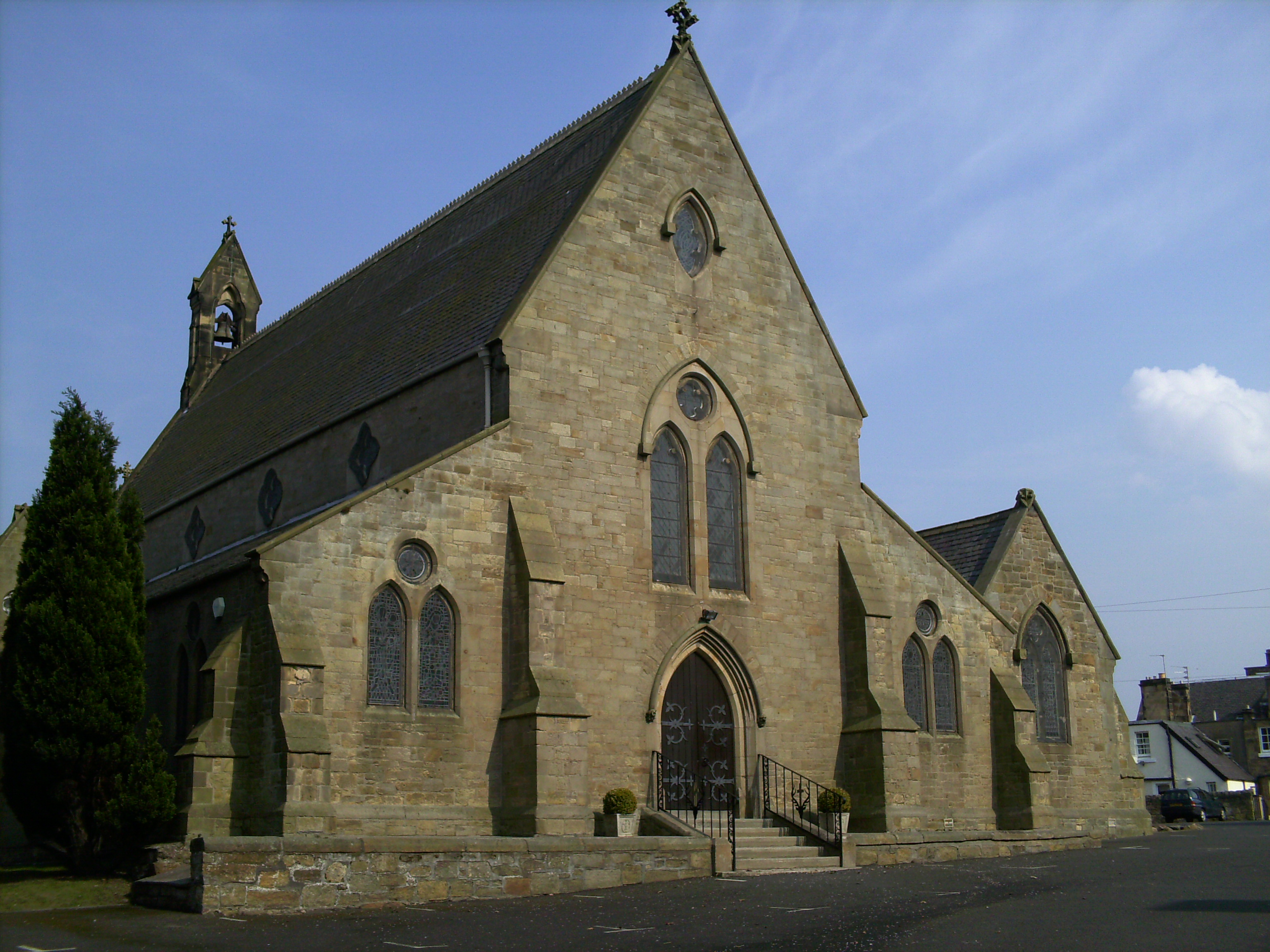
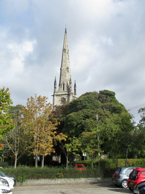
St David's Church, Dalkeith

St David's Church is a Roman Catholic Parish church in Dalkeith, Midlothian. It was founded in 1854 by Cecil Chetwynd Kerr, Marchioness of Lothian. It...

Dalkeith railway station

Dalkeith railway station served the town of Dalkeith, Scotland, from 1838 to 1964 on the Dalkeith branch of the Edinburgh and Dalkeith Railway. == History... ==

Nearby Amenities

Located within 500m of 55.888623,-3.080717
Traffic Signals
Lat/Long: 55.8865027/-3.074635
Hardengreen Junction
Historic Railway: junction
Railway: site
Lat/Long: 55.8852736/-3.0828377
Crossing
Crossing: uncontrolled
Crossing Island: yes
Kerb: lowered
Tactile Paving: yes
Lat/Long: 55.8903078/-3.0777088
Crossing
Crossing: uncontrolled
Crossing Island: yes
Kerb: lowered
Tactile Paving: yes
Lat/Long: 55.8886998/-3.080228
Noexit: yes
Lat/Long: 55.8870939/-3.087134
Eskbank
Place: suburb
Lat/Long: 55.8885421/-3.0805266
Turning Circle
Lat/Long: 55.8852902/-3.0834294
Turning Circle
Lat/Long: 55.8877291/-3.0848861
Traffic Calming: hump
Lat/Long: 55.8851118/-3.076148
Barrier: bollard
Bicycle: yes
Bollard: fixed
Foot: yes
Material: concrete
Lat/Long: 55.8868366/-3.0789439
Post Box
Collection Times: Mo-Fr 17:30; Sa 12:00
Operator: Royal Mail
Post Box Type: pillar
Ref: EH22 240
Royal Cypher: GR
Royal Cypher Wikidata: Q33102273
Lat/Long: 55.8902302/-3.0780483
Post Box
Collection Times: Mo-Fr 09:00; Sa 07:00
Operator: Royal Mail
Post Box Type: wall
Ref: EH22 45D
Royal Cypher: VR
Royal Cypher Wikidata: Q33102356
Lat/Long: 55.8889512/-3.0760374
Shop: car
Lat/Long: 55.891205/-3.0757389
Post Office
Source: OS OpenData StreetView
Wheelchair: yes
Lat/Long: 55.8886033/-3.0824765
Crossing
Crossing: uncontrolled
Kerb: raised
Lat/Long: 55.8894908/-3.0822813
Bus Stop
Glenesk Crescent
Bus: yes
Naptan AdministrativeAreaCode: 130
Naptan Area Name: Midlothian
Naptan AtcoAreaCode: 628
Naptan AtcoCode: 6280326560
Naptan Bearing: NE
Naptan CommonName: Glenesk Crescent
Naptan Indicator: at
Naptan Landmark: Eskbank Toll Roundabout
Naptan LocalityName: Dalkeith
Naptan NaptanCode: 64323492
Naptan NptgLocalityCode: ES000968
Naptan SourceLocalityType: Lo
Naptan StopAreaCode: 628G326560
Naptan StopAreaType: GPBS
Naptan StopArea Name: Glenesk Crescent
Naptan Street: Eskbank Road
Naptan Verified: yes
Public Transport: platform
Shelter: yes
Source: NaPTAN + Survey
Lat/Long: 55.8896667/-3.0789428
Bus Stop
Eskbank Toll
Bench: yes
Bus: yes
Naptan AdministrativeAreaCode: 130
Naptan Area Name: Midlothian
Naptan AtcoAreaCode: 628
Naptan AtcoCode: 6280301100
Naptan Bearing: SW
Naptan CommonName: Eskbank Toll
Naptan Indicator: at
Naptan Landmark: Eskbank Toll Roundabout
Naptan LocalityName: Dalkeith
Naptan NaptanCode: 64323486
Naptan NptgLocalityCode: ES000968
Naptan SourceLocalityType: Lo
Naptan Street: Eskbank Road
Naptan Verified: yes
Public Transport: platform
Shelter: yes
Source: NaPTAN + Survey
Tactile Paving: no
Lat/Long: 55.8887761/-3.0799893
Bus Stop
Eskbank Court
Bin: yes
Bus: yes
Mapillary: 266701911864206
Naptan AdministrativeAreaCode: 130
Naptan Area Name: Midlothian
Naptan AtcoAreaCode: 628
Naptan AtcoCode: 6280327210
Naptan Bearing: NW
Naptan CommonName: Eskbank Court
Naptan Indicator: at
Naptan Landmark: Eskbank Toll
Naptan LocalityName: Eskbank
Naptan NaptanCode: 64329268
Naptan NptgLocalityCode: N0067286
Naptan ShortCommonName: -
Naptan SourceLocalityType: Add
Naptan StopAreaCode: 628G327210
Naptan StopAreaType: GPBS
Naptan StopArea Name: Eskbank Court
Naptan Street: Melville Road
Naptan Verified: yes
Pole: yes
Public Transport: platform
Ref: 64329268
Shelter: no
Source: NaPTAN + Survey
Survey Date: 2019-08-16
Lat/Long: 55.8889516/-3.0813989
Bus Stop
Eskbank Court
Bus: yes
Naptan AdministrativeAreaCode: 130
Naptan Area Name: Midlothian
Naptan AtcoAreaCode: 628
Naptan AtcoCode: 6280300310
Naptan Bearing: SE
Naptan CommonName: Eskbank Court
Naptan Indicator: opp
Naptan Landmark: Eskbank Toll
Naptan LocalityName: Eskbank
Naptan NaptanCode: 64329269
Naptan NptgLocalityCode: N0067286
Naptan ShortCommonName: -
Naptan SourceLocalityType: Add
Naptan StopAreaCode: 628G327210
Naptan StopAreaType: GPBS
Naptan StopArea Name: Eskbank Court
Naptan Street: Melville Road
Naptan Verified: yes
Public Transport: platform
Ref: 64329269
Shelter: no
Source: NaPTAN + Survey
Lat/Long: 55.8892862/-3.0817026
Post Box
Collection Times: Mo-Fr 09:00; Sa 07:00
Operator: Royal Mail
Post Box Type: wall
Ref: EH22 40D
Royal Cypher: EVIIR
Royal Cypher Wikidata: Q33102324
Lat/Long: 55.8857823/-3.0809763
Glen Esk Junction
Alt Name: Glenesk Junction
Historic Railway: junction
Lat/Long: 55.8922843/-3.0829001
Crossing
Button Operated: yes
Crossing: traffic_signals
Crossing Island: no
Tactile Paving: yes
Lat/Long: 55.8865675/-3.0745592
Fuel
Lat/Long: 55.8851414/-3.0851071
Entrance: yes
Lat/Long: 55.8899989/-3.0805434
Shop: car_repair
Lat/Long: 55.8880013/-3.0807323
Eskbank & Dalkeith
Historic Railway: station
Railway: site
Lat/Long: 55.8882421/-3.0828945
Lasswade Road
End Date: 1849
Historic Railway: station
Note: Location not sure, could also be on the other side of the Lasswade Road.
Operator: North British Railway
Railway: site
Start Date: before 1843-06
Website: http://www.disused-stations.org.uk/l/lasswade_road/index.shtml
Wikidata: Q38251764
Wikipedia: en:Lasswade Road railway station
Lat/Long: 55.8888998/-3.0828879
Glenesk Junction
Abandoned Railway: signal_box
Lat/Long: 55.8923017/-3.0828793
Eskbank Trading
Addr City: Dalkeith
Addr Housenumber: 2
Addr Postcode: EH22 3EU
Addr Street: Station Road
Addr Suburb: Eskbank
Brand: Costcutter
Brand Wikidata: Q5175072
Fhrs Id: 158996
Shop: convenience
Source Addr: FHRS Open Data
Lat/Long: 55.8886399/-3.0823143
Kerb: no
Lat/Long: 55.8872431/-3.0824614
Barrier: bollard
Lat/Long: 55.887279/-3.0824858
Addr City: Dalkeith
Addr Housenumber: 3
Addr Street: Lasswade Road
Lat/Long: 55.8885831/-3.0809769
Post Box
Collection Times: Mo-Fr 17:15; Sa 12:00
Operator: Royal Mail
Post Box Type: pillar
Ref: EH22 36
Royal Cypher: scottish_crown
Lat/Long: 55.8886328/-3.0822343
Crossing
Bicycle: no
Crossing: traffic_signals
Crossing Ref: pelican
Lat/Long: 55.8887373/-3.0823011
Bus Stop
Glenesk Crescent
Bus: yes
Naptan AdministrativeAreaCode: 130
Naptan Area Name: Midlothian
Naptan AtcoAreaCode: 628
Naptan AtcoCode: 6280301090
Naptan Bearing: SW
Naptan CommonName: Glenesk Crescent
Naptan Indicator: opp
Naptan Landmark: opp 38
Naptan LocalityName: Dalkeith
Naptan NaptanCode: 64323489
Naptan NptgLocalityCode: ES000968
Naptan SourceLocalityType: Lo
Naptan StopAreaCode: 628G326560
Naptan StopAreaType: GPBS
Naptan StopArea Name: Glenesk Crescent
Naptan Street: Eskbank Road
Naptan Verified: yes
Public Transport: platform
Shelter: no
Source: NaPTAN + Survey
Lat/Long: 55.890412/-3.0773135
Addr City: Dalkeith
Addr Housenumber: 12
Addr Street: Ancrum Road
Addr Suburb: Eskbank
Lat/Long: 55.8867432/-3.0793899
Addr City: Dalkeith
Addr Housename: Elmslee
Addr Housenumber: 12B
Addr Street: Ancrum Road
Addr Suburb: Eskbank
Lat/Long: 55.8866926/-3.0791296
Addr City: Dalkeith
Addr Housenumber: 14
Addr Street: Ancrum Road
Addr Suburb: Eskbank
Lat/Long: 55.8867071/-3.078772
Addr City: Dalkeith
Addr Housenumber: 16
Addr Street: Ancrum Road
Addr Suburb: Eskbank
Lat/Long: 55.886706/-3.0784221
Addr City: Dalkeith
Addr Housenumber: 18
Addr Street: Ancrum Road
Addr Suburb: Eskbank
Lat/Long: 55.8867239/-3.0779178
Addr City: Dalkeith
Addr Housename: Rosegarth
Addr Housenumber: 4
Addr Postcode: EH22 3AJ
Addr Street: Ancrum Road
Addr Suburb: Eskbank
Lat/Long: 55.8866637/-3.080213
Addr City: Dalkeith
Addr Housenumber: 20
Addr Street: Ancrum Bank
Addr Suburb: Eskbank
Lat/Long: 55.8867524/-3.0774
Addr City: Dalkeith
Addr Housenumber: 6
Addr Street: Ancrum Road
Addr Suburb: Eskbank
Lat/Long: 55.8866892/-3.0799431
Addr City: Dalkeith
Addr Housenumber: 8
Addr Street: Ancrum Road
Addr Suburb: Eskbank
Lat/Long: 55.8866984/-3.0798141
Addr City: Dalkeith
Addr Housenumber: 10
Addr Street: Ancrum Road
Addr Suburb: Eskbank
Lat/Long: 55.8867276/-3.0796023
Addr City: Dalkeith
Addr Housenumber: 24
Addr Street: Dalhousie Road
Addr Suburb: Eskbank
Lat/Long: 55.88534/-3.0811012
Crossing
Crossing: traffic_signals
Crossing Island: no
Tactile Paving: yes
Lat/Long: 55.8865877/-3.0748951
Addr Housenumber: 26/1
Addr Street: Hardengreen Industrial Estate
Lat/Long: 55.8842868/-3.0822789
Addr Housenumber: 26/1
Addr Street: Hardengreen Industrial Estate
Lat/Long: 55.8844684/-3.0822771
Addr Housenumber: 26/2
Addr Street: Hardengreen Industrial Estate
Lat/Long: 55.8842845/-3.0825136
Addr Housenumber: 26/2
Addr Street: Hardengreen Industrial Estate
Lat/Long: 55.8844659/-3.0825224
Three Craws
Artwork Type: sculpture
Tourism: artwork
Lat/Long: 55.8887098/-3.0810635
Unicorn
Artwork Type: sculpture
Tourism: artwork
Lat/Long: 55.886546/-3.0739262
Post Box
Collection Times: Mo-Fr 09:00; Sa 07:00
Operator: Royal Mail
Post Box Type: wall
Ref: EH22 30D
Royal Cypher: VR
Royal Cypher Wikidata: Q33102356
Lat/Long: 55.8866344/-3.0746739
Barrier: cycle_barrier
Lat/Long: 55.888844/-3.0825163
Bus Stop
Station Road
Bus: yes
Naptan AdministrativeAreaCode: 130
Naptan Area Name: Midlothian
Naptan AtcoAreaCode: 628
Naptan AtcoCode: 6280301430
Naptan Bearing: SW
Naptan CommonName: Station Road
Naptan Indicator: near
Naptan Landmark: Springfield Home
Naptan LocalityName: Eskbank
Naptan NaptanCode: 64323649
Naptan NptgLocalityCode: N0067286
Naptan SourceLocalityType: Add
Naptan StopAreaCode: 628G326250
Naptan StopAreaType: GPBS
Naptan StopArea Name: Bonnyrigg Road
Naptan Street: Bonnyrigg Road
Naptan Verified: yes
Public Transport: platform
Source: NaPTAN + Survey
Lat/Long: 55.8876583/-3.0816524
Bus Stop
Bonnyrigg Road
Bus: yes
Naptan AdministrativeAreaCode: 130
Naptan Area Name: Midlothian
Naptan AtcoAreaCode: 628
Naptan AtcoCode: 6280326250
Naptan Bearing: NE
Naptan CommonName: Bonnyrigg Road
Naptan Indicator: at 20
Naptan Landmark: Railway Bridge
Naptan LocalityName: Eskbank
Naptan NaptanCode: 64323643
Naptan NptgLocalityCode: N0067286
Naptan SourceLocalityType: Add
Naptan StopAreaCode: 628G326250
Naptan StopAreaType: GPBS
Naptan StopArea Name: Bonnyrigg Road
Naptan Street: Bonnyrigg Road
Naptan Verified: yes
Public Transport: platform
Source: NaPTAN + Survey
Lat/Long: 55.8866705/-3.0832897
Bus Stop
Westfield Park
Bin: yes
Bus: yes
Naptan AdministrativeAreaCode: 130
Naptan Area Name: Midlothian
Naptan AtcoAreaCode: 628
Naptan AtcoCode: 6280326245
Naptan Bearing: NE
Naptan CommonName: Westfield Park
Naptan Indicator: opp
Naptan Landmark: Shorts Garage
Naptan LocalityName: Eskbank
Naptan NaptanCode: 64323653
Naptan NptgLocalityCode: N0067286
Naptan SourceLocalityType: Add
Naptan StopAreaCode: 628G301440
Naptan StopAreaType: GPBS
Naptan StopArea Name: Westfield Park
Naptan Street: Bonnyrigg Road
Naptan Verified: yes
Public Transport: platform
Shelter: yes
Source: NaPTAN + Survey
Lat/Long: 55.8853416/-3.085214
Bus Stop
Westfield Park
Bus: yes
Naptan AdministrativeAreaCode: 130
Naptan Area Name: Midlothian
Naptan AtcoAreaCode: 628
Naptan AtcoCode: 6280301440
Naptan Bearing: SW
Naptan CommonName: Westfield Park
Naptan Indicator: at
Naptan Landmark: Shorts Garage
Naptan LocalityName: Eskbank
Naptan NaptanCode: 64323652
Naptan NptgLocalityCode: N0067286
Naptan SourceLocalityType: Add
Naptan StopAreaCode: 628G301440
Naptan StopAreaType: GPBS
Naptan StopArea Name: Westfield Park
Naptan Street: Bonnyrigg Road
Naptan Verified: yes
Public Transport: platform
Shelter: yes
Source: NaPTAN + Survey
Lat/Long: 55.8851506/-3.0852702
Give Way
Lat/Long: 55.8900752/-3.0782921
Addr City: Dalkeith
Addr Housenumber: 40
Addr Street: Eskbank Road
Addr Suburb: Eskbank
Lat/Long: 55.8899175/-3.0788053
Addr City: Dalkeith
Addr Housenumber: 42
Addr Street: Eskbank Road
Lat/Long: 55.8897469/-3.0791682
Addr City: Dalkeith
Addr Housenumber: 2
Addr Street: Avenue Road
Addr Suburb: Eskbank
Lat/Long: 55.8894324/-3.0797852
Addr City: Dalkeith
Addr Housenumber: 15
Addr Street: Newbattle Road
Lat/Long: 55.8879574/-3.0784531
Addr City: Dalkeith
Addr Housenumber: 6
Addr Street: Waverley Road
Lat/Long: 55.8893814/-3.0769864
Addr City: Dalkeith
Addr Housenumber: 16
Addr Street: Park Road
Lat/Long: 55.8894882/-3.0749611
Stop
Direction: backward
Lat/Long: 55.8900948/-3.0779837
Traffic Calming: hump
Lat/Long: 55.8895511/-3.0769993
Traffic Calming: hump
Lat/Long: 55.8891779/-3.0762887
Addr City: Dalkeith
Addr Housenumber: 22
Addr Street: Park Road
Lat/Long: 55.889934/-3.0741565
Addr City: Dalkeith
Addr Housenumber: 1
Addr Street: Waverley Road
Lat/Long: 55.8895397/-3.0766022
Give Way
Lat/Long: 55.8877834/-3.0783294
Traffic Calming: hump
Lat/Long: 55.8878801/-3.0781557
Traffic Calming: hump
Lat/Long: 55.8881873/-3.0776037
Traffic Calming: hump
Lat/Long: 55.8884345/-3.0771595
Traffic Calming: hump
Lat/Long: 55.8887814/-3.0765361
Traffic Calming: hump
Lat/Long: 55.889129/-3.0759236
Traffic Calming: hump
Lat/Long: 55.8893793/-3.0754713
Traffic Calming: hump
Lat/Long: 55.8897224/-3.0748682
Addr City: Dalkeith
Addr Housenumber: 3
Addr Street: Crame Terrace
Addr Suburb: Eskbank
Lat/Long: 55.8907275/-3.0867029
Addr City: Dalkeith
Addr Housenumber: 1
Addr Street: Crame Terrace
Addr Suburb: Eskbank
Lat/Long: 55.8908534/-3.086733
Addr City: Dalkeith
Addr Housenumber: 1
Addr Street: Martin Place
Addr Suburb: Eskbank
Lat/Long: 55.8894582/-3.0867171
Addr City: Dalkeith
Addr Housenumber: 3
Addr Street: Martin Place
Addr Suburb: Eskbank
Lat/Long: 55.88947/-3.0869766
Addr City: Dalkeith
Addr Housenumber: 5
Addr Street: Martin Place
Addr Suburb: Eskbank
Lat/Long: 55.8894827/-3.0872245
Addr City: Dalkeith
Addr Housenumber: 38
Addr Street: Lasswade Road
Addr Suburb: Eskbank
Lat/Long: 55.889094/-3.087845
Addr City: Dalkeith
Addr Housenumber: 32
Addr Street: Lasswade Road
Addr Suburb: Eskbank
Lat/Long: 55.8889947/-3.0868886
Addr City: Dalkeith
Addr Housenumber: 28
Addr Street: Lasswade Road
Addr Suburb: Eskbank
Lat/Long: 55.8889152/-3.0863157
Addr City: Dalkeith
Addr Housenumber: 24
Addr Street: Lasswade Road
Addr Suburb: Eskbank
Lat/Long: 55.8889221/-3.0856708
Addr City: Dalkeith
Addr Housenumber: 18
Addr Street: Lasswade Road
Addr Suburb: Eskbank
Lat/Long: 55.8889618/-3.0848447
Addr City: Dalkeith
Addr Housenumber: 16
Addr Street: Lasswade Road
Addr Suburb: Eskbank
Lat/Long: 55.8889876/-3.0844852
Addr City: Dalkeith
Addr Housenumber: 13
Addr Street: Weir Court
Addr Suburb: Eskbank
Lat/Long: 55.8896103/-3.0848092
Addr City: Dalkeith
Addr Housenumber: 8
Addr Street: Lasswade Road
Addr Suburb: Eskbank
Lat/Long: 55.8889576/-3.0832164
Give Way
Lat/Long: 55.8865392/-3.0858001
Give Way
Direction: forward
Lat/Long: 55.888802/-3.0837581
Give Way
Lat/Long: 55.8881606/-3.0838429
Give Way
Lat/Long: 55.8880895/-3.0849538
Give Way
Lat/Long: 55.8879415/-3.0875603
Give Way
Lat/Long: 55.888908/-3.0876383
Give Way
Lat/Long: 55.8863004/-3.0851372
Barrier: entrance
Lat/Long: 55.890901/-3.0876169
Crossing
Crossing: traffic_signals
Crossing Island: no
Kerb: lowered
Tactile Paving: yes
Lat/Long: 55.8899291/-3.0784353
Give Way
Direction: forward
Lat/Long: 55.8867056/-3.0806763
Give Way
Direction: forward
Lat/Long: 55.8866171/-3.0808483
Addr City: Dalkeith
Addr Housenumber: 33
Addr Street: Dalhousie Road
Addr Suburb: Eskbank
Lat/Long: 55.8865134/-3.0806118
Addr City: Dalkeith
Addr Housenumber: 14
Addr Street: Dalhousie Road
Addr Suburb: Eskbank
Lat/Long: 55.8862636/-3.0810058
Addr City: Dalkeith
Addr Housenumber: 16
Addr Street: Dalhousie Road
Addr Suburb: Eskbank
Lat/Long: 55.8862408/-3.0810088
Addr City: Dalkeith
Addr Housenumber: 18
Addr Street: Dalhousie Road
Addr Suburb: Eskbank
Lat/Long: 55.8860522/-3.0810335
Addr City: Dalkeith
Addr Housenumber: 20
Addr Street: Dalhousie Road
Addr Suburb: Eskbank
Lat/Long: 55.8860304/-3.0810363
Addr City: Dalkeith
Addr Housenumber: 37
Addr Street: Dalhousie Road
Addr Suburb: Eskbank
Lat/Long: 55.8862131/-3.0806439
Addr City: Dalkeith
Addr Housenumber: 39
Addr Street: Dalhousie Road
Addr Suburb: Eskbank
Lat/Long: 55.8861958/-3.0806462
Addr City: Dalkeith
Addr Housenumber: 41
Addr Street: Dalhousie Road
Addr Suburb: Eskbank
Lat/Long: 55.8860694/-3.080663
Addr City: Dalkeith
Addr Housenumber: 45
Addr Street: Dalhousie Road
Addr Suburb: Eskbank
Lat/Long: 55.885879/-3.080681
Addr City: Dalkeith
Addr Housenumber: 2
Addr Street: Melville Terrace
Addr Suburb: Eskbank
Lat/Long: 55.8857391/-3.0813022
Addr City: Dalkeith
Addr Housenumber: 1
Addr Street: Melville Terrace
Addr Suburb: Eskbank
Lat/Long: 55.8857337/-3.0811728
Addr City: Dalkeith
Addr Housenumber: 47
Addr Street: Dalhousie Road
Addr Suburb: Eskbank
Lat/Long: 55.8856055/-3.0807201
Addr City: Dalkeith
Addr Housenumber: 22
Addr Street: Dalhousie Road
Addr Suburb: Eskbank
Lat/Long: 55.8855115/-3.0810905
Addr City: Dalkeith
Addr Housenumber: 26
Addr Street: Dalhousie Road
Addr Suburb: Eskbank
Lat/Long: 55.8852666/-3.0811645
Addr City: Dalkeith
Addr Housenumber: 28
Addr Street: Dalhousie Road
Addr Suburb: Eskbank
Lat/Long: 55.8850477/-3.081194
Addr City: Dalkeith
Addr Housenumber: 13
Addr Street: Dalhousie Crescent
Addr Suburb: Eskbank
Lat/Long: 55.884446/-3.0796155
Addr City: Dalkeith
Addr Housenumber: 12
Addr Street: Dalhousie Crescent
Addr Suburb: Eskbank
Lat/Long: 55.8845854/-3.0793348
Addr City: Dalkeith
Addr Housenumber: 11
Addr Street: Dalhousie Crescent
Addr Suburb: Eskbank
Lat/Long: 55.8846606/-3.0790045
Addr City: Dalkeith
Addr Housenumber: 10
Addr Street: Dalhousie Crescent
Addr Suburb: Eskbank
Lat/Long: 55.8847308/-3.0787935
Addr City: Dalkeith
Addr Housenumber: 9
Addr Street: Dalhousie Crescent
Addr Suburb: Eskbank
Lat/Long: 55.8848035/-3.0784751
Addr City: Dalkeith
Addr Housenumber: 8
Addr Street: Dalhousie Crescent
Addr Suburb: Eskbank
Lat/Long: 55.88483/-3.0778791
Addr City: Dalkeith
Addr Housenumber: 7
Addr Street: Dalhousie Crescent
Addr Suburb: Eskbank
Lat/Long: 55.8849459/-3.0776813
Addr City: Dalkeith
Addr Housenumber: 6
Addr Street: Dalhousie Crescent
Addr Suburb: Eskbank
Lat/Long: 55.8850368/-3.078434
Addr City: Dalkeith
Addr Housenumber: 5
Addr Street: Dalhousie Crescent
Addr Suburb: Eskbank
Lat/Long: 55.8849712/-3.0787336
Addr City: Dalkeith
Addr Housenumber: 4
Addr Street: Dalhousie Crescent
Addr Suburb: Eskbank
Lat/Long: 55.8849074/-3.0789486
Addr City: Dalkeith
Addr Housenumber: 3
Addr Street: Dalhousie Crescent
Addr Suburb: Eskbank
Lat/Long: 55.8848764/-3.079279
Addr City: Dalkeith
Addr Housenumber: 2
Addr Street: Dalhousie Crescent
Addr Suburb: Eskbank
Lat/Long: 55.884798/-3.0795009
Addr City: Dalkeith
Addr Housenumber: 1
Addr Street: Dalhousie Crescent
Addr Suburb: Eskbank
Lat/Long: 55.8846542/-3.0799731
Lanes: 1
Traffic Calming: choker
Lat/Long: 55.8847638/-3.0791438
Addr City: Dalkeith
Addr Housenumber: 32
Addr Street: Dalhousie Road
Addr Suburb: Eskbank
Lat/Long: 55.8842886/-3.0802479
Addr City: Dalkeith
Addr Housenumber: 34
Addr Street: Dalhousie Road
Addr Suburb: Eskbank
Lat/Long: 55.8842154/-3.0801725
Addr City: Dalkeith
Addr Housenumber: 18
Addr Street: Abbey Road
Lat/Long: 55.8869691/-3.0743116
Addr City: Dalkeith
Addr Housenumber: 17
Addr Street: Abbey Road
Lat/Long: 55.8870741/-3.0741593
Addr City: Dalkeith
Addr Housenumber: 16
Addr Street: Abbey Road
Lat/Long: 55.8871837/-3.0740005
Addr City: Dalkeith
Addr Housenumber: 15
Addr Street: Abbey Road
Lat/Long: 55.8872884/-3.0738436
Addr City: Dalkeith
Addr Housenumber: 14
Addr Street: Abbey Road
Lat/Long: 55.8873871/-3.0737706
Addr City: Dalkeith
Addr Housenumber: 13
Addr Street: Abbey Road
Lat/Long: 55.887502/-3.0736036
Addr City: Dalkeith
Addr Housenumber: 12
Addr Street: Abbey Road
Lat/Long: 55.8875587/-3.0734678
Addr City: Dalkeith
Addr Housenumber: 11
Addr Street: Abbey Road
Lat/Long: 55.8876513/-3.0734125
Addr City: Dalkeith
Addr Housenumber: 10
Addr Street: Abbey Road
Lat/Long: 55.8877619/-3.0732635
Addr City: Dalkeith
Addr Housenumber: 9
Addr Street: Abbey Road
Lat/Long: 55.8877997/-3.0731237
Addr City: Dalkeith
Addr Housenumber: 8
Addr Street: Abbey Road
Lat/Long: 55.887825/-3.0730939
Addr City: Dalkeith
Addr Housenumber: 7
Addr Street: Abbey Road
Lat/Long: 55.8879239/-3.07297
Addr City: Dalkeith
Addr Housenumber: 6
Addr Street: Abbey Road
Lat/Long: 55.8879813/-3.0728956
Addr City: Dalkeith
Addr Housenumber: 5
Addr Street: Abbey Road
Lat/Long: 55.8880888/-3.0727585
Give Way
Direction: backward
Lat/Long: 55.8847096/-3.080513
Give Way
Direction: forward
Lat/Long: 55.8844177/-3.0800591
Barrier: kerb
Lat/Long: 55.8889854/-3.0880503
Barrier: cycle_barrier
Lat/Long: 55.8890159/-3.0880708
Addr City: Dalkeith
Addr Housenumber: 36
Addr Street: Lasswade Road
Addr Suburb: Eskbank
Lat/Long: 55.8890814/-3.0875318
Addr City: Dalkeith
Addr Housenumber: 34
Addr Street: Lasswade Road
Addr Suburb: Eskbank
Lat/Long: 55.8890418/-3.0872044
Addr City: Dalkeith
Addr Housenumber: 30
Addr Street: Lasswade Road
Addr Suburb: Eskbank
Lat/Long: 55.8889511/-3.0866191
Addr City: Dalkeith
Addr Housenumber: 26
Addr Street: Lasswade Road
Addr Suburb: Eskbank
Lat/Long: 55.8888919/-3.0859421
Addr City: Dalkeith
Addr Housenumber: 22
Addr Street: Lasswade Road
Addr Suburb: Eskbank
Lat/Long: 55.8889314/-3.0854111
Addr City: Dalkeith
Addr Housenumber: 20
Addr Street: Lasswade Road
Addr Suburb: Eskbank
Lat/Long: 55.8889488/-3.085116
Addr City: Dalkeith
Addr Housenumber: 39
Addr Street: Lasswade Road
Addr Suburb: Eskbank
Lat/Long: 55.8888539/-3.0881733
Addr City: Dalkeith
Addr Housenumber: 37
Addr Street: Lasswade Road
Addr Suburb: Eskbank
Lat/Long: 55.8888421/-3.0878098
Addr City: Dalkeith
Addr Housenumber: 35
Addr Street: Lasswade Road
Addr Suburb: Eskbank
Lat/Long: 55.8888133/-3.087401
Addr City: Dalkeith
Addr Housenumber: 33
Addr Street: Lasswade Road
Addr Suburb: Eskbank
Lat/Long: 55.8887729/-3.0870465
Addr City: Dalkeith
Addr Housenumber: 31
Addr Street: Lasswade Road
Addr Suburb: Eskbank
Lat/Long: 55.8887206/-3.086747
Addr City: Dalkeith
Addr Housenumber: 29
Addr Street: Lasswade Road
Addr Suburb: Eskbank
Lat/Long: 55.8886724/-3.0864235
Addr City: Dalkeith
Addr Housenumber: 25
Addr Street: Lasswade Road
Addr Suburb: Eskbank
Lat/Long: 55.8886445/-3.0858065
Addr City: Dalkeith
Addr Housenumber: 27
Addr Street: Lasswade Road
Addr Suburb: Eskbank
Lat/Long: 55.8886633/-3.0861069
Addr City: Dalkeith
Addr Housenumber: 23
Addr Street: Lasswade Road
Addr Suburb: Eskbank
Lat/Long: 55.8886934/-3.0852887
Addr City: Dalkeith
Addr Housenumber: 21
Addr Street: Lasswade Road
Addr Suburb: Eskbank
Lat/Long: 55.8887095/-3.0848087
Addr City: Dalkeith
Addr Housenumber: 19
Addr Street: Lasswade Road
Addr Suburb: Eskbank
Addr Unit: Oakenend
Lat/Long: 55.8886959/-3.0844404
Addr City: Dalkeith
Addr Housenumber: 10
Addr Street: Lasswade Road
Addr Suburb: Eskbank
Lat/Long: 55.8889642/-3.0834749
Addr City: Dalkeith
Addr Housenumber: 12
Addr Street: Lasswade Road
Addr Suburb: Eskbank
Lat/Long: 55.8889816/-3.0837385
Addr City: Dalkeith
Addr Housenumber: 14
Addr Street: Lasswade Road
Addr Suburb: Eskbank
Lat/Long: 55.8890031/-3.0839705
Give Way
Direction: forward
Lat/Long: 55.88889/-3.0842588
Addr City: Dalkeith
Addr Housenumber: 17
Addr Street: Lasswade Road
Addr Suburb: Eskbank
Lat/Long: 55.8887321/-3.0841467
Addr City: Dalkeith
Addr Housenumber: 15
Addr Street: Lasswade Road
Addr Suburb: Eskbank
Lat/Long: 55.8886015/-3.0834863
Addr City: Dalkeith
Addr Housenumber: 13
Addr Street: Lasswade Road
Addr Suburb: Eskbank
Lat/Long: 55.8886025/-3.0832806
Addr City: Dalkeith
Addr Housenumber: 1
Addr Street: Avenue Road
Addr Suburb: Eskbank
Lat/Long: 55.8891172/-3.0799549
Addr City: Dalkeith
Addr Housenumber: 46
Addr Street: Eskbank Road
Addr Suburb: Eskbank
Lat/Long: 55.8890887/-3.0799972
Addr City: Dalkeith
Addr Housenumber: 44
Addr Street: Eskbank Road
Addr Suburb: Eskbank
Lat/Long: 55.8895067/-3.0793393
Addr City: Dalkeith
Addr Housenumber: 38
Addr Street: Eskbank Road
Addr Suburb: Eskbank
Lat/Long: 55.8904181/-3.078272
Addr City: Dalkeith
Addr Housenumber: 47
Addr Street: Eskbank Road
Addr Suburb: Eskbank
Lat/Long: 55.8900823/-3.0772731
Addr City: Dalkeith
Addr Housenumber: 22
Lat/Long: 55.8888262/-3.0823832
Addr City: Dalkeith
Addr Housenumber: 21
Lat/Long: 55.8888178/-3.0822838
Give Way
Direction: forward
Lat/Long: 55.88926/-3.0819319
Addr City: Dalkeith
Addr Housenumber: 2
Addr Postcode: EH22 3EU
Addr Street: Station Road
Addr Suburb: Eskbank
Lat/Long: 55.8886569/-3.0822334
Entrance: staircase
Lat/Long: 55.8887648/-3.0818701
Entrance: staircase
Lat/Long: 55.8887494/-3.0816704
Addr City: Dalkeith
Addr Housename: Bernafay
Addr Housenumber: 9
Addr Street: Lasswade Road
Lat/Long: 55.8884861/-3.0815806
Crossing
Crossing: uncontrolled
Crossing Island: yes
Kerb: lowered
Tactile Paving: yes
Lat/Long: 55.8882982/-3.0804709
Crossing
Crossing: uncontrolled
Crossing Island: yes
Kerb: lowered
Tactile Paving: yes
Lat/Long: 55.8883768/-3.0807176
Crossing
Crossing: uncontrolled
Crossing Island: yes
Kerb: lowered
Tactile Paving: yes
Lat/Long: 55.8886215/-3.0809027
Lasswade Road
Location: indoor
Operator: SP Distribution
Power: substation
Substation: minor_distribution
Lat/Long: 55.8884819/-3.0814055
Addr City: Dalkeith
Addr Housenumber: 5
Addr Street: Lasswade Road
Lat/Long: 55.8885872/-3.0810298
Addr City: Dalkeith
Addr Housenumber: 1
Addr Street: Lasswade Road
Lat/Long: 55.8885786/-3.0809189
Eskbank Antiques
Addr City: Dalkeith
Addr Housenumber: 1
Addr Street: Lasswade Road
Shop: antiques
Lat/Long: 55.8885556/-3.0809382
Crossing
Crossing: uncontrolled
Crossing Island: yes
Kerb: lowered
Tactile Paving: yes
Lat/Long: 55.8884545/-3.0801831
Stop
Direction: forward
Lat/Long: 55.8886162/-3.0808496
Crossing
Crossing: uncontrolled
Crossing Island: yes
Kerb: lowered
Tactile Paving: yes
Lat/Long: 55.8887237/-3.0808201
Addr City: Dalkeith
Addr Housenumber: 50
Addr Street: Eskbank Road
Lat/Long: 55.8888294/-3.0803492
Addr City: Dalkeith
Addr Housenumber: 48
Addr Street: Eskbank Road
Lat/Long: 55.8889689/-3.0802741
Addr City: Dalkeith
Addr Housenumber: 59
Addr Street: Eskbank Road
Lat/Long: 55.8888492/-3.0795793
Addr City: Dalkeith
Addr Housenumber: 57
Addr Street: Eskbank Road
Lat/Long: 55.8890419/-3.0792726
Crossing
Crossing: uncontrolled
Crossing Island: yes
Kerb: lowered
Tactile Paving: yes
Lat/Long: 55.8892201/-3.079412
Addr City: Dalkeith
Addr Housename: Fala House
Addr Housenumber: 55
Addr Street: Eskbank Road
Lat/Long: 55.8891638/-3.0790918
Addr City: Dalkeith
Addr Housenumber: 53
Addr Street: Eskbank Road
Lat/Long: 55.889425/-3.0783999
Addr City: Dalkeith
Addr Housenumber: 51
Addr Street: Eskbank Road
Lat/Long: 55.8897389/-3.0783099
Addr City: Dalkeith
Addr Housename: The Birks
Addr Housenumber: 49
Addr Street: Eskbank Road
Lat/Long: 55.889859/-3.0780273
Barrier: kerb
Wheelchair: no
Lat/Long: 55.88973/-3.0822769
Barrier: kerb
Wheelchair: no
Lat/Long: 55.8895193/-3.0822508
Addr City: Dalkeith
Addr Housenumber: 14
Addr Street: Melville Road
Lat/Long: 55.8895464/-3.082137
Addr City: Dalkeith
Addr Housenumber: 12
Addr Street: Melville Road
Lat/Long: 55.8893188/-3.081468
Addr City: Dalkeith
Addr Housenumber: 10
Addr Street: Melville Road
Lat/Long: 55.8890836/-3.0811238
Addr City: Dalkeith
Addr Housenumber: 8
Addr Street: Melville Road
Lat/Long: 55.8889498/-3.0809235
Addr City: Dalkeith
Addr Housenumber: 6
Addr Street: Melville Road
Lat/Long: 55.8889044/-3.0808264
Addr City: Dalkeith
Addr Housenumber: 4
Addr Street: Melville Road
Lat/Long: 55.8888231/-3.0806436
Addr City: Dalkeith
Addr Housenumber: 2
Addr Street: Melville Road
Lat/Long: 55.8887801/-3.0805536
Location: outdoor
Power: substation
Substation: minor_distribution
Lat/Long: 55.8895947/-3.0830906
Barrier: kerb
Wheelchair: no
Lat/Long: 55.889463/-3.0823249
Addr City: Dalkeith
Addr Housenumber: 39
Addr Street: Eskbank Court
Level: 2
Lat/Long: 55.8892444/-3.0821047
Addr City: Dalkeith
Addr Housenumber: 38
Addr Street: Eskbank Court
Lat/Long: 55.8892366/-3.0821688
Addr City: Dalkeith
Addr Housenumber: 37
Addr Street: Eskbank Court
Lat/Long: 55.8892882/-3.0823474
Addr City: Dalkeith
Addr Housenumber: 36
Addr Street: Eskbank Court
Level: 2
Lat/Long: 55.8893224/-3.0823832
Addr City: Dalkeith
Addr Housenumber: 35
Addr Street: Eskbank Court
Lat/Long: 55.8893808/-3.0824249
Addr City: Dalkeith
Addr Housenumber: 34
Addr Street: Eskbank Court
Lat/Long: 55.8893079/-3.0824427
Addr City: Dalkeith
Addr Housenumber: 33
Addr Street: Eskbank Court
Lat/Long: 55.8892479/-3.0824328
Addr City: Dalkeith
Addr Housenumber: 32
Addr Street: Eskbank Court
Lat/Long: 55.8892301/-3.0824371
Addr City: Dalkeith
Addr Housenumber: 31
Addr Street: Eskbank Court
Lat/Long: 55.8891753/-3.0824505
Addr City: Dalkeith
Addr Housenumber: 30
Addr Street: Eskbank Court
Lat/Long: 55.8891575/-3.0824549
Addr City: Dalkeith
Addr Housenumber: 29
Addr Street: Eskbank Court
Lat/Long: 55.889105/-3.0824677
Addr City: Dalkeith
Addr Housenumber: 28
Addr Street: Eskbank Court
Lat/Long: 55.8890848/-3.0824726
Addr City: Dalkeith
Addr Housenumber: 27
Addr Street: Eskbank Court
Lat/Long: 55.8890306/-3.0824858
Addr City: Dalkeith
Addr Housenumber: 26
Addr Street: Eskbank Court
Lat/Long: 55.8890135/-3.08249
Addr City: Dalkeith
Addr Housenumber: 25
Addr Street: Eskbank Court
Lat/Long: 55.8889589/-3.0825033
Addr City: Dalkeith
Addr Housenumber: 24
Addr Street: Eskbank Court
Lat/Long: 55.8889426/-3.0825073
Addr City: Dalkeith
Addr Housenumber: 23
Addr Street: Eskbank Court
Lat/Long: 55.8888938/-3.0825439
Entrance: staircase
Lat/Long: 55.8889996/-3.0817014
Entrance: staircase
Lat/Long: 55.8889621/-3.0814854
Entrance: staircase
Lat/Long: 55.8889184/-3.0815593
Entrance: staircase
Lat/Long: 55.8888093/-3.0816557
Entrance: staircase
Lat/Long: 55.8888247/-3.0818562
Addr City: Dalkeith
Addr Housenumber: 1
Addr Street: Eskbank Court
Lat/Long: 55.8891308/-3.0819309
Addr City: Dalkeith
Addr Housenumber: 2
Addr Street: Eskbank Court
Level: 2
Lat/Long: 55.889169/-3.0819286
Addr City: Dalkeith
Addr Housenumber: 1
Addr Street: Newbattle Road
Lat/Long: 55.8885067/-3.0798528
Addr City: Dalkeith
Addr Housenumber: 3
Addr Street: Newbattle Road
Lat/Long: 55.8884138/-3.0796146
Addr City: Dalkeith
Addr Housenumber: 5
Addr Street: Newbattle Road
Lat/Long: 55.8882805/-3.0792914
Addr City: Dalkeith
Addr Housenumber: 9
Addr Street: Newbattle Road
Lat/Long: 55.8881687/-3.0790073
Addr City: Dalkeith
Addr Housenumber: 13
Addr Street: Newbattle Road
Lat/Long: 55.8881144/-3.0788803
Addr City: Dalkeith
Addr Housename: Appin Lodge
Addr Housenumber: 6
Addr Street: Newbattle Road
Lat/Long: 55.8879845/-3.0795044
Addr City: Dalkeith
Addr Housename: Hazelbank
Addr Housenumber: 8
Addr Street: Newbattle Road
Lat/Long: 55.8878105/-3.0790841
Addr City: Dalkeith
Addr Housenumber: 10
Addr Street: Newbattle Road
Lat/Long: 55.8876878/-3.0787087
Addr City: Dalkeith
Addr Housenumber: 12
Addr Street: Newbattle Road
Lat/Long: 55.8876603/-3.0786358
Addr City: Dalkeith
Addr Housenumber: 14
Addr Street: Newbattle Road
Lat/Long: 55.8875404/-3.0782823
Addr City: Dalkeith
Addr Housenumber: 17
Addr Street: Newbattle Road
Lat/Long: 55.8877213/-3.0779654
Addr City: Dalkeith
Addr Housenumber: 4
Addr Street: Eskbank Terrace
Lat/Long: 55.8875602/-3.0767888
Addr City: Dalkeith
Addr Housenumber: 3
Addr Street: Eskbank Terrace
Lat/Long: 55.8876939/-3.0765678
Addr City: Dalkeith
Addr Housenumber: 2
Addr Street: Eskbank Terrace
Lat/Long: 55.8878304/-3.0763291
Addr City: Dalkeith
Addr Housenumber: 1
Addr Street: Eskbank Terrace
Lat/Long: 55.8879617/-3.0759784
Addr City: Dalkeith
Addr Housenumber: 19
Addr Street: Newbattle Road
Lat/Long: 55.8875217/-3.0772911
Addr City: Dalkeith
Addr Housenumber: 23
Addr Street: Newbattle Road
Lat/Long: 55.8871049/-3.0758066
Addr City: Dalkeith
Addr Housenumber: 21
Addr Street: Newbattle Road
Lat/Long: 55.8871154/-3.0761327
Bus Stop
Ancrum Bank
Bench: no
Bin: no
Bus: yes
Naptan AtcoCode: 6280326530
Naptan Bearing: NW
Naptan CommonName: Ancrum Bank
Naptan Indicator: at
Naptan NaptanCode: 64323946
Naptan Street: Newbattle Road
Passenger Information Display: no
Public Transport: platform
Shelter: yes
Lat/Long: 55.8869758/-3.0762121
Bus Stop
Ancrum Bank
Bench: no
Bin: no
Bus: yes
Naptan AtcoCode: 6280301110
Naptan Bearing: SE
Naptan CommonName: Ancrum Bank
Naptan Indicator: opp
Naptan NaptanCode: 64323945
Naptan Street: Newbattle Road
Passenger Information Display: no
Public Transport: platform
Ref: 6280301110
Shelter: yes
Source: NaPTAN
Lat/Long: 55.8869997/-3.0760566
Addr City: Dalkeith
Addr Housenumber: 13
Addr Street: St Davids Terrace
Lat/Long: 55.8866907/-3.0735207
Addr City: Dalkeith
Addr Housenumber: 12
Addr Street: St Davids Terrace
Lat/Long: 55.886987/-3.0733795
Addr City: Dalkeith
Addr Housenumber: 11
Addr Street: St Davids Terrace
Lat/Long: 55.8870817/-3.0732277
Bus Stop
Eskbank Toll
Bench: yes
Bus: yes
Naptan AtcoCode: 6280301105
Naptan Bearing: SE
Naptan CommonName: Eskbank Toll
Naptan Indicator: SE-bound
Naptan NaptanCode: 64323646
Naptan Street: Newbattle Road
Public Transport: platform
Ref: 6280301105
Shelter: yes
Source: NaPTAN
Tactile Paving: no
Lat/Long: 55.8881412/-3.0792706
Addr City: Dalkeith
Addr Housenumber: 6
Addr Street: Avenue Road
Addr Suburb: Eskbank
Lat/Long: 55.8896397/-3.0807176
Addr City: Dalkeith
Addr Housenumber: 3
Addr Street: Avenue Road
Addr Suburb: Eskbank
Lat/Long: 55.8893569/-3.0803126
Addr City: Dalkeith
Addr Housenumber: 5
Addr Street: Avenue Road
Addr Suburb: Eskbank
Lat/Long: 55.889372/-3.080369
Addr City: Dalkeith
Addr Housenumber: 7
Addr Street: Avenue Road
Addr Suburb: Eskbank
Lat/Long: 55.889413/-3.0805221
Addr City: Dalkeith
Addr Housenumber: 9
Addr Street: Avenue Road
Addr Suburb: Eskbank
Lat/Long: 55.8894284/-3.0805794
Addr City: Dalkeith
Addr Housenumber: 4
Addr Street: Avenue Road
Addr Suburb: Eskbank
Lat/Long: 55.8895053/-3.0803391
Addr City: Dalkeith
Addr Housenumber: 21
Addr Street: Glenesk Crescent
Addr Suburb: Eskbank
Lat/Long: 55.8895991/-3.0803594
Addr City: Dalkeith
Addr Housenumber: 19
Addr Street: Glenesk Crescent
Addr Suburb: Eskbank
Lat/Long: 55.8896418/-3.0802786
Addr City: Dalkeith
Addr Housenumber: 17
Addr Street: Glenesk Crescent
Addr Suburb: Eskbank
Lat/Long: 55.8896575/-3.0802516
Addr City: Dalkeith
Addr Housenumber: 15
Addr Street: Glenesk Crescent
Addr Suburb: Eskbank
Lat/Long: 55.8897258/-3.0801339
Addr City: Dalkeith
Addr Housenumber: 13
Addr Street: Glenesk Crescent
Addr Suburb: Eskbank
Lat/Long: 55.8897418/-3.0801062
Addr City: Dalkeith
Addr Housenumber: 11
Addr Street: Glenesk Crescent
Addr Suburb: Eskbank
Lat/Long: 55.8898082/-3.0799919
Addr City: Dalkeith
Addr Housenumber: 5
Addr Street: Glenesk Crescent
Addr Suburb: Eskbank
Lat/Long: 55.88983/-3.0799543
Addr City: Dalkeith
Addr Housenumber: 3
Addr Street: Glenesk Crescent
Addr Suburb: Eskbank
Lat/Long: 55.8898946/-3.0798429
Addr City: Dalkeith
Addr Housenumber: 1
Addr Street: Glenesk Crescent
Addr Suburb: Eskbank
Lat/Long: 55.8898996/-3.0798344
Addr City: Dalkeith
Addr Housenumber: 7,9
Addr Street: Glenesk Crescent
Addr Suburb: Eskbank
Lat/Long: 55.8898187/-3.0799738
Addr City: Dalkeith
Addr Housenumber: 12
Addr Street: Glenesk Crescent
Addr Suburb: Eskbank
Lat/Long: 55.8903476/-3.0793458
Addr City: Dalkeith
Addr Housenumber: 10
Addr Street: Glenesk Crescent
Addr Suburb: Eskbank
Lat/Long: 55.8903527/-3.0793009
Addr City: Dalkeith
Addr Housenumber: 8
Addr Street: Glenesk Crescent
Addr Suburb: Eskbank
Lat/Long: 55.8903714/-3.07913
Addr City: Dalkeith
Addr Housenumber: 6
Addr Street: Glenesk Crescent
Addr Suburb: Eskbank
Lat/Long: 55.8903746/-3.0790872
Addr City: Dalkeith
Addr Housenumber: 4
Addr Street: Glenesk Crescent
Addr Suburb: Eskbank
Lat/Long: 55.8903797/-3.0789083
Addr City: Dalkeith
Addr Housenumber: 2
Addr Street: Glenesk Crescent
Addr Suburb: Eskbank
Lat/Long: 55.8903805/-3.0788636
Glenesk Crescent
Location: indoor
Operator: SP Distribution
Power: substation
Substation: minor_distribution
Lat/Long: 55.8901072/-3.0784752
Addr City: Dalkeith
Addr Housenumber: 2
Addr Street: Waverley Road
Lat/Long: 55.8894877/-3.0772167
Addr City: Dalkeith
Addr Housename: Rosetta
Addr Housenumber: 4
Addr Street: Waverley Road
Lat/Long: 55.8894293/-3.0771545
Addr City: Dalkeith
Addr Housename: Ivy Lodge
Addr Housenumber: 8
Addr Street: Waverley Road
Lat/Long: 55.8892554/-3.0767594
Addr City: Dalkeith
Addr Housenumber: 5
Addr Street: Waverley Road
Lat/Long: 55.889271/-3.076106
Addr City: Dalkeith
Addr Housenumber: 3
Addr Street: Waverley Road
Lat/Long: 55.8893946/-3.0763311
Addr City: Dalkeith
Addr Housename: Harford House
Addr Housenumber: 15
Addr Street: Park Road
Lat/Long: 55.8892823/-3.0759626
Addr City: Dalkeith
Addr Housenumber: 14A
Addr Street: Park Road
Lat/Long: 55.8893116/-3.0751947
Addr City: Dalkeith
Addr Housenumber: 18
Addr Street: Park Road
Lat/Long: 55.8895728/-3.0748079
Addr City: Dalkeith
Addr Housenumber: 20
Addr Street: Park Road
Lat/Long: 55.8898045/-3.0743614
Addr City: Dalkeith
Addr Housenumber: 17
Addr Street: Park Road
Lat/Long: 55.8895718/-3.0755048
Addr City: Dalkeith
Addr Housename: Craigelm
Addr Housenumber: 19
Addr Street: Park Road
Lat/Long: 55.8897051/-3.0752632
Addr City: Dalkeith
Addr Housename: Woodbrae
Addr Housenumber: 21
Addr Street: Park Road
Lat/Long: 55.8898364/-3.0750313
Addr City: Dalkeith
Addr Housenumber: 23
Addr Street: Park Road
Lat/Long: 55.8899283/-3.0748623
Addr City: Dalkeith
Addr Housenumber: 27
Addr Street: Park Road
Lat/Long: 55.890359/-3.0749599
Addr City: Dalkeith
Addr Housenumber: 25
Addr Street: Park Road
Lat/Long: 55.890004/-3.0747171
Addr City: Dalkeith
Addr Housenumber: 29
Addr Street: Park Road
Lat/Long: 55.8901082/-3.0745449
Addr City: Dalkeith
Addr Housenumber: 31
Addr Street: Park Road
Lat/Long: 55.8901974/-3.0745218
Waste Basket
Lat/Long: 55.8890088/-3.0880239
Addr City: Dalkeith
Addr Housenumber: 13
Addr Street: Martin Place
Addr Suburb: Eskbank
Lat/Long: 55.8894989/-3.0879847
Addr City: Dalkeith
Addr Housenumber: 11
Addr Street: Martin Place
Addr Suburb: Eskbank
Lat/Long: 55.889497/-3.0878685
Addr City: Dalkeith
Addr Housenumber: 9
Addr Street: Martin Place
Addr Suburb: Eskbank
Lat/Long: 55.8894936/-3.0876897
Addr City: Dalkeith
Addr Housenumber: 7
Addr Street: Martin Place
Addr Suburb: Eskbank
Lat/Long: 55.8894793/-3.087488
Addr City: Dalkeith
Addr Housenumber: 12
Addr Street: Martin Place
Addr Suburb: Eskbank
Lat/Long: 55.8897973/-3.0880441
Addr City: Dalkeith
Addr Housenumber: 10
Addr Street: Martin Place
Addr Suburb: Eskbank
Lat/Long: 55.8898058/-3.0877915
Addr City: Dalkeith
Addr Housenumber: 8
Addr Street: Martin Place
Addr Suburb: Eskbank
Lat/Long: 55.8897514/-3.087542
Addr City: Dalkeith
Addr Housenumber: 6
Addr Street: Martin Place
Addr Suburb: Eskbank
Lat/Long: 55.8896835/-3.0873239
Addr City: Dalkeith
Addr Housenumber: 4
Addr Street: Martin Place
Addr Suburb: Eskbank
Lat/Long: 55.889676/-3.0871328
Addr City: Dalkeith
Addr Housenumber: 2
Addr Street: Martin Place
Addr Suburb: Eskbank
Lat/Long: 55.8896884/-3.0869489
Addr City: Dalkeith
Addr Housenumber: 17
Addr Street: Crame Terrace
Addr Suburb: Eskbank
Lat/Long: 55.8897995/-3.0865505
Addr City: Dalkeith
Addr Housenumber: 15
Addr Street: Crame Terrace
Addr Suburb: Eskbank
Lat/Long: 55.8898992/-3.0865666
Addr City: Dalkeith
Addr Housenumber: 13
Addr Street: Crame Terrace
Addr Suburb: Eskbank
Lat/Long: 55.8900033/-3.0865794
Addr City: Dalkeith
Addr Housenumber: 11
Addr Street: Crame Terrace
Addr Suburb: Eskbank
Lat/Long: 55.8901009/-3.0865751
Addr City: Dalkeith
Addr Housenumber: 9
Addr Street: Crame Terrace
Addr Suburb: Eskbank
Lat/Long: 55.8902147/-3.0866181
Addr City: Dalkeith
Addr Housenumber: 7
Addr Street: Crame Terrace
Addr Suburb: Eskbank
Lat/Long: 55.8903269/-3.0866579
Addr City: Dalkeith
Addr Housenumber: 5
Addr Street: Crame Terrace
Addr Suburb: Eskbank
Lat/Long: 55.8904302/-3.0866812
Addr City: Dalkeith
Addr Housenumber: 19
Addr Street: Crame Terrace
Addr Suburb: Eskbank
Lat/Long: 55.889699/-3.0865277
Addr City: Dalkeith
Addr Housenumber: 21
Addr Street: Crame Terrace
Addr Suburb: Eskbank
Lat/Long: 55.8895981/-3.0865129
Addr City: Dalkeith
Addr Housenumber: 25
Addr Street: Weir Court
Addr Suburb: Eskbank
Lat/Long: 55.8905075/-3.0862528
Addr City: Dalkeith
Addr Housenumber: 23
Addr Street: Weir Court
Addr Suburb: Eskbank
Lat/Long: 55.8905178/-3.0860648
Addr City: Dalkeith
Addr Housenumber: 21
Addr Street: Weir Court
Addr Suburb: Eskbank
Lat/Long: 55.8903872/-3.0851376
Addr City: Dalkeith
Addr Housenumber: 32
Addr Street: Weir Court
Addr Suburb: Eskbank
Lat/Long: 55.8907195/-3.0862958
Addr City: Dalkeith
Addr Housenumber: 30
Addr Street: Weir Court
Addr Suburb: Eskbank
Lat/Long: 55.8907323/-3.0861085
Addr City: Dalkeith
Addr Housenumber: 28
Addr Street: Weir Court
Addr Suburb: Eskbank
Lat/Long: 55.8907392/-3.0859121
Addr City: Dalkeith
Addr Housenumber: 26
Addr Street: Weir Court
Addr Suburb: Eskbank
Lat/Long: 55.890728/-3.0856704
Addr City: Dalkeith
Addr Housenumber: 24
Addr Street: Weir Court
Addr Suburb: Eskbank
Lat/Long: 55.890743/-3.0854462
Give Way
Direction: forward
Lat/Long: 55.8895219/-3.0843914
Give Way
Direction: forward
Lat/Long: 55.8905791/-3.0858244
Addr City: Dalkeith
Addr Housenumber: 22
Addr Street: Weir Court
Addr Suburb: Eskbank
Lat/Long: 55.890675/-3.0852114
Addr City: Dalkeith
Addr Housenumber: 20
Addr Street: Weir Court
Addr Suburb: Eskbank
Lat/Long: 55.8906177/-3.0850074
Addr City: Dalkeith
Addr Housenumber: 18
Addr Street: Weir Court
Addr Suburb: Eskbank
Lat/Long: 55.8905615/-3.0848137
Addr City: Dalkeith
Addr Housenumber: 16
Addr Street: Weir Court
Addr Suburb: Eskbank
Lat/Long: 55.8901479/-3.0843264
Addr City: Dalkeith
Addr Housenumber: 14
Addr Street: Weir Court
Addr Suburb: Eskbank
Lat/Long: 55.8900305/-3.08424
Addr City: Dalkeith
Addr Housenumber: 12
Addr Street: Weir Court
Addr Suburb: Eskbank
Lat/Long: 55.88992/-3.0842047
Addr City: Dalkeith
Addr Housenumber: 10
Addr Street: Weir Court
Addr Suburb: Eskbank
Lat/Long: 55.8897938/-3.0842074
Addr City: Dalkeith
Addr Housenumber: 19
Addr Street: Weir Court
Addr Suburb: Eskbank
Lat/Long: 55.8899728/-3.0846287
Addr City: Dalkeith
Addr Housenumber: 17
Addr Street: Weir Court
Addr Suburb: Eskbank
Lat/Long: 55.8898473/-3.0845933
Addr City: Dalkeith
Addr Housenumber: 15
Addr Street: Weir Court
Addr Suburb: Eskbank
Lat/Long: 55.8896278/-3.0846025
Addr City: Dalkeith
Addr Housenumber: 11
Addr Street: Weir Court
Addr Suburb: Eskbank
Lat/Long: 55.8895892/-3.0850286
Addr City: Dalkeith
Addr Housenumber: 9
Addr Street: Weir Court
Addr Suburb: Eskbank
Lat/Long: 55.8893693/-3.0852727
Addr City: Dalkeith
Addr Housenumber: 7
Addr Street: Weir Court
Addr Suburb: Eskbank
Lat/Long: 55.8893793/-3.0851556
Addr City: Dalkeith
Addr Housenumber: 5
Addr Street: Weir Court
Addr Suburb: Eskbank
Lat/Long: 55.8893864/-3.0849689
Addr City: Dalkeith
Addr Housenumber: 3
Addr Street: Weir Court
Addr Suburb: Eskbank
Lat/Long: 55.8894018/-3.0847848
Addr City: Dalkeith
Addr Housenumber: 1
Addr Street: Weir Court
Addr Suburb: Eskbank
Lat/Long: 55.8894106/-3.0846055
Bus Stop
Eskbank Toll
Bus: yes
Naptan AtcoCode: 6280326525
Naptan Bearing: NW
Naptan CommonName: Eskbank Toll
Naptan Indicator: near
Naptan NaptanCode: 64323645
Naptan Street: Newbattle Road
Public Transport: platform
Lat/Long: 55.888214/-3.0797416
The data included in this document is from www.openstreetmap.org. The data is made available under ODbL.

Have you been to Dalkeith?

Leave your review of Dalkeith below (or comments, questions and feedback).