Crookdale Plantation

Wood, Forest in Derbyshire Derbyshire Dales

England

Crookdale Plantation

Arbor Low henge - flat stones One of the earliest sites in England to have been designated a scheduled ancient monument, and one of the few to have been given a fully detailed description by Historic England (list entry 1011087), the henge consists of a stone circle within an elliptical bank and ditch (40m by 52m) with two entrances and a later bowl barrow. The immediate surrounding area contains a number of other tumuli, barrows and ancient earthworks. The dating is roughly Late Neolithic to Late Bronze Age (c.2400-1500BC).  

The stone circle itself originally comprised 41-43 upright limestone slabs, with some further stones at the centre representing a burial chamber (more than one burial was found during excavations at the site). The stones have at some time in the past been laid flat on the ground. An interpretation board on site attributes this to mediaeval superstition or religious persecution, but someone we met on site who seemed to know it well said he believed it was a more recent (19th century?) action.
Arbor Low henge - flat stones Credit: Stephen Craven

Crookdale Plantation is a picturesque woodland located in the heart of Derbyshire, England. Situated near the village of Crookdale, the plantation spans over a vast area, offering visitors a serene and tranquil escape from the bustling city life.

Covered in a dense carpet of trees, Crookdale Plantation is primarily composed of native species such as oak, beech, and birch. The diverse range of flora found within the plantation creates a rich and vibrant ecosystem, attracting a variety of wildlife. Visitors often have the opportunity to spot a plethora of bird species, including woodpeckers, owls, and finches, as well as small mammals like squirrels and rabbits.

The plantation boasts a well-maintained network of walking trails, making it a popular destination for nature enthusiasts and hikers. The trails wind through the woodland, offering breathtaking views of the surrounding countryside. In spring, the woodland floor is adorned with a carpet of bluebells, creating a mesmerizing scene that attracts photographers and nature lovers alike.

Crookdale Plantation is also home to a diverse range of fungi, with mushroom enthusiasts flocking to the woodland in autumn to observe and identify various species. The plantation's rich soil and moist climate create the perfect conditions for mushrooms to thrive.

With its stunning natural beauty and abundance of wildlife, Crookdale Plantation is a must-visit destination for those seeking a peaceful retreat in the heart of Derbyshire. Whether you are a nature lover, hiker, or photographer, this enchanting woodland offers a truly unforgettable experience.

If you have any feedback on the listing, please let us know in the comments section below.

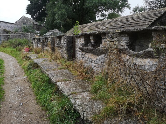
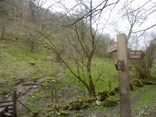
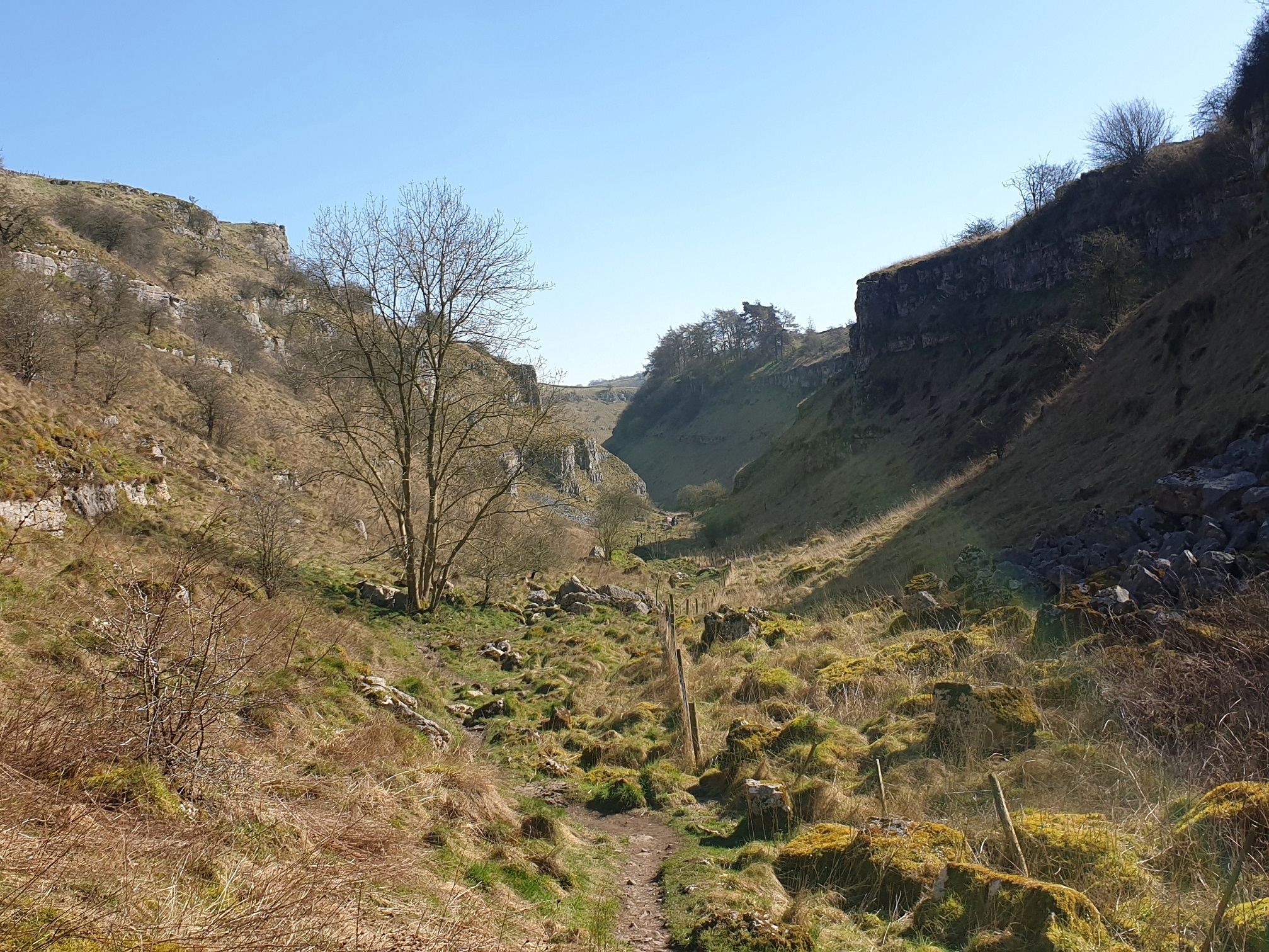
Crookdale Plantation Images

Images are sourced within 2km of 53.170508/-1.7483277 or Grid Reference SK1663. Thanks to Geograph Open Source API. All images are credited.

Arbor Low henge - flat stones One of the earliest sites in England to have been designated a scheduled ancient monument, and one of the few to have been given a fully detailed description by Historic England (list entry 1011087), the henge consists of a stone circle within an elliptical bank and ditch (40m by 52m) with two entrances and a later bowl barrow. The immediate surrounding area contains a number of other tumuli, barrows and ancient earthworks. The dating is roughly Late Neolithic to Late Bronze Age (c.2400-1500BC).  

The stone circle itself originally comprised 41-43 upright limestone slabs, with some further stones at the centre representing a burial chamber (more than one burial was found during excavations at the site). The stones have at some time in the past been laid flat on the ground. An interpretation board on site attributes this to mediaeval superstition or religious persecution, but someone we met on site who seemed to know it well said he believed it was a more recent (19th century?) action.
Arbor Low henge - flat stones
One of the earliest sites in England to have been designated a scheduled ancient monument, and one of the few to have been given a fully detailed description by Historic England (list entry 1011087), the henge consists of a stone circle within an elliptical bank and ditch (40m by 52m) with two entrances and a later bowl barrow. The immediate surrounding area contains a number of other tumuli, barrows and ancient earthworks. The dating is roughly Late Neolithic to Late Bronze Age (c.2400-1500BC). The stone circle itself originally comprised 41-43 upright limestone slabs, with some further stones at the centre representing a burial chamber (more than one burial was found during excavations at the site). The stones have at some time in the past been laid flat on the ground. An interpretation board on site attributes this to mediaeval superstition or religious persecution, but someone we met on site who seemed to know it well said he believed it was a more recent (19th century?) action.
Arbor Low henge - ditch and bank One of the earliest sites in England to have been designated a scheduled ancient monument, and one of the few to have been given a fully detailed description by Historic England (list entry 1011087), the henge consists of a stone circle within an elliptical bank and ditch (40m by 52m) with two entrances and a later bowl barrow. The immediate surrounding area contains a number of other tumuli, barrows and ancient earthworks. The dating is roughly Late Neolithic to Late Bronze Age (c.2400-1500BC).  

The ditch and bank are seen here from the top of the bank.  The site was fully excavated c.1902, so the exact profile of the bank is probably not original.
Arbor Low henge - ditch and bank
One of the earliest sites in England to have been designated a scheduled ancient monument, and one of the few to have been given a fully detailed description by Historic England (list entry 1011087), the henge consists of a stone circle within an elliptical bank and ditch (40m by 52m) with two entrances and a later bowl barrow. The immediate surrounding area contains a number of other tumuli, barrows and ancient earthworks. The dating is roughly Late Neolithic to Late Bronze Age (c.2400-1500BC). The ditch and bank are seen here from the top of the bank. The site was fully excavated c.1902, so the exact profile of the bank is probably not original.
Arbor Low henge - VR boundary stone The boundary stones around the henge are not ancient, but were added around the time the site was excavated c.1902 (at the end of the Victorian era). Some of them therefore have the initials VR, and some GR, for Victoria and her successor King George.
Arbor Low henge - VR boundary stone
The boundary stones around the henge are not ancient, but were added around the time the site was excavated c.1902 (at the end of the Victorian era). Some of them therefore have the initials VR, and some GR, for Victoria and her successor King George.
Field scabious Flowers growing on the bank of Arbor Low henge.
Field scabious
Flowers growing on the bank of Arbor Low henge.
Approaching the entrance to Arbor Low henge  The elliptical henge originally had two opposite entrances, but this is the one used by visitors approaching on the permitted route through Upper Oldhams Farm.
Approaching the entrance to Arbor Low henge
The elliptical henge originally had two opposite entrances, but this is the one used by visitors approaching on the permitted route through Upper Oldhams Farm.
View from Arbor Low towards Gib Hill  Gib Hill is a burial mound or barrow, somewhat camouflaged in this view against a distant hill (roughly in the centre of the picture, a bit to the left of the cow in the foreground).  The two sites are believed to be associated but are separately scheduled.
View from Arbor Low towards Gib Hill
Gib Hill is a burial mound or barrow, somewhat camouflaged in this view against a distant hill (roughly in the centre of the picture, a bit to the left of the cow in the foreground). The two sites are believed to be associated but are separately scheduled.
Upper Oldhams Farm A beef farm close to Arbor Low henge. There is no public right of way through this farm or its surrounding fields, but visitors are invited to contribute £1 by way of purchasing a temporary right of passage to the henge.
Upper Oldhams Farm
A beef farm close to Arbor Low henge. There is no public right of way through this farm or its surrounding fields, but visitors are invited to contribute £1 by way of purchasing a temporary right of passage to the henge.
Track to Upper Oldhams Farm A beef farm close to Arbor Low henge. There is no public right of way through this farm or its surrounding fields, but visitors are invited to contribute £1 by way of purchasing a temporary right of passage to the henge.
Track to Upper Oldhams Farm
A beef farm close to Arbor Low henge. There is no public right of way through this farm or its surrounding fields, but visitors are invited to contribute £1 by way of purchasing a temporary right of passage to the henge.
Signs to Arbor Low and Upper Oldhams A beef farm close to Arbor Low henge. There is no public right of way through this farm or its surrounding fields, but visitors are invited to contribute £1 by way of purchasing a temporary right of passage to the henge, and the English Heritage car park is part way up this track.
Signs to Arbor Low and Upper Oldhams
A beef farm close to Arbor Low henge. There is no public right of way through this farm or its surrounding fields, but visitors are invited to contribute £1 by way of purchasing a temporary right of passage to the henge, and the English Heritage car park is part way up this track.
Minor road below Arbor Low Note the rosebay-willowherb growing in the verge.  This plant seems to be generally less abundant than it was when I was young, but we saw quite a bit of it in Derbyshire on this occasion.
Minor road below Arbor Low
Note the rosebay-willowherb growing in the verge. This plant seems to be generally less abundant than it was when I was young, but we saw quite a bit of it in Derbyshire on this occasion.
Belt of trees on a ridge The line of these trees corresponds not only with a minor ridge in the landscape but also the parish boundary between Middleton and Smerrill (this side) and Hartington Middle Quarter the other. Even recent maps show a tumulus in this field but there's no obvious sign of it on the ground.
Belt of trees on a ridge
The line of these trees corresponds not only with a minor ridge in the landscape but also the parish boundary between Middleton and Smerrill (this side) and Hartington Middle Quarter the other. Even recent maps show a tumulus in this field but there's no obvious sign of it on the ground.
Slurry spreading The older practice of throwing slurry out of the top of a tanker has been replaced by spreading it evenly through a row of tubes on the back of the tanker. It still attracts the birds.
Slurry spreading
The older practice of throwing slurry out of the top of a tanker has been replaced by spreading it evenly through a row of tubes on the back of the tanker. It still attracts the birds.
A long wall This dry stone wall continues for 280 metres in a straight line, not unusual for this part of Derbyshire.
A long wall
This dry stone wall continues for 280 metres in a straight line, not unusual for this part of Derbyshire.
A view down Long Rake Looking into the distance is the distinctive profile of Sheen Hill in <a href="https://www.geograph.org.uk/gridref/SK1162">SK1162</a>.
A view down Long Rake
Looking into the distance is the distinctive profile of Sheen Hill in SK1162.
Cattle in a field above Parsley Hay I couldn't be sure from this distance but as all the farms in the area seemed to be beef rather than dairy, I expect these are bullocks.
Cattle in a field above Parsley Hay
I couldn't be sure from this distance but as all the farms in the area seemed to be beef rather than dairy, I expect these are bullocks.
Flock of birds in a field above Parsley Hay A nearby field was being sprayed with slurry, so I guess this field had already had the same treatment.
Flock of birds in a field above Parsley Hay
A nearby field was being sprayed with slurry, so I guess this field had already had the same treatment.
One Ash Grange Farm Not sure what these are for. Some old cattle feeders?
One Ash Grange Farm
Not sure what these are for. Some old cattle feeders?
The High Peak Trail A very cold and icy section of the trail just south east of the A515 road bridge.
The High Peak Trail
A very cold and icy section of the trail just south east of the A515 road bridge.
Show me another place!

Crookdale Plantation is located at Grid Ref: SK1663 (Lat: 53.170508, Lng: -1.7483277)

Administrative County: Derbyshire

District: Derbyshire Dales

Police Authority: Derbyshire

What 3 Words

///calendars.happily.frames. Near Newhaven, Derbyshire

Related Wikis

Arbor Low

Arbor Low is a well-preserved Neolithic henge in the Derbyshire Peak District, England. It lies on a Carboniferous Limestone plateau known as the White...

Gib Hill

Gib Hill is a large burial mound in the Peak District, Derbyshire, England. It is thought to be a Neolithic oval barrow with an Early Bronze Age round...

Cales Dale

Cales Dale is a short valley towards the head of Lathkill Dale near Monyash, Derbyshire in the Peak District of England. Cales Dale is included within...

Limey Way

The Limey Way is a 65-kilometre (40 mi) challenge walk through Derbyshire, England. It starts at Castleton and progresses through 15 major and 5 minor...

Lathkill Dale

Lathkill Dale is the valley of the River Lathkill near Bakewell, Derbyshire in the Peak District of England. The river emerges into the dale from springs...

Middleton and Smerrill

Middleton and Smerrill is a civil parish within the Derbyshire Dales district, in the county of Derbyshire, England. Largely rural except for the village...

Newhaven Tunnel

Newhaven Tunnel was a railway tunnel located on the Cromford and High Peak Railway near the village of Newhaven in Derbyshire. Mostly used for moving mineral...

Parsley Hay railway station

Parsley Hay railway station served Parsley Hay, a hamlet within Hartington Middle Quarter civil parish, about 9.3 miles (15 km) south east of Buxton, Derbyshire...

Nearby Amenities

Located within 500m of 53.170508,-1.7483277
Barrier: stile
Material: stone
Source: survey;bing
Stile: squeezer
Lat/Long: 53.1729835/-1.7455287
Description: Lump of rock on ground
Ele: 326.4909668
Lat/Long: 53.1724555/-1.7541597
Power: pole
Source: Bing
Lat/Long: 53.1741482/-1.7514582
Power: pole
Source: Bing
Lat/Long: 53.1733033/-1.7496285
Power: pole
Source: Bing
Lat/Long: 53.1724518/-1.7477713
Power: pole
Source: Bing
Lat/Long: 53.1737307/-1.7505489
Power: pole
Source: Bing
Lat/Long: 53.1728891/-1.748711
Power: pole
Lat/Long: 53.1695889/-1.7415318
Power: pole
Lat/Long: 53.1699981/-1.7423958
Power: pole
Lat/Long: 53.1703911/-1.7432839
Power: pole
Lat/Long: 53.1707768/-1.7441206
Power: pole
Lat/Long: 53.1712041/-1.7450299
Power: pole
Lat/Long: 53.1716306/-1.7459769
Power: pole
Lat/Long: 53.1720395/-1.7468473
Barrier: cattle_grid
Lat/Long: 53.1729476/-1.7512799
The data included in this document is from www.openstreetmap.org. The data is made available under ODbL.

Have you been to Crookdale Plantation?

Leave your review of Crookdale Plantation below (or comments, questions and feedback).