Dalby
Settlement in Yorkshire Hambleton
England
Dalby

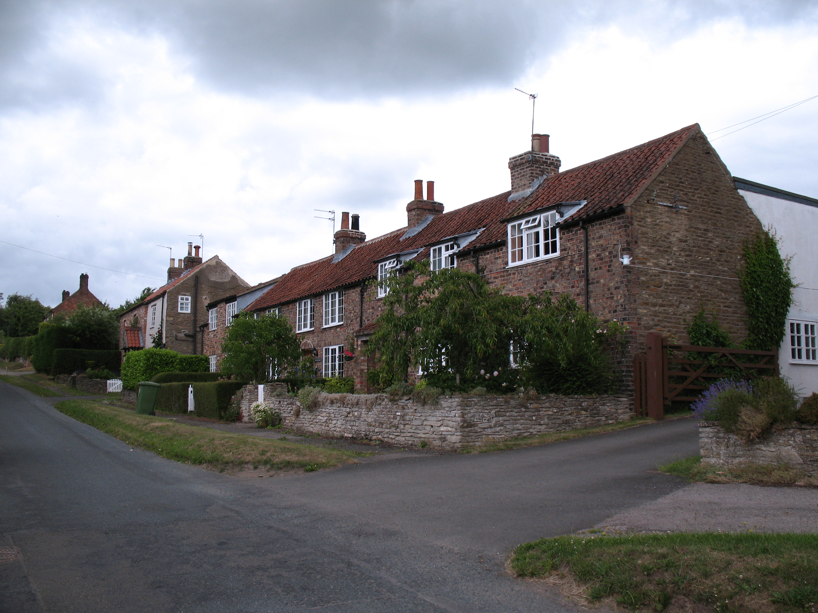
Dalby is a small village located in the county of Yorkshire, England. Situated within the picturesque North York Moors National Park, it is surrounded by rolling hills, expansive woodlands, and breathtaking scenery. The village itself is nestled in a valley and is home to a close-knit community of approximately 200 residents.
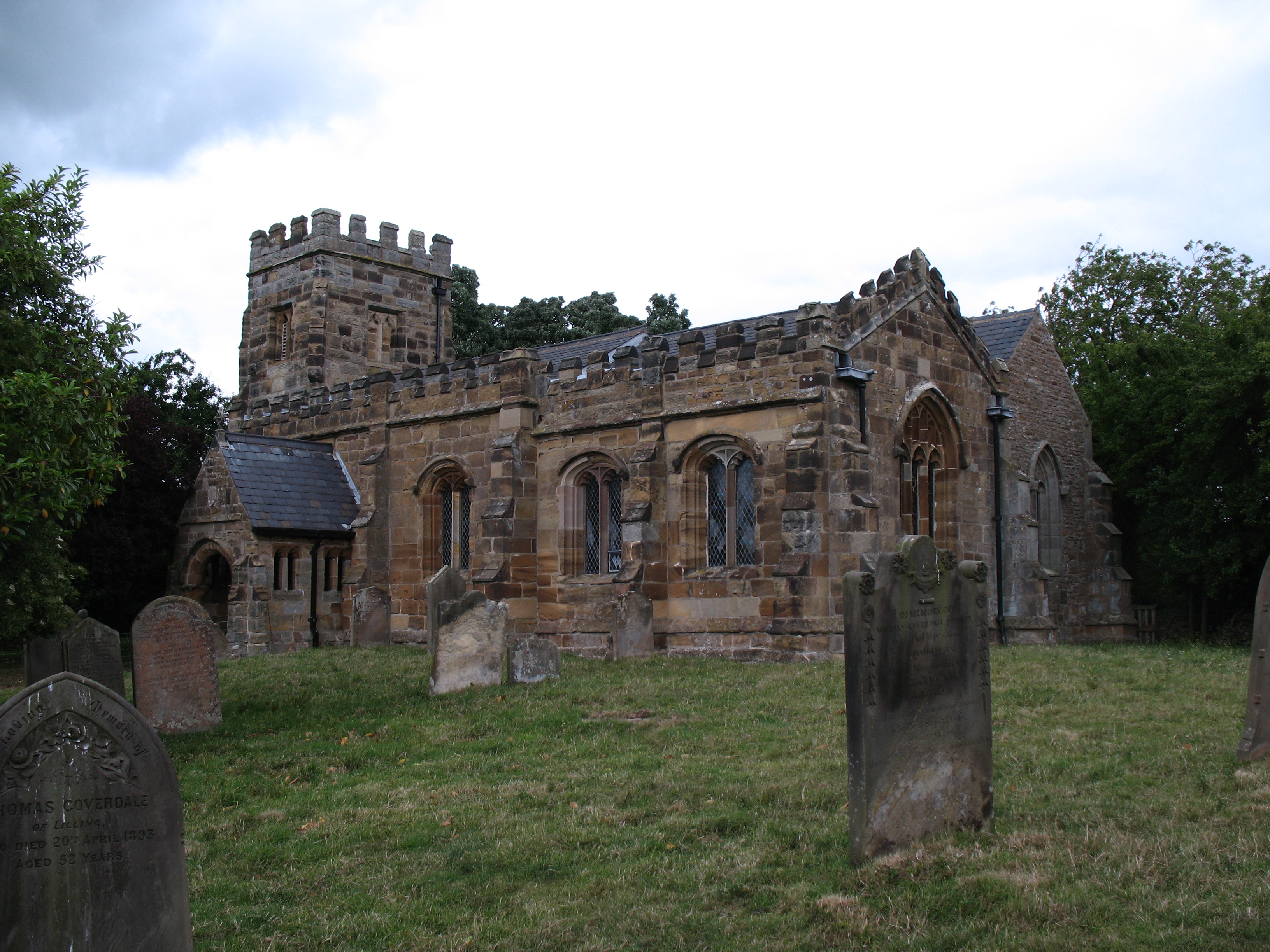
Dalby is known for its rich history, dating back to the medieval period. The village features several well-preserved buildings from this era, including St. Peter's Church, which stands proudly at the heart of the community. The church, with its striking architecture and beautiful stained glass windows, serves as a reminder of the village's past.
The local economy of Dalby primarily revolves around agriculture, with many residents working in farming and livestock rearing. The fertile landscape and favorable climate make it an ideal location for agricultural activities. In addition, due to its proximity to the North York Moors, the village attracts a steady stream of tourists who come to explore the area's natural beauty and enjoy outdoor activities such as hiking and cycling.
Dalby offers limited amenities, including a small village shop, a post office, and a traditional pub, where locals and visitors can gather for a pint and a chat. Despite its small size, the village holds various community events throughout the year, such as a summer fair and a Christmas market, fostering a strong sense of community spirit.
Overall, Dalby is a quaint and peaceful village, offering a tranquil escape from the hustle and bustle of city life. Its idyllic location, historical charm, and warm community make it an appealing destination for both residents and tourists alike.
If you have any feedback on the listing, please let us know in the comments section below.
Dalby Images
Images are sourced within 2km of 54.132437/-1.020427 or Grid Reference SE6471. Thanks to Geograph Open Source API. All images are credited.


Dalby is located at Grid Ref: SE6471 (Lat: 54.132437, Lng: -1.020427)
Division: North Riding
Administrative County: North Yorkshire
District: Hambleton
Police Authority: North Yorkshire
What 3 Words
///dunes.elbowed.dares. Near Sheriff Hutton, North Yorkshire
Nearby Locations
Related Wikis

Howardian Hills
The Howardian Hills are an Area of Outstanding Natural Beauty located between the Yorkshire Wolds, the North York Moors National Park, and the Vale of...
St Martin's Church, Whenby
St Martin's Church is a redundant Anglican church in the village of Whenby, North Yorkshire, England. It is recorded in the National Heritage List for...
Whenby
Whenby is a civil parish and village in North Yorkshire, England. The village and parish is largely agricultural in nature, and although the village has...

Scackleton
Scackleton is a village and civil parish in the Ryedale district of North Yorkshire, England. It is in the Howardian Hills and 2 miles (3.2 km) south-west...

Terrington
Terrington is a large village and civil parish in the Ryedale district of North Yorkshire, England. It is situated in the Howardian Hills, 4 miles (6.4...

Brandsby-cum-Stearsby
Brandsby-cum-Stearsby is a civil parish in the Hambleton district of North Yorkshire, England, with a population of 234 (2001 census), increasing to 383...

Coulton, North Yorkshire
Coulton is a village and civil parish in the Ryedale district of North Yorkshire, England, it is about 6 miles (9.7 km) south of Helmsley. == History... ==

Farlington, North Yorkshire
Farlington is a small village and civil parish in the Hambleton District of North Yorkshire, England. It is situated approximately 9.5 miles (15.3 km)...
Nearby Amenities
Located within 500m of 54.132437,-1.020427Have you been to Dalby?
Leave your review of Dalby below (or comments, questions and feedback).