Carr Wood

Wood, Forest in Yorkshire Harrogate

England

Carr Wood

Fewston Reservoir
Fewston Reservoir Credit: Martin Norman

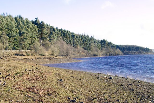
Carr Wood is a charming woodland located in Yorkshire, England. Covering an area of approximately 100 hectares, this forested area offers a tranquil escape from the hustle and bustle of nearby urban centers. Situated near the village of Carr, the wood is easily accessible and is a popular destination for nature enthusiasts and walkers alike.

The woodland is primarily composed of a mix of deciduous and coniferous trees, creating a diverse and visually stunning landscape. Ancient oak and beech trees can be found throughout, providing a sense of history and grandeur. The forest floor is blanketed with a rich carpet of ferns, wildflowers, and mosses, adding to the enchanting atmosphere.

Carr Wood is home to a variety of wildlife, making it a haven for nature lovers. Birdwatchers will be delighted by the presence of woodpeckers, owls, and other woodland birds. Deer can often be spotted grazing in the clearings, adding a touch of wild beauty to the surroundings.

Several walking trails wind their way through the wood, allowing visitors to explore its beauty at their own pace. The well-maintained paths are suitable for all abilities, making it an ideal destination for families and casual walkers. Along the way, there are picnic areas and benches, offering opportunities to rest and soak in the serenity of the surroundings.

Overall, Carr Wood is a picturesque woodland that encapsulates the natural beauty of Yorkshire. With its diverse flora and fauna, peaceful ambiance, and easily accessible location, it is a must-visit destination for those seeking a respite in nature.

If you have any feedback on the listing, please let us know in the comments section below.

Carr Wood Images

Images are sourced within 2km of 53.995897/-1.7493611 or Grid Reference SE1655. Thanks to Geograph Open Source API. All images are credited.

Fewston Reservoir
Fewston Reservoir
Blubberhouses Early Sunday morning at Blubberhouses Cricket club, locals prepare for a Duck race and Country fair in aid of Motor Neurone Disease Association
Blubberhouses
Early Sunday morning at Blubberhouses Cricket club, locals prepare for a Duck race and Country fair in aid of Motor Neurone Disease Association
Low Dam near the River Washburn Low dam is retained by an embankment which runs next to the River washburn, it is a good place to see Dragonflies
Low Dam near the River Washburn
Low dam is retained by an embankment which runs next to the River washburn, it is a good place to see Dragonflies
Weir on the River Washburn The Weir on the River Washburn close to where the road crosses Nethernooks Bridge
Weir on the River Washburn
The Weir on the River Washburn close to where the road crosses Nethernooks Bridge
Washburn during reservoir release The Washburn with water during a release of water between the reservoirs up and downstream of here with kayakers taking full advantage.
Washburn during reservoir release
The Washburn with water during a release of water between the reservoirs up and downstream of here with kayakers taking full advantage.
Fewston One of the Washburn reservoirs, with the church viewable in the background. The A59 runs along the treeline on the right hand side.
Fewston
One of the Washburn reservoirs, with the church viewable in the background. The A59 runs along the treeline on the right hand side.
HMS Forest Moor
HMS Forest Moor
Plane Trees Farm
Plane Trees Farm
Slow Road
Slow Road
Fewston Reservoir On a dull December afternoon: a brisk wind was breaking up the surface of the water. This reservoir is fed by the River Washburn, a tributary of the River Wharfe. Completed in 1879 it has a capacity of 846 million gallons. It is one of the major network of reservoirs owned by Yorkshire Water in the Skipton area. See <span class="nowrap"><a title="http://www.yorkshirewater.com/?SCH=&RGN=17&ACT=0&search=Go&OBH=864#" rel="nofollow ugc noopener" href="http://www.yorkshirewater.com/?SCH=&RGN=17&ACT=0&search=Go&OBH=864#">Link</a><img style="margin-left:2px;" alt="External link" title="External link - shift click to open in new window" src="https://s1.geograph.org.uk/img/external.png" width="10" height="10"/></span> for a list.
Fewston Reservoir
On a dull December afternoon: a brisk wind was breaking up the surface of the water. This reservoir is fed by the River Washburn, a tributary of the River Wharfe. Completed in 1879 it has a capacity of 846 million gallons. It is one of the major network of reservoirs owned by Yorkshire Water in the Skipton area. See LinkExternal link for a list.
Bothams Farm Bothams Farm faces North-East and looks across the valley towards Blubberhouses on the opposite side of the A59. The track leading up to the farm is marked "Private" and barking dogs reinforce the fact!
Bothams Farm
Bothams Farm faces North-East and looks across the valley towards Blubberhouses on the opposite side of the A59. The track leading up to the farm is marked "Private" and barking dogs reinforce the fact!
Looking East from Shepherd Hill These fields now cover the course of a Roman Road which traversed the Washburn Valley. Fewston Reservoir (SE1754) is seen in the distance. The moles seem to prefer the field to the south of the wall!
Looking East from Shepherd Hill
These fields now cover the course of a Roman Road which traversed the Washburn Valley. Fewston Reservoir (SE1754) is seen in the distance. The moles seem to prefer the field to the south of the wall!
Roman Road, Blubberhouses Moor This footpath follows the course of a Roman Road across the wilderness of Blubberhouses Moor
Roman Road, Blubberhouses Moor
This footpath follows the course of a Roman Road across the wilderness of Blubberhouses Moor
Two kayakers on the Washburn
Blubberhouses, St Andrew's Church This Church is on the south side of the A59 at the junction with Shepherds Hill
Blubberhouses, St Andrew's Church
This Church is on the south side of the A59 at the junction with Shepherds Hill
Rafters on Washburn weir Coming over the larger of the weirs on the Washburn during a reservoir release. The water is regularly released from the higher reservoirs into ones further downstream, and people can pay to take advantage of the water mainly in kayaks or rafts.
Rafters on Washburn weir
Coming over the larger of the weirs on the Washburn during a reservoir release. The water is regularly released from the higher reservoirs into ones further downstream, and people can pay to take advantage of the water mainly in kayaks or rafts.
Washburn Looking down the Washburn during a full release from Thruscross reservoir into Fewston reservoir.
Washburn
Looking down the Washburn during a full release from Thruscross reservoir into Fewston reservoir.
Rafting down the Washburn An inflatable raft travels down the Washburn during full release from Thruscross reservoir to Fewston reservoir.
Rafting down the Washburn
An inflatable raft travels down the Washburn during full release from Thruscross reservoir to Fewston reservoir.
Show me another place!

Carr Wood is located at Grid Ref: SE1655 (Lat: 53.995897, Lng: -1.7493611)

Division: West Riding

Administrative County: North Yorkshire

District: Harrogate

Police Authority: North Yorkshire

What 3 Words

///lobby.expanded.rhino. Near Ilkley, West Yorkshire

Related Wikis

Blubberhouses

Blubberhouses is a small village and civil parish in the Washburn Valley in North Yorkshire, England. The population as at the 2011 Census was less than...
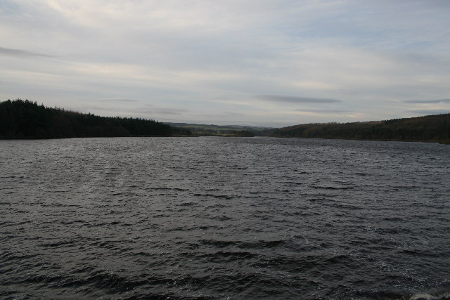
Fewston Reservoir

Fewston Reservoir is located in the Washburn valley north of Otley and west of Harrogate in Yorkshire, England. It was built in 1879. The capacity is about...

Kex Gill Bypass

The Kex Gill Bypass is a future stretch of A-road across Kex Gill Moor to Blubberhouses in North Yorkshire, England. The route is part of the A59 road...

HMS Forest Moor

HMS Forest Moor was a Royal Navy land base located in Nidderdale in the borough of Harrogate, North Yorkshire, England. == History == The establishment...

Thruscross Reservoir

Thruscross Reservoir is the northernmost of four reservoirs in the Washburn valley, lying north of Otley and west of Harrogate in North Yorkshire, England...

Fewston

Fewston is a village and civil parish in the Harrogate district of North Yorkshire, England. It is situated north of Otley and close to Swinsty and Fewston...

Timble

Timble is a village in the Harrogate district of North Yorkshire, England. It is situated on the slopes of the Washburn valley, north of Otley and close...

Thruscross

Thruscross is a small settlement and civil parish in the Harrogate district of North Yorkshire, England. It lies in the Washburn Valley, 11 miles (18...

Nearby Amenities

Located within 500m of 53.995897,-1.7493611
Barrier: height_restrictor
Maxheight: 2.1
Lat/Long: 53.9936736/-1.744924
Fewston Reservoir
Whitewater: egress
Lat/Long: 53.9936904/-1.743113
Manor House
Building: yes
Source: npe
Lat/Long: 53.9914645/-1.748351
Blubberhouses
Is In: UK, England, North Yorkshire, Yorkshire Dales, Washburndale
Is In County: North Yorkshire
Is In Municipality: Harrogate
Place: village
Wikidata: Q2802888
Wikipedia: en:Blubberhouses
Lat/Long: 53.9950271/-1.744316
Stop
Direction: backward
Stop: minor
Lat/Long: 53.993674/-1.7450668
Information: board
Tourism: information
Lat/Long: 53.9937029/-1.7439026
Noexit: yes
Lat/Long: 53.9936387/-1.7433543
Scaife Hall Farm
Addr City: Otley
Addr Postcode: LS21 2PL
Addr Street: Hardisty Hill
Addr Suburb: Blubberhouses
Source: website
Tourism: hostel
Website: http://scaifehallfarm.co.uk
Lat/Long: 53.9982784/-1.7464912
Source: Bing
Lat/Long: 53.9932592/-1.7456198
Barrier: stile
Lat/Long: 53.9985489/-1.7436322
The data included in this document is from www.openstreetmap.org. The data is made available under ODbL.

Have you been to Carr Wood?

Leave your review of Carr Wood below (or comments, questions and feedback).