Snowbottom Belt

Wood, Forest in Gloucestershire Cotswold

England

Snowbottom Belt

Arable land near Aldsworth
Arable land near Aldsworth Credit: Vieve Forward

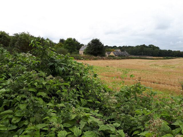
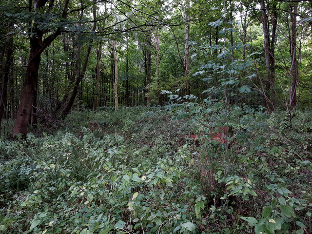
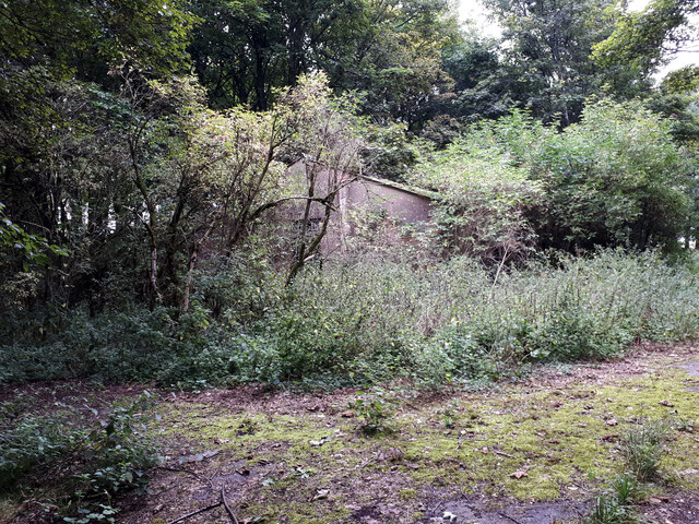
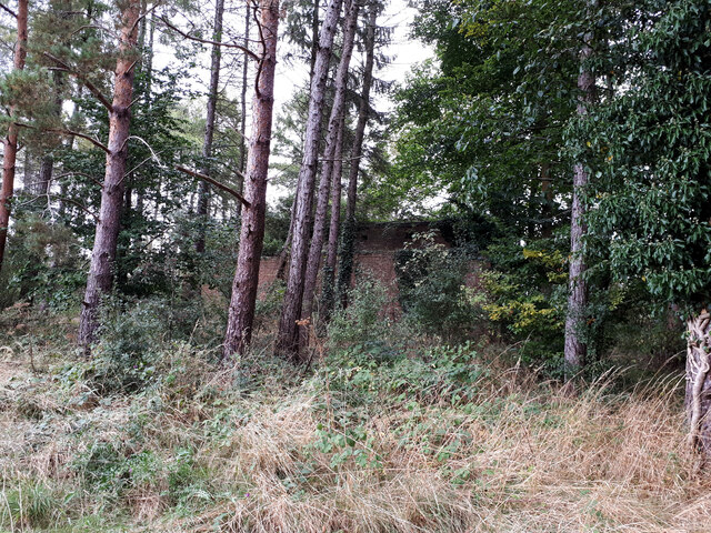
Snowbottom Belt is a small woodland area located in Gloucestershire, England. Nestled in the heart of the picturesque Forest of Dean, it covers an area of approximately 200 acres. The woodland boasts a diverse range of flora and fauna, making it a haven for nature enthusiasts and wildlife lovers.

The woodland is primarily composed of deciduous trees such as oak, beech, and ash, which create a dense canopy overhead, filtering the sunlight that reaches the forest floor. The forest is known for its rich biodiversity, home to a variety of plant species including bluebells, wood anemones, and wild garlic, which create a vibrant carpet of colors during the spring months.

Snowbottom Belt is also inhabited by a myriad of wildlife. Visitors may spot deer, badgers, foxes, and squirrels, as well as a wide array of bird species including woodpeckers, owls, and warblers. The woodland is a designated Site of Special Scientific Interest (SSSI), highlighting its importance for conservation and preservation of the natural habitat.

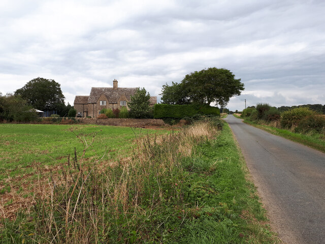
The forest offers numerous walking trails and paths, allowing visitors to explore and immerse themselves in the tranquility of nature. There are also designated picnic areas, providing a perfect spot to relax and enjoy the peaceful surroundings. Snowbottom Belt is managed by the Gloucestershire Wildlife Trust, ensuring the preservation of its natural beauty for generations to come.

Overall, Snowbottom Belt in Gloucestershire is a stunning woodland area, showcasing the beauty of nature in all its glory. It offers a serene escape from the hustle and bustle of daily life, inviting visitors to connect with the natural world and appreciate its wonders.

If you have any feedback on the listing, please let us know in the comments section below.

Snowbottom Belt Images

Images are sourced within 2km of 51.809542/-1.7650069 or Grid Reference SP1612. Thanks to Geograph Open Source API. All images are credited.

Arable land near Aldsworth
Blackpits Copse
Blackpits Copse
RAF Windrush ancillary building RAF Windrush opened in Spring 1940 and closed in Autumn 1945. Its role was to train pilots for the Royal Air Force. The role was unspectacular but contributed greatly to the success of the RAF and eventual victory. It is not known how many pilots passed through the Windrush training programmes but it they are certainly numbered in their thousands. Training courses ran for four weeks for the single-engined Harvard Advanced Trainer and six weeks for the twin-engined Oxford and Anson aircraft. Over 1500 personnel were based here including ground crews, trainee pilots, flying instructors and WAAF staff, with approximately 90 aircraft in all. 

Being a training airfield there were many crashes on the airfield itself and in the vicinity with a number of fatalities. A plaque mounted on the control tower commemorates the action of Sergeant Pilot Bruce Hancock of the Voluntary Reserve on the evening of Sunday 18th August 1940. That night, while flying an unarmed Avro Anson trainer he was seen to sacrifice his life by ramming and destroying an attacking enemy Heinkel 111 bomber. Another plaque commemorating this incident is mounted in the wall of the churchyard of St Peter’s, Windrush.
RAF Windrush ancillary building
RAF Windrush opened in Spring 1940 and closed in Autumn 1945. Its role was to train pilots for the Royal Air Force. The role was unspectacular but contributed greatly to the success of the RAF and eventual victory. It is not known how many pilots passed through the Windrush training programmes but it they are certainly numbered in their thousands. Training courses ran for four weeks for the single-engined Harvard Advanced Trainer and six weeks for the twin-engined Oxford and Anson aircraft. Over 1500 personnel were based here including ground crews, trainee pilots, flying instructors and WAAF staff, with approximately 90 aircraft in all. Being a training airfield there were many crashes on the airfield itself and in the vicinity with a number of fatalities. A plaque mounted on the control tower commemorates the action of Sergeant Pilot Bruce Hancock of the Voluntary Reserve on the evening of Sunday 18th August 1940. That night, while flying an unarmed Avro Anson trainer he was seen to sacrifice his life by ramming and destroying an attacking enemy Heinkel 111 bomber. Another plaque commemorating this incident is mounted in the wall of the churchyard of St Peter’s, Windrush.
Cats Abbey Buildings Self-catering conference centre, with accommodation available for all kinds of groups to hire. <span class="nowrap"><a title="https://www.catsabbey.com/" rel="nofollow ugc noopener" href="https://www.catsabbey.com/">Link</a><img style="margin-left:2px;" alt="External link" title="External link - shift click to open in new window" src="https://s1.geograph.org.uk/img/external.png" width="10" height="10"/></span>
Cats Abbey Buildings
Self-catering conference centre, with accommodation available for all kinds of groups to hire. LinkExternal link
East Cottages aka Sunnyside The Ordnance Survey gives alternative names.
East Cottages aka Sunnyside
The Ordnance Survey gives alternative names.
Drive to Stone Barn Stone Barn is named Blackpits Barn on my 2009 OS Explorer map. Now converted to a beautiful wedding venue, presumably this name was thought too gloomy.
Drive to Stone Barn
Stone Barn is named Blackpits Barn on my 2009 OS Explorer map. Now converted to a beautiful wedding venue, presumably this name was thought too gloomy.
RAF Windrush Stanton air raid shelter near Cats Abbey Buildings An outlying Stanton shelter (e37074) relating to RAF Windrush. See also <a href="https://www.geograph.org.uk/photo/6960652">SP1713 : RAF Windrush Stanton air raid shelter near Cats Abbey Buildings</a>.
RAF Windrush Stanton air raid shelter near Cats Abbey Buildings
An outlying Stanton shelter (e37074) relating to RAF Windrush. See also SP1713 : RAF Windrush Stanton air raid shelter near Cats Abbey Buildings.
RAF Windrush Stanton air raid shelter near Cats Abbey Buildings Entrance to Stanton shelter, see also <a href="https://www.geograph.org.uk/photo/6960650">SP1713 : RAF Windrush Stanton air raid shelter near Cats Abbey Buildings</a>.
RAF Windrush Stanton air raid shelter near Cats Abbey Buildings
RAF Windrush ancillary structure, Budgehill Wood Ancillary structure associated with former RAF Windrush. See also <a href="https://www.geograph.org.uk/photo/6960758">SP1711 : RAF Windrush ancillary structure, Budgehill Wood</a>, <a href="https://www.geograph.org.uk/photo/384882">SP1712 : In Budgehill Wood</a>, and <a href="https://www.geograph.org.uk/photo/384887">SP1712 : In Budgehill Wood</a>.
RAF Windrush ancillary structure, Budgehill Wood
Ancillary structure associated with former RAF Windrush. See also SP1711 : RAF Windrush ancillary structure, Budgehill Wood, SP1712 : In Budgehill Wood, and SP1712 : In Budgehill Wood.
RAF Windrush large WW2 ancillary building next to Camp Barn Large building ancillary to former RAF Windrush.
RAF Windrush large WW2 ancillary building next to Camp Barn
Large building ancillary to former RAF Windrush.
Show me another place!

Snowbottom Belt is located at Grid Ref: SP1612 (Lat: 51.809542, Lng: -1.7650069)

Administrative County: Gloucestershire

District: Cotswold

Police Authority: Gloucestershire

What 3 Words

///beefed.remind.adopters. Near Northleach, Gloucestershire

Nearby Locations

Snowbottom Belt

Related Wikis

Lodge Park and Sherborne Estate

Lodge Park was built as a grandstand in the Sherborne Estate near the villages of Sherborne, Aldsworth and Northleach in Gloucestershire, England. The...

RAF Windrush

Royal Air Force Windrush, or more simply RAF Windrush, is a former Royal Air Force satellite station near Windrush, Gloucestershire, England. It was opened...

Windrush, Gloucestershire

Windrush is a village and civil parish in Gloucestershire, England, approximately five miles southeast of Northleach. It lies in the Cotswolds on the River...

Sherborne House, Gloucestershire

Sherborne House is a large house in the village of Sherborne, Gloucestershire, England. It is a former country house that has been converted into flats...

Church of St Bartholomew, Aldsworth

The Anglican Church of St Bartholomew at Aldsworth in the Cotswold District of Gloucestershire, England was built in the late 12th century. It is a grade...

Sherborne, Gloucestershire

Sherborne is a village and civil parish almost 3.5 miles (5.6 km) east of Northleach in Gloucestershire. Sherborne is a linear village, extending more...

Church of St Peter, Windrush

The Anglican Church of St Peter at Windrush in the Cotswold District of Gloucestershire, England was built in the 12th century. It is a grade I listed...

Aldsworth

Aldsworth is a village and civil parish in the Cotswold district of Gloucestershire, about ten miles north-east of Cirencester. In 2010 its population...

Nearby Amenities

Located within 500m of 51.809542,-1.7650069
WINDRUSH
Disused: yes
Man Made: petroleum_well
Ref GB Decc: LQ/07-2
Source: DECC
Lat/Long: 51.8083056/-1.7594444
The data included in this document is from www.openstreetmap.org. The data is made available under ODbL.

Have you been to Snowbottom Belt?

Leave your review of Snowbottom Belt below (or comments, questions and feedback).