Alegar Bank Wood

Wood, Forest in Yorkshire

England

Alegar Bank Wood

Brighouse Bus Station
Brighouse Bus Station Credit: Jonathan Thacker

Alegar Bank Wood is a picturesque woodland located in the county of Yorkshire, England. Situated in the heart of the countryside, this enchanting forest covers an area of approximately 100 acres. The wood is easily accessible, located just a short distance from the charming village of Alegar.

This ancient woodland is a haven for nature lovers and those seeking tranquility amidst the beauty of nature. The forest is predominantly made up of broadleaf trees, including oak, beech, and birch, which create a stunning canopy overhead. The woodland floor is adorned with a diverse array of wildflowers, ferns, and mosses, adding to its ethereal charm.

Alegar Bank Wood is home to a wide variety of wildlife, making it a popular spot for birdwatchers and nature enthusiasts. Visitors may catch a glimpse of woodland birds such as woodpeckers, nuthatches, and tawny owls, as well as small mammals like squirrels, rabbits, and voles. The forest also provides a habitat for deer, though they are often shy and elusive.

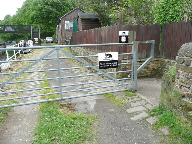
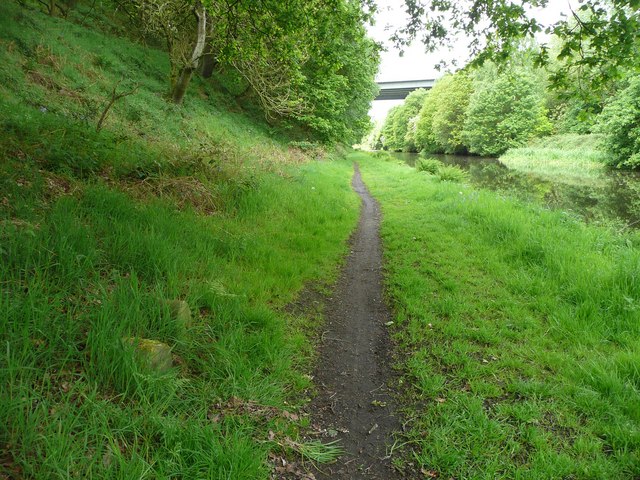
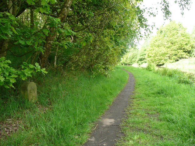
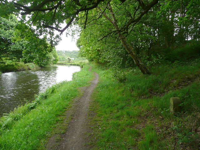
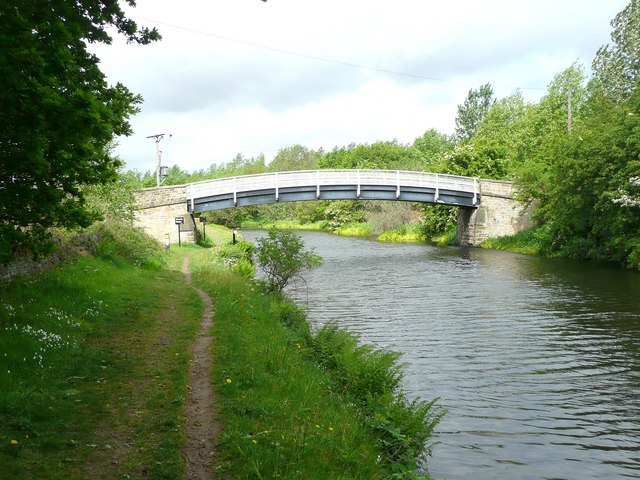
Visitors can explore the wood's many footpaths and trails, which wind through the ancient trees and offer stunning views of the surrounding countryside. The wood is also intersected by a small stream, adding to its idyllic atmosphere.

Alegar Bank Wood offers a peaceful retreat from the hustle and bustle of everyday life, providing a place for relaxation, exploration, and connection with nature. It is a true gem in the Yorkshire countryside, offering visitors a chance to immerse themselves in the beauty and tranquility of this ancient woodland.

If you have any feedback on the listing, please let us know in the comments section below.

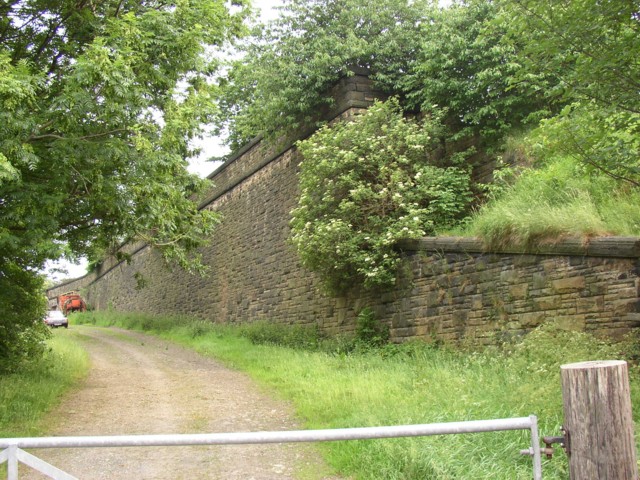
Alegar Bank Wood Images

Images are sourced within 2km of 53.700547/-1.7678242 or Grid Reference SE1522. Thanks to Geograph Open Source API. All images are credited.

Brighouse Bus Station
Central Methodist Church, Brighouse, east side Formerly Bethel Methodist Church. Dates from 1905 and designed by John Wills and Son <span class="nowrap"><a title="https://historicengland.org.uk/listing/the-list/list-entry/1183964?section=official-list-entry" rel="nofollow ugc noopener" href="https://historicengland.org.uk/listing/the-list/list-entry/1183964?section=official-list-entry">Link</a><img style="margin-left:2px;" alt="External link" title="External link - shift click to open in new window" src="https://s1.geograph.org.uk/img/external.png" width="10" height="10"/></span>
Central Methodist Church, Brighouse, east side
Formerly Bethel Methodist Church. Dates from 1905 and designed by John Wills and Son LinkExternal link
Central Methodist Church, Brighouse, south west corner Formerly Bethel Methodist Church. Dates from 1905 and designed by John Wills and Son. <span class="nowrap"><a title="https://historicengland.org.uk/listing/the-list/list-entry/1183964?section=official-list-entry" rel="nofollow ugc noopener" href="https://historicengland.org.uk/listing/the-list/list-entry/1183964?section=official-list-entry">Link</a><img style="margin-left:2px;" alt="External link" title="External link - shift click to open in new window" src="https://s1.geograph.org.uk/img/external.png" width="10" height="10"/></span>
Central Methodist Church, Brighouse, south west corner
Formerly Bethel Methodist Church. Dates from 1905 and designed by John Wills and Son. LinkExternal link
Cafe opposite the Bus Station, Brighouse
The former Salvation Army Hall revealed The play gym has moved out and its boards taken down, revealing the original frontage of the building with its inscription. See <a href="https://www.geograph.org.uk/photo/366034">SE1422 : Children's play gym, Bethel Street, Brighouse</a> and <a href="https://www.geograph.org.uk/photo/366042">SE1422 : Foundation stones, Bethel Street, Brighouse</a>.
The former Salvation Army Hall revealed
The play gym has moved out and its boards taken down, revealing the original frontage of the building with its inscription. See SE1422 : Children's play gym, Bethel Street, Brighouse and SE1422 : Foundation stones, Bethel Street, Brighouse.
Grain silos in Brighouse
Junction 25, M62 eastbound
The M62 eastbound at junction 25 on ramp
Railway boundary stone at the Anchor Pit canal lock, Bradley One of a series of at least four stones erected by the Lancashire and Yorkshire Railway, who presumably owned the land between the railway and the canal.
Railway boundary stone at the Anchor Pit canal lock, Bradley
One of a series of at least four stones erected by the Lancashire and Yorkshire Railway, who presumably owned the land between the railway and the canal.
Railway boundary stone at the Anchor Pit canal lock, Bradley One of a series of at least four stones erected by the Lancashire and Yorkshire Railway, who presumably owned the land between the railway and the canal. This view shows the towpath alongside the lock. For close view see <a href="https://www.geograph.org.uk/photo/2413293">SE1521 : Railway boundary stone at the Anchor Pit canal lock, Bradley</a>.
Railway boundary stone at the Anchor Pit canal lock, Bradley
One of a series of at least four stones erected by the Lancashire and Yorkshire Railway, who presumably owned the land between the railway and the canal. This view shows the towpath alongside the lock. For close view see SE1521 : Railway boundary stone at the Anchor Pit canal lock, Bradley.
Canal milestone and railway boundary stone, Bradley The boundary stone is one of a series of at least four erected by the Lancashire and Yorkshire Railway, who presumably owned the land between the railway and the canal, now woodland. The milestone indicates 14 miles from Fall Ing (Wakefield).
Canal milestone and railway boundary stone, Bradley
The boundary stone is one of a series of at least four erected by the Lancashire and Yorkshire Railway, who presumably owned the land between the railway and the canal, now woodland. The milestone indicates 14 miles from Fall Ing (Wakefield).
Canal milestone and railway boundary stone, Bradley The boundary stone is one of a series of at least four erected by the Lancashire and Yorkshire Railway, who presumably owned the land between the railway and the canal, now woodland. The milestone indicates 14 miles from Fall Ing (Wakefield).  The bridge in the distance carries the M62 over the valley.
Canal milestone and railway boundary stone, Bradley
The boundary stone is one of a series of at least four erected by the Lancashire and Yorkshire Railway, who presumably owned the land between the railway and the canal, now woodland. The milestone indicates 14 miles from Fall Ing (Wakefield). The bridge in the distance carries the M62 over the valley.
Railway boundary stone, Bradley One of a series of at least four stones erected by the Lancashire and Yorkshire Railway, who presumably owned the land between the railway and the canal, now woodland.
Railway boundary stone, Bradley
One of a series of at least four stones erected by the Lancashire and Yorkshire Railway, who presumably owned the land between the railway and the canal, now woodland.
Railway boundary stone on the canal towpath, Bradley -  One of a series of at least four stones erected by the Lancashire and Yorkshire Railway, who presumably owned the land between the railway and the canal, now woodland.
Railway boundary stone on the canal towpath, Bradley -
One of a series of at least four stones erected by the Lancashire and Yorkshire Railway, who presumably owned the land between the railway and the canal, now woodland.
Brearley Bridge This crosses the canal, giving access to an island between the canal (the Kirklees Cut of the Calder and Hebble Navigation) and the River Calder.
Brearley Bridge
This crosses the canal, giving access to an island between the canal (the Kirklees Cut of the Calder and Hebble Navigation) and the River Calder.
New house, Slead Avenue, Brighouse
Show me another place!

Alegar Bank Wood is located at Grid Ref: SE1522 (Lat: 53.700547, Lng: -1.7678242)

Division: West Riding

Unitary Authority: Calderdale

Police Authority: West Yorkshire

What 3 Words

///sank.wasp.ledge. Near Brighouse, West Yorkshire

Nearby Locations

Alegar Bank Wood

Related Wikis

Clifton Road railway station

Clifton Road was a railway station built by the Lancashire and Yorkshire Railway to serve the village of Clifton north east of Brighouse in West Yorkshire...

Blakeborough's Bridge

Blakeborough's Bridge crosses the River Calder in Brighouse, West Yorkshire, England. It was built in 1962 to link J. Blakeborough and Sons works and offices...

Clifton, West Yorkshire

Clifton is a village on the eastern outskirts of Brighouse in the Calderdale district of West Yorkshire, England. == History == Clifton is mentioned as...

Brighouse Bridge

The Brighouse Bridge crosses the River Calder in Brighouse, West Yorkshire, England. It was built in 1825 as part of the Halifax and Huddersfield Turnpike...

Nearby Amenities

Located within 500m of 53.700547,-1.7678242
Clifton Road
Historic Railway: station
Railway: site
Source: npe
Wikidata: Q5133305
Wikipedia: en:Clifton Road railway station
Lat/Long: 53.7012744/-1.7694116
Bus Stop
Wakefield Road / Locksley Street
Towards: Dewsbury, Mirfield
Lat/Long: 53.6986311/-1.7640989
Bus Stop
Clifton Common / Ash Grove
Bus: yes
Local Ref: 45021221
Naptan AtcoCode: 450021221
Naptan Bearing: SW
Naptan CommonName: Clifton Common Ash Grove
Naptan Crossing: Ash Grove
Naptan Indicator: Stop 45021221
Naptan PlusbusZoneRef: LEEDS
Naptan ShortCommonName: Ash Grove
Naptan Street: Clifton Common
Naptan Verified: yes
Public Transport: platform
Ref: 45021221
Source: naptan_import
Towards: Brighouse
Lat/Long: 53.7028603/-1.7689708
Bus Stop
Clifton Common Thornhills Lane
Local Ref: 45016712
Naptan AtcoCode: 450016712
Naptan Bearing: SW
Naptan CommonName: Clifton Common Thornhills Lane
Naptan Crossing: Thornhills Lane
Naptan Indicator: Stop 45016712
Naptan Notes: OSR taken place 131005
Naptan PlusbusZoneRef: LEEDS
Naptan ShortCommonName: Thornhills Lane
Naptan Street: Clifton Common
Naptan Verified: no
Source: naptan_import
Lat/Long: 53.7040708/-1.7657221
Bus Stop
Clifton Common Thornhills Lane
Local Ref: 45016713
Naptan AtcoCode: 450016713
Naptan Bearing: NE
Naptan CommonName: Clifton Common Thornhills Lane
Naptan Crossing: Thornhills Lane
Naptan Indicator: Stop 45016713
Naptan Notes: OSR taken place 131005
Naptan PlusbusZoneRef: LEEDS
Naptan ShortCommonName: Thornhills Lane
Naptan Street: Clifton Common
Naptan Verified: no
Shelter: no
Source: naptan_import
Lat/Long: 53.704013/-1.7662
Bus Stop
Wakefield Road Locksley Road
Local Ref: 45021210
Naptan AtcoCode: 450021210
Naptan Bearing: SE
Naptan CommonName: Wakefield Road Locksley Road
Naptan Crossing: Locksley Road
Naptan Indicator: Stop 45021210
Naptan PlusbusZoneRef: LEEDS
Naptan ShortCommonName: Locksley Road
Naptan Street: Wakefield Road
Naptan Verified: no
Shelter: no
Source: naptan_import
Lat/Long: 53.6987247/-1.7645632
Bus Stop
Wakefield Road Locksley Road
Local Ref: 45021211
Naptan AtcoCode: 450021211
Naptan Bearing: NW
Naptan CommonName: Wakefield Road Locksley Road
Naptan Crossing: Locksley Road
Naptan Indicator: Stop 45021211
Naptan Landmark: Conference Centre
Naptan PlusbusZoneRef: LEEDS
Naptan ShortCommonName: Locksley Road
Naptan Street: Wakefield Road
Naptan Verified: no
Source: naptan_import
Lat/Long: 53.6990949/-1.7654396
Bus Stop
Wakefield Road Sherwood Road
Local Ref: 45021212
Naptan AtcoCode: 450021212
Naptan Bearing: SE
Naptan CommonName: Wakefield Road Sherwood Road
Naptan Crossing: Sherwood Road
Naptan Indicator: Stop 45021212
Naptan PlusbusZoneRef: LEEDS
Naptan ShortCommonName: Sherwood Road
Naptan Street: Wakefield Road
Naptan Verified: no
Shelter: no
Source: naptan_import
Lat/Long: 53.7003129/-1.7677655
Bus Stop
Wakefield Road Sherwood Road
Local Ref: 45021213
Naptan AtcoCode: 450021213
Naptan Bearing: W
Naptan CommonName: Wakefield Road Sherwood Road
Naptan Crossing: Sherwood Road
Naptan Indicator: Stop 45021213
Naptan Landmark: Romida Sports
Naptan PlusbusZoneRef: LEEDS
Naptan ShortCommonName: Sherwood Road
Naptan Street: Wakefield Road
Naptan Verified: no
Shelter: no
Source: naptan_import
Lat/Long: 53.7006965/-1.7692779
Bus Stop
Wakefield Road Grove Street
Bus: yes
Local Ref: 45021214
Naptan AtcoCode: 450021214
Naptan Bearing: E
Naptan CommonName: Wakefield Road Grove Street
Naptan Crossing: Grove Street
Naptan Indicator: Stop 45021214
Naptan Landmark: Northern Timber Merchants
Naptan PlusbusZoneRef: LEEDS
Naptan ShortCommonName: Grove Street
Naptan Street: Wakefield Road
Naptan Verified: no
Public Transport: platform
Shelter: no
Source: naptan_import
Lat/Long: 53.7018066/-1.7733316
Bus Stop
Wakefield Road Grove Street
Bus: yes
Local Ref: 45021215
Naptan AtcoCode: 450021215
Naptan Bearing: W
Naptan CommonName: Wakefield Road Grove Street
Naptan Crossing: Grove Street
Naptan Indicator: Stop 45021215
Naptan PlusbusZoneRef: LEEDS
Naptan ShortCommonName: Grove Street
Naptan Street: Wakefield Road
Naptan Verified: no
Public Transport: platform
Source: naptan_import
Lat/Long: 53.7018073/-1.7737254
Bus Stop
Clifton Common Alegar Street
Local Ref: 45021218
Naptan AtcoCode: 450021218
Naptan Bearing: E
Naptan CommonName: Clifton Common Alegar Street
Naptan Crossing: Alegar Street
Naptan Indicator: Stop 45021218
Naptan PlusbusZoneRef: LEEDS
Naptan ShortCommonName: Alegar Street
Naptan Street: Clifton Common
Naptan Verified: no
Shelter: no
Source: naptan_import
Lat/Long: 53.7021284/-1.7723756
Bus Stop
Clifton Common Alegar Street
Local Ref: 45021219
Naptan AtcoCode: 450021219
Naptan Bearing: W
Naptan CommonName: Clifton Common Alegar Street
Naptan Crossing: Alegar Street
Naptan Indicator: Stop 45021219
Naptan PlusbusZoneRef: LEEDS
Naptan ShortCommonName: Alegar Street
Naptan Street: Clifton Common
Source: naptan_import
Lat/Long: 53.7020917/-1.7720122
Bus Stop
Clifton Common Ash Grove
Bus: yes
Local Ref: 45021220
Naptan AtcoCode: 450021220
Naptan Bearing: NE
Naptan CommonName: Clifton Common Ash Grove
Naptan Crossing: Ash Grove
Naptan Indicator: Stop 45021220
Naptan PlusbusZoneRef: LEEDS
Naptan ShortCommonName: Ash Grove
Naptan Street: Clifton Common
Public Transport: platform
Source: naptan_import
Lat/Long: 53.7029672/-1.7691748
Bus Stop
Wakefield Road Grove Street
Bus: yes
Local Ref: 45025465
Naptan AtcoCode: 450025465
Naptan Bearing: E
Naptan CommonName: Wakefield Road Grove Street
Naptan Crossing: Grove Street
Naptan Indicator: Stop 45025465
Naptan Landmark: Robin Hood Garage
Naptan PlusbusZoneRef: LEEDS
Naptan ShortCommonName: Grove Street
Naptan Street: Wakefield Road
Naptan Verified: no
Public Transport: platform
Shelter: no
Source: naptan_import
Lat/Long: 53.7021147/-1.7746629
Post Box
Operator: Royal Mail
Ref: HD6 272
Lat/Long: 53.7026857/-1.7698136
Post Box
Operator: Royal Mail
Ref: HD6 276
Lat/Long: 53.7002523/-1.7731478
Post Box
Operator: Royal Mail
Ref: HD6 211
Lat/Long: 53.700257/-1.7731987
Power: pole
Lat/Long: 53.7003429/-1.7667201
Power: pole
Lat/Long: 53.7009415/-1.7665941
Power: pole
Lat/Long: 53.7014893/-1.7665002
Power: pole
Lat/Long: 53.7020165/-1.766417
Power: pole
Lat/Long: 53.7026072/-1.7663339
Power: pole
Lat/Long: 53.7031867/-1.7662212
Power: pole
Lat/Long: 53.7035916/-1.766586
Power: pole
Lat/Long: 53.703536/-1.7667389
Power: pole
Lat/Long: 53.703182/-1.7664117
Power: pole
Lat/Long: 53.7026199/-1.7665136
Power: pole
Lat/Long: 53.7020403/-1.7666075
Power: pole
Lat/Long: 53.70151/-1.7666853
Power: pole
Lat/Long: 53.7009304/-1.7667791
Power: pole
Lat/Long: 53.7003143/-1.7668864
Power: pole
Lat/Long: 53.6977879/-1.7690161
Power: pole
Lat/Long: 53.6986156/-1.7713542
Traffic Calming: bump
Lat/Long: 53.6987191/-1.766579
Crossing
Crossing: marked
Tactile Paving: yes
Lat/Long: 53.701791/-1.7750337
Generator Method: photovoltaic
Generator Output Electricity: yes
Generator Source: solar
Generator Type: solar_photovoltaic_panel
Location: roof
Power: generator
Lat/Long: 53.7015005/-1.7729643
Generator Method: photovoltaic
Generator Output Electricity: yes
Generator Source: solar
Generator Type: solar_photovoltaic_panel
Location: roof
Power: generator
Lat/Long: 53.7026929/-1.769228
Generator Method: photovoltaic
Generator Output Electricity: yes
Generator Source: solar
Generator Type: solar_photovoltaic_panel
Location: roof
Power: generator
Lat/Long: 53.7040489/-1.7692602
Generator Method: photovoltaic
Generator Output Electricity: yes
Generator Source: solar
Generator Type: solar_photovoltaic_panel
Location: roof
Power: generator
Lat/Long: 53.7037663/-1.7690992
Generator Method: photovoltaic
Generator Output Electricity: yes
Generator Source: solar
Generator Type: solar_photovoltaic_panel
Location: roof
Power: generator
Lat/Long: 53.7038202/-1.7689946
Generator Method: photovoltaic
Generator Output Electricity: yes
Generator Source: solar
Generator Type: solar_photovoltaic_panel
Location: roof
Power: generator
Lat/Long: 53.70416/-1.7674711
Generator Method: photovoltaic
Generator Output Electricity: yes
Generator Source: solar
Generator Type: solar_photovoltaic_panel
Location: roof
Power: generator
Lat/Long: 53.7047427/-1.7671171
Generator Method: photovoltaic
Generator Output Electricity: yes
Generator Source: solar
Generator Type: solar_photovoltaic_panel
Location: roof
Power: generator
Lat/Long: 53.7034551/-1.7626673
Generator Method: photovoltaic
Generator Output Electricity: yes
Generator Source: solar
Generator Type: solar_photovoltaic_panel
Location: roof
Power: generator
Lat/Long: 53.7025818/-1.7628349
Generator Method: photovoltaic
Generator Output Electricity: yes
Generator Source: solar
Generator Type: solar_photovoltaic_panel
Location: roof
Power: generator
Lat/Long: 53.7030105/-1.7616628
Generator Method: photovoltaic
Generator Output Electricity: yes
Generator Source: solar
Generator Type: solar_photovoltaic_panel
Location: roof
Power: generator
Lat/Long: 53.7026262/-1.7620423
Generator Method: photovoltaic
Generator Output Electricity: yes
Generator Source: solar
Generator Type: solar_photovoltaic_panel
Location: roof
Power: generator
Lat/Long: 53.7027644/-1.7622301
Generator Method: photovoltaic
Generator Output Electricity: yes
Generator Source: solar
Generator Type: solar_photovoltaic_panel
Location: roof
Power: generator
Lat/Long: 53.7036678/-1.7641184
Crossing
Crossing: marked
Lat/Long: 53.7019966/-1.7748905
Access: customers
Door: sliding
Entrance: main
Lat/Long: 53.7019791/-1.7748132
Entrance: shop
Lat/Long: 53.7017732/-1.7749642
Traffic Calming: hump
Lat/Long: 53.7015364/-1.7726183
Man Made: mast
Lat/Long: 53.7004226/-1.7749924
Crossing
Crossing: zebra
Lat/Long: 53.6997705/-1.7729593
Crossing
Crossing: zebra
Lat/Long: 53.6998988/-1.7727812
Atm
Currency GBP: yes
Drive Through: no
Fee: no
Lat/Long: 53.7010276/-1.7716417
Crossing
Crossing: zebra
Lat/Long: 53.7006136/-1.7697787
Crossing
Crossing: zebra
Lat/Long: 53.7006403/-1.7699061
Traffic Calming: bump
Lat/Long: 53.7000898/-1.7684764
Crossing
Crossing: zebra
Lat/Long: 53.698517/-1.7670764
Crossing
Crossing: zebra
Lat/Long: 53.6988227/-1.766772
Traffic Calming: bump
Lat/Long: 53.6985133/-1.7668245
Access: private
Barrier: lift_gate
Bicycle: no
Foot: no
Horse: no
Lat/Long: 53.6962057/-1.7686996
Access: private
Barrier: lift_gate
Bicycle: no
Foot: no
Horse: no
Lat/Long: 53.6962799/-1.7687484
Crossing
Crossing: zebra
Lat/Long: 53.6962434/-1.7687819
Crossing
Crossing: zebra
Lat/Long: 53.6961923/-1.768712
Entrance: main
Lat/Long: 53.6960653/-1.7681819
The data included in this document is from www.openstreetmap.org. The data is made available under ODbL.

Have you been to Alegar Bank Wood?

Leave your review of Alegar Bank Wood below (or comments, questions and feedback).