Black Bottoms Wood

Wood, Forest in Durham

England

Black Bottoms Wood

B6274 approaching Staindrop The B6274 winding its way northwards towards the village about to pass the County Durham road sign in the colours used there commonly, to name places.
B6274 approaching Staindrop Credit: Trevor Littlewood

Black Bottoms Wood is a picturesque forest located in Durham, England. Spread across a sprawling area, this woodland is known for its natural beauty, diverse wildlife, and tranquil atmosphere. The wood is situated near the village of Black Bottoms, hence the name.

The forest is primarily composed of deciduous trees, including oak, beech, and ash, which create a dense canopy that filters sunlight and provides a cool shade during summer months. The floor of the wood is covered in a rich carpet of ferns, mosses, and wildflowers, creating a vibrant and colorful landscape.

Black Bottoms Wood is home to a wide variety of wildlife, making it a haven for nature enthusiasts. Visitors can spot numerous species of birds, such as woodpeckers, owls, and jays, as well as small mammals like rabbits, squirrels, and hedgehogs. The forest is also known for its diverse insect life, including butterflies, beetles, and dragonflies.

Walking trails wind through the wood, allowing visitors to explore its natural wonders at their own pace. These paths are well-maintained and offer breathtaking views of the surrounding countryside. The wood is a popular destination for hikers, joggers, and families looking to enjoy a peaceful day out in nature.

Black Bottoms Wood is a true gem of Durham, offering a serene and captivating experience for both locals and tourists alike. Its untouched beauty and abundant wildlife make it a must-visit destination for anyone seeking a connection with nature.

If you have any feedback on the listing, please let us know in the comments section below.

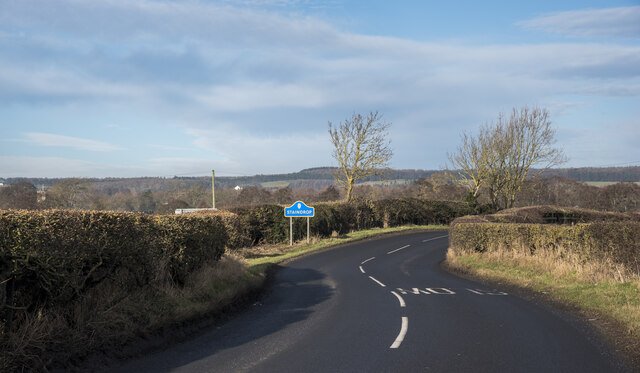
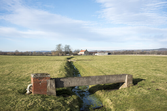
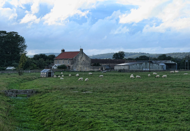
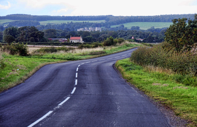
Black Bottoms Wood Images

Images are sourced within 2km of 54.577221/-1.7635238 or Grid Reference NZ1520. Thanks to Geograph Open Source API. All images are credited.

B6274 approaching Staindrop The B6274 winding its way northwards towards the village about to pass the County Durham road sign in the colours used there commonly, to name places.
B6274 approaching Staindrop
The B6274 winding its way northwards towards the village about to pass the County Durham road sign in the colours used there commonly, to name places.
Low bridges over stream The minor stream is a feeder of Langley Beck and is about to pass beneath the B6274; it's also crossed twice in the field. The nearer crossing is by a pipe which is supported by a concrete channel; the farther one must be a crossing point for farm vehicles.
Low bridges over stream
The minor stream is a feeder of Langley Beck and is about to pass beneath the B6274; it's also crossed twice in the field. The nearer crossing is by a pipe which is supported by a concrete channel; the farther one must be a crossing point for farm vehicles.
Road leading to telephone box in Langton Langton is a small settlement in County Durham; the blue and yellow road sign is typical of the style in use in the county. The telephone box is a small feature in the distance along the road.
Road leading to telephone box in Langton
Langton is a small settlement in County Durham; the blue and yellow road sign is typical of the style in use in the county. The telephone box is a small feature in the distance along the road.
Minor road, Langton The minor road into the village has a K6 type telephone box beside it.

In 1935, the Post Office commissioned a new kiosk from Sir Giles Gilbert Scott to celebrate the Jubilee of King George V.  The K6 Jubilee Kiosk, as it is known, was similar to the K2 box, being made of cast iron and painted red but was 25% lighter in weight.  By the end of the 1930s there were 20,000 K6 telephone boxes in use all over the UK.

Beside the telephone box there is also a postbox and the village noticeboard.
Minor road, Langton
The minor road into the village has a K6 type telephone box beside it. In 1935, the Post Office commissioned a new kiosk from Sir Giles Gilbert Scott to celebrate the Jubilee of King George V. The K6 Jubilee Kiosk, as it is known, was similar to the K2 box, being made of cast iron and painted red but was 25% lighter in weight. By the end of the 1930s there were 20,000 K6 telephone boxes in use all over the UK. Beside the telephone box there is also a postbox and the village noticeboard.
Minor road, Langton The minor road becomes Hulam Lane as it continues past Langton Farm.  

There is an Ordnance Survey bench mark on the corner of the farm building.
Minor road, Langton
The minor road becomes Hulam Lane as it continues past Langton Farm. There is an Ordnance Survey bench mark on the corner of the farm building.
Bench Mark, Langton Farm The Ordnance Survey bench mark is to be found on the east side of the barn.  For a wider view of the barn <a href="https://www.geograph.org.uk/photo/2457266">NZ1619 : Minor road, Langton</a> and for further information on the cut mark and others in the area <span class="nowrap"><a title="http://www.bench-marks.org.uk/bm38268" rel="nofollow ugc noopener" href="http://www.bench-marks.org.uk/bm38268">Link</a><img style="margin-left:2px;" alt="External link" title="External link - shift click to open in new window" src="https://s1.geograph.org.uk/img/external.png" width="10" height="10"/></span>
Bench Mark, Langton Farm
The Ordnance Survey bench mark is to be found on the east side of the barn. For a wider view of the barn NZ1619 : Minor road, Langton and for further information on the cut mark and others in the area LinkExternal link
Pump, Langton The pump is hidden in the hedge beside the drystone wall.
Pump, Langton
The pump is hidden in the hedge beside the drystone wall.
Alwent Alwent Farm.
Alwent
Alwent Farm.
B6274 The B6274 near Alwent south of Staindrop.
B6274
The B6274 near Alwent south of Staindrop.
Public footpath entrance from the B6274 to Alwent and beyond
A young tree plantation south of Alwent
A farmers bridge also carrying a public footpath at Alwent
Track to Selaby Farm Lots of farms are painted white in the area - it indicates that they belong to Raby estate. But they are not uniform in their architecture by any means, and Selaby farm seems quite unusual with its up-and-down roofline.
Track to Selaby Farm
Lots of farms are painted white in the area - it indicates that they belong to Raby estate. But they are not uniform in their architecture by any means, and Selaby farm seems quite unusual with its up-and-down roofline.
Stream under B6274 at Alwent Looking downstream from the B6274 roadbridge, it's not immediately obvious that this small stream is about to disappear underground, only to reappear at the far side of the next field. The large-scale map doesn't make clear whether this behaviour is natural or man-made. After it issues, it continues uninterrupted to flow into Langley Beck.
Stream under B6274 at Alwent
Looking downstream from the B6274 roadbridge, it's not immediately obvious that this small stream is about to disappear underground, only to reappear at the far side of the next field. The large-scale map doesn't make clear whether this behaviour is natural or man-made. After it issues, it continues uninterrupted to flow into Langley Beck.
Selaby Farm
Selaby Farm
Selaby Lane towards Langton
Stile and signage for footpath from Selaby Lane South to Hollin Hall West and beyond
Stile and signage for footpath from Selaby Lane
South to Hollin Hall West and beyond
High Mulberry Farm, Hilton, near West Auckland High Mulberry Farm
High Mulberry Farm, Hilton, near West Auckland
High Mulberry Farm
Show me another place!

Black Bottoms Wood is located at Grid Ref: NZ1520 (Lat: 54.577221, Lng: -1.7635238)

Unitary Authority: County Durham

Police Authority: Durham

What 3 Words

///alone.lengthen.pokers. Near Ingleton, Co. Durham

Nearby Locations

Black Bottoms Wood

Related Wikis

Hilton, County Durham

Hilton is a village and civil parish in County Durham, about 9 miles (14 km) northwest of Darlington. Nearby places are Ingleton and Staindrop. The 2011...

Langton, County Durham

Langton is a village and civil parish in County Durham, in England. It is situated to the west of Darlington, near Headlam and Ingleton. The population...

Ingleton, County Durham

Ingleton is a village and civil parish in County Durham, England. The population of the parish (which includes Headlam and Langton) as taken at the 2011...

Staindrop

Staindrop is a village and civil parish in County Durham, England. It is situated approximately 6 miles (9.7 km) north east of Barnard Castle, on the A688...

Nearby Amenities

Located within 500m of 54.577221,-1.7635238
site of Langton Grange
Addr Housename: site of Langton Grange
Building: yes
Lat/Long: 54.5740658/-1.7608578
The data included in this document is from www.openstreetmap.org. The data is made available under ODbL.

Have you been to Black Bottoms Wood?

Leave your review of Black Bottoms Wood below (or comments, questions and feedback).