Attlepin Turn Spinney

Wood, Forest in Gloucestershire Cotswold

England

Attlepin Turn Spinney

Market Hall, Chipping Campden Dates from 1627 <span class="nowrap"><a title="https://historicengland.org.uk/listing/the-list/list-entry/1078442?section=official-list-entry" rel="nofollow ugc noopener" href="https://historicengland.org.uk/listing/the-list/list-entry/1078442?section=official-list-entry">Link</a><img style="margin-left:2px;" alt="External link" title="External link - shift click to open in new window" src="https://s1.geograph.org.uk/img/external.png" width="10" height="10"/></span>
Market Hall, Chipping Campden Credit: Jonathan Thacker

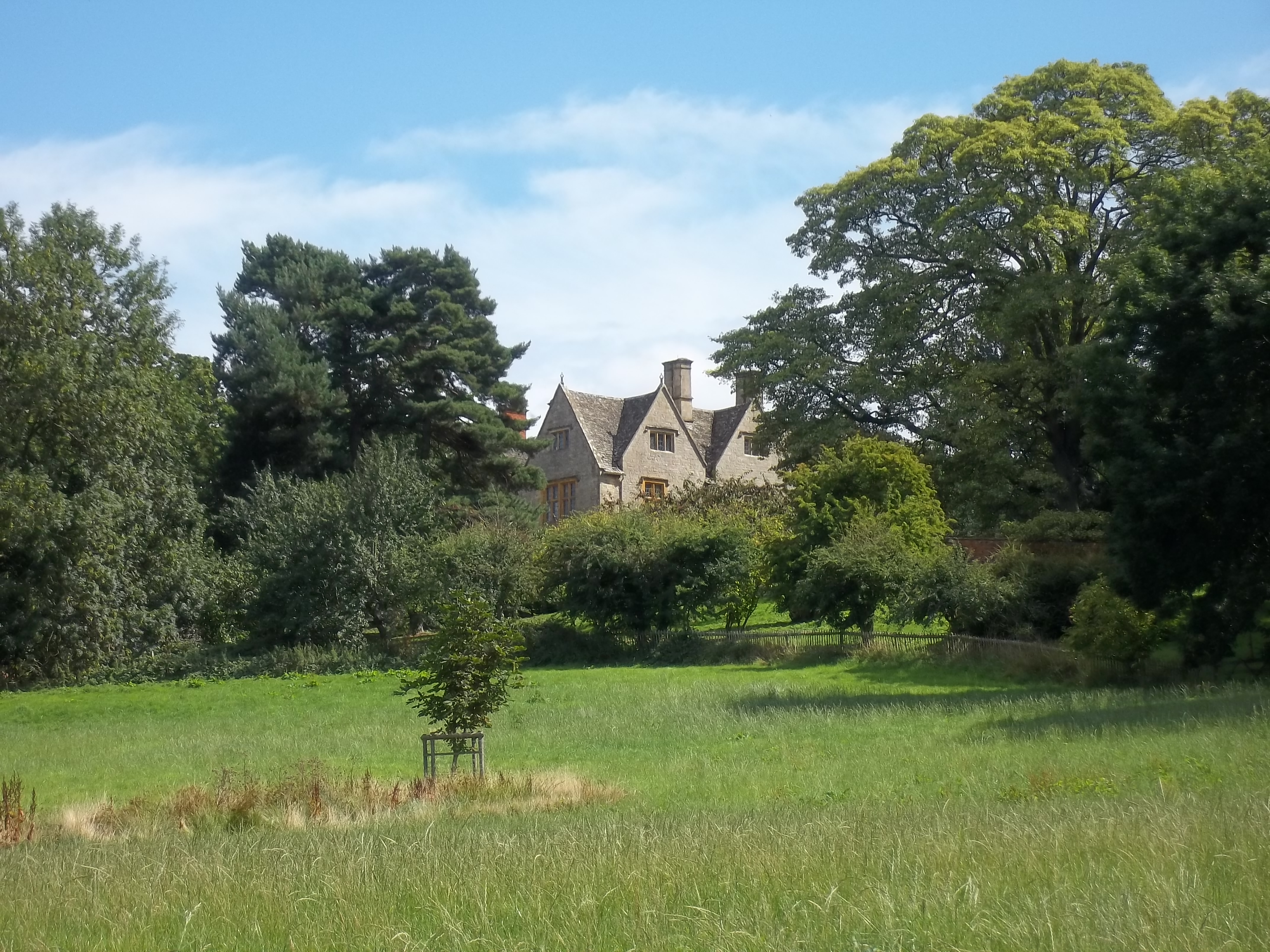
Attlepin Turn Spinney is a picturesque woodland area located in Gloucestershire, England. Covering an area of approximately 20 acres, it is a part of the larger Forest of Dean. The spinney is known for its dense and diverse vegetation, consisting primarily of native deciduous trees such as oak, beech, and silver birch.

The woodland is a haven for wildlife, providing a rich habitat for a variety of species. It is home to numerous bird species, including woodpeckers, nuthatches, and great tits, which can be heard chirping and singing throughout the year. Additionally, the spinney attracts small mammals like squirrels, foxes, and badgers.

Visitors to Attlepin Turn Spinney can enjoy walking trails that meander through the woodland, offering a peaceful and tranquil experience. The forest floor is carpeted with wildflowers in the spring, adding bursts of color to the green landscape, and during autumn, the trees transform into a vibrant tapestry of red, gold, and orange.

The spinney is a popular destination for nature enthusiasts, photographers, and families seeking outdoor activities. Picnic spots are available, allowing visitors to relax and enjoy the natural surroundings. With its close proximity to the Forest of Dean, Attlepin Turn Spinney offers a convenient starting point for further exploration of the larger forest area.

Overall, Attlepin Turn Spinney is a delightful woodland retreat, offering a serene escape from the hustle and bustle of everyday life. Its natural beauty, wildlife diversity, and peaceful ambiance make it a must-visit location for nature lovers in Gloucestershire.

If you have any feedback on the listing, please let us know in the comments section below.

Attlepin Turn Spinney Images

Images are sourced within 2km of 52.064902/-1.7802708 or Grid Reference SP1540. Thanks to Geograph Open Source API. All images are credited.

Market Hall, Chipping Campden Dates from 1627 <span class="nowrap"><a title="https://historicengland.org.uk/listing/the-list/list-entry/1078442?section=official-list-entry" rel="nofollow ugc noopener" href="https://historicengland.org.uk/listing/the-list/list-entry/1078442?section=official-list-entry">Link</a><img style="margin-left:2px;" alt="External link" title="External link - shift click to open in new window" src="https://s1.geograph.org.uk/img/external.png" width="10" height="10"/></span>
Market Hall, Chipping Campden
Dates from 1627 LinkExternal link
War Memorial, Chipping Campden Designed by F. L. Griggs <span class="nowrap"><a title="https://en.wikipedia.org/wiki/F._L._Griggs" rel="nofollow ugc noopener" href="https://en.wikipedia.org/wiki/F._L._Griggs">Link</a><img style="margin-left:2px;" alt="External link" title="External link - shift click to open in new window" src="https://s1.geograph.org.uk/img/external.png" width="10" height="10"/></span> 1919 <span class="nowrap"><a title="https://historicengland.org.uk/listing/the-list/list-entry/1342012?section=official-list-entry" rel="nofollow ugc noopener" href="https://historicengland.org.uk/listing/the-list/list-entry/1342012?section=official-list-entry">Link</a><img style="margin-left:2px;" alt="External link" title="External link - shift click to open in new window" src="https://s1.geograph.org.uk/img/external.png" width="10" height="10"/></span>
War Memorial, Chipping Campden
Designed by F. L. Griggs LinkExternal link 1919 LinkExternal link
Dovers House, Chipping Campden Dates from the 1720s <span class="nowrap"><a title="https://historicengland.org.uk/listing/the-list/list-entry/1305077?section=official-list-entry" rel="nofollow ugc noopener" href="https://historicengland.org.uk/listing/the-list/list-entry/1305077?section=official-list-entry">Link</a><img style="margin-left:2px;" alt="External link" title="External link - shift click to open in new window" src="https://s1.geograph.org.uk/img/external.png" width="10" height="10"/></span> The home of F. L. Griggs <span class="nowrap"><a title="https://en.wikipedia.org/wiki/F._L._Griggs" rel="nofollow ugc noopener" href="https://en.wikipedia.org/wiki/F._L._Griggs">Link</a><img style="margin-left:2px;" alt="External link" title="External link - shift click to open in new window" src="https://s1.geograph.org.uk/img/external.png" width="10" height="10"/></span>
Dovers House, Chipping Campden
Dates from the 1720s LinkExternal link The home of F. L. Griggs LinkExternal link
The Lanterns, Chipping Campden Date from the early nineteenth century <span class="nowrap"><a title="https://historicengland.org.uk/listing/the-list/list-entry/1078414?section=official-list-entry" rel="nofollow ugc noopener" href="https://historicengland.org.uk/listing/the-list/list-entry/1078414?section=official-list-entry">Link</a><img style="margin-left:2px;" alt="External link" title="External link - shift click to open in new window" src="https://s1.geograph.org.uk/img/external.png" width="10" height="10"/></span>
The Lanterns, Chipping Campden
Date from the early nineteenth century LinkExternal link
Braithwaite House, Chipping Campden Dates from the early eighteenth century <span class="nowrap"><a title="https://historicengland.org.uk/listing/the-list/list-entry/1342036?section=official-list-entry" rel="nofollow ugc noopener" href="https://historicengland.org.uk/listing/the-list/list-entry/1342036?section=official-list-entry">Link</a><img style="margin-left:2px;" alt="External link" title="External link - shift click to open in new window" src="https://s1.geograph.org.uk/img/external.png" width="10" height="10"/></span>
Braithwaite House, Chipping Campden
Dates from the early eighteenth century LinkExternal link
Church Street., Chipping Campden
Former school and church rooms, Chipping Campden Dates 1837 <span class="nowrap"><a title="https://historicengland.org.uk/listing/the-list/list-entry/1171906?section=official-list-entry" rel="nofollow ugc noopener" href="https://historicengland.org.uk/listing/the-list/list-entry/1171906?section=official-list-entry">Link</a><img style="margin-left:2px;" alt="External link" title="External link - shift click to open in new window" src="https://s1.geograph.org.uk/img/external.png" width="10" height="10"/></span>
Former school and church rooms, Chipping Campden
Dates 1837 LinkExternal link
Entrance to Campden House Dates from about 1613 <span class="nowrap"><a title="https://historicengland.org.uk/listing/the-list/list-entry/1341979?section=official-list-entry" rel="nofollow ugc noopener" href="https://historicengland.org.uk/listing/the-list/list-entry/1341979?section=official-list-entry">Link</a><img style="margin-left:2px;" alt="External link" title="External link - shift click to open in new window" src="https://s1.geograph.org.uk/img/external.png" width="10" height="10"/></span> Campden House was burnt down in 1645 and never rebuilt.
Entrance to Campden House
Dates from about 1613 LinkExternal link Campden House was burnt down in 1645 and never rebuilt.
Church of St James, Chipping Campden, east end Predominantly of the fifteenth century though containing earlier fabric <span class="nowrap"><a title="https://historicengland.org.uk/listing/the-list/list-entry/1341977?section=official-list-entry" rel="nofollow ugc noopener" href="https://historicengland.org.uk/listing/the-list/list-entry/1341977?section=official-list-entry">Link</a><img style="margin-left:2px;" alt="External link" title="External link - shift click to open in new window" src="https://s1.geograph.org.uk/img/external.png" width="10" height="10"/></span>
Church of St James, Chipping Campden, east end
Predominantly of the fifteenth century though containing earlier fabric LinkExternal link
Site and remains of Campden House Constructed on a grand scale in the early seventeenth century, the house was burnt down in 1645 and never rebuilt <span class="nowrap"><a title="https://historicengland.org.uk/listing/the-list/list-entry/1013875?section=official-list-entry" rel="nofollow ugc noopener" href="https://historicengland.org.uk/listing/the-list/list-entry/1013875?section=official-list-entry">Link</a><img style="margin-left:2px;" alt="External link" title="External link - shift click to open in new window" src="https://s1.geograph.org.uk/img/external.png" width="10" height="10"/></span>
Site and remains of Campden House
Constructed on a grand scale in the early seventeenth century, the house was burnt down in 1645 and never rebuilt LinkExternal link
Church Cottages, Chipping Campden
Almshouses, Chipping Campden Date from 1612 <span class="nowrap"><a title="https://historicengland.org.uk/listing/the-list/list-entry/1078454?section=official-list-entry" rel="nofollow ugc noopener" href="https://historicengland.org.uk/listing/the-list/list-entry/1078454?section=official-list-entry">Link</a><img style="margin-left:2px;" alt="External link" title="External link - shift click to open in new window" src="https://s1.geograph.org.uk/img/external.png" width="10" height="10"/></span> Contemporary with the Almshouses is the pavement which is also listed <span class="nowrap"><a title="https://historicengland.org.uk/listing/the-list/list-entry/1305520?section=official-list-entry" rel="nofollow ugc noopener" href="https://historicengland.org.uk/listing/the-list/list-entry/1305520?section=official-list-entry">Link</a><img style="margin-left:2px;" alt="External link" title="External link - shift click to open in new window" src="https://s1.geograph.org.uk/img/external.png" width="10" height="10"/></span>
Almshouses, Chipping Campden
Date from 1612 LinkExternal link Contemporary with the Almshouses is the pavement which is also listed LinkExternal link
Mill Cottage, Chipping Campden Eighteenth century cottage <span class="nowrap"><a title="https://historicengland.org.uk/listing/the-list/list-entry/1078450?section=official-list-entry" rel="nofollow ugc noopener" href="https://historicengland.org.uk/listing/the-list/list-entry/1078450?section=official-list-entry">Link</a><img style="margin-left:2px;" alt="External link" title="External link - shift click to open in new window" src="https://s1.geograph.org.uk/img/external.png" width="10" height="10"/></span>
Mill Cottage, Chipping Campden
Eighteenth century cottage LinkExternal link
Outbuilding to Court House, Chipping Campden Dates from abut 1612 <span class="nowrap"><a title="https://historicengland.org.uk/listing/the-list/list-entry/1305564?section=official-list-entry" rel="nofollow ugc noopener" href="https://historicengland.org.uk/listing/the-list/list-entry/1305564?section=official-list-entry">Link</a><img style="margin-left:2px;" alt="External link" title="External link - shift click to open in new window" src="https://s1.geograph.org.uk/img/external.png" width="10" height="10"/></span>
Outbuilding to Court House, Chipping Campden
Dates from abut 1612 LinkExternal link
Grassland of Calf's Lane, Chipping Campden Part of the grounds of the long-lost Campden House <span class="nowrap"><a title="https://historicengland.org.uk/listing/the-list/list-entry/1013875?section=official-list-entry" rel="nofollow ugc noopener" href="https://historicengland.org.uk/listing/the-list/list-entry/1013875?section=official-list-entry">Link</a><img style="margin-left:2px;" alt="External link" title="External link - shift click to open in new window" src="https://s1.geograph.org.uk/img/external.png" width="10" height="10"/></span> On the right is a pond which was part of the landscaped gardens.
Grassland of Calf's Lane, Chipping Campden
Part of the grounds of the long-lost Campden House LinkExternal link On the right is a pond which was part of the landscaped gardens.
Line of trees of Calf's Lane The roadway on the right is a public footpath.
Line of trees of Calf's Lane
The roadway on the right is a public footpath.
Grounds of the forner Campden House An overgrown water feature of the lost gardens of Campden House <span class="nowrap"><a title="https://historicengland.org.uk/listing/the-list/list-entry/1013875?section=official-list-entry" rel="nofollow ugc noopener" href="https://historicengland.org.uk/listing/the-list/list-entry/1013875?section=official-list-entry">Link</a><img style="margin-left:2px;" alt="External link" title="External link - shift click to open in new window" src="https://s1.geograph.org.uk/img/external.png" width="10" height="10"/></span>
Grounds of the forner Campden House
An overgrown water feature of the lost gardens of Campden House LinkExternal link
Show me another place!

Attlepin Turn Spinney is located at Grid Ref: SP1540 (Lat: 52.064902, Lng: -1.7802708)

Administrative County: Gloucestershire

District: Cotswold

Police Authority: Gloucestershire

What 3 Words

///maple.sing.confusion. Near Chipping Campden, Gloucestershire

Nearby Locations

Attlepin Turn Spinney

Related Wikis

Burnt Norton (house)

Burnt Norton is a manor house in Aston-sub-Edge, near Chipping Campden, Gloucestershire, best known for being the inspiration for T. S. Eliot's poem of...

Campden Tunnel Gravel Pit

Campden Tunnel Gravel Pit (grid reference SP161408) is a 0.2-hectare (0.49-acre) geological Site of Special Scientific Interest in Gloucestershire, notified...

Chipping Campden School

Chipping Campden School is a non-selective secondary school and sixth form with academy status located in Chipping Campden, in the English county of Gloucestershire...

Church of St James, Chipping Campden

The Anglican Church of St James at Chipping Campden in the Cotswold District of Gloucestershire, England was built in the 15th century incorporating an...

Chipping Campden

Chipping Campden is a market town in the Cotswold district of Gloucestershire, England. It is notable for its terraced High Street, dating from the 14th...

North Cotswold Community Radio

North Cotswold Community Radio is a non-profit community internet radio station serving primarily the North Cotswolds and the surrounding area in west...

Ernest Wilson Memorial Garden

Ernest Wilson Memorial Garden is located at the north eastern edge of Chipping Campden in Gloucestershire, England, in an area of the High Street known...

Chipping Campden Town Hall

Chipping Campden Town Hall is a municipal building in the High Street, Chipping Campden, Gloucestershire, England. The building, which is the meeting place...

Nearby Amenities

Located within 500m of 52.064902,-1.7802708
Bus Stop
Attlepin Turn
Bus: yes
Naptan AtcoCode: 1600GLA06125
Naptan Bearing: NE
Naptan CommonName: Attlepin Turn
Naptan NaptanCode: glogpgjp
Naptan Street: Campden Rd B4081
Naptan Verified: no
Note: exists on ground
Public Transport: platform
Source: naptan_import
Lat/Long: 52.0648289/-1.7806755
Bus Stop
Attlepin Turn
Bus: yes
Naptan AtcoCode: 1600GLA06126
Naptan Bearing: SW
Naptan CommonName: Attlepin Turn
Naptan NaptanCode: glogpgjt
Naptan Street: Campden Rd B4081
Naptan Verified: no
Public Transport: platform
Source: naptan_import
Lat/Long: 52.0648018/-1.7806026
Bus Stop
Paul's Pike House
Bus: yes
Naptan AtcoCode: 1600GLC499
Naptan Bearing: N
Naptan CommonName: Paul's Pike House
Naptan NaptanCode: glogdpat
Naptan Street: Aston Rd B4081
Naptan Verified: no
Public Transport: platform
Source: naptan_import
Lat/Long: 52.0620576/-1.7844086
Bus Stop
Paul's Pike House
Bus: yes
Naptan AtcoCode: 1600GLC500
Naptan Bearing: S
Naptan CommonName: Paul's Pike House
Naptan NaptanCode: glogdpaw
Naptan Street: Aston Rd B4081
Naptan Verified: no
Public Transport: platform
Source: naptan_import
Lat/Long: 52.0620485/-1.7843066
Paul's Pike
Place: locality
Lat/Long: 52.0627795/-1.7842094
Give Way
Source: bing
Lat/Long: 52.062272/-1.7842644
Power: pole
Lat/Long: 52.0679154/-1.7855653
Power: pole
Lat/Long: 52.0673824/-1.7848887
Attlepin
Power: pole
Transformer: distribution
Voltage Primary: 11000
Lat/Long: 52.065607/-1.783156
Power: pole
Lat/Long: 52.0661689/-1.7835879
Power: pole
Lat/Long: 52.0668313/-1.7841639
Power: pole
Lat/Long: 52.064945/-1.7826377
Power: pole
Lat/Long: 52.0642153/-1.7820315
Power: pole
Lat/Long: 52.0637445/-1.7816573
Power: pole
Lat/Long: 52.062925/-1.78188
Power: pole
Lat/Long: 52.0628858/-1.7848793
Paul's Pike
Power: pole
Transformer: distribution
Voltage Primary: 11000
Lat/Long: 52.0630635/-1.7840338
Power: pole
Lat/Long: 52.0624422/-1.7827617
Power: pole
Lat/Long: 52.062117/-1.7820979
Power: pole
Lat/Long: 52.0608975/-1.7836053
Power: pole
Lat/Long: 52.0612582/-1.7828617
Power: pole
Lat/Long: 52.0615501/-1.7822461
Hurst
Power: pole
Transformer: distribution
Voltage Primary: 11000
Lat/Long: 52.0613143/-1.7823118
Power: pole
Lat/Long: 52.0611143/-1.7810391
Power: pole
Lat/Long: 52.0606246/-1.7799635
The data included in this document is from www.openstreetmap.org. The data is made available under ODbL.

Have you been to Attlepin Turn Spinney?

Leave your review of Attlepin Turn Spinney below (or comments, questions and feedback).