Badger Beck Plantation
Wood, Forest in Yorkshire Richmondshire
England
Badger Beck Plantation
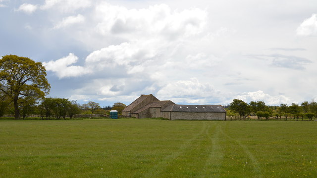
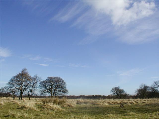
Badger Beck Plantation is a picturesque woodland located in the county of Yorkshire, England. Situated near the village of Wood, the plantation covers a vast area of lush greenery and magnificent trees, making it a haven for nature enthusiasts and wildlife lovers alike.
The plantation is known for its dense forest, which is predominantly composed of native tree species such as oak, beech, and birch. These towering trees create a serene and tranquil atmosphere, providing a perfect escape from the hustle and bustle of urban life. Walking along the well-maintained trails, visitors can immerse themselves in the beauty of the woodland, breathing in the fresh scent of pine and listening to the soothing sounds of birdsong.
Badger Beck Plantation is also home to a diverse range of wildlife, making it a popular spot for animal enthusiasts. One may spot various species of birds, including woodpeckers, owls, and jays, as well as mammals such as badgers, foxes, and deer. The plantation's rich biodiversity provides a thriving habitat for these creatures, ensuring their survival and contributing to the overall ecological balance of the area.
In addition to its natural wonders, Badger Beck Plantation offers a range of recreational activities. Visitors can enjoy picnicking amidst the enchanting scenery, or engage in outdoor pursuits such as hiking and cycling along the designated trails. The plantation also hosts educational programs and guided tours, allowing visitors to learn about the rich history and significance of the woodland.
Overall, Badger Beck Plantation is a hidden gem in Yorkshire, offering a peaceful retreat and an opportunity to connect with nature in its purest form.
If you have any feedback on the listing, please let us know in the comments section below.
Badger Beck Plantation Images
Images are sourced within 2km of 54.384057/-1.7738419 or Grid Reference SE1498. Thanks to Geograph Open Source API. All images are credited.


Badger Beck Plantation is located at Grid Ref: SE1498 (Lat: 54.384057, Lng: -1.7738419)
Division: North Riding
Administrative County: North Yorkshire
District: Richmondshire
Police Authority: North Yorkshire
What 3 Words
///hits.replenish.clotting. Near Richmond, North Yorkshire
Nearby Locations
Related Wikis
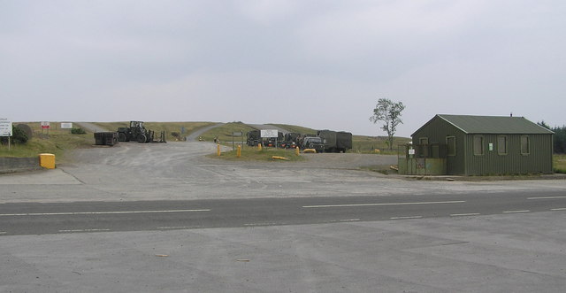
Hipswell Moor
Hipswell Moor is an area used for military training, near Catterick Garrison in North Yorkshire, England. It includes parts of the civil parishes of Barden...

Hudswell, North Yorkshire
Hudswell is a village and civil parish on the border of the Yorkshire Dales, in North Yorkshire, England. The population at the ONS Census 2011 was 353...

St Joseph and St Francis Xavier Church
St Joseph and St Francis Xavier Church is a Roman Catholic Parish church in Richmond, North Yorkshire. It is situated between Newbiggin and Victoria Road...
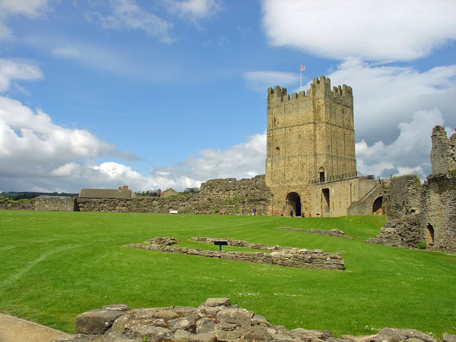
Richmond Castle
Richmond Castle in Richmond, North Yorkshire, England, stands in a commanding position above the River Swale, close to the centre of the town of Richmond...

Richmond Town Hall, North Yorkshire
Richmond Town Hall is a municipal building in the Market Place, Richmond, North Yorkshire, England. The structure, which is the meeting place of Richmond...

Green Howards Regimental Museum
The Green Howards Regimental Museum is the museum of the Green Howards infantry regiment of the British Army. It is located in the old Trinity Church in...

Richmond, North Yorkshire
Richmond is a market town and civil parish in the district and county of North Yorkshire, England. It is in the Swaledale valley, near the River Swale...

St Martin's, North Yorkshire
St Martin's is a civil parish in North Yorkshire, England. It is located south of the town of Richmond, covering the residential areas south of the River...
Nearby Amenities
Located within 500m of 54.384057,-1.7738419Have you been to Badger Beck Plantation?
Leave your review of Badger Beck Plantation below (or comments, questions and feedback).