Brockhill Clump

Wood, Forest in Gloucestershire Cotswold

England

Brockhill Clump

Upper Slaughter church The sunken path leading to St Peter's church in Upper Slaughter.  The church is Grade II* listed, see: <span class="nowrap"><a title="https://historicengland.org.uk/listing/the-list/list-entry/1237720?section=official-list-entry" rel="nofollow ugc noopener" href="https://historicengland.org.uk/listing/the-list/list-entry/1237720?section=official-list-entry">Link</a><img style="margin-left:2px;" alt="External link" title="External link - shift click to open in new window" src="https://s1.geograph.org.uk/img/external.png" width="10" height="10"/></span>
Upper Slaughter church Credit: Philip Halling

Brockhill Clump is a picturesque woodland located in Gloucestershire, England. It is situated near the town of Cheltenham and covers an area of approximately 50 acres. The clump is part of the larger Cotswold Hills, renowned for their natural beauty and rural charm.

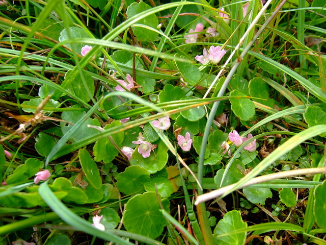
This ancient woodland is predominantly composed of deciduous trees, such as oak, beech, and ash. These towering trees provide a dense canopy, creating a cool and shaded environment beneath. The forest floor is covered in a rich carpet of wildflowers, ferns, and mosses, adding to the enchanting atmosphere.

Brockhill Clump is home to a diverse range of wildlife, including numerous bird species such as woodpeckers, tawny owls, and nightingales. Deer, badgers, and foxes can also be spotted roaming the forest, while butterflies and dragonflies flit among the foliage during the warmer months.

The clump offers several walking trails, allowing visitors to explore its natural beauty at their leisure. These paths wind through the trees, offering glimpses of picturesque vistas and tranquil ponds. The peaceful ambiance and abundance of wildlife make it a popular destination for nature enthusiasts, walkers, and photographers alike.

Managed by local conservation organizations, Brockhill Clump is carefully preserved to maintain its ecological balance and protect its natural heritage. The woodland is open to the public year-round, offering a peaceful sanctuary away from the hustle and bustle of urban life. Visitors can immerse themselves in the beauty of nature, relax, and recharge in this idyllic woodland setting.

If you have any feedback on the listing, please let us know in the comments section below.

Brockhill Clump Images

Images are sourced within 2km of 51.911724/-1.7987104 or Grid Reference SP1323. Thanks to Geograph Open Source API. All images are credited.

Upper Slaughter church The sunken path leading to St Peter's church in Upper Slaughter.  The church is Grade II* listed, see: <span class="nowrap"><a title="https://historicengland.org.uk/listing/the-list/list-entry/1237720?section=official-list-entry" rel="nofollow ugc noopener" href="https://historicengland.org.uk/listing/the-list/list-entry/1237720?section=official-list-entry">Link</a><img style="margin-left:2px;" alt="External link" title="External link - shift click to open in new window" src="https://s1.geograph.org.uk/img/external.png" width="10" height="10"/></span>
Upper Slaughter church
The sunken path leading to St Peter's church in Upper Slaughter. The church is Grade II* listed, see: LinkExternal link
Upper Slaughter church Upper Slaughter church is dedicated to St Peter and dates from the 12th century.  The church is Grade II* listed, see: <span class="nowrap"><a title="https://historicengland.org.uk/listing/the-list/list-entry/1237720?section=official-list-entry" rel="nofollow ugc noopener" href="https://historicengland.org.uk/listing/the-list/list-entry/1237720?section=official-list-entry">Link</a><img style="margin-left:2px;" alt="External link" title="External link - shift click to open in new window" src="https://s1.geograph.org.uk/img/external.png" width="10" height="10"/></span>
Upper Slaughter church
Upper Slaughter church is dedicated to St Peter and dates from the 12th century. The church is Grade II* listed, see: LinkExternal link
Tower of Upper Slaughter church The tower of St Peter's church, Upper Slaughter.  The church is Grade II* listed, see: <span class="nowrap"><a title="https://historicengland.org.uk/listing/the-list/list-entry/1237720?section=official-list-entry" rel="nofollow ugc noopener" href="https://historicengland.org.uk/listing/the-list/list-entry/1237720?section=official-list-entry">Link</a><img style="margin-left:2px;" alt="External link" title="External link - shift click to open in new window" src="https://s1.geograph.org.uk/img/external.png" width="10" height="10"/></span>
Tower of Upper Slaughter church
The tower of St Peter's church, Upper Slaughter. The church is Grade II* listed, see: LinkExternal link
Upper Slaughter The River Eye flowing through the village of Upper Slaughter.
Upper Slaughter
The River Eye flowing through the village of Upper Slaughter.
Lords of the Manor Hotel The Lords of the Manor Hotel viewed across the Eye valley at Upper Slaughter.  The hotel building is Grade I listed, see: <span class="nowrap"><a title="https://historicengland.org.uk/listing/the-list/list-entry/1237768?section=official-list-entry" rel="nofollow ugc noopener" href="https://historicengland.org.uk/listing/the-list/list-entry/1237768?section=official-list-entry">Link</a><img style="margin-left:2px;" alt="External link" title="External link - shift click to open in new window" src="https://s1.geograph.org.uk/img/external.png" width="10" height="10"/></span>  A similar view to when I photographed the same scene almost a year ago.
Lords of the Manor Hotel
The Lords of the Manor Hotel viewed across the Eye valley at Upper Slaughter. The hotel building is Grade I listed, see: LinkExternal link A similar view to when I photographed the same scene almost a year ago.
Old Milestone, B4068 Metal plate attached to stone post by the B4068, on the SE verge In parish of UPPER SLAUGHTER (COTSWOLD District), W of reservoir, near Eyford Cottages and Eyford Knoll. Stow iron plate erected by the Foss & Cross (Stow on the Wold) turnpike trust in the 19th century. Other views see <a title="https://www.geograph.org.uk/photo/1937294" href="https://www.geograph.org.uk/photo/1937294">Link</a> or <a title="https://www.geograph.org.uk/photo/4275899" href="https://www.geograph.org.uk/photo/4275899">Link</a> . Cut Benchmark  representing 167.0 m ASL.

Inscription reads: STOW. 3 / GLO,ᴿ 22 / CHELT,ᴹ 15

Milestone Society National ID: GL_SWCM03
Old Milestone, B4068
Metal plate attached to stone post by the B4068, on the SE verge In parish of UPPER SLAUGHTER (COTSWOLD District), W of reservoir, near Eyford Cottages and Eyford Knoll. Stow iron plate erected by the Foss & Cross (Stow on the Wold) turnpike trust in the 19th century. Other views see Link or Link . Cut Benchmark representing 167.0 m ASL. Inscription reads: STOW. 3 / GLO,ᴿ 22 / CHELT,ᴹ 15 Milestone Society National ID: GL_SWCM03
Cambrays and attached Barn, Upper Slaughter Grade II listed. Listing number 1274418.
Cambrays and attached Barn, Upper Slaughter
Grade II listed. Listing number 1274418.
The Ford, Upper Slaughter Crossing the River Eye.
The Ford, Upper Slaughter
Crossing the River Eye.
The Old Schoolhouse Upper Slaughter.
The Old Schoolhouse
Upper Slaughter.
St Peter's Church, Upper Slaughter Grade II* listed. Listing number 1237720. Dating from the 12th century with alterations of 1822. Witts Mortuary Chapel of 1854 by Francis Niblett, and careful restoration of 1877 by John Edward Knight Cutts.
St Peter's Church, Upper Slaughter
Grade II* listed. Listing number 1237720. Dating from the 12th century with alterations of 1822. Witts Mortuary Chapel of 1854 by Francis Niblett, and careful restoration of 1877 by John Edward Knight Cutts.
Cottages in the village centre Upper Slaughter.
Cottages in the village centre
Upper Slaughter.
Lords of the Manor Hotel Grade II listed. Listing number 1274419. House, onetime Rectory, now hotel. Early 18th century core, extended north and south 1855 by the Rev Francis Witts.
Lords of the Manor Hotel
Grade II listed. Listing number 1274419. House, onetime Rectory, now hotel. Early 18th century core, extended north and south 1855 by the Rev Francis Witts.
Lords of the Manor Hotel Grade II listed. Listing number 1274419. House, onetime Rectory, now hotel. Early 18th century  core, extended north and south 1855 by the Rev Francis Witts.
Lords of the Manor Hotel
Grade II listed. Listing number 1274419. House, onetime Rectory, now hotel. Early 18th century core, extended north and south 1855 by the Rev Francis Witts.
Stone Stile, Upper Slaughter GS2814 On Gloucestershire footpath HSU8 as it approaches the Wardens Way (bridleway HSU5). The view from the bridleway is <a href="https://www.geograph.org.uk/photo/7200164">SP1523 : Stone Stile, Upper Slaughter GS2814</a>
Stone Stile, Upper Slaughter GS2814
On Gloucestershire footpath HSU8 as it approaches the Wardens Way (bridleway HSU5). The view from the bridleway is SP1523 : Stone Stile, Upper Slaughter GS2814
Stone Stile, Upper Slaughter GS2814 On Gloucestershire footpath HSU8 as it approaches the Wardens Way (bridleway HSU5). The view to the bridleway is <a href="https://www.geograph.org.uk/photo/7200161">SP1523 : Stone Stile, Upper Slaughter GS2814</a>.
Stone Stile, Upper Slaughter GS2814
On Gloucestershire footpath HSU8 as it approaches the Wardens Way (bridleway HSU5). The view to the bridleway is SP1523 : Stone Stile, Upper Slaughter GS2814.
Upper Slaughter Church
Bridge over the River Eye, Upper Slaughter In a scene that is unmistakeably in the Cotswolds, a lane crosses the River Eye and runs up to a house called The Bridges. The Slaughter name comes from the Old English for 'muddy place'.
Bridge over the River Eye, Upper Slaughter
In a scene that is unmistakeably in the Cotswolds, a lane crosses the River Eye and runs up to a house called The Bridges. The Slaughter name comes from the Old English for 'muddy place'.
River Eye, Upper Slaughter A bench provides a peaceful refuge overlooking the diminutive reed-choked River Eye at Upper Slaughter.
River Eye, Upper Slaughter
A bench provides a peaceful refuge overlooking the diminutive reed-choked River Eye at Upper Slaughter.
Show me another place!

Brockhill Clump is located at Grid Ref: SP1323 (Lat: 51.911724, Lng: -1.7987104)

Administrative County: Gloucestershire

District: Cotswold

Police Authority: Gloucestershire

What 3 Words

///encrusted.universes.tadpoles. Near Bourton on the Water, Gloucestershire

Nearby Locations

Brockhill Clump

Related Wikis

Brassey SSSI

Brassey (grid reference SP139223) is a 2.1-hectare (5.2-acre) biological Site of Special Scientific Interest in Gloucestershire, notified in 1954 and renotified...

Upper Slaughter

Upper Slaughter is a village in the Cotswold district of Gloucestershire, England, 4 miles (6.4 km) south west of Stow-on-the-Wold. The village lies off...

Lower Slaughter

Lower Slaughter is a village in the Cotswold district of Gloucestershire, England, 4 miles (6.4 km) south west of Stow-on-the-Wold. The village is built...

Harford Railway Cutting

Harford Railway Cutting (SP135218 to SP141215) is a 1.2-hectare (3.0-acre) geological Site of Special Scientific Interest in Gloucestershire, notified...

Nearby Amenities

Located within 500m of 51.911724,-1.7987104
Bus Stop
Brockhill Clump
Bus: yes
Naptan AtcoCode: 1600GL767
Naptan Bearing: NE
Naptan CommonName: Brockhill Clump
Naptan NaptanCode: glogdmpd
Naptan Street: B4068
Naptan Verified: no
Public Transport: platform
Source: naptan_import
Lat/Long: 51.9117069/-1.7976175
Bus Stop
Brockhill Clump
Bus: yes
Naptan AtcoCode: 1600GL768
Naptan Bearing: SW
Naptan CommonName: Brockhill Clump
Naptan NaptanCode: glogdmpg
Naptan Street: B4068
Naptan Verified: no
Public Transport: platform
Source: naptan_import
Lat/Long: 51.911617/-1.7976324
Wales Barn
Power: pole
Transformer: distribution
Voltage Primary: 11000
Lat/Long: 51.911927/-1.7951086
Eyford Knoll
Power: pole
Transformer: distribution
Voltage Primary: 11000
Lat/Long: 51.9150392/-1.7944501
Power: pole
Lat/Long: 51.9142359/-1.7941269
Power: pole
Lat/Long: 51.913268/-1.7937836
Power: pole
Lat/Long: 51.9125144/-1.7939338
Power: pole
Lat/Long: 51.9117508/-1.7940954
Power: pole
Lat/Long: 51.9113975/-1.7921662
Tuppenny Barn
Power: pole
Transformer: distribution
Voltage Primary: 11000
Lat/Long: 51.9092114/-1.8018081
Power: pole
Lat/Long: 51.909383/-1.8000385
Power: pole
Lat/Long: 51.909503/-1.7988181
Power: pole
Lat/Long: 51.9096511/-1.7972906
Power: pole
Lat/Long: 51.9097628/-1.7961359
Power: pole
Lat/Long: 51.9104437/-1.7949839
Power: pole
Lat/Long: 51.9110104/-1.7940331
Power: pole
Lat/Long: 51.9115696/-1.793101
The data included in this document is from www.openstreetmap.org. The data is made available under ODbL.

Have you been to Brockhill Clump?

Leave your review of Brockhill Clump below (or comments, questions and feedback).