Down's Plantation

Wood, Forest in Gloucestershire Cotswold

England

Down's Plantation

The Croft, Fairford The same view as this one from 14 years ago. <a href="https://www.geograph.org.uk/photo/641894">SP1501 : Croft Lane, Fairford</a>
A bit more foliage, but otherwise not much different.
The Croft, Fairford Credit: Des Blenkinsopp

Down's Plantation is a picturesque woodland located in Gloucestershire, England. Spanning over an area of approximately 100 acres, the plantation is nestled within the beautiful Forest of Dean. Its tranquil setting and lush greenery make it a popular destination for nature enthusiasts and those seeking a peaceful retreat.

The plantation is predominantly composed of various species of deciduous trees, including oak, beech, and ash. These towering trees create a dense canopy that provides ample shade during the summer months and a stunning display of colors during the autumn season. The forest floor is covered with a rich carpet of ferns, bluebells, and wildflowers, adding to its natural charm.

A network of well-maintained walking trails winds through the plantation, offering visitors the opportunity to explore its diverse ecosystem. These paths range from leisurely strolls to more challenging hikes, catering to individuals of all fitness levels. Along the way, hikers may encounter an array of wildlife, such as deer, squirrels, and a variety of bird species.

Down's Plantation is not only a haven for nature lovers but also serves as an important habitat for several endangered plant and animal species. The plantation is actively managed by local conservation organizations, ensuring the preservation of its ecological integrity.

Visitors to the plantation can also enjoy various recreational activities, including picnicking, birdwatching, and photography. Additionally, the plantation offers educational programs and guided tours to promote awareness about the importance of conservation and sustainable land management.

Overall, Down's Plantation in Gloucestershire is a captivating woodland retreat that provides an opportunity to connect with nature and appreciate the beauty of the Forest of Dean.

If you have any feedback on the listing, please let us know in the comments section below.

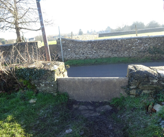
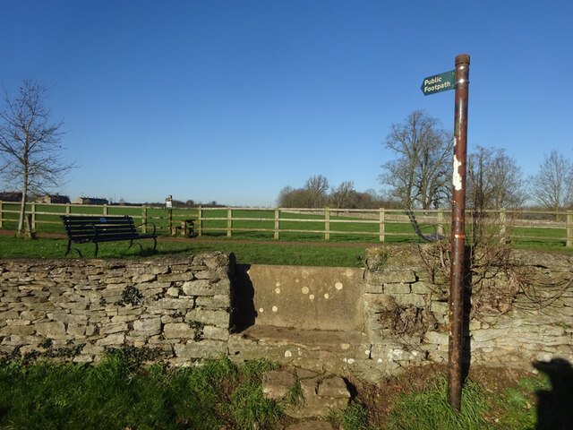
Down's Plantation Images

Images are sourced within 2km of 51.721127/-1.8009175 or Grid Reference SP1302. Thanks to Geograph Open Source API. All images are credited.

The Croft, Fairford The same view as this one from 14 years ago. <a href="https://www.geograph.org.uk/photo/641894">SP1501 : Croft Lane, Fairford</a>
A bit more foliage, but otherwise not much different.
The Croft, Fairford
The same view as this one from 14 years ago. SP1501 : Croft Lane, Fairford A bit more foliage, but otherwise not much different.
Stone Stile, Fairford Off Mill Lane on Gloucestershire footpath BFA11 looking SE. The view from the road is <a href="https://www.geograph.org.uk/photo/7069675">SP1401 : Stone Stile, Fairford</a>. This is opposite another stone stile see <a title="https://www.geograph.org.uk/photo/7069689" href="https://www.geograph.org.uk/photo/7069689">Link</a> & <a title="https://www.geograph.org.uk/photo/7069691" href="https://www.geograph.org.uk/photo/7069691">Link</a>
Stone Stile, Fairford
Off Mill Lane on Gloucestershire footpath BFA11 looking SE. The view from the road is SP1401 : Stone Stile, Fairford. This is opposite another stone stile see Link & Link
Stone Stile, Fairford Off Mill Lane on Gloucestershire footpath BFA11 looking NW. The view from the footpath is <a href="https://www.geograph.org.uk/photo/7069672">SP1401 : Stone Stile, Fairford</a>. This is opposite another stone stile see <a title="https://www.geograph.org.uk/photo/7069689" href="https://www.geograph.org.uk/photo/7069689">Link</a> & <a title="https://www.geograph.org.uk/photo/7069691" href="https://www.geograph.org.uk/photo/7069691">Link</a>
Stone Stile, Fairford
Off Mill Lane on Gloucestershire footpath BFA11 looking NW. The view from the footpath is SP1401 : Stone Stile, Fairford. This is opposite another stone stile see Link & Link
Stone Stile, Fairford Off Mill Lane on Gloucestershire footpath BFA11 looking South. The view from the field is <a href="https://www.geograph.org.uk/photo/7069691">SP1401 : Stone Stile, Fairford</a>. This is opposite another stone stile see <a title="https://www.geograph.org.uk/photo/7069675" href="https://www.geograph.org.uk/photo/7069675">Link</a> & <a title="https://www.geograph.org.uk/photo/7069672" href="https://www.geograph.org.uk/photo/7069672">Link</a>
Stone Stile, Fairford
Off Mill Lane on Gloucestershire footpath BFA11 looking South. The view from the field is SP1401 : Stone Stile, Fairford. This is opposite another stone stile see Link & Link
Stone Stile, Fairford Off Mill Lane on Gloucestershire footpath BFA11 looking North. The view from the road is <a href="https://www.geograph.org.uk/photo/7069689">SP1401 : Stone Stile, Fairford</a>. This is opposite another stone stile see <a title="https://www.geograph.org.uk/photo/7069675" href="https://www.geograph.org.uk/photo/7069675">Link</a> & <a title="https://www.geograph.org.uk/photo/7069672" href="https://www.geograph.org.uk/photo/7069672">Link</a>
Stone Stile, Fairford
Off Mill Lane on Gloucestershire footpath BFA11 looking North. The view from the road is SP1401 : Stone Stile, Fairford. This is opposite another stone stile see Link & Link
Stone Stile, Fairford Looking North to Mill Lane and a leisure area from Gloucestershire footpath BFA12. The view South is <a href="https://www.geograph.org.uk/photo/7069731">SP1401 : Stone Stile, Fairford</a>. The slab was recast &/or covered with concrete in 1961. The stile is owned by the Earnest Cook Trust.
Stone Stile, Fairford
Looking North to Mill Lane and a leisure area from Gloucestershire footpath BFA12. The view South is SP1401 : Stone Stile, Fairford. The slab was recast &/or covered with concrete in 1961. The stile is owned by the Earnest Cook Trust.
Stone Stile, Fairford Looking South from Mill Lane to Gloucestershire footpath BFA12. The view North is <a href="https://www.geograph.org.uk/photo/7069728">SP1401 : Stone Stile, Fairford</a>. The slab was recast &/or covered with concrete in 1961. The stile is owned by the Earnest Cook Trust.
Stone Stile, Fairford
Looking South from Mill Lane to Gloucestershire footpath BFA12. The view North is SP1401 : Stone Stile, Fairford. The slab was recast &/or covered with concrete in 1961. The stile is owned by the Earnest Cook Trust.
Stone Stile, Fairford Looking to Milton Street on Gloucestershire footpaths BFA12 & BFA11. The view looking in is <a href="https://www.geograph.org.uk/photo/7288622">SP1401 : Stone Stile, Fairford</a>.
Stone Stile, Fairford
Looking to Milton Street on Gloucestershire footpaths BFA12 & BFA11. The view looking in is SP1401 : Stone Stile, Fairford.
Stone Stile, Fairford Off "the Garrets" on Gloucestershire footpath BFA11 looking East. The view from the field is <a href="https://www.geograph.org.uk/photo/7069775">SP1401 : Stone Stile, Fairford</a>. On the RH abutment there is a Benchmark representing 96.0 m ASL.
Stone Stile, Fairford
Off "the Garrets" on Gloucestershire footpath BFA11 looking East. The view from the field is SP1401 : Stone Stile, Fairford. On the RH abutment there is a Benchmark representing 96.0 m ASL.
Stone Stile, Fairford Off "the Garrets" on Gloucestershire footpath BFA11 looking West. The view from the road is <a href="https://www.geograph.org.uk/photo/7069772">SP1401 : Stone Stile, Fairford</a>.
Stone Stile, Fairford
Off "the Garrets" on Gloucestershire footpath BFA11 looking West. The view from the road is SP1401 : Stone Stile, Fairford.
Stone Stile, Fairford On Gloucestershire footpath BFA10, running SW from Horcott Road. This is looking North in the direction of the road. The view South is <a href="https://www.geograph.org.uk/photo/7069840">SP1400 : Stone Stile, Fairford</a>.
Stone Stile, Fairford
On Gloucestershire footpath BFA10, running SW from Horcott Road. This is looking North in the direction of the road. The view South is SP1400 : Stone Stile, Fairford.
Stone Stile, Fairford On Gloucestershire footpath BFA10, running SW from Horcott Road. This is looking South, away from the road. The view Northis <a href="https://www.geograph.org.uk/photo/7069838">SP1400 : Stone Stile, Fairford</a>.
Stone Stile, Fairford
On Gloucestershire footpath BFA10, running SW from Horcott Road. This is looking South, away from the road. The view Northis SP1400 : Stone Stile, Fairford.
Stone Stile, Quenington Off Mawley Road on Gloucestershire footpath BQU8 looking SW. The view looking NE is <a href="https://www.geograph.org.uk/photo/7069903">SP1404 : Stone Stile, Quenington</a>.
Stone Stile, Quenington
Off Mawley Road on Gloucestershire footpath BQU8 looking SW. The view looking NE is SP1404 : Stone Stile, Quenington.
Stone Stile, Quenington Off Mawley Road on Gloucestershire footpath BQU8 looking NE. The view looking SW is <a href="https://www.geograph.org.uk/photo/7069895">SP1404 : Stone Stile, Quenington</a>.
Stone Stile, Quenington
Off Mawley Road on Gloucestershire footpath BQU8 looking NE. The view looking SW is SP1404 : Stone Stile, Quenington.
River Coln, Fairford This is a view upstream of the tributary of the Thames. The viewpoint was afforded by the Town Bridge <a href="https://www.geograph.org.uk/photo/6859832">SP1501 : Bridge over the River Coln, Fairford</a>
River Coln, Fairford
This is a view upstream of the tributary of the Thames. The viewpoint was afforded by the Town Bridge SP1501 : Bridge over the River Coln, Fairford
Weir, millpond and bridge, Fairford When I was last here, the bridge was obscured by vegetation <a href="https://www.geograph.org.uk/photo/6612819">SP1401 : Millpond, Fairford</a> For those who might be interested, the bridge straddles the gridline between two grid squares.
Weir, millpond and bridge, Fairford
When I was last here, the bridge was obscured by vegetation SP1401 : Millpond, Fairford For those who might be interested, the bridge straddles the gridline between two grid squares.
Corner of Coronation Street On the corner of Coronation Street and Cirencester Road some old houses are partly hidden by a clutter of poles and notices.
Corner of Coronation Street
On the corner of Coronation Street and Cirencester Road some old houses are partly hidden by a clutter of poles and notices.
Stone Stile, Fairford Looking from Milton Street on Gloucestershire footpaths BFA12 & BFA11. The view looking out is <a href="https://www.geograph.org.uk/photo/7069749">SP1401 : Stone Stile, Fairford</a>.
Stone Stile, Fairford
Looking from Milton Street on Gloucestershire footpaths BFA12 & BFA11. The view looking out is SP1401 : Stone Stile, Fairford.
Show me another place!

Down's Plantation is located at Grid Ref: SP1302 (Lat: 51.721127, Lng: -1.8009175)

Administrative County: Gloucestershire

District: Cotswold

Police Authority: Gloucestershire

What 3 Words

///drum.elbowing.congested. Near Fairford, Gloucestershire

Related Wikis

Farmor's School

Farmor's School is a secondary school with academy status in Fairford, Gloucestershire. Including the Sixth Form, the school currently has about 1,000...

Fairford Park

Fairford Park is a 4,200-acre (1,700 ha) estate in the southern Cotswolds in Gloucestershire, England, close to the small town of Fairford. Purchased by...

Quenington Preceptory

Quenington Preceptory was a preceptory of the Knights Hospitaller in Quenington, Gloucestershire, England. The manor of Quenington was given by Agnes de...

Quenington

Quenington is a nucleated village and larger rural civil parish in the Cotswold district of Gloucestershire, England, on the River Coln 8 miles (13 km...

Fairford

Fairford is a market town in Gloucestershire, England. The town lies in the Cotswold hills on the River Coln, 6 miles (9.7 km) east of Cirencester, 4 miles...

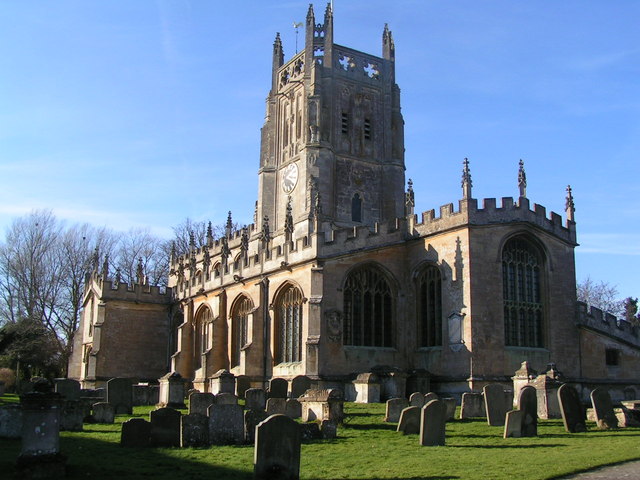
St Mary's Church, Fairford

St Mary's Church is a Church of England church in Fairford, Gloucestershire, England. It is notable for its complete set of 28 medieval stained-glass...

Sunhill

Sunhill is hamlet at the junction of a five-ways crossroads in the English county of Gloucestershire. == Overview == Sunhill is located on the ancient...

Fairford Town F.C.

Fairford Town Football Club is a football club based in Fairford, Gloucestershire, England. Affiliated to the Gloucestershire County Football Association...

Nearby Amenities

Located within 500m of 51.721127,-1.8009175
Power: pole
Source: Bing
Lat/Long: 51.7211763/-1.8067253
Power: pole
Source: Bing
Lat/Long: 51.7200912/-1.8057704
Power: pole
Lat/Long: 51.7222996/-1.8076882
Power: pole
Lat/Long: 51.7189797/-1.804786
Power: pole
Lat/Long: 51.7178215/-1.8040377
The data included in this document is from www.openstreetmap.org. The data is made available under ODbL.

Have you been to Down's Plantation?

Leave your review of Down's Plantation below (or comments, questions and feedback).