Long Copse

Wood, Forest in Hampshire New Forest

England

Long Copse

Daffodils beside the footpath On the way to Whitsbury. Many daffodils along this bank. I suspect they were planted by local residents.
Daffodils beside the footpath Credit: Clive Perrin

Long Copse is a picturesque woodland located in the county of Hampshire, England. Covering an area of approximately 50 acres, it is a beautiful and diverse natural habitat. The forest is nestled in the heart of the South Downs National Park, offering visitors a tranquil and peaceful retreat from the bustling city life.

Long Copse is characterized by its dense canopy of native trees, including oak, beech, and birch. These towering trees create a shaded and cool environment, perfect for exploring on a hot summer's day. The forest floor is covered in a thick layer of leaf litter, providing a home for a variety of small mammals, insects, and fungi.

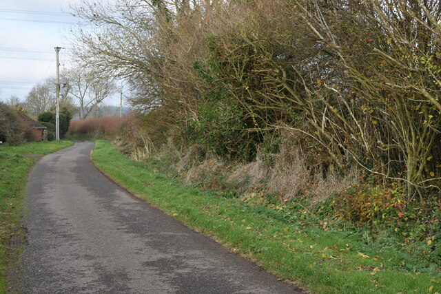
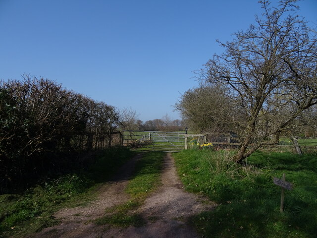
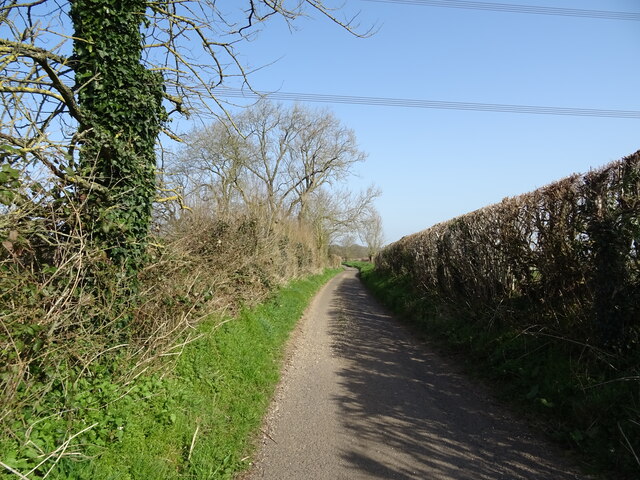
The woodland is crisscrossed with a network of well-maintained walking trails, allowing visitors to fully immerse themselves in the natural beauty of the area. These trails lead to several scenic viewpoints, offering stunning vistas of the surrounding countryside. Long Copse is also home to a small stream, which adds to the tranquility of the setting.

The forest is a haven for wildlife, attracting a wide range of bird species, including woodpeckers, owls, and warblers. It is not uncommon to spot deer, foxes, and squirrels while exploring the woodland. Wildflowers such as bluebells, primroses, and wood anemones carpet the forest floor in the spring, adding a burst of color to the landscape.

Long Copse is a popular destination for nature enthusiasts, hikers, and families looking to escape into the great outdoors. With its diverse ecosystem and peaceful atmosphere, it offers a unique and enchanting experience for all who visit.

If you have any feedback on the listing, please let us know in the comments section below.

Long Copse Images

Images are sourced within 2km of 50.96265/-1.806721 or Grid Reference SU1318. Thanks to Geograph Open Source API. All images are credited.

Daffodils beside the footpath On the way to Whitsbury. Many daffodils along this bank. I suspect they were planted by local residents.
Daffodils beside the footpath
On the way to Whitsbury. Many daffodils along this bank. I suspect they were planted by local residents.
Field south of Breamore Park
Footpath west of Breamore
Fields west of Flood Street Farm
Flood Street, looking towards Peasash Farm
Gated track
Gated track
Lane towards Outwick
Crop field towards Floodstreet Copse
Lane heading north, Flood Street
Fingerpost near Flood Street
Field, Breamore
Field, Breamore
Lane, Breamore
Lane, Breamore
Breamore Church - Interior Inside St Mary's Church which has many Saxon details.
<span class="nowrap"><a title="www.nationalchurchestrust.org/church/st-mary-breamore" rel="nofollow ugc noopener" href="http://www.nationalchurchestrust.org/church/st-mary-breamore">Link</a><img style="margin-left:2px;" alt="External link" title="External link - shift click to open in new window" src="https://s1.geograph.org.uk/img/external.png" width="10" height="10"/></span>
Breamore Church - Interior
Inside St Mary's Church which has many Saxon details. LinkExternal link
Breamore Church - Wall Painting Inside St Mary's Church which has many Saxon details.
<span class="nowrap"><a title="www.nationalchurchestrust.org/church/st-mary-breamore" rel="nofollow ugc noopener" href="http://www.nationalchurchestrust.org/church/st-mary-breamore">Link</a><img style="margin-left:2px;" alt="External link" title="External link - shift click to open in new window" src="https://s1.geograph.org.uk/img/external.png" width="10" height="10"/></span>
Breamore Church - Wall Painting
Inside St Mary's Church which has many Saxon details. LinkExternal link
Breamore Church - Carved Head Inside St Mary's Church which has many Saxon details.
<span class="nowrap"><a title="www.nationalchurchestrust.org/church/st-mary-breamore" rel="nofollow ugc noopener" href="http://www.nationalchurchestrust.org/church/st-mary-breamore">Link</a><img style="margin-left:2px;" alt="External link" title="External link - shift click to open in new window" src="https://s1.geograph.org.uk/img/external.png" width="10" height="10"/></span>
Breamore Church - Carved Head
Inside St Mary's Church which has many Saxon details. LinkExternal link
Breamore Church - King Edward the Confessor Stained glass window inside St Mary's Church which has many Saxon details.
<span class="nowrap"><a title="www.nationalchurchestrust.org/church/st-mary-breamore" rel="nofollow ugc noopener" href="http://www.nationalchurchestrust.org/church/st-mary-breamore">Link</a><img style="margin-left:2px;" alt="External link" title="External link - shift click to open in new window" src="https://s1.geograph.org.uk/img/external.png" width="10" height="10"/></span>
Breamore Church - King Edward the Confessor
Stained glass window inside St Mary's Church which has many Saxon details. LinkExternal link
Breamore - Font Inside St Mary's Church which has many Saxon details.
<span class="nowrap"><a title="www.nationalchurchestrust.org/church/st-mary-breamore" rel="nofollow ugc noopener" href="http://www.nationalchurchestrust.org/church/st-mary-breamore">Link</a><img style="margin-left:2px;" alt="External link" title="External link - shift click to open in new window" src="https://s1.geograph.org.uk/img/external.png" width="10" height="10"/></span>
Breamore - Font
Inside St Mary's Church which has many Saxon details. LinkExternal link
Breamore - Parish Church St Mary's Church has many Saxon details.
<span class="nowrap"><a title="www.nationalchurchestrust.org/church/st-mary-breamore" rel="nofollow ugc noopener" href="http://www.nationalchurchestrust.org/church/st-mary-breamore">Link</a><img style="margin-left:2px;" alt="External link" title="External link - shift click to open in new window" src="https://s1.geograph.org.uk/img/external.png" width="10" height="10"/></span>
Breamore - Parish Church
St Mary's Church has many Saxon details. LinkExternal link
Show me another place!

Long Copse is located at Grid Ref: SU1318 (Lat: 50.96265, Lng: -1.806721)

Administrative County: Hampshire

District: New Forest

Police Authority: Hampshire

What 3 Words

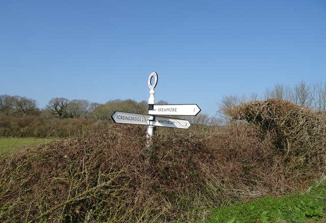
///cherry.published.ultra. Near Fordingbridge, Hampshire

Related Wikis

Whitsbury

Whitsbury is a village and civil parish in Hampshire, England, close to Fordingbridge. Whitsbury is a part of a group of villages on the edge of the Cranborne...

Whitsbury Castle

Whitsbury Castle, or Whitsbury Castle Ditches, is the site of an Iron Age univallate hillfort located near the village of Whitsbury in Hampshire. The fort...
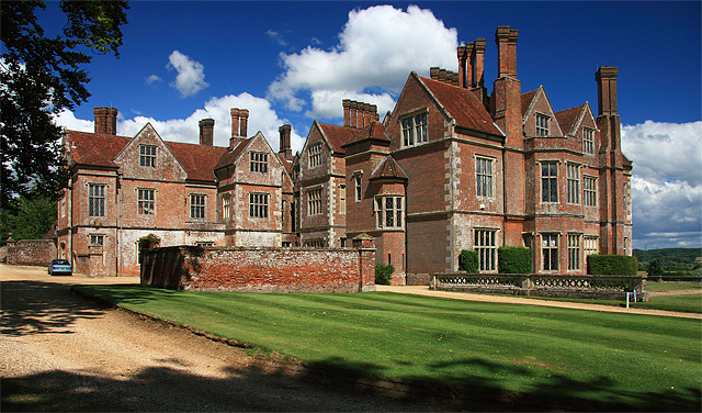
Breamore House

Breamore House is an Elizabethan manor house noted for its fine collection of paintings and furniture and situated NW of Breamore village, north of Fordingbridge...
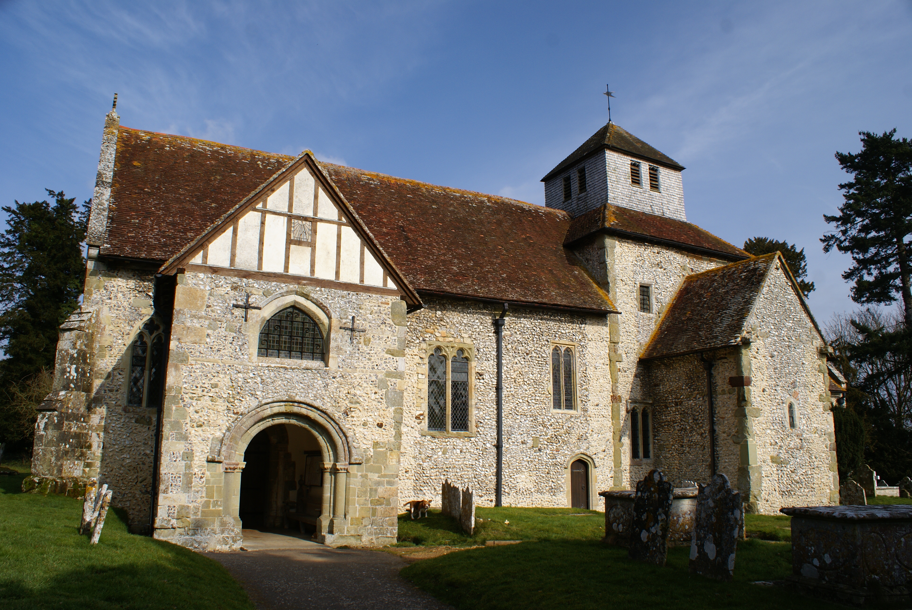
Breamore Priory

Breamore Priory was a priory of Austin canons in Breamore, Hampshire, England. == Foundation == The priory was founded some time towards the end of the...

Rockbourne Roman Villa

Rockbourne Roman Villa is a Roman courtyard villa excavated and put on public display in the village of Rockbourne in the English county of Hampshire....
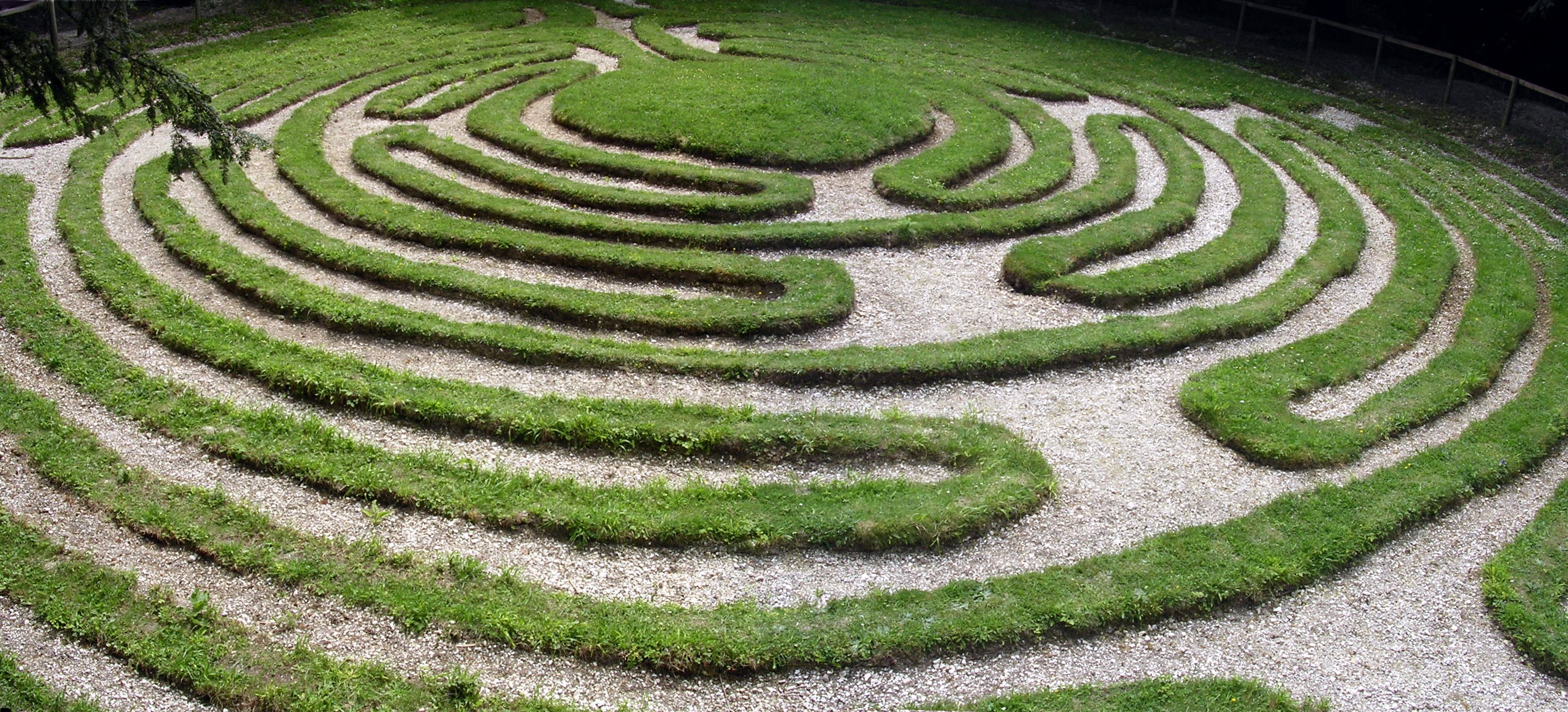
Mizmaze

Mizmaze (or Miz-Maze or Miz Maze) is the name given to two of England's eight surviving historic turf mazes, and also to a third, presumably once similar...

Breamore

Breamore ( BREM-ər) is a village and civil parish near Fordingbridge in Hampshire, England. The parish includes a notable Elizabethan country house, Breamore...

Rockbourne

Rockbourne is a village and civil parish in the English county of Hampshire, close to Fordingbridge. == Overview == Rockbourne is a village of thatched...

Nearby Amenities

Located within 500m of 50.96265,-1.806721
Post Box
Operator: Royal Mail
Post Box Type: lamp
Ref: SP6 288
Royal Cypher: EIIR
Royal Cypher Wikidata: Q33102113
Lat/Long: 50.9606822/-1.8096342
Silver Hills
Place: locality
Lat/Long: 50.9600389/-1.8043832
Hurst's Coppice
Place: locality
Lat/Long: 50.9594528/-1.8054111
Brickplots
Place: locality
Lat/Long: 50.960441/-1.8032253
Brickplots Coppice
Place: locality
Lat/Long: 50.9599912/-1.8026951
Bare Plots
Place: locality
Lat/Long: 50.9589075/-1.8078026
Whitsbury Firs
Place: locality
Lat/Long: 50.9632131/-1.8095614
Long Copse
Place: locality
Lat/Long: 50.9633995/-1.8071601
Three Corner Copse
Place: locality
Lat/Long: 50.9624258/-1.8071766
The data included in this document is from www.openstreetmap.org. The data is made available under ODbL.

Have you been to Long Copse?

Leave your review of Long Copse below (or comments, questions and feedback).