Llansantffraed-Cwmdeuddwr

Settlement in Radnorshire

Wales

Llansantffraed-Cwmdeuddwr

Clock Tower, Rhayader
Clock Tower, Rhayader Credit: Richard Sutcliffe

The requested URL returned error: 429 Too Many Requests

If you have any feedback on the listing, please let us know in the comments section below.

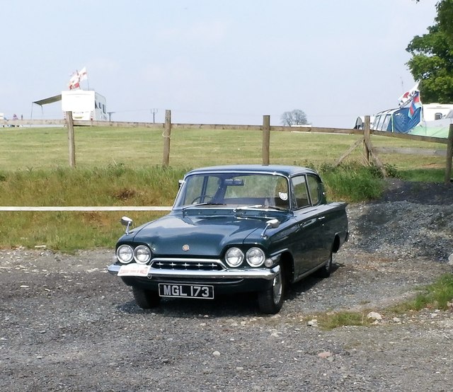
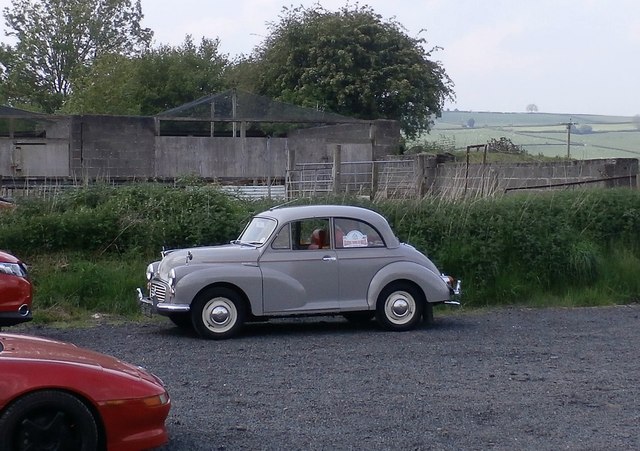
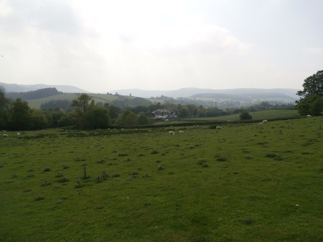
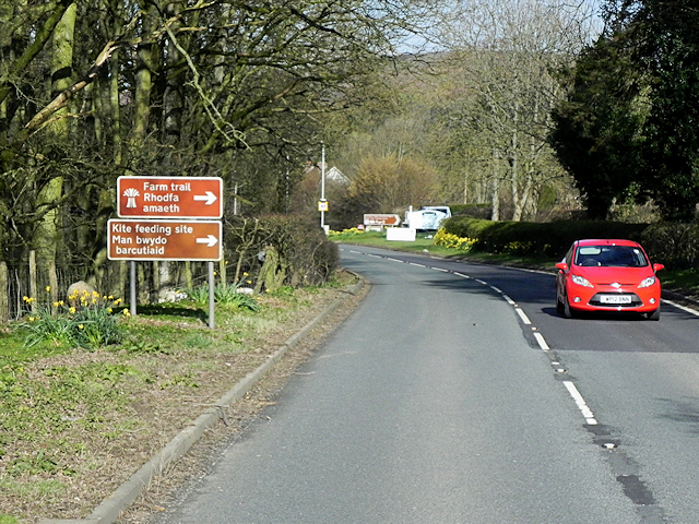
Llansantffraed-Cwmdeuddwr Images

Images are sourced within 2km of 52.296723/-3.518423 or Grid Reference SN9667. Thanks to Geograph Open Source API. All images are credited.

Clock Tower, Rhayader
Car Park with Peacocks at Gigrin Farm
Peacock at Gigrin Farm
Ford Consul Classic at Gigrin Farm
Morris Minor at Gigrin Farm
Sheep Pasture at Gigrin Farm
Red Kites at Gigrin Farm
Flock of Red Kites at Gigrin Farm
The A470 Entering Rhayader from the South The A470, also known as the Cardiff to Glan Conwy Trunk Road, is the major long-distance road in Wales, from Cardiff on the south coast to Llandudno on the north coast. It is 185 miles long, and has undergone considerable road improvement in the last two decades. While previously one had to navigate the narrow roads of Llanidloes and Dolgellau, both these market towns are now bypassed due to extensive road modernisation.

The road travels through two of Wales's national parks, the Brecon Beacons in the South and Snowdonia National Park, starting just south of Dinas Mawddwy in the North. It is a primary trunk route throughout its length, and the southernmost 26 miles, from Cardiff Bay to Merthyr Tydfil, is mainly direct and good quality dual carriageway, but most of the route from north of Merthyr to Llandudno is single carriageway.
<span class="nowrap"><a title="http://www.sabre-roads.org.uk/wiki/index.php?title=A470" rel="nofollow ugc noopener" href="http://www.sabre-roads.org.uk/wiki/index.php?title=A470">Link</a><img style="margin-left:2px;" alt="External link" title="External link - shift click to open in new window" src="https://s1.geograph.org.uk/img/external.png" width="10" height="10"/></span>  SABRE
The A470 Entering Rhayader from the South
The A470, also known as the Cardiff to Glan Conwy Trunk Road, is the major long-distance road in Wales, from Cardiff on the south coast to Llandudno on the north coast. It is 185 miles long, and has undergone considerable road improvement in the last two decades. While previously one had to navigate the narrow roads of Llanidloes and Dolgellau, both these market towns are now bypassed due to extensive road modernisation. The road travels through two of Wales's national parks, the Brecon Beacons in the South and Snowdonia National Park, starting just south of Dinas Mawddwy in the North. It is a primary trunk route throughout its length, and the southernmost 26 miles, from Cardiff Bay to Merthyr Tydfil, is mainly direct and good quality dual carriageway, but most of the route from north of Merthyr to Llandudno is single carriageway. LinkExternal link SABRE
Red Kite Feeding Signs on the A470 at Rhayader The red kite is Wales' most popular bird (<span class="nowrap"><a title="https://www.highbeam.com/doc/1G1-169667894.html" rel="nofollow ugc noopener" href="https://www.highbeam.com/doc/1G1-169667894.html">Link</a><img style="margin-left:2px;" alt="External link" title="External link - shift click to open in new window" src="https://s1.geograph.org.uk/img/external.png" width="10" height="10"/></span> Daily Post) and is a national symbol of wildlife in Wales. Red kites are regularly fed by humans in some parts of mid-Wales. This has a dual purpose: it is intended to help sustain and increase the kite population through the provision of extra food, and it also acts as a tourism draw.

Gigrin Farm Red Kite Feeding and Rehabilitation Centre, near Rhayader is one kite feeding location where between 200 and 500 kites visit per day.  It is signposted by brown (tourist route) signs on the A470 into the town from the south.
Red Kite Feeding Signs on the A470 at Rhayader
The red kite is Wales' most popular bird (LinkExternal link Daily Post) and is a national symbol of wildlife in Wales. Red kites are regularly fed by humans in some parts of mid-Wales. This has a dual purpose: it is intended to help sustain and increase the kite population through the provision of extra food, and it also acts as a tourism draw. Gigrin Farm Red Kite Feeding and Rehabilitation Centre, near Rhayader is one kite feeding location where between 200 and 500 kites visit per day. It is signposted by brown (tourist route) signs on the A470 into the town from the south.
Rhayader, Tan House Bridge Rhayader (Welsh: Rhaeadr Gwy) is a small market town in Powys; its population was recorded as  2088 at the 2011 census. The town is one of the principal centres of population in the predominantly rural historic county of Radnorshire. It is situated on the A470, roughly midway between north and south Wales, 13 miles north of Builth Wells and 30 miles east of Aberystwyth, some 700ft above sea level in the Upper Wye Valley.

The name "Rhayader" is corrupted from the Welsh "Rhaeadr Gwy", meaning Waterfall on the Wye. Little remains of the waterfall itself, it having been destroyed in 1780 to make way for the bridge linking the town to Cwmdauddwr and the Elan Valley.
Rhayader, Tan House Bridge
Rhayader (Welsh: Rhaeadr Gwy) is a small market town in Powys; its population was recorded as 2088 at the 2011 census. The town is one of the principal centres of population in the predominantly rural historic county of Radnorshire. It is situated on the A470, roughly midway between north and south Wales, 13 miles north of Builth Wells and 30 miles east of Aberystwyth, some 700ft above sea level in the Upper Wye Valley. The name "Rhayader" is corrupted from the Welsh "Rhaeadr Gwy", meaning Waterfall on the Wye. Little remains of the waterfall itself, it having been destroyed in 1780 to make way for the bridge linking the town to Cwmdauddwr and the Elan Valley.
Rhayader, South Street Rhayader (Welsh: Rhaeadr Gwy) is a small market town in Powys; its population was recorded as  2088 at the 2011 census. The town is one of the principal centres of population in the predominantly rural historic county of Radnorshire. It is situated on the A470, roughly midway between north and south Wales, 13 miles north of Builth Wells and 30 miles east of Aberystwyth, some 700ft above sea level in the Upper Wye Valley.

The name "Rhayader" is corrupted from the Welsh "Rhaeadr Gwy", meaning Waterfall on the Wye. Little remains of the waterfall itself, it having been destroyed in 1780 to make way for the bridge linking the town to Cwmdauddwr and the Elan Valley.
Rhayader, South Street
Rhayader (Welsh: Rhaeadr Gwy) is a small market town in Powys; its population was recorded as 2088 at the 2011 census. The town is one of the principal centres of population in the predominantly rural historic county of Radnorshire. It is situated on the A470, roughly midway between north and south Wales, 13 miles north of Builth Wells and 30 miles east of Aberystwyth, some 700ft above sea level in the Upper Wye Valley. The name "Rhayader" is corrupted from the Welsh "Rhaeadr Gwy", meaning Waterfall on the Wye. Little remains of the waterfall itself, it having been destroyed in 1780 to make way for the bridge linking the town to Cwmdauddwr and the Elan Valley.
South Street, Rhayader Rhayader (Welsh: Rhaeadr Gwy) is a small market town in Powys; its population was recorded as  2088 at the 2011 census. The town is one of the principal centres of population in the predominantly rural historic county of Radnorshire. It is situated on the A470, roughly midway between north and south Wales, 13 miles north of Builth Wells and 30 miles east of Aberystwyth, some 700ft above sea level in the Upper Wye Valley.

The name "Rhayader" is corrupted from the Welsh "Rhaeadr Gwy", meaning Waterfall on the Wye. Little remains of the waterfall itself, it having been destroyed in 1780 to make way for the bridge linking the town to Cwmdauddwr and the Elan Valley.
South Street, Rhayader
Rhayader (Welsh: Rhaeadr Gwy) is a small market town in Powys; its population was recorded as 2088 at the 2011 census. The town is one of the principal centres of population in the predominantly rural historic county of Radnorshire. It is situated on the A470, roughly midway between north and south Wales, 13 miles north of Builth Wells and 30 miles east of Aberystwyth, some 700ft above sea level in the Upper Wye Valley. The name "Rhayader" is corrupted from the Welsh "Rhaeadr Gwy", meaning Waterfall on the Wye. Little remains of the waterfall itself, it having been destroyed in 1780 to make way for the bridge linking the town to Cwmdauddwr and the Elan Valley.
Rhayader, West Street Rhayader (Welsh: Rhaeadr Gwy) is a small market town in Powys; its population was recorded as  2088 at the 2011 census. The town is one of the principal centres of population in the predominantly rural historic county of Radnorshire. It is situated on the A470, roughly midway between north and south Wales, 13 miles north of Builth Wells and 30 miles east of Aberystwyth, some 700ft above sea level in the Upper Wye Valley.

The name "Rhayader" is corrupted from the Welsh "Rhaeadr Gwy", meaning Waterfall on the Wye. Little remains of the waterfall itself, it having been destroyed in 1780 to make way for the bridge linking the town to Cwmdauddwr and the Elan Valley.
Rhayader, West Street
Rhayader (Welsh: Rhaeadr Gwy) is a small market town in Powys; its population was recorded as 2088 at the 2011 census. The town is one of the principal centres of population in the predominantly rural historic county of Radnorshire. It is situated on the A470, roughly midway between north and south Wales, 13 miles north of Builth Wells and 30 miles east of Aberystwyth, some 700ft above sea level in the Upper Wye Valley. The name "Rhayader" is corrupted from the Welsh "Rhaeadr Gwy", meaning Waterfall on the Wye. Little remains of the waterfall itself, it having been destroyed in 1780 to make way for the bridge linking the town to Cwmdauddwr and the Elan Valley.
Rhayader, Bridge Street Rhayader (Welsh: Rhaeadr Gwy) is a small market town in Powys; its population was recorded as  2088 at the 2011 census. The town is one of the principal centres of population in the predominantly rural historic county of Radnorshire. It is situated on the A470, roughly midway between north and south Wales, 13 miles north of Builth Wells and 30 miles east of Aberystwyth, some 700ft above sea level in the Upper Wye Valley.

The name "Rhayader" is corrupted from the Welsh "Rhaeadr Gwy", meaning Waterfall on the Wye. Little remains of the waterfall itself, it having been destroyed in 1780 to make way for the bridge linking the town to Cwmdauddwr and the Elan Valley.
Rhayader, Bridge Street
Rhayader (Welsh: Rhaeadr Gwy) is a small market town in Powys; its population was recorded as 2088 at the 2011 census. The town is one of the principal centres of population in the predominantly rural historic county of Radnorshire. It is situated on the A470, roughly midway between north and south Wales, 13 miles north of Builth Wells and 30 miles east of Aberystwyth, some 700ft above sea level in the Upper Wye Valley. The name "Rhayader" is corrupted from the Welsh "Rhaeadr Gwy", meaning Waterfall on the Wye. Little remains of the waterfall itself, it having been destroyed in 1780 to make way for the bridge linking the town to Cwmdauddwr and the Elan Valley.
Bridge Street, Rhayader Rhayader (Welsh: Rhaeadr Gwy) is a small market town in Powys; its population was recorded as  2088 at the 2011 census. The town is one of the principal centres of population in the predominantly rural historic county of Radnorshire. It is situated on the A470, roughly midway between north and south Wales, 13 miles north of Builth Wells and 30 miles east of Aberystwyth, some 700ft above sea level in the Upper Wye Valley.

The name "Rhayader" is corrupted from the Welsh "Rhaeadr Gwy", meaning Waterfall on the Wye. Little remains of the waterfall itself, it having been destroyed in 1780 to make way for the bridge linking the town to Cwmdauddwr and the Elan Valley.
Bridge Street, Rhayader
Rhayader (Welsh: Rhaeadr Gwy) is a small market town in Powys; its population was recorded as 2088 at the 2011 census. The town is one of the principal centres of population in the predominantly rural historic county of Radnorshire. It is situated on the A470, roughly midway between north and south Wales, 13 miles north of Builth Wells and 30 miles east of Aberystwyth, some 700ft above sea level in the Upper Wye Valley. The name "Rhayader" is corrupted from the Welsh "Rhaeadr Gwy", meaning Waterfall on the Wye. Little remains of the waterfall itself, it having been destroyed in 1780 to make way for the bridge linking the town to Cwmdauddwr and the Elan Valley.
Rhayader, Wye View Terrace The A470 entering Rhayader from the north.
Rhayader, Wye View Terrace
The A470 entering Rhayader from the north.
Wye View Terrace Rhayader (Welsh: Rhaeadr Gwy) is a small market town in Powys; its population was recorded as  2088 at the 2011 census. The town is one of the principal centres of population in the predominantly rural historic county of Radnorshire. It is situated on the A470, roughly midway between north and south Wales, 13 miles north of Builth Wells and 30 miles east of Aberystwyth, some 700ft above sea level in the Upper Wye Valley.

The name "Rhayader" is corrupted from the Welsh "Rhaeadr Gwy", meaning Waterfall on the Wye. Little remains of the waterfall itself, it having been destroyed in 1780 to make way for the bridge linking the town to Cwmdauddwr and the Elan Valley.
Wye View Terrace
Rhayader (Welsh: Rhaeadr Gwy) is a small market town in Powys; its population was recorded as 2088 at the 2011 census. The town is one of the principal centres of population in the predominantly rural historic county of Radnorshire. It is situated on the A470, roughly midway between north and south Wales, 13 miles north of Builth Wells and 30 miles east of Aberystwyth, some 700ft above sea level in the Upper Wye Valley. The name "Rhayader" is corrupted from the Welsh "Rhaeadr Gwy", meaning Waterfall on the Wye. Little remains of the waterfall itself, it having been destroyed in 1780 to make way for the bridge linking the town to Cwmdauddwr and the Elan Valley.
Show me another place!

Llansantffraed-Cwmdeuddwr is located at Grid Ref: SN9667 (Lat: 52.296723, Lng: -3.518423)

Unitary Authority: Powys

Police Authority: Dyfed Powys

Also known as: Llansanffraid Cwmteuddwr, Cwmteuddwr

What 3 Words

///battle.outcasts.suave. Near Rhayader, Powys

Related Wikis

Cwmdauddwr

Cwmdauddwr (rarely referred to by its correct full name of Llansanffraid Cwmteuddwr) is a village in Powys, Wales. It is contiguous with the town of Rhayader...

Rhayader railway station

Rhayader railway station was a station serving the town of Rhayader, Powys, on the Mid Wales Railway line. It was opened in 1864 in Cwmdauddwr, a village...

Rhayader Rural District

Rhayader was, from 1894 to 1974, a rural district in the administrative county of Radnorshire, Wales. The district was formed by the Local Government Act...

Rhayader Town F.C.

Rhayader Town Football Club (Welsh: Clwb Pêl-droed Tref Rhaeadr Gwy) are a Welsh football team. The club dates from around 1884 and their ground is called...

Nearby Amenities

Located within 500m of 52.296723,-3.518423
Source: npe
Lat/Long: 52.2969201/-3.5211002
Source: npe
Lat/Long: 52.2973717/-3.5204075
Llansantffraed-Cwmdeuddwr
Created By: Potlatch 0.10e
Is In: Powys;Wales;UK
Note: this is not Rhayader itself
Place: village
Lat/Long: 52.2982693/-3.5184786
Rhayader
Historic Railway: station
Railway: site
Wikidata: Q7320276
Wikipedia: en:Rhayader railway station
Lat/Long: 52.2996915/-3.516856
Pub
Triangle
Wikidata: Q80584323
Lat/Long: 52.2983056/-3.5151448
Tourism: artwork
Lat/Long: 52.2981838/-3.5174145
Pipeline: valve
Lat/Long: 52.293678/-3.522027
Post Box
Brand: Royal Mail
Brand Wikidata: Q638098
Brand Wikipedia: en:Royal Mail
Operator: Royal Mail
Operator Wikidata: Q638098
Post Box Type: wall
Ref: LD6 62D
Royal Cypher: GVIR
Royal Cypher Wikidata: Q33102169
Lat/Long: 52.299306/-3.5146662
Waterway: weir
Lat/Long: 52.2990893/-3.5143049
Place Of Worship
St Bride’s Cwmdauddwr
Religion: christian
Wikidata: Q29493888
Lat/Long: 52.2975273/-3.5151216
Cafe
The Lost ARC
Cuisine: regional
Lat/Long: 52.3000442/-3.5139142
Drinking Water
Access: yes
Wheelchair: yes
Lat/Long: 52.2998774/-3.5135412
Place Of Worship
Religion: animist
Lat/Long: 52.2994634/-3.5127402
Man Made: mast
Tower Type: communication
Lat/Long: 52.2997927/-3.5178266
Direction: WNW
Generator Method: photovoltaic
Generator Output Electricity: yes
Generator Solar Modules: 20
Generator Source: solar
Generator Type: solar_photovoltaic_panel
Location: roof
Power: generator
Lat/Long: 52.3001282/-3.517392
Direction: 165
Generator Method: photovoltaic
Generator Output Electricity: yes
Generator Solar Modules: 16
Generator Source: solar
Generator Type: solar_photovoltaic_panel
Location: roof
Power: generator
Lat/Long: 52.299404/-3.5134289
Direction: 165
Generator Method: photovoltaic
Generator Output Electricity: yes
Generator Solar Modules: 6
Generator Source: solar
Generator Type: solar_photovoltaic_panel
Location: roof
Power: generator
Lat/Long: 52.2995483/-3.5136214
Direction: S
Generator Method: photovoltaic
Generator Output Electricity: yes
Generator Solar Modules: 35
Generator Source: solar
Generator Type: solar_photovoltaic_panel
Location: roof
Power: generator
Lat/Long: 52.2999575/-3.5137159
Direction: 195
Generator Method: photovoltaic
Generator Output Electricity: yes
Generator Solar Modules: 8
Generator Source: solar
Generator Type: solar_photovoltaic_panel
Location: roof
Power: generator
Lat/Long: 52.3001814/-3.5161185
Entrance: yes
Lat/Long: 52.2981385/-3.5120333
Direction: ESE
Generator Method: photovoltaic
Generator Output Electricity: yes
Generator Solar Modules: 20
Generator Source: solar
Generator Type: solar_photovoltaic_panel
Location: roof
Power: generator
Lat/Long: 52.300099/-3.5172967
Neil's Wheels
Phone: +44 7495 919508
Shop: bicycle
Source: survey:June 2022
Lat/Long: 52.299302/-3.5143207
The data included in this document is from www.openstreetmap.org. The data is made available under ODbL.

Have you been to Llansantffraed-Cwmdeuddwr?

Leave your review of Llansantffraed-Cwmdeuddwr below (or comments, questions and feedback).