Hinkley Wood

Wood, Forest in Staffordshire Staffordshire Moorlands

England

Hinkley Wood

Autumn view from Blore Pastures  Taken from Blore Pastures Picnic site looking across towards Bunster Hill and the mouth of Dovedale.
Autumn view from Blore Pastures Credit: Trevor Harris

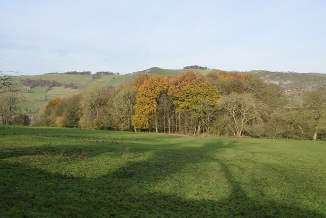
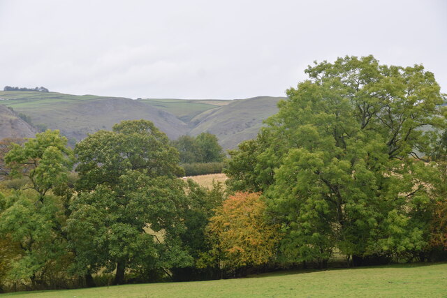
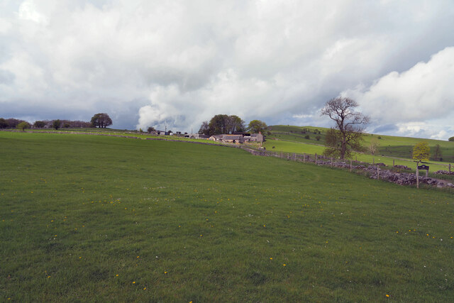
Hinkley Wood is a picturesque forest located in Staffordshire, England. Covering an area of approximately 200 hectares, the wood is a haven for nature enthusiasts and outdoor adventurers alike. The forest is situated near the village of Hinkley, which is about 10 miles northeast of the city of Burton upon Trent.

Hinkley Wood is primarily composed of oak and birch trees, creating a dense and vibrant canopy that provides shade and shelter to a diverse range of flora and fauna. The forest floor is carpeted with a variety of wildflowers, adding bursts of color to the lush green landscape.

The wood is crisscrossed by a network of well-maintained footpaths and trails, making it easily accessible to visitors of all ages and abilities. These paths lead visitors through the heart of the forest, allowing them to explore its hidden corners and discover its natural beauty.

Wildlife thrives in Hinkley Wood, with a plethora of species calling it home. Birdwatchers can spot various species of woodland birds, while nature lovers may encounter foxes, badgers, and even the occasional deer. In the spring and summer months, the forest comes alive with the sounds of buzzing insects and the sight of butterflies fluttering among the flowers.

Hinkley Wood offers a tranquil retreat from the hustle and bustle of everyday life. Whether visitors are looking for a peaceful walk, a spot of birdwatching, or simply a place to relax and reconnect with nature, this enchanting forest provides the perfect setting.

If you have any feedback on the listing, please let us know in the comments section below.
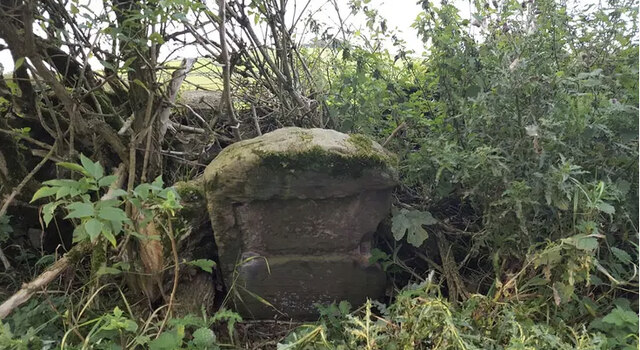
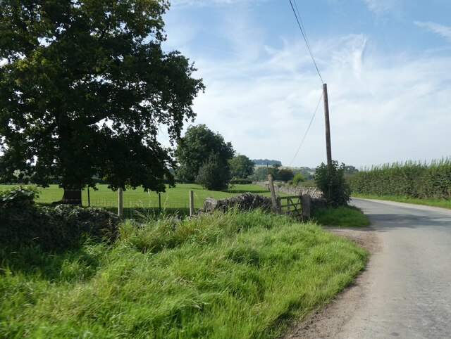
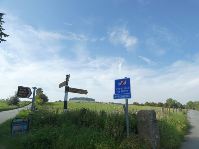
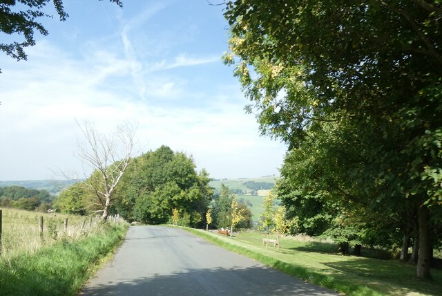
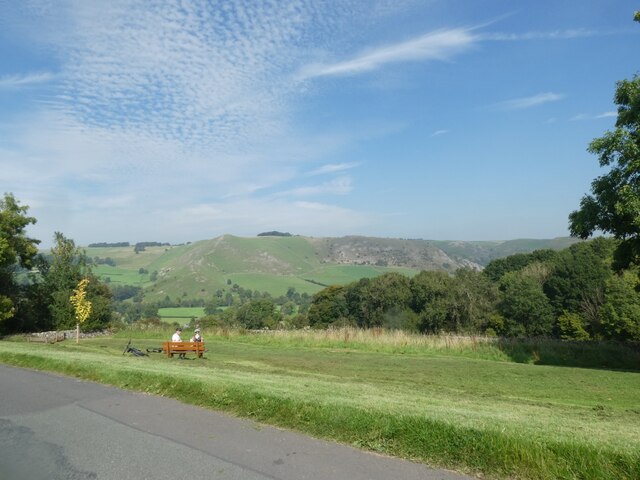
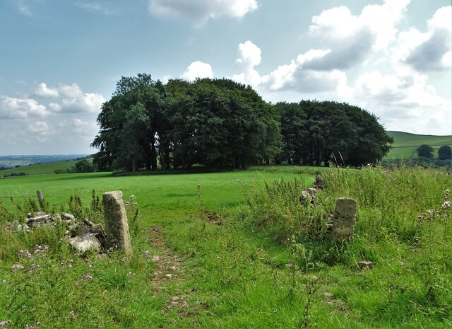
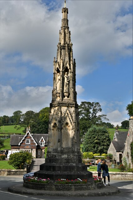
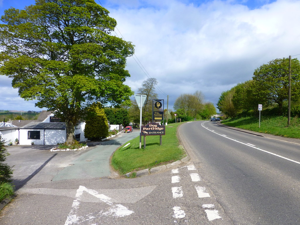
Hinkley Wood Images

Images are sourced within 2km of 53.052061/-1.8125549 or Grid Reference SK1250. Thanks to Geograph Open Source API. All images are credited.

Autumn view from Blore Pastures  Taken from Blore Pastures Picnic site looking across towards Bunster Hill and the mouth of Dovedale.
Autumn view from Blore Pastures
Taken from Blore Pastures Picnic site looking across towards Bunster Hill and the mouth of Dovedale.
View towards Dove Dale  Taken from the picnic area on Blore Pasture.
View towards Dove Dale
Taken from the picnic area on Blore Pasture.
The Waterings Farm The farm is off Blore Lane and has a good view across and down the valley.
The Waterings Farm
The farm is off Blore Lane and has a good view across and down the valley.
Looking along Blore Lane Looking back down the road from the position of the previous submission <a href="https://www.geograph.org.uk/photo/7479439">SK1249 : The Waterings Farm</a>.
Looking along Blore Lane
Looking back down the road from the position of the previous submission SK1249 : The Waterings Farm.
Long straight length of A52, west of Swinscoe The A52 is a major east-west road in the East Midlands. It runs east from a junction with the A53 at Newcastle-under-Lyme near Stoke-on-Trent (just east of the M6) to the Lincolnshire coast at Mablethorpe. Running for approximately 147 miles, its route passes via Ashbourne, Derby, Stapleford, Nottingham, West Bridgford, Bingham, Grantham, Boston and Skegness.
Long straight length of A52, west of Swinscoe
The A52 is a major east-west road in the East Midlands. It runs east from a junction with the A53 at Newcastle-under-Lyme near Stoke-on-Trent (just east of the M6) to the Lincolnshire coast at Mablethorpe. Running for approximately 147 miles, its route passes via Ashbourne, Derby, Stapleford, Nottingham, West Bridgford, Bingham, Grantham, Boston and Skegness.
Old Milestone by Ilam-Moor Lane, west of Blore Stone post (plate lost) by the UC road, Ilam-Moor Lane, in parish of Blore with Swinscoe (Staffordshire Moorlands District), West of Blore cross-roads, on grass verge, on South side of road. Cheadle iron plate, erected by the Cheadle to Butterton Moor (District of Cheadle) turnpike trust in the 19th century. 

Inscription once read:-
(CHEADLE)
(10)

Staffordshire HER.
HER Number: 20672 <span class="nowrap"><a title="https://www.heritagegateway.org.uk/Gateway/Results_Single.aspx?uid=MST5936&resourceID=1010" rel="nofollow ugc noopener" href="https://www.heritagegateway.org.uk/Gateway/Results_Single.aspx?uid=MST5936&resourceID=1010">Link</a><img style="margin-left:2px;" alt="External link" title="External link - shift click to open in new window" src="https://s1.geograph.org.uk/img/external.png" width="10" height="10"/></span>

Milestone Society National ID: ST_CDBM10
Old Milestone by Ilam-Moor Lane, west of Blore
Stone post (plate lost) by the UC road, Ilam-Moor Lane, in parish of Blore with Swinscoe (Staffordshire Moorlands District), West of Blore cross-roads, on grass verge, on South side of road. Cheadle iron plate, erected by the Cheadle to Butterton Moor (District of Cheadle) turnpike trust in the 19th century. Inscription once read:- (CHEADLE) (10) Staffordshire HER. HER Number: 20672 LinkExternal link Milestone Society National ID: ST_CDBM10
Verge and field gate near Coldwall Farm
An addendum to the road sign, near Blore Hall Unsuitable for HGVs on the original sign, with the addition "And coaches"; presumably in the past some coach drivers thought that they could use the road
An addendum to the road sign, near Blore Hall
Unsuitable for HGVs on the original sign, with the addition "And coaches"; presumably in the past some coach drivers thought that they could use the road
Road across Blore Pastures
Seat on Blore Pastures, and view north-east
Above The River Manifold Looking north to Throwley
Above The River Manifold
Looking north to Throwley
Copse above Rushley Wood
Spring on the side of Bunster Hill Trickling gently next to the path climbing out of the Manifold Valley above Ilam.
Spring on the side of Bunster Hill
Trickling gently next to the path climbing out of the Manifold Valley above Ilam.
Footpath across a ridge and furrow field Evidence of medieval ploughing picked out by the footsteps of walkers.
Footpath across a ridge and furrow field
Evidence of medieval ploughing picked out by the footsteps of walkers.
Ilam Cross, The Mary Watts-Russell Memorial
Show me another place!

Hinkley Wood is located at Grid Ref: SK1250 (Lat: 53.052061, Lng: -1.8125549)

Administrative County: Staffordshire

District: Staffordshire Moorlands

Police Authority: Staffordshire

What 3 Words

///greed.warp.marked. Near Mayfield, Staffordshire

Nearby Locations

Hinkley Wood

Related Wikis

Ilam Park

Ilam Park is a 158-acre (0.64 km2) country park situated in Ilam, on both banks of the River Manifold five miles (8 km) north west of Ashbourne, England...

White Peak Estate

The White Peak Estate (previously known as the South Peak Estate) of the National Trust comprises several land holdings in the Southern Peak District....

Ilam, Staffordshire

Ilam ( ) is a village in the Staffordshire Peak District of England, lying on the River Manifold. The population of the civil parish as taken at the 2011...

River Manifold

The River Manifold is a river in Staffordshire, England. It is a tributary of the River Dove (which also flows through the Peak District, forming the boundary...

Blore with Swinscoe

Blore with Swinscoe is a civil parish north-west of Ashbourne, in the Staffordshire Moorlands district of Staffordshire, England, on the edge of the Peak...

Blore

Blore (grid reference SK137493) is a small village and parish in the Staffordshire Moorlands District of England. It is on an acclivity above Dovedale...

Swinscoe

Swinscoe is a small hamlet within the Staffordshire Moorlands in Staffordshire, England. Administratively, the hamlet is part of the civil parish of Blore...

Calton, Staffordshire

Calton is a village and a former parochial chapelry and civil parish, now in the parish of Waterhouses, in the Staffordshire Moorlands district of Staffordshire...

Nearby Amenities

Located within 500m of 53.052061,-1.8125549
Ilam Hall Youth Hostel
Brand: YHA
Brand Wikidata: Q8059214
Contact Website: https://www.yha.org.uk/hostel/yha-ilam-hall
Operator: Youth Hostels Association
Source: local_knowledge
Tourism: hostel
Lat/Long: 53.0530347/-1.8053559
Waterway: weir
Lat/Long: 53.0520741/-1.8052619
Parking
Ilam Hall overflow car park
Operator: National Trust
Lat/Long: 53.0541145/-1.806608
Toilets
Changing Table: yes
Changing Table Fee: no
Fee: no
Toilets Disposal: flush
Toilets Position: seated;urinal
Toilets Wheelchair: yes
Lat/Long: 53.0528926/-1.8059529
Cafe
Cuisine: coffee_shop
Lat/Long: 53.0526918/-1.8058175
Barrier: stile
Material: stone
Source: survey;bing;gps
Stile: stepover
Lat/Long: 53.0509213/-1.8187082
Barrier: stile
Material: stone
Source: survey;gps
Stile: stepover
Lat/Long: 53.0514888/-1.8175773
Barrier: stile
Material: wood
Source: survey;bing;gps
Stile: stepover
Lat/Long: 53.0563437/-1.810441
Entrance: main
Lat/Long: 53.0526695/-1.8057775
Barrier: entrance
Source: survey;gps
Lat/Long: 53.0487177/-1.814165
Tourism: information
Lat/Long: 53.0527563/-1.80593
Tourism: picnic_site
Lat/Long: 53.0525693/-1.8058294
Barrier: entrance
Source: survey;gps
Lat/Long: 53.0493114/-1.8177611
Saxon Cross
Historic: monument
Lat/Long: 53.0523123/-1.8092085
Information: route_marker
Tourism: information
Lat/Long: 53.0563048/-1.8104238
Bench
Backrest: no
Material: wood
Lat/Long: 53.0523073/-1.8091141
Fixme: refine location
Man Made: beehive
Lat/Long: 53.0518355/-1.8071625
Fixme: refine location
Man Made: beehive
Lat/Long: 53.0517958/-1.8071685
Ilam Hall Bunkhouse
Operator: National Trust
Tourism: bunkhouse
Lat/Long: 53.0527961/-1.8059868
The data included in this document is from www.openstreetmap.org. The data is made available under ODbL.

Have you been to Hinkley Wood?

Leave your review of Hinkley Wood below (or comments, questions and feedback).