Beggar's Bush Plantation

Wood, Forest in Northumberland

England

Beggar's Bush Plantation

Storm Arwen at Fiddler's Elbow Everywhere one goes in mid and north Northumberland one sees the consequences of Storm Arwen's ferocity in swathes of fallen trees. On November 26th 2021 the storm is estimated to have damaged 16 million trees: the Great Storm of 1987 destroyed 15 million trees.
Storm Arwen at Fiddler's Elbow Credit: Leanmeanmo

Beggar's Bush Plantation is a sprawling wood and forest area located in Northumberland, England. Covering a vast expanse of land, it is a haven for nature enthusiasts and those seeking tranquility amidst the beauty of the outdoors.

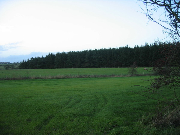
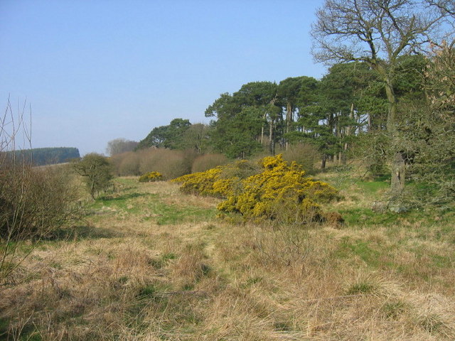
The plantation is characterized by its dense woodland, consisting primarily of native tree species such as oak, beech, and ash. The dense canopy created by these trees provides a cool and shaded environment, making it a perfect destination for those seeking respite from the summer heat. Walking through the plantation, visitors are greeted by a chorus of bird songs and the gentle rustling of leaves, creating a soothing and immersive natural soundtrack.

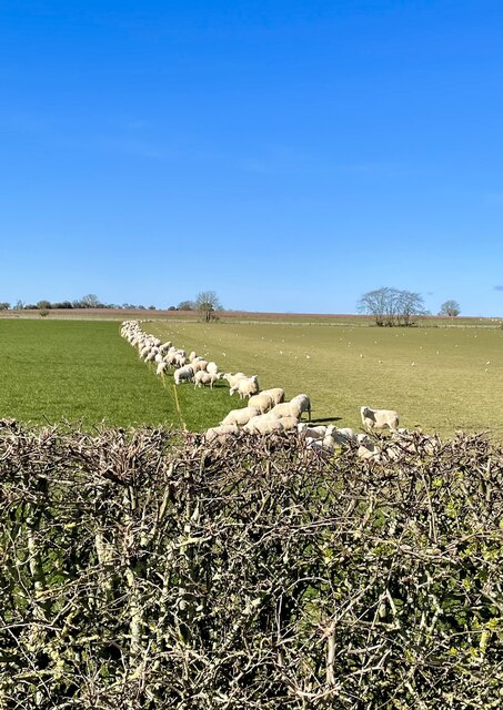
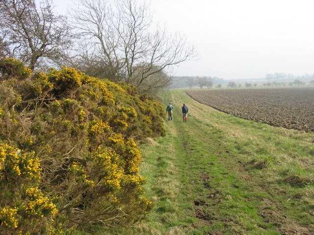
The diverse flora and fauna found within Beggar's Bush Plantation is a testament to its ecological importance. The forest floor is carpeted with a variety of wildflowers, adding vibrant pops of color to the landscape. The plantation is also home to a rich assortment of wildlife, including deer, foxes, and numerous bird species. Birdwatchers often flock to the area to catch glimpses of rare or migratory birds.

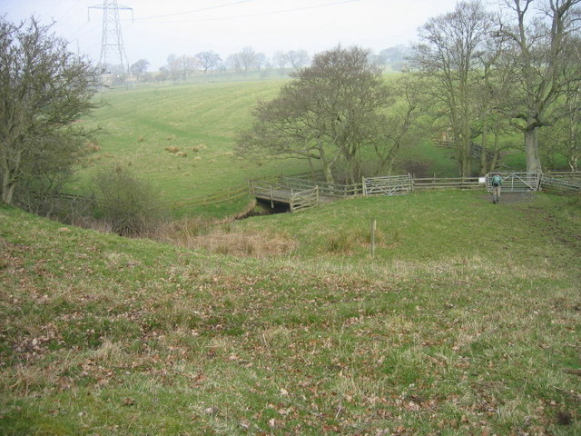
Numerous walking trails wind their way through the plantation, allowing visitors to explore its beauty at their own pace. These trails are well-maintained and offer varying levels of difficulty, catering to both casual strollers and avid hikers. Interpretive signs along the trails provide information about the local flora and fauna, enriching the visitor's experience.

Overall, Beggar's Bush Plantation is a natural treasure in Northumberland, offering a serene and picturesque environment for nature lovers to immerse themselves in the beauty of the wood and forest.

If you have any feedback on the listing, please let us know in the comments section below.

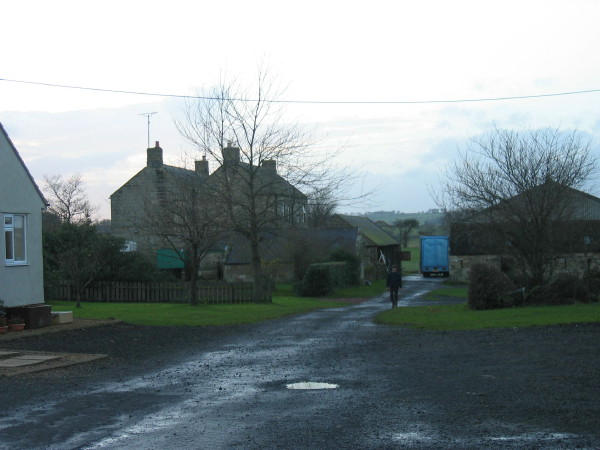
Beggar's Bush Plantation Images

Images are sourced within 2km of 55.249828/-1.8039424 or Grid Reference NZ1295. Thanks to Geograph Open Source API. All images are credited.

Storm Arwen at Fiddler's Elbow Everywhere one goes in mid and north Northumberland one sees the consequences of Storm Arwen's ferocity in swathes of fallen trees. On November 26th 2021 the storm is estimated to have damaged 16 million trees: the Great Storm of 1987 destroyed 15 million trees.
Storm Arwen at Fiddler's Elbow
Everywhere one goes in mid and north Northumberland one sees the consequences of Storm Arwen's ferocity in swathes of fallen trees. On November 26th 2021 the storm is estimated to have damaged 16 million trees: the Great Storm of 1987 destroyed 15 million trees.
Snaking Tod Burn Post Storm Arwen the tortuous course of the Tod Burn (on old maps)  is exposed.
Snaking Tod Burn
Post Storm Arwen the tortuous course of the Tod Burn (on old maps) is exposed.
Wholme Gill Head Plantation clear felled Finally reaping the dubious benefit of Storm Arwen some 18 months on, in a short section of the Tod Burn (on old maps) valley.
Wholme Gill Head Plantation clear felled
Finally reaping the dubious benefit of Storm Arwen some 18 months on, in a short section of the Tod Burn (on old maps) valley.
Form an orderly line there! Munching the new grass that has been exposed when the electric fence was moved.
Form an orderly line there!
Munching the new grass that has been exposed when the electric fence was moved.
North Birks Farm
North Birks Farm
South Birks
South Birks
Plantation and farmland
Viewlaw Farm
Viewlaw Farm
Footpath near High Southward Edge
Bridge over Tod Burn
Footpath and ploughed land near Beggar's Bush Plantation
A ford near Burnside A low water level in the burn has resulted in a dry ford. A footbridge is just out of shot to the left.
A ford near Burnside
A low water level in the burn has resulted in a dry ford. A footbridge is just out of shot to the left.
Grazing field with set aside strip at Croftside
Rough grazing field
Rough grazing field
Archie's Pond, Longhorsley
Wildlife? It's amazing what wildlife you spot in Northumberland!
Wildlife?
It's amazing what wildlife you spot in Northumberland!
Llamas On the same farm as the camel in Longhorsley, Northumberland
Llamas
On the same farm as the camel in Longhorsley, Northumberland
Village Football Field Longhorsely,Northumberland
Village Football Field
Longhorsely,Northumberland
Show me another place!

Beggar's Bush Plantation is located at Grid Ref: NZ1295 (Lat: 55.249828, Lng: -1.8039424)

Unitary Authority: Northumberland

Police Authority: Northumbria

What 3 Words

///stocky.shampoos.chosen. Near Longhorsley, Northumberland

Nearby Locations

Beggar's Bush Plantation

Related Wikis

Longhorsley

Longhorsley is a village in Northumberland, England about 7 miles (11 km) northwest of Morpeth, and about 14 miles (23 km) south of Alnwick. The A697 road...

Linden Hall, Northumberland

Linden Hall is a former mansion house in the civil parish of Longhorsley, Northumberland, England which is now operated as a hotel and country club. This...

Brinkburn Mill

Brinkburn Mill is a water mill located near Rothbury, in Northumberland. It once formed part of the precincts of Brinkburn Priory and was constructed in...

Brinkburn Priory

Brinkburn Priory is a former monastery built, starting in the 12th century, on a bend of the River Coquet, about 4 miles (6 km) east of Rothbury, Northumberland...

Nearby Amenities

Located within 500m of 55.249828,-1.8039424
Power: pole
Lat/Long: 55.245922/-1.800313
Power: pole
Lat/Long: 55.2461528/-1.7995943
Power: pole
Lat/Long: 55.2470376/-1.7985906
Power: pole
Lat/Long: 55.2475011/-1.7988369
Power: pole
Lat/Long: 55.2484133/-1.799328
Power: pole
Lat/Long: 55.2490579/-1.800304
Power: pole
Lat/Long: 55.2498903/-1.801546
Power: pole
Lat/Long: 55.2506313/-1.8026648
Power: pole
Lat/Long: 55.2512902/-1.80398
Power: pole
Lat/Long: 55.2520134/-1.8054265
Power: pole
Lat/Long: 55.253882/-1.8069655
Turning Circle
Lat/Long: 55.2457465/-1.8051401
Turning Circle
Lat/Long: 55.2454482/-1.8047632
The data included in this document is from www.openstreetmap.org. The data is made available under ODbL.

Have you been to Beggar's Bush Plantation?

Leave your review of Beggar's Bush Plantation below (or comments, questions and feedback).