Crow Wood

Wood, Forest in Northumberland

England

Crow Wood

Adder on Eglingham Moor This is, I believe, the first time I've seen an adder in the wild. My walking companion had seen them before on these moors.
Adder on Eglingham Moor Credit: Stephen Craven

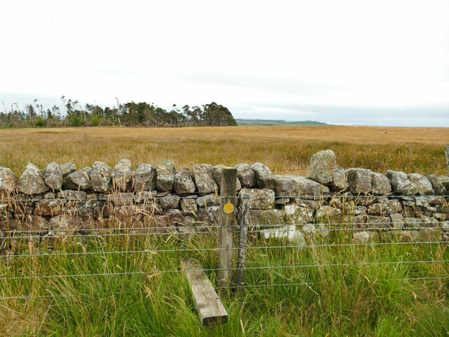
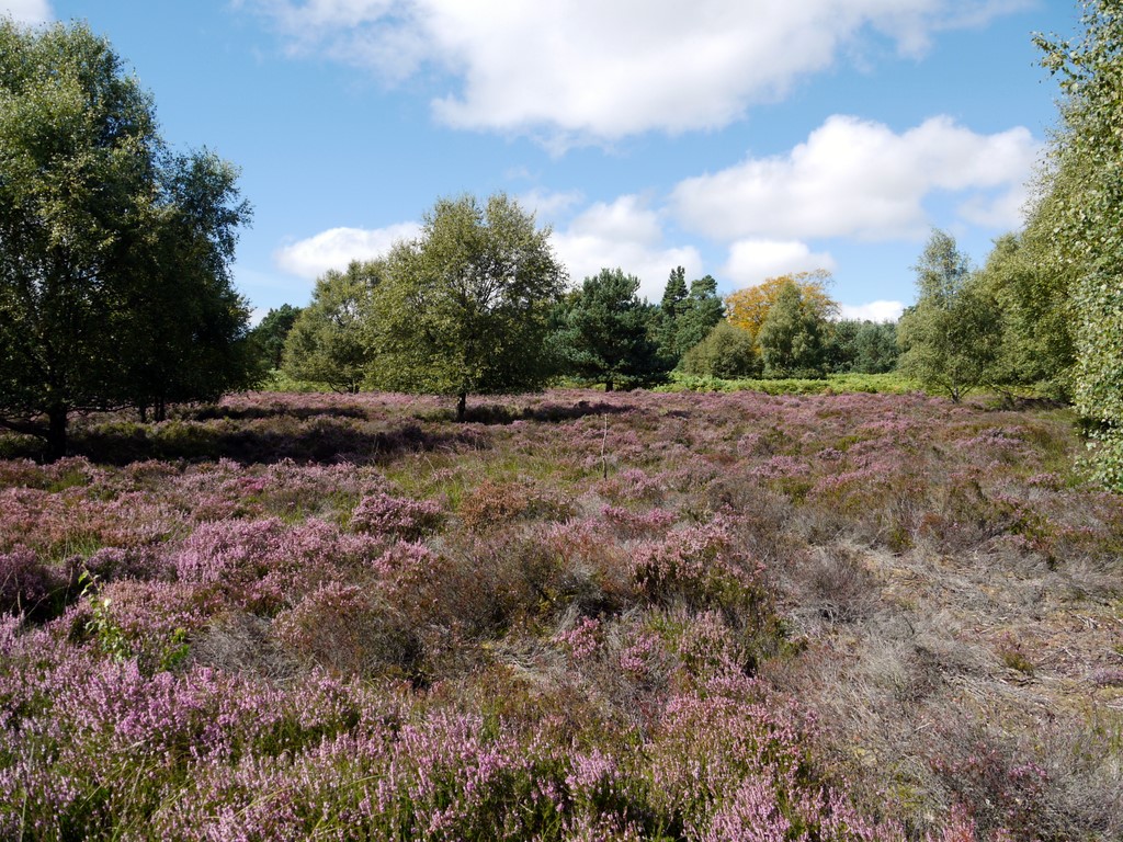
Crow Wood is a picturesque forest located in the county of Northumberland, England. It spans an area of approximately 500 acres and is known for its dense canopy of trees, diverse wildlife, and tranquil surroundings. The wood is situated near the village of Crowhurst, nestled between rolling hills and valleys.

The forest is primarily composed of broadleaf trees, including oak, beech, and birch, which create a rich and vibrant woodland environment. The dense foliage provides a haven for various species of birds, such as woodpeckers, owls, and thrushes, making it a popular destination for birdwatchers.

Crow Wood features a network of well-maintained walking trails, allowing visitors to explore the beauty of the forest at their own pace. These pathways wind through the trees, offering glimpses of wildflowers, moss-covered rocks, and babbling streams that meander through the wood. The trails cater to different levels of difficulty, accommodating both leisurely strolls and more challenging hikes.

The forest is also home to a diverse range of wildlife, including deer, foxes, badgers, and squirrels. Nature enthusiasts and photographers often visit the wood in the hopes of catching a glimpse of these elusive creatures in their natural habitat.

Crow Wood is a popular destination for outdoor activities such as picnicking, camping, and nature photography. Its peaceful ambiance and natural beauty make it an ideal escape for those seeking solace in the heart of nature.

If you have any feedback on the listing, please let us know in the comments section below.

Crow Wood Images

Images are sourced within 2km of 55.486076/-1.803089 or Grid Reference NU1221. Thanks to Geograph Open Source API. All images are credited.

Adder on Eglingham Moor This is, I believe, the first time I've seen an adder in the wild. My walking companion had seen them before on these moors.
Adder on Eglingham Moor
This is, I believe, the first time I've seen an adder in the wild. My walking companion had seen them before on these moors.
Tarry Woods, Eglingham Moor Even from this distance you can see the damage caused by Storm Arwen in November 2021.
Tarry Woods, Eglingham Moor
Even from this distance you can see the damage caused by Storm Arwen in November 2021.
Footpath crossing a field boundary on Eglingham Moor A wooden stile over a wire fence and a through-stone stile in a wall.
Footpath crossing a field boundary on Eglingham Moor
A wooden stile over a wire fence and a through-stone stile in a wall.
Adder's den, Eglingham Moor My walking companion identified this as such; we had already seen one of the snakes nearby <a href="https://www.geograph.org.uk/photo/7238506">NU1020 : Adder on Eglingham Moor</a>.
Adder's den, Eglingham Moor
My walking companion identified this as such; we had already seen one of the snakes nearby NU1020 : Adder on Eglingham Moor.
Coloured cattle, Eglingham Moor A mixture of black, brown, white and black-and-white cattle in this herd.
Coloured cattle, Eglingham Moor
A mixture of black, brown, white and black-and-white cattle in this herd.
Gate at the top of Tarry Lane This side of the gate is a public bridleway across the moor; beyond it is a surfaced road with the status of a public byway, leading down to Eglingham village. Another bridleway leads off to the right.
Gate at the top of Tarry Lane
This side of the gate is a public bridleway across the moor; beyond it is a surfaced road with the status of a public byway, leading down to Eglingham village. Another bridleway leads off to the right.
Triangulation pillar on Eglingham Moor The trig point is not at the highest point of the moor, but there is a good view over the valley to the south from this point. See <a href="https://www.geograph.org.uk/photo/5981431">NU1021 : Trig point on Eglingham Moor</a> for a bit more information.
Triangulation pillar on Eglingham Moor
The trig point is not at the highest point of the moor, but there is a good view over the valley to the south from this point. See NU1021 : Trig point on Eglingham Moor for a bit more information.
View from Eglingham Moor North-eastwards to the wind farm above North Charlton.
View from Eglingham Moor
North-eastwards to the wind farm above North Charlton.
Fallen trees in Tarry Wood (1) Victims of Storm Arwen in November 2021. So many trees were lost in Northumberland in that storm that many had not been dealt with eight months later.
Fallen trees in Tarry Wood (1)
Victims of Storm Arwen in November 2021. So many trees were lost in Northumberland in that storm that many had not been dealt with eight months later.
Fallen trees in Tarry Wood (2) Victims of Storm Arwen in November 2021. So many trees were lost in Northumberland in that storm that many had not been dealt with eight months later.
Fallen trees in Tarry Wood (2)
Victims of Storm Arwen in November 2021. So many trees were lost in Northumberland in that storm that many had not been dealt with eight months later.
Eglinghammoor
Eglinghammoor
A long straight, Eglingham Crossing the Coal Burn.
A long straight, Eglingham
Crossing the Coal Burn.
Fields near Eglingham
Fields near West Ditchburn
West Ditchburn
West Ditchburn
New sheds near West Ditchburn
Log stacks, West Ditchburn Clearing up after a devastating gale on 26th November 2021.
Log stacks, West Ditchburn
Clearing up after a devastating gale on 26th November 2021.
House at top of field The house at Tarry seen from the byway climbing towards it.
Russel Wills has a similar image: in his description he tells that the name comes from a type of coal that once was mined there, having a high tar content - <a title="https://www.geograph.org.uk/photo/3282438" href="https://www.geograph.org.uk/photo/3282438">Link</a> .
House at top of field
The house at Tarry seen from the byway climbing towards it. Russel Wills has a similar image: in his description he tells that the name comes from a type of coal that once was mined there, having a high tar content - Link .
Show me another place!

Crow Wood is located at Grid Ref: NU1221 (Lat: 55.486076, Lng: -1.803089)

Unitary Authority: Northumberland

Police Authority: Northumbria

What 3 Words

///hounded.rising.thousands. Near Ellingham, Northumberland

Nearby Locations

Crow Wood Beatrice Wood

Related Wikis

Eglingham

Eglingham is a village in Northumberland, England, situated about 7 miles (11 km) north-west of Alnwick and 10 miles (16 km) from Wooler. It lies in the...

Eglingham Hall

Eglingham Hall (grid reference NU10421954) is a former mansion house and a Grade II* listed building situated at Eglingham, near Alnwick, Northumberland...

Cateran Hole

Cateran Hole is a circa 35m length cave set in the Gritstone of Cateran Hill in Northumberland. It lies about 4 miles due north of Eglingham, and can be...

Bewick and Beanley Moors

Bewick and Beanley Moors is the name given to a Site of Special Scientific Interest (SSSI) in north Northumberland, in the north-east of England. The moors...

South Charlton

South Charlton is a small village and former civil parish, now in the parish of Eglingham, in the county of Northumberland, England, five miles (8 km)...

North Charlton

North Charlton is a hamlet and former civil parish, now in the parish of Eglingham, in Northumberland, England. It is situated between Alnwick and Berwick...

Brownieside

Brownieside is a hamlet in Northumberland, in England. It is situated between Alnwick and Berwick-upon-Tweed, on the A1 a short distance to the north of...

Hunterheugh Crags

Hunterheugh Crags are part of the Fellsandstone escarpment, 5 miles (8 km) north west of Alnwick, Northumberland, England and 9 miles (14 km) from the...

Have you been to Crow Wood?

Leave your review of Crow Wood below (or comments, questions and feedback).