Bishops Planting

Wood, Forest in Staffordshire East Staffordshire

England

Bishops Planting

Thorney Lanes Standing on a small triangle of grass looking along Thorney Lanes.
Thorney Lanes Credit: Malcolm Neal

Bishops Planting is a picturesque woodland area located in Staffordshire, England. Nestled in the heart of the county, this woodland is a haven for nature enthusiasts and those seeking tranquility amidst the beauty of the countryside.

Covering an area of approximately 100 acres, Bishops Planting is known for its dense forestation and diverse range of flora and fauna. The woodland is predominantly composed of deciduous trees, including oak, beech, and birch, which create a lush green canopy. The forest floor is adorned with a carpet of wildflowers, such as bluebells and primroses, adding bursts of color to the landscape during the springtime.

The woodland is crisscrossed by a network of well-maintained trails, making it a popular destination for walkers, hikers, and joggers. These winding paths offer visitors the opportunity to explore the woodland at their own pace, immersing themselves in the serene atmosphere and taking in the sights and sounds of nature.

Bishops Planting is also home to a variety of wildlife. Birdwatchers can spot an array of species, including woodpeckers, nuthatches, and tawny owls. Squirrels scurry through the trees, while rabbits and hares can be seen darting across the forest floor. The woodland provides a vital habitat for these creatures, ensuring their survival and contributing to the overall biodiversity of the area.

Whether it's a leisurely stroll, a birdwatching expedition, or simply a desire to reconnect with nature, Bishops Planting in Staffordshire offers a serene retreat for anyone seeking solace in the beauty of the woodlands.

If you have any feedback on the listing, please let us know in the comments section below.

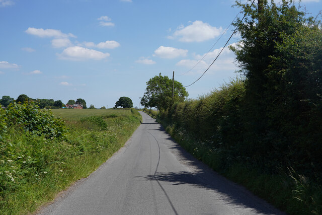
Bishops Planting Images

Images are sourced within 2km of 52.801006/-1.8166604 or Grid Reference SK1222. Thanks to Geograph Open Source API. All images are credited.

Thorney Lanes Standing on a small triangle of grass looking along Thorney Lanes.
Thorney Lanes
Standing on a small triangle of grass looking along Thorney Lanes.
Thorney Lanes This is just before the junction with Abbots Bromley Road.
Thorney Lanes
This is just before the junction with Abbots Bromley Road.
Maker Lane The road surface on Maker Lane is very variable and in some places there are very deep potholes.
Maker Lane
The road surface on Maker Lane is very variable and in some places there are very deep potholes.
By Nicholls Covert The sign says "The Deer Park" but I think it is just a cafe and farm shop.
By Nicholls Covert
The sign says "The Deer Park" but I think it is just a cafe and farm shop.
The track to Red Hill The surface is just crushed limestone without tarmac so it will probably erode quite quickly.
The track to Red Hill
The surface is just crushed limestone without tarmac so it will probably erode quite quickly.
Maker Lane Looking along Maker Lane.
Maker Lane
Looking along Maker Lane.
Yoxall Road This road has recently been tar sprayed and covered in limestone chippings and has a 10 MPH speed limit to prevent damage to the paintwork.
Yoxall Road
This road has recently been tar sprayed and covered in limestone chippings and has a 10 MPH speed limit to prevent damage to the paintwork.
Approaching Hoar Cross Further along Yoxall Road near the cross roads with Hoar Cross just visible, not that it is a very big place.
Approaching Hoar Cross
Further along Yoxall Road near the cross roads with Hoar Cross just visible, not that it is a very big place.
Brakenhurst Road With deep shadow on one side and bright sunlight on the other, the camera has coped with the difference quite well.
Brakenhurst Road
With deep shadow on one side and bright sunlight on the other, the camera has coped with the difference quite well.
Direction Sign - Signpost in Hoar Cross Located on the southwest side of the crossroads of Newborough Road, Abbots Bromley Road and Hoar Cross Road in Hoar Cross parish. 3 arms and perforated disc finial. See also <a title="https://www.geograph.org.uk/photo/3555123" href="https://www.geograph.org.uk/photo/3555123">Link</a>.

Milestone Society National ID: ST_SK1323
Direction Sign - Signpost in Hoar Cross
Located on the southwest side of the crossroads of Newborough Road, Abbots Bromley Road and Hoar Cross Road in Hoar Cross parish. 3 arms and perforated disc finial. See also Link. Milestone Society National ID: ST_SK1323
The "Noon Column" Jackson's Bank This is one of six noon columns created by the sculptor David Nash, one being located in each of the six main areas of the National Forest. The column is so positioned that a thin pencil of light will pass through the slot at true noon. <span class="nowrap"><a title="http://www.landshapes.org/newsandevents/news/Physicalprojects.php" rel="nofollow ugc noopener" href="http://www.landshapes.org/newsandevents/news/Physicalprojects.php">Link</a><img style="margin-left:2px;" alt="External link" title="External link - shift click to open in new window" src="https://s1.geograph.org.uk/img/external.png" width="10" height="10"/></span>
The "Noon Column" Jackson's Bank
This is one of six noon columns created by the sculptor David Nash, one being located in each of the six main areas of the National Forest. The column is so positioned that a thin pencil of light will pass through the slot at true noon. LinkExternal link
Hoar Cross A traditional signpost, topped with the Staffordshire knot, stands at this cross-roads. The Menell Ingram Arms public house is partially hidden behind the tree.
Hoar Cross
A traditional signpost, topped with the Staffordshire knot, stands at this cross-roads. The Menell Ingram Arms public house is partially hidden behind the tree.
Hay meadow and hay bales Seen from the road between Hoar Cross and Newborough
Hay meadow and hay bales
Seen from the road between Hoar Cross and Newborough
The drive to Bentilee Park farm
Meaford Farm
Meaford Farm
The end of the road, Rowley Farms From both 1:50000 and 1:25000, Rowley Farms appears to be a hamlet name.
The end of the road, Rowley Farms
From both 1:50000 and 1:25000, Rowley Farms appears to be a hamlet name.
Ladysmith Farm This farm stands in splendid isolation in the middle of its grid square at the end of a mile-long drive.
Ladysmith Farm
This farm stands in splendid isolation in the middle of its grid square at the end of a mile-long drive.
Hoar Cross Nursing Home This is a partial conversion from houses or cottages of the Hoar Cross Hall Estate.
Hoar Cross Nursing Home
This is a partial conversion from houses or cottages of the Hoar Cross Hall Estate.
Show me another place!

Bishops Planting is located at Grid Ref: SK1222 (Lat: 52.801006, Lng: -1.8166604)

Administrative County: Staffordshire

District: East Staffordshire

Police Authority: Staffordshire

What 3 Words

///modifies.steep.mixture. Near Yoxall, Staffordshire

Related Wikis

Church of the Holy Angels, Hoar Cross

The Church of the Holy Angels is an Anglican church in Hoar Cross, Staffordshire, England. It is a Grade I listed building. == History == It was built...
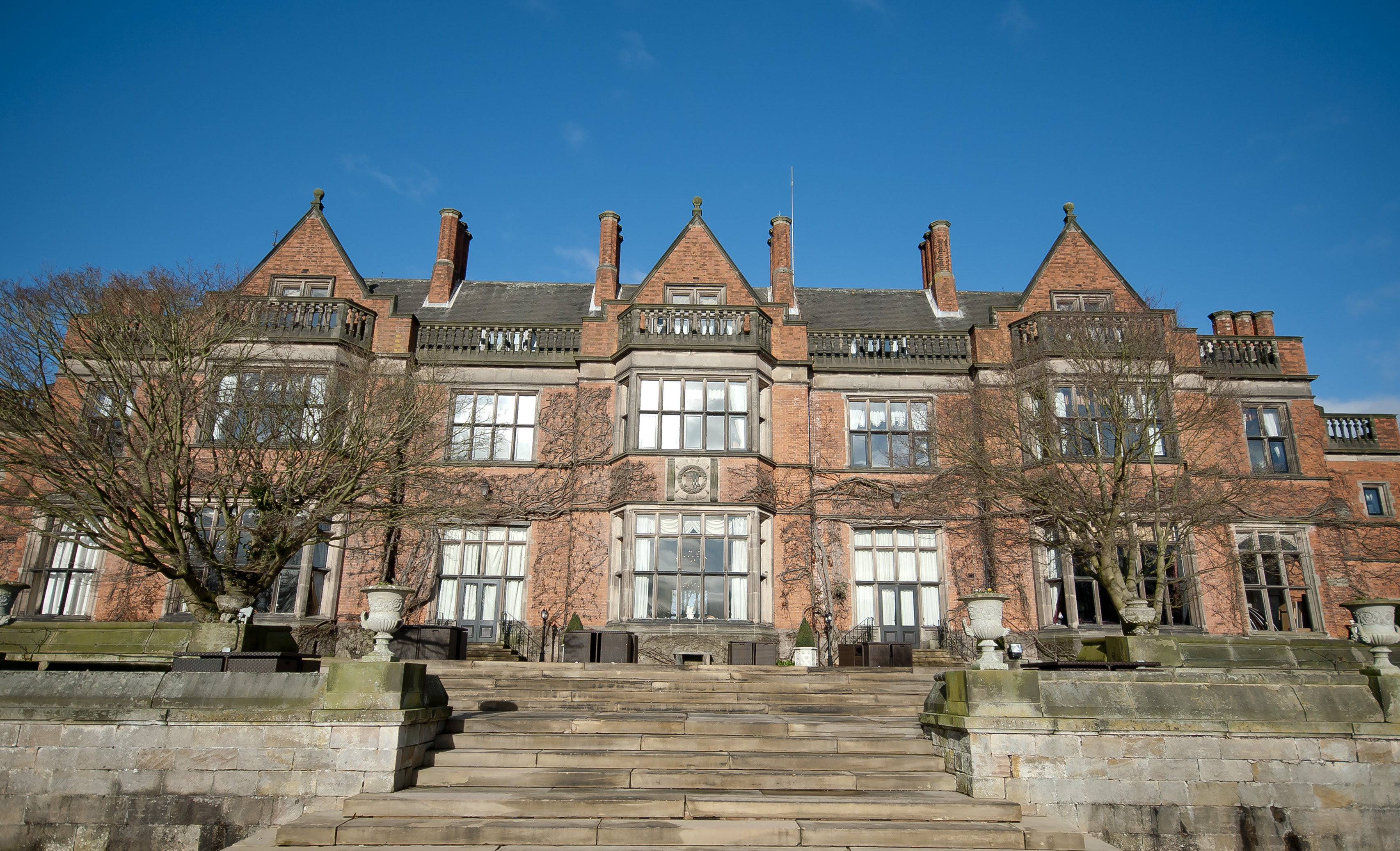
Hoar Cross Hall

Hoar Cross Hall is a 19th-century country mansion near the villages of Hoar Cross and Hamstall Ridware, Staffordshire. England. The Grade II listed building...

Hoar Cross

Hoar Cross is a small village and civil parish in the Borough of East Staffordshire, situated approximately 7 miles (11 km) west of Burton upon Trent....

Newborough, Staffordshire

Newborough is a village and civil parish in the county of Staffordshire, England. It is located 3 miles (5 km) south west of Hanbury and 8 miles (13 km...

Church of St Michael and All Angels, Hamstall Ridware

The Church of St Michael and All Angels is a parish church and Grade I listed building in the village of Hamstall Ridware, Staffordshire. The church is...

Tatenhill Airfield

Tatenhill Airfield (ICAO: EGBM) is a licensed airfield operated by Tatenhill Aviation Ltd. Its CAA Ordinary Licence (Number P813) allows flights for the...

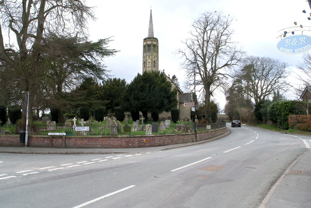
Church of St Peter, Yoxall

The Church of St Peter is a Grade II* listed building in Yoxall, East Staffordshire, Staffordshire, England, built in the early 13th century. == References ==

Hamstall Ridware

Hamstall Ridware is a village and civil parish in the Lichfield district of Staffordshire, England. It is in the Trent Valley, and lies close to the villages...

Nearby Amenities

Located within 500m of 52.801006,-1.8166604
Post Box
Brand: Royal Mail
Brand Wikidata: Q638098
Brand Wikipedia: en:Royal Mail
Operator: Royal Mail
Operator Wikidata: Q638098
Ref: DE13 1220
Lat/Long: 52.8042937/-1.8162691
Barrier: stile
Lat/Long: 52.8000853/-1.8099699
Barrier: kissing_gate
Lat/Long: 52.7995328/-1.8110898
The data included in this document is from www.openstreetmap.org. The data is made available under ODbL.

Have you been to Bishops Planting?

Leave your review of Bishops Planting below (or comments, questions and feedback).