Clemonseats Plantation

Wood, Forest in Derbyshire Derbyshire Dales

England

Clemonseats Plantation

Custard Fields Farm from the High Peak Trail A curious name for a farm, but not new: a genealogy site has the burial register for a resident of the farm in 1856.  It appears to be a beef farm judging by the cattle in nearby fields.
Custard Fields Farm from the High Peak Trail Credit: Stephen Craven

Clemonseats Plantation is a picturesque woodland area located in Derbyshire, England. Situated in the heart of the county, it covers a vast expanse of land, offering visitors a serene and peaceful environment to explore.

The plantation is predominantly made up of various species of trees, including oak, beech, and pine, creating a diverse and vibrant ecosystem. The lush greenery and dense foliage provide a haven for numerous species of birds, insects, and small mammals, making it a popular spot for nature lovers and wildlife enthusiasts.

Visitors can enjoy a leisurely stroll along the well-maintained trails that wind through the plantation, immersing themselves in the natural beauty of the surroundings. These trails offer breathtaking views of the forest, with sunlight filtering through the canopy above, creating a mesmerizing play of light and shadow.

Clemonseats Plantation also boasts a small lake, adding to its charm and providing a tranquil spot for visitors to relax and enjoy a picnic or simply soak in the tranquil ambiance.

The plantation is open to the public throughout the year, with no admission fee, making it an accessible destination for all. It is also a popular location for outdoor activities such as hiking, birdwatching, and photography.

Overall, Clemonseats Plantation offers a captivating experience for nature enthusiasts, providing a tranquil escape from the hustle and bustle of daily life. Its natural beauty and diverse ecosystem make it a must-visit destination for anyone seeking solace in the heart of Derbyshire.

If you have any feedback on the listing, please let us know in the comments section below.

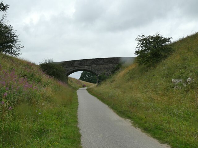
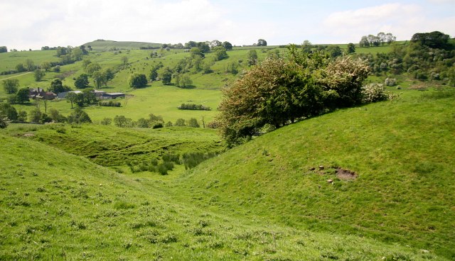
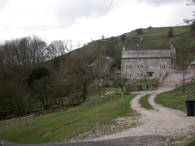
Clemonseats Plantation Images

Images are sourced within 2km of 53.182146/-1.8156251 or Grid Reference SK1265. Thanks to Geograph Open Source API. All images are credited.

Custard Fields Farm from the High Peak Trail A curious name for a farm, but not new: a genealogy site has the burial register for a resident of the farm in 1856.  It appears to be a beef farm judging by the cattle in nearby fields.
Custard Fields Farm from the High Peak Trail
A curious name for a farm, but not new: a genealogy site has the burial register for a resident of the farm in 1856. It appears to be a beef farm judging by the cattle in nearby fields.
Limestone scenery in Long Dale The limestone outcrop beyond the bend in the road is called Vincent Knoll and  has a bowl barrow (bronze age burial mound) on top of it, although as the barrow only survives to a height of less than one metre, it is not noticeable from this distance.
Limestone scenery in Long Dale
The limestone outcrop beyond the bend in the road is called Vincent Knoll and has a bowl barrow (bronze age burial mound) on top of it, although as the barrow only survives to a height of less than one metre, it is not noticeable from this distance.
Beef cattle at Custard Fields Farm Seen from the High Peak Trail.
Beef cattle at Custard Fields Farm
Seen from the High Peak Trail.
Embankment on the High Peak Trail The trail follows the route of a former railway, with its cuttings and embankments.
Embankment on the High Peak Trail
The trail follows the route of a former railway, with its cuttings and embankments.
Original railway alignment below Cotesfield Farm The 1880 map shows this as the route of the Cormford and High Peak Railway.  It had a curve of less than 100 metres radius a little further on, presumably acceptable for a horse-drawn mineral line with short wheelbase wagons as built in 1831, but very tight for later steam operation. On the 1898 map, by which time the line was being operated by the London and North Western Railway, a smoother curve had been built - now the High Peak Trail.  The section of the old alignment shown here is now part of the access road to Cotesfield Farm. See also <a href="https://www.geograph.org.uk/photo/5540494">SK1364 : Former railway route at Cotesfield Farm</a>.
Original railway alignment below Cotesfield Farm
The 1880 map shows this as the route of the Cormford and High Peak Railway. It had a curve of less than 100 metres radius a little further on, presumably acceptable for a horse-drawn mineral line with short wheelbase wagons as built in 1831, but very tight for later steam operation. On the 1898 map, by which time the line was being operated by the London and North Western Railway, a smoother curve had been built - now the High Peak Trail. The section of the old alignment shown here is now part of the access road to Cotesfield Farm. See also SK1364 : Former railway route at Cotesfield Farm.
Accommodation bridge for Cotesfield Farm This bridge only carries farm traffic to a field isolated between the original and later alignments of the railway.
Accommodation bridge for Cotesfield Farm
This bridge only carries farm traffic to a field isolated between the original and later alignments of the railway.
Cutting on the High Peak Trail Just south of Sparklow.
Cutting on the High Peak Trail
Just south of Sparklow.
Ruined drystone wall Building walls like this was relatively easy when labour was cheap, and limestone available 'on the spot'. Maintaining them is now expensive, and many have fallen into disuse.
Ruined drystone wall
Building walls like this was relatively easy when labour was cheap, and limestone available 'on the spot'. Maintaining them is now expensive, and many have fallen into disuse.
Road towards Endmoor Seen from the bridge on the High Peak Trail. See also <a href="https://www.geograph.org.uk/photo/1772828">SK1365 : Minor road under the High Peak Trail</a>.
Road towards Endmoor
Seen from the bridge on the High Peak Trail. See also SK1365 : Minor road under the High Peak Trail.
Former lead workings near Sparklow The line of small mounds is the remains of a series of shallow pits following a vein of lead ore. According to the Peak District Mines Historical Society website, the height of lead mining in Derbyshire came in the 17th and 18th centuries, and I presume mining had finished here by the time the railway was built in 1831, as there is no sign on old maps of there being a siding nearby.  The hollow in the foreground was a small limestone quarry, perhaps to build local walls or even the railway bridge from which the photo was taken (now part of the High Peak Trail).
Former lead workings near Sparklow
The line of small mounds is the remains of a series of shallow pits following a vein of lead ore. According to the Peak District Mines Historical Society website, the height of lead mining in Derbyshire came in the 17th and 18th centuries, and I presume mining had finished here by the time the railway was built in 1831, as there is no sign on old maps of there being a siding nearby. The hollow in the foreground was a small limestone quarry, perhaps to build local walls or even the railway bridge from which the photo was taken (now part of the High Peak Trail).
Old railway bridge near Sparklow The bridge carried a twin-track freight line (originally Cromford and High Peak Railway, later LNWR). It is now part of the High Peak Trail.
Old railway bridge near Sparklow
The bridge carried a twin-track freight line (originally Cromford and High Peak Railway, later LNWR). It is now part of the High Peak Trail.
Gorse alongside a lane near Sparklow
A murder of crows The collective noun seemed appropriate here, as two flocks appeared to come together in an aggressive manner.
A murder of crows
The collective noun seemed appropriate here, as two flocks appeared to come together in an aggressive manner.
Cattle and ruined laithe
Mosey Low A small hill on the west side of Long Dale.
Mosey Low
A small hill on the west side of Long Dale.
Crossroads below Mosey Low A junction of two minor roads. The sign on the left points to Pilsbury Lodge caravan site; the one on the right indicates the road straight on to Earl Staindale, and back to Hartington the other way, with the road across being part of National Cycle Route 549.
Crossroads below Mosey Low
A junction of two minor roads. The sign on the left points to Pilsbury Lodge caravan site; the one on the right indicates the road straight on to Earl Staindale, and back to Hartington the other way, with the road across being part of National Cycle Route 549.
Ruined laithes near Mosey Low The buildings in the centre of the photo, now a ruin, are shown but not named on older large scale maps.  I presume they were laithes (field barns) rather than a farmhouse.
Ruined laithes near Mosey Low
The buildings in the centre of the photo, now a ruin, are shown but not named on older large scale maps. I presume they were laithes (field barns) rather than a farmhouse.
Sheep among the rocks The off-white animals blend in well with the limestone outcrop on the slope of Mosey Low.
Sheep among the rocks
The off-white animals blend in well with the limestone outcrop on the slope of Mosey Low.
Show me another place!

Clemonseats Plantation is located at Grid Ref: SK1265 (Lat: 53.182146, Lng: -1.8156251)

Administrative County: Derbyshire

District: Derbyshire Dales

Police Authority: Derbyshire

What 3 Words

///tags.nips.mixers. Near Newhaven, Derbyshire

Nearby Locations

Clemonseats Plantation

Related Wikis

Cromford and High Peak Railway

The Cromford and High Peak Railway (C&HPR) was a standard-gauge line between the Cromford Canal wharf at High Peak Junction and the Peak Forest Canal at...

Hurdlow railway station

Hurdlow railway station was near to the hamlet of Hurdlow within Hartington Middle Quarter civil parish, to the south east of Buxton, Derbyshire on the...

Pilsbury Castle

Pilsbury Castle was a Norman castle in Derbyshire near the present-day village of Pilsbury, overlooking the River Dove. == Details == Pilsbury Castle occupied...

Hartington Middle Quarter

Hartington Middle Quarter is a civil parish within the Derbyshire Dales district, which is in the county of Derbyshire, England. Formerly a part of Hartington...

Pilsbury

Pilsbury is a hamlet in the English county of Derbyshire, approximately 2 miles north of Hartington. It is on the side of the valley of the River Dove...

Crowdecote

Crowdecote (sometimes spelled Crowdicote) is a small village in Derbyshire, England. It is situated on the border between Derbyshire and Staffordshire...

White Peak

The White Peak, also known as the Low Peak, is a limestone plateau that forms the central and southern part of the Peak District in England. It is mostly...

Parsley Hay railway station

Parsley Hay railway station served Parsley Hay, a hamlet within Hartington Middle Quarter civil parish, about 9.3 miles (15 km) south east of Buxton, Derbyshire...

Nearby Amenities

Located within 500m of 53.182146,-1.8156251
The data included in this document is from www.openstreetmap.org. The data is made available under ODbL.

Have you been to Clemonseats Plantation?

Leave your review of Clemonseats Plantation below (or comments, questions and feedback).