Coronation Wood
Wood, Forest in Staffordshire Lichfield
England
Coronation Wood
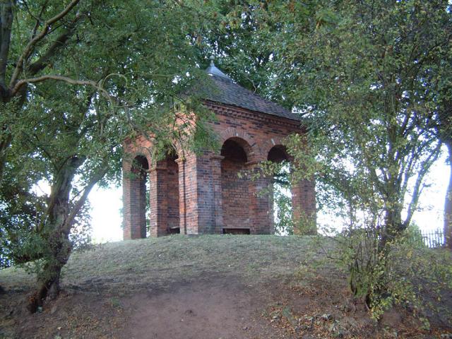
Coronation Wood is a beautiful forest located in Staffordshire, England. Spanning over a vast area, this woodland is a popular destination for nature enthusiasts and visitors seeking tranquility amidst nature. The wood is named after the coronation year of King George VI, marking its establishment in 1937.
The forest boasts a diverse range of flora and fauna, making it an ideal habitat for various species. It is home to a variety of trees, including oak, beech, and ash, which provide a lush and verdant landscape. The forest floor is covered with an array of wildflowers, creating a vibrant and colorful scene during the spring and summer months. Wildlife such as deer, foxes, and squirrels can often be spotted roaming freely throughout the wood.
Coronation Wood offers several walking trails and paths that wind through its enchanting surroundings. These paths are suitable for individuals of all ages and fitness levels, making it a popular destination for families and outdoor enthusiasts. Along these trails, visitors can admire the natural beauty of the forest, listen to the melodic songs of birds, and enjoy peaceful picnics in designated areas. The wood also features a small pond, where visitors can relax and observe various species of water-dwelling creatures.
Overall, Coronation Wood is a haven for nature lovers and a place where one can escape the hustle and bustle of everyday life. Its picturesque landscapes, diverse wildlife, and serene atmosphere make it a must-visit destination for anyone seeking a peaceful retreat in the heart of Staffordshire.
If you have any feedback on the listing, please let us know in the comments section below.
Coronation Wood Images
Images are sourced within 2km of 52.660018/-1.8202661 or Grid Reference SK1206. Thanks to Geograph Open Source API. All images are credited.


Coronation Wood is located at Grid Ref: SK1206 (Lat: 52.660018, Lng: -1.8202661)
Administrative County: Staffordshire
District: Lichfield
Police Authority: Staffordshire
What 3 Words
///responses.codes.prefect. Near Lichfield, Staffordshire
Nearby Locations
Related Wikis

Swinfen
Swinfen is a small community about two miles south of Lichfield in the civil parish of Swinfen and Packington, Staffordshire. Swinfen is referred to in...
HM Prison Swinfen Hall
HM Prison Swinfen Hall is a Category C men's prison and Young Offenders Institution, located in the village of Swinfen (near Lichfield) in Staffordshire...
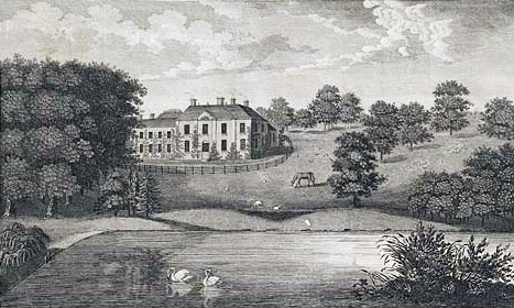
Freeford Hall
Freeford Manor (previously known as Freeford Hall) is a privately owned 18th-century country house at Freeford, near Lichfield, Staffordshire. It is the...
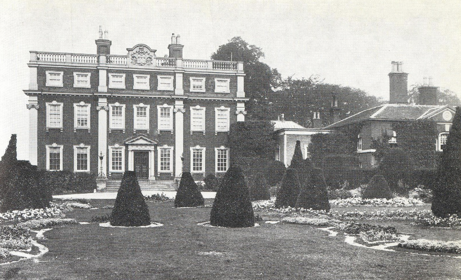
Swinfen Hall
Swinfen Hall is an 18th-century country mansion house, now converted into a hotel, situated at Swinfen, in the Lichfield District of Staffordshire in England...
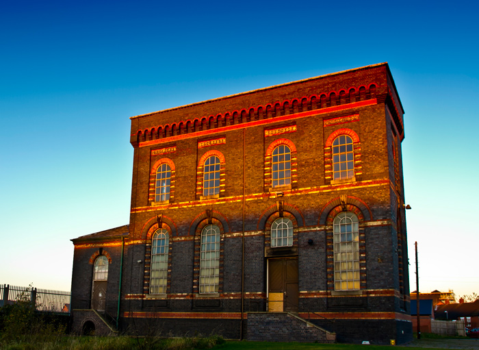
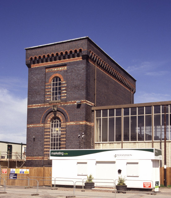
Sandfields Pumping Station
Sandfields Pumping Station is a disused pumping station in Lichfield, in Staffordshire, England. The engine house was built in 1873 and contains the original...
King Edward VI School, Lichfield
King Edward VI School, Lichfield, is a co-educational secondary school and sixth form located near the heart of the city of Lichfield, Staffordshire, England...
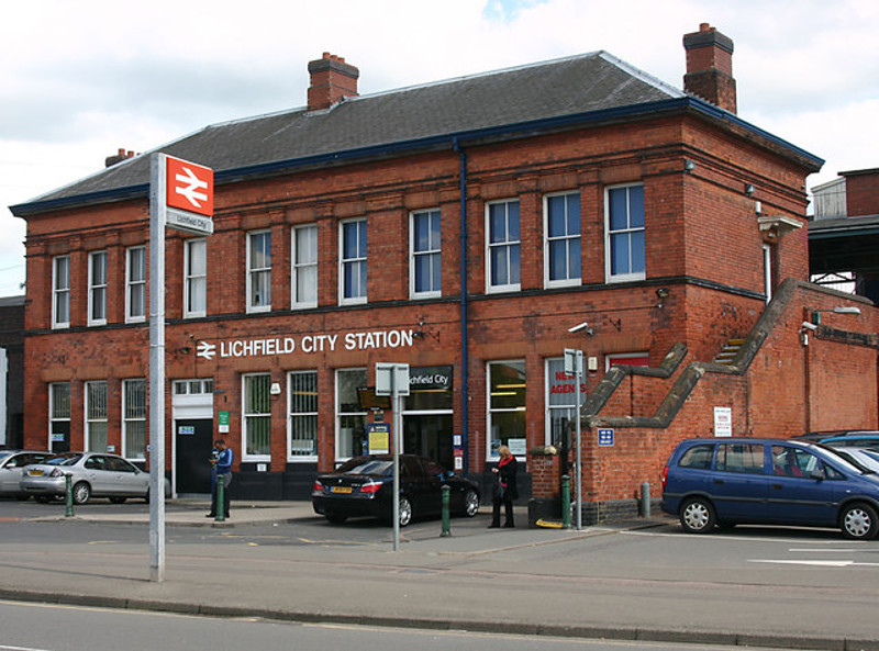
Lichfield City railway station
Lichfield City is one of two railway stations serving the cathedral city of Lichfield, in Staffordshire, England. It is situated in the city-centre, and...

Hospital of St John Baptist without the Barrs
The Hospital of St John Baptist without the Barrs is a building with an adjacent chapel in the city of Lichfield, Staffordshire, England. It is a Grade...
Nearby Amenities
Located within 500m of 52.660018,-1.8202661Have you been to Coronation Wood?
Leave your review of Coronation Wood below (or comments, questions and feedback).