Knowle Covert
Wood, Forest in Staffordshire Lichfield
England
Knowle Covert
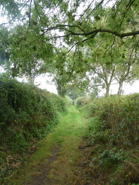
Knowle Covert is a woodland area located in Staffordshire, England. Covering an approximate area of [insert area], it is a picturesque forested area known for its natural beauty and rich biodiversity. The woodland is predominantly made up of deciduous trees, such as oak, beech, and birch, which create a dense canopy and provide a habitat for various species of wildlife.
The forest is a popular destination for nature lovers, hikers, and birdwatchers due to its peaceful atmosphere and scenic trails. Visitors can explore the woodland through a network of well-maintained pathways that meander through the trees, offering opportunities to spot native wildlife such as deer, squirrels, and a variety of bird species.
Knowle Covert is also home to a diverse range of flora, with wildflowers and ferns adding color and vibrancy to the forest floor. The woodland is particularly enchanting during spring when bluebells bloom, creating a stunning carpet of purple and providing a fragrant aroma.
The area is well-preserved and managed by the local authorities to ensure the protection of its natural habitats. This includes regular maintenance of the trails, monitoring of wildlife populations, and conservation efforts to protect the forest's biodiversity.
Knowle Covert is easily accessible, with parking facilities and amenities available nearby. Whether it's for a leisurely walk, a peaceful picnic, or an opportunity to connect with nature, Knowle Covert offers a serene and enchanting escape for visitors of all ages.
If you have any feedback on the listing, please let us know in the comments section below.
Knowle Covert Images
Images are sourced within 2km of 52.65868/-1.8267617 or Grid Reference SK1106. Thanks to Geograph Open Source API. All images are credited.


Knowle Covert is located at Grid Ref: SK1106 (Lat: 52.65868, Lng: -1.8267617)
Administrative County: Staffordshire
District: Lichfield
Police Authority: Staffordshire
What 3 Words
///units.weeds.ground. Near Lichfield, Staffordshire
Nearby Locations
Related Wikis

Swinfen
Swinfen is a small community about two miles south of Lichfield in the civil parish of Swinfen and Packington, Staffordshire. Swinfen is referred to in...
HM Prison Swinfen Hall
HM Prison Swinfen Hall is a Category C men's prison and Young Offenders Institution, located in the village of Swinfen (near Lichfield) in Staffordshire...
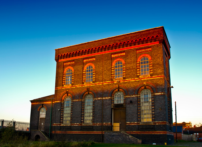
Sandfields Pumping Station
Sandfields Pumping Station is a disused pumping station in Lichfield, in Staffordshire, England. The engine house was built in 1873 and contains the original...

Wall, Staffordshire
Wall is a small village and civil parish in Staffordshire, England, just south of Lichfield. It lies on the site of the Roman settlement of Letocetum....
Nearby Amenities
Located within 500m of 52.65868,-1.8267617Have you been to Knowle Covert?
Leave your review of Knowle Covert below (or comments, questions and feedback).