Bear Wood

Wood, Forest in Gloucestershire Cotswold

England

Bear Wood

Sign indicating fuel pipeline Sign on the roadside at SP098078 to the south-east of the village of Winson indicating the course of an ESSO fuel pipeline as it crosses the Coln valley.
Sign indicating fuel pipeline Credit: Philip Halling

Bear Wood is a captivating and picturesque woodland located in Gloucestershire, England. Nestled within the mesmerizing Forest of Dean, this ancient woodland spans over 600 acres, offering visitors an enchanting and immersive experience in nature.

The wood is renowned for its diverse range of flora and fauna, boasting a rich biodiversity that attracts nature enthusiasts from far and wide. Towering oak trees dominate the landscape, creating a dense canopy that filters sunlight and casts a magical glow on the forest floor. The woodland is also home to an array of other tree species, including beech, hazel, and birch, which contribute to the wood's vibrant and ever-changing colors throughout the seasons.

Wildlife thrives in Bear Wood, with a variety of species calling it their home. Visitors may encounter and observe deer, badgers, foxes, and an abundance of birdlife, including woodpeckers and owls. The wood's tranquil atmosphere and untouched beauty make it an ideal habitat for these creatures.

For those seeking adventure, Bear Wood offers a network of well-maintained footpaths and trails, allowing visitors to explore its charming nooks and crannies. The wood also features a visitor center, providing educational resources and information about the local ecosystem and conservation efforts. Interpretive displays and interactive exhibits further enhance the visitor experience, allowing individuals of all ages to learn about the wood's history, ecology, and importance in preserving the region's natural heritage.

Whether one seeks solace in nature, wishes to immerse themselves in wildlife observation, or desires to learn about Gloucestershire's natural wonders, Bear Wood is a captivating destination that promises a memorable and educational experience for all.

If you have any feedback on the listing, please let us know in the comments section below.

Bear Wood Images

Images are sourced within 2km of 51.775366/-1.8322465 or Grid Reference SP1108. Thanks to Geograph Open Source API. All images are credited.

Sign indicating fuel pipeline Sign on the roadside at SP098078 to the south-east of the village of Winson indicating the course of an ESSO fuel pipeline as it crosses the Coln valley.
Sign indicating fuel pipeline
Sign on the roadside at SP098078 to the south-east of the village of Winson indicating the course of an ESSO fuel pipeline as it crosses the Coln valley.
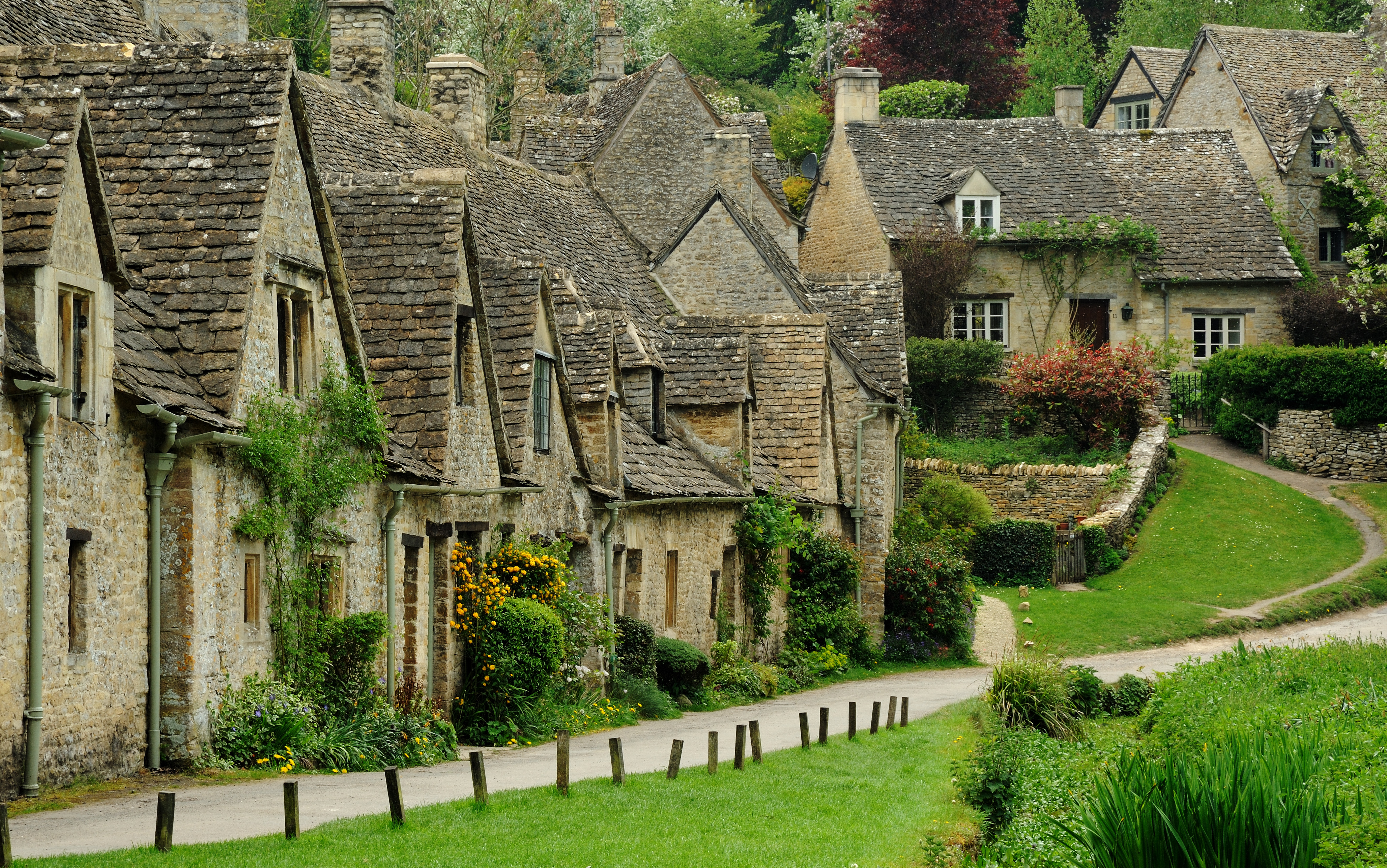
Arlington Row, Bibury
Approaching Kilkenny Farm The farm is partly obscured by a clump of mature trees. This is very early (6:33) on a somewhat misty spring morning.
Approaching Kilkenny Farm
The farm is partly obscured by a clump of mature trees. This is very early (6:33) on a somewhat misty spring morning.
Lane to Kilkenny Farm The lane is passing Hollybush Plantation on the right, with the Leach valley on the left. The distant clump of trees, faint in the early morning light, is seen more clearly in <a href="https://www.geograph.org.uk/photo/4673391">SP1309 : Approaching Kilkenny Farm</a>.
Lane to Kilkenny Farm
The lane is passing Hollybush Plantation on the right, with the Leach valley on the left. The distant clump of trees, faint in the early morning light, is seen more clearly in SP1309 : Approaching Kilkenny Farm.
Middle Kilkenny Cottages Their tall stacks can be seen above the hedge by the lane to the B4425.
Middle Kilkenny Cottages
Their tall stacks can be seen above the hedge by the lane to the B4425.
Farmland near Kilkenny Cottages From the same spot as <a href="https://www.geograph.org.uk/photo/4673479">SP1308 : Middle Kilkenny Cottages</a> on the same misty morning, looking to the right. The distant row of trees is along the B4425.
Farmland near Kilkenny Cottages
From the same spot as SP1308 : Middle Kilkenny Cottages on the same misty morning, looking to the right. The distant row of trees is along the B4425.
Lane approaching Middle Kilkenny Cottages Placing <a href="https://www.geograph.org.uk/photo/4673479">SP1308 : Middle Kilkenny Cottages</a> in more context, from the same spot (and the same spot as <a href="https://www.geograph.org.uk/photo/4673676">SP1308 : Farmland near Kilkenny Cottages</a>).
Lane approaching Middle Kilkenny Cottages
Placing SP1308 : Middle Kilkenny Cottages in more context, from the same spot (and the same spot as SP1308 : Farmland near Kilkenny Cottages).
Lane passing Kilkenny Farm On the right is a listed barn dated 1795 <span class="nowrap"><a title="http://list.historicengland.org.uk/resultsingle.aspx?uid=1156017&searchtype=mapsearch" rel="nofollow ugc noopener" href="http://list.historicengland.org.uk/resultsingle.aspx?uid=1156017&searchtype=mapsearch">Link</a><img style="margin-left:2px;" alt="External link" title="External link - shift click to open in new window" src="https://s1.geograph.org.uk/img/external.png" width="10" height="10"/></span> .
Lane passing Kilkenny Farm
On the right is a listed barn dated 1795 LinkExternal link .
Bridleway near Kilkenny Farm Bridleway KBY 7/1 approaching Kilkenny Farm soon after sunrise.
Bridleway near Kilkenny Farm
Bridleway KBY 7/1 approaching Kilkenny Farm soon after sunrise.
Bridleway to Kilkenny Barn Veering left here towards a small wood beside the barn.
Bridleway to Kilkenny Barn
Veering left here towards a small wood beside the barn.
Morning sun near Kilkenny Barn Rather like <a href="https://www.geograph.org.uk/photo/4695706">SP1309 : Bridleway near Kilkenny Farm</a>, but further west and a different wood. Same bridleway, though.
Morning sun near Kilkenny Barn
Rather like SP1309 : Bridleway near Kilkenny Farm, but further west and a different wood. Same bridleway, though.
Approaching the Salt Way Bridleway KBY 7/1 approaches a diagonal crossroads with the Salt Way, following restricted byway KBY/6.
Approaching the Salt Way
Bridleway KBY 7/1 approaches a diagonal crossroads with the Salt Way, following restricted byway KBY/6.
Salt Way Heading south from the junction seen in <a href="https://www.geograph.org.uk/photo/4695743">SP1208 : Approaching the Salt Way</a> in the direction of Coln St Aldwyns.
Salt Way
Heading south from the junction seen in SP1208 : Approaching the Salt Way in the direction of Coln St Aldwyns.
Salt Way by New Covert Plantation A reverse view of <a href="https://www.geograph.org.uk/photo/4423195">SP1208 : Salt Way by New Covert Plantation</a>.
Salt Way by New Covert Plantation
Salt Way nearing Saltway Barn See <a href="https://www.geograph.org.uk/photo/231391">SP1109 : Gatepost, Saltway Barn</a>. This is restricted byway KBY 6/2.
Salt Way nearing Saltway Barn
See SP1109 : Gatepost, Saltway Barn. This is restricted byway KBY 6/2.
Salt Way at Saltway Barn Following restricted byway KBY 6 and crossing bridleway KBY 5. See also <a href="https://www.geograph.org.uk/photo/4423490">SP1109 : Saltway Barn</a> and <a href="https://www.geograph.org.uk/photo/231391">SP1109 : Gatepost, Saltway Barn</a>, taken at the same spot.
Salt Way at Saltway Barn
Following restricted byway KBY 6 and crossing bridleway KBY 5. See also SP1109 : Saltway Barn and SP1109 : Gatepost, Saltway Barn, taken at the same spot.
Crop near RAF Bibury A cereal crop on the other side of the bridleway <a href="https://www.geograph.org.uk/photo/4423108">SP1108 : Bridleway to Ablington</a> from <a href="https://www.geograph.org.uk/photo/4423125">SP1108 : Towards The Cinema Piece</a>, and rather more advanced. In the distance is Bear Wood.
Crop near RAF Bibury
A cereal crop on the other side of the bridleway SP1108 : Bridleway to Ablington from SP1108 : Towards The Cinema Piece, and rather more advanced. In the distance is Bear Wood.
Gatepost, Saltway Barn Also shown in <a href="https://www.geograph.org.uk/photo/231391">SP1109 : Gatepost, Saltway Barn</a>. See also <a href="https://www.geograph.org.uk/photo/4423490">SP1109 : Saltway Barn</a> and <a href="https://www.geograph.org.uk/photo/4695764">SP1109 : Salt Way at Saltway Barn</a>. Ahead is bridleway KBY 5.
Gatepost, Saltway Barn
Also shown in SP1109 : Gatepost, Saltway Barn. See also SP1109 : Saltway Barn and SP1109 : Salt Way at Saltway Barn. Ahead is bridleway KBY 5.
Show me another place!

Bear Wood is located at Grid Ref: SP1108 (Lat: 51.775366, Lng: -1.8322465)

Administrative County: Gloucestershire

District: Cotswold

Police Authority: Gloucestershire

What 3 Words

///acrobats.shrug.pilots. Near Northleach, Gloucestershire

Nearby Locations

Bear Wood

Related Wikis

Have you been to Bear Wood?

Leave your review of Bear Wood below (or comments, questions and feedback).