Castlebank Plantation
Wood, Forest in Yorkshire Richmondshire
England
Castlebank Plantation
Castlebank Plantation is a picturesque woodland located in Yorkshire, England. Situated in the heart of the county, this forested area covers a vast expanse of approximately 200 acres. It is nestled within the rolling hills and tranquil countryside, offering a serene escape for nature enthusiasts and outdoor lovers.
The plantation is renowned for its diverse range of tree species, including oak, beech, birch, and pine. The lush vegetation forms a dense canopy, providing shade and shelter for various wildlife species. Visitors can spot an array of birds, such as woodpeckers, owls, and thrushes, as well as small mammals like rabbits and foxes.
The woodland is crisscrossed by a network of well-maintained walking trails, allowing visitors to explore its natural beauty. These paths wind their way through the plantation, offering stunning views of the surrounding landscape and opportunities for peaceful solitude. Additionally, there are designated picnic areas where visitors can relax and enjoy a meal amidst the tranquil ambience.
Moreover, Castlebank Plantation is steeped in history, as its name suggests. It is believed that the area was once home to a medieval castle, although only ruins remain today. These remnants add a touch of mystique to the woodland, making it an intriguing destination for history enthusiasts.
Overall, Castlebank Plantation is a captivating woodland retreat that offers a harmonious blend of natural beauty and historical significance. Its peaceful atmosphere and diverse flora and fauna make it a must-visit destination for anyone seeking solace in the embrace of nature.
If you have any feedback on the listing, please let us know in the comments section below.
Castlebank Plantation Images
Images are sourced within 2km of 54.312513/-1.8245111 or Grid Reference SE1190. Thanks to Geograph Open Source API. All images are credited.


![Leyburn buildings [2] The Methodist church is located in Harmby Road. Built in 1884 of squared, coursed rubble stone under a slate roof.
Leyburn is a market town in the Richmondshire district of North Yorkshire, some 16 miles west of Northallerton and 7½ miles southwest of Richmond. The town was mentioned in the Domesday Book and its growth as a major hub is linked to the decline in fortunes of nearby Wensley, which had prominence as the only market town in Wensleydale until being devastated by the plague in 1563. Leyburn is a gateway town to the Yorkshire Dales National Park and relies heavily on tourism.](https://s0.geograph.org.uk/geophotos/02/45/41/2454120_2fbea405.jpg)
![Leyburn buildings [1] The Picturehouse was originally the Elite. Closed in 2007 when the owners retired, it re-opened in 2008 with local volunteers. Now, sadly, it seems to be closed again and up for sale.
Leyburn is a market town in the Richmondshire district of North Yorkshire, some 16 miles west of Northallerton and 7½ miles southwest of Richmond. The town was mentioned in the Domesday Book and its growth as a major hub is linked to the decline in fortunes of nearby Wensley, which had prominence as the only market town in Wensleydale until being devastated by the plague in 1563. Leyburn is a gateway town to the Yorkshire Dales National Park and relies heavily on tourism.](https://s0.geograph.org.uk/geophotos/02/45/41/2454144_d6cc1eef.jpg)
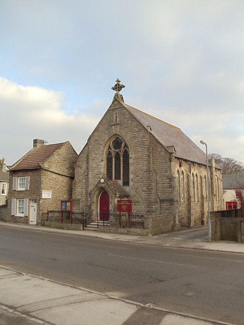
![Parish church [1] The Anglican parish church of St Matthew was built in 1868 after many years of parishioners having to travel to nearby Wensley, which, until the plague of 1563 was by far the most important of the two locations. The church is constructed of sandstone under a Welsh sale roof. Inside is a fine hammer beam roof. Listed, grade II, with details at: <span class="nowrap"><a title="https://historicengland.org.uk/listing/the-list/list-entry/1318565" rel="nofollow ugc noopener" href="https://historicengland.org.uk/listing/the-list/list-entry/1318565">Link</a><img style="margin-left:2px;" alt="External link" title="External link - shift click to open in new window" src="https://s1.geograph.org.uk/img/external.png" width="10" height="10"/></span>
Leyburn is a market town in the Richmondshire district of North Yorkshire, some 16 miles west of Northallerton and 7½ miles southwest of Richmond. The town was mentioned in the Domesday Book and its growth as a major hub is linked to the decline in fortunes of nearby Wensley, which had prominence as the only market town in Wensleydale until being devastated by the plague in 1563. Leyburn is a gateway town to the Yorkshire Dales National Park and relies heavily on tourism.](https://s0.geograph.org.uk/geophotos/02/45/41/2454156_88874ca9.jpg)


Castlebank Plantation is located at Grid Ref: SE1190 (Lat: 54.312513, Lng: -1.8245111)
Division: North Riding
Administrative County: North Yorkshire
District: Richmondshire
Police Authority: North Yorkshire
What 3 Words
///gobbles.winded.morphing. Near Leyburn, North Yorkshire
Nearby Locations
Related Wikis
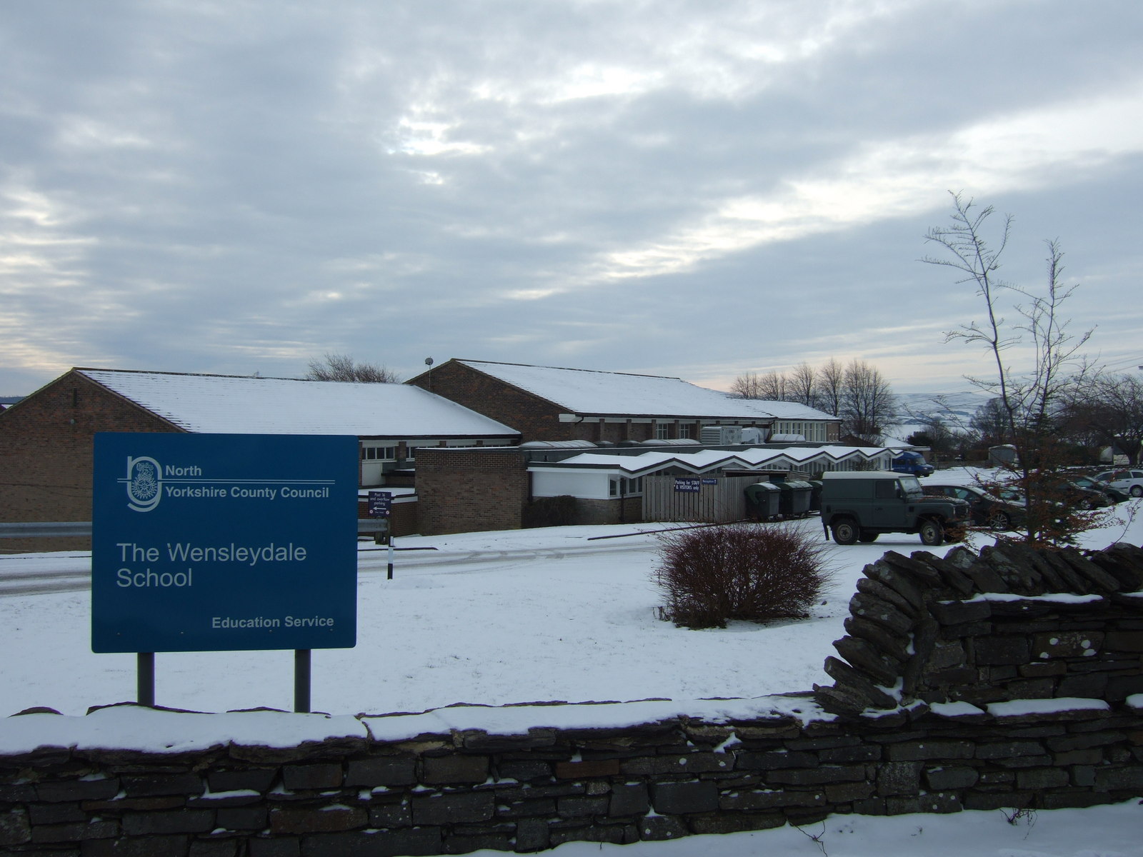
The Wensleydale School
The Wensleydale School and Sixth Form is a co-educational comprehensive school situated on Richmond Road, Leyburn, North Yorkshire, England. == History... ==

St Matthew's Church, Leyburn, North Yorkshire
The church of St Matthew Leyburn (also known as The Parish Church of St Matthew, Leyburn) is the parish church for Leyburn in North Yorkshire, England...
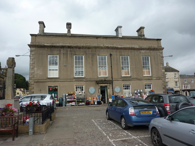
Leyburn Town Hall
Leyburn Town Hall is a municipal building in the Market Place, Leyburn, North Yorkshire, England. The structure, which is used for retail purposes and...
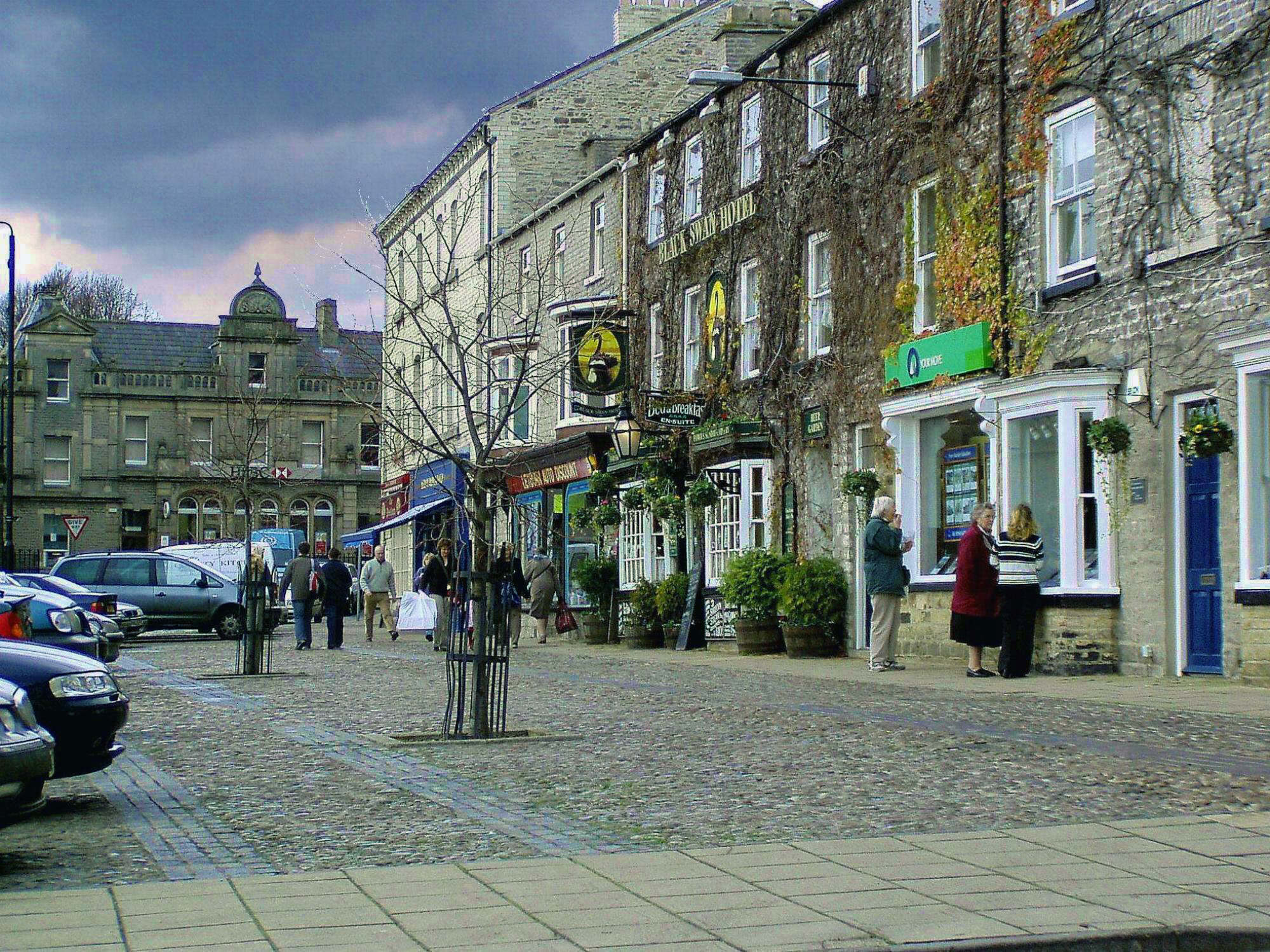
Leyburn
Leyburn is a market town and civil parish in North Yorkshire, England, sitting above the northern bank of the River Ure in Wensleydale. Historically in...

Leyburn railway station
Leyburn railway station is on the Wensleydale Railway, a seasonal, heritage service and serves the town of Leyburn in North Yorkshire, England. During...

Tennants (auctioneers)
Tennants is an auction house based at Leyburn in North Yorkshire, England. It claims to be the largest family-owned fine art auctioneers in the United...
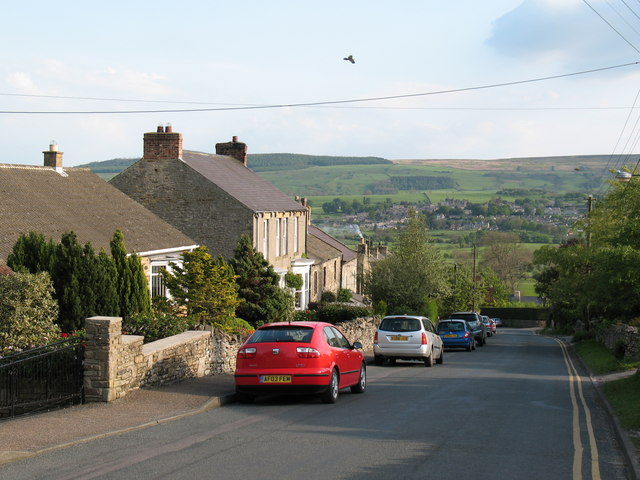
Harmby
Harmby is a village and civil parish in Lower Wensleydale very near to Leyburn, in North Yorkshire, England. It is closely connected with Spennithorne...
Bellerby
Bellerby is a village and civil parish in North Yorkshire, England, about 7 miles (11 km) south-west of Richmond. The village has one pub, the Cross Keys...
Nearby Amenities
Located within 500m of 54.312513,-1.8245111Have you been to Castlebank Plantation?
Leave your review of Castlebank Plantation below (or comments, questions and feedback).