Bath Wood

Wood, Forest in Staffordshire East Staffordshire

England

Bath Wood

Thorney Lanes Standing on a small triangle of grass looking along Thorney Lanes.
Thorney Lanes Credit: Malcolm Neal

Bath Wood is a picturesque woodland located in Staffordshire, England. Covering an area of approximately 100 hectares, this ancient forest is nestled within the Cannock Chase Area of Outstanding Natural Beauty. Bath Wood is renowned for its diverse range of flora and fauna, making it a haven for nature enthusiasts and wildlife lovers.

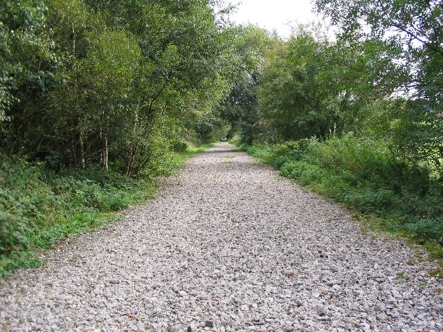
The wood is dominated by a mixture of deciduous and coniferous trees, including oak, birch, beech, and Scots pine. The dense canopy provides a serene and shaded atmosphere, offering a welcome escape from the hustle and bustle of everyday life. As visitors wander along the well-maintained trails, they can spot a plethora of woodland creatures, including deer, squirrels, and a variety of bird species.

The forest is also home to a rich assortment of plant life, such as bluebells, wild garlic, and foxgloves, which create a vibrant and colorful display during the spring and summer months. Additionally, Bath Wood boasts several small streams and ponds that contribute to the overall beauty and tranquility of the area.

Visitors to Bath Wood can enjoy a range of activities, from leisurely walks and picnics to birdwatching and photography. The forest is equipped with designated picnic areas and benches, providing ample opportunities for relaxation and enjoying the natural surroundings.

Overall, Bath Wood offers a unique and enchanting experience for nature enthusiasts, providing a haven of tranquility and beauty in the heart of Staffordshire.

If you have any feedback on the listing, please let us know in the comments section below.
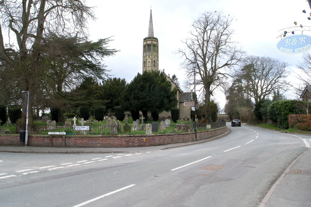
Bath Wood Images

Images are sourced within 2km of 52.806529/-1.8314566 or Grid Reference SK1123. Thanks to Geograph Open Source API. All images are credited.

Thorney Lanes Standing on a small triangle of grass looking along Thorney Lanes.
Thorney Lanes
Standing on a small triangle of grass looking along Thorney Lanes.
Thorney Lanes This is just before the junction with Abbots Bromley Road.
Thorney Lanes
This is just before the junction with Abbots Bromley Road.
Maker Lane The road surface on Maker Lane is very variable and in some places there are very deep potholes.
Maker Lane
The road surface on Maker Lane is very variable and in some places there are very deep potholes.
Approaching Hoar Cross Further along Yoxall Road near the cross roads with Hoar Cross just visible, not that it is a very big place.
Approaching Hoar Cross
Further along Yoxall Road near the cross roads with Hoar Cross just visible, not that it is a very big place.
Direction Sign - Signpost in Hoar Cross Located on the southwest side of the crossroads of Newborough Road, Abbots Bromley Road and Hoar Cross Road in Hoar Cross parish. 3 arms and perforated disc finial. See also <a title="https://www.geograph.org.uk/photo/3555123" href="https://www.geograph.org.uk/photo/3555123">Link</a>.

Milestone Society National ID: ST_SK1323
Direction Sign - Signpost in Hoar Cross
Located on the southwest side of the crossroads of Newborough Road, Abbots Bromley Road and Hoar Cross Road in Hoar Cross parish. 3 arms and perforated disc finial. See also Link. Milestone Society National ID: ST_SK1323
Old Milepost by the B5234, Abbots Bromley parish Cast iron post by the B5234, in parish of ABBOTS BROMLEY (EAST STAFFORDSHIRE District), roadside, in front of hedge, on South side of road. Lathe iron casting, erected by the County Council in the 19th/20th century. 

Inscription reads:-
: ABBOTS - / BROMLEY 1 : : ABBOTS / BROMLEY : : NEWBOROUGH 2½ / BURTON 10 : 
: Chas. Lathe, Tipton. :

Grade II listed.  
List Entry Number: 1038408 <span class="nowrap"><a title="https://historicengland.org.uk/listing/the-list/list-entry/1038408" rel="nofollow ugc noopener" href="https://historicengland.org.uk/listing/the-list/list-entry/1038408">Link</a><img style="margin-left:2px;" alt="External link" title="External link - shift click to open in new window" src="https://s1.geograph.org.uk/img/external.png" width="10" height="10"/></span>

Milestone Society National ID: ST_ASBT01.
Old Milepost by the B5234, Abbots Bromley parish
Cast iron post by the B5234, in parish of ABBOTS BROMLEY (EAST STAFFORDSHIRE District), roadside, in front of hedge, on South side of road. Lathe iron casting, erected by the County Council in the 19th/20th century. Inscription reads:- : ABBOTS - / BROMLEY 1 : : ABBOTS / BROMLEY : : NEWBOROUGH 2½ / BURTON 10 : : Chas. Lathe, Tipton. : Grade II listed. List Entry Number: 1038408 LinkExternal link Milestone Society National ID: ST_ASBT01.
Woodland at Roost Hill It is interesting to contrast the attitude of private forestry operators (as here, no public access) with that of the Forestry Commission who regard public access and recreation as part of their responsibilities.
Woodland at Roost Hill
It is interesting to contrast the attitude of private forestry operators (as here, no public access) with that of the Forestry Commission who regard public access and recreation as part of their responsibilities.
Hoar Cross A traditional signpost, topped with the Staffordshire knot, stands at this cross-roads. The Menell Ingram Arms public house is partially hidden behind the tree.
Hoar Cross
A traditional signpost, topped with the Staffordshire knot, stands at this cross-roads. The Menell Ingram Arms public house is partially hidden behind the tree.
Hay meadow and hay bales Seen from the road between Hoar Cross and Newborough
Hay meadow and hay bales
Seen from the road between Hoar Cross and Newborough
Slate House Farm, Bromley Wood, near Abbots Bromley, Staffordshire. Slate House Farm is situated alongside the B5234, Abbots Bromley to Burton upon Trent road, in the hamlet of Bromley Wood. It is a dairy farm with 60 Holstein-Friesian milk cows. Brickwork in the gable end of the barn facing, proudly states the age of the building as 1859. The white farm sign on the end of the barn tells us that the farm not only supplies farm assured milk to the Dairy Crest creamery but also that food standards are assured with the 'little red tractor' symbol. It may be coincidence but the farmer has a new red Massey Ferguson tractor parked in the farmyard!
Slate House Farm, Bromley Wood, near Abbots Bromley, Staffordshire.
Slate House Farm is situated alongside the B5234, Abbots Bromley to Burton upon Trent road, in the hamlet of Bromley Wood. It is a dairy farm with 60 Holstein-Friesian milk cows. Brickwork in the gable end of the barn facing, proudly states the age of the building as 1859. The white farm sign on the end of the barn tells us that the farm not only supplies farm assured milk to the Dairy Crest creamery but also that food standards are assured with the 'little red tractor' symbol. It may be coincidence but the farmer has a new red Massey Ferguson tractor parked in the farmyard!
Fields of maize near Newborough, Staffordshire. Fields of maize look remarkably healthy in the early evening sunshine, despite a heatwave and lack of rain over the previous few weeks! The view is from the B5234 looking south-west. The edge of Birch Wood is on the left and Barn Farm can be clearly seen on the ridge in the middle distance. The cooling towers of Rugeley Power Station can just be picked out in the far distance, with Cannock Chase beyond.
Fields of maize near Newborough, Staffordshire.
Fields of maize look remarkably healthy in the early evening sunshine, despite a heatwave and lack of rain over the previous few weeks! The view is from the B5234 looking south-west. The edge of Birch Wood is on the left and Barn Farm can be clearly seen on the ridge in the middle distance. The cooling towers of Rugeley Power Station can just be picked out in the far distance, with Cannock Chase beyond.
Dairy farming near Abbots Bromley The piece of blue piping on the electric fence makes a simple footpath stile
Dairy farming near Abbots Bromley
The piece of blue piping on the electric fence makes a simple footpath stile
The drive to Bentilee Park farm
Bentilee A substantial Victorian farmhouse graces this farm.
Bentilee
A substantial Victorian farmhouse graces this farm.
The end of the road, Rowley Farms From both 1:50000 and 1:25000, Rowley Farms appears to be a hamlet name.
The end of the road, Rowley Farms
From both 1:50000 and 1:25000, Rowley Farms appears to be a hamlet name.
Ladysmith Farm This farm stands in splendid isolation in the middle of its grid square at the end of a mile-long drive.
Ladysmith Farm
This farm stands in splendid isolation in the middle of its grid square at the end of a mile-long drive.
Hoar Cross Nursing Home This is a partial conversion from houses or cottages of the Hoar Cross Hall Estate.
Hoar Cross Nursing Home
This is a partial conversion from houses or cottages of the Hoar Cross Hall Estate.
Nicholl's Covert and the drive to Cross Hayes House
Show me another place!

Bath Wood is located at Grid Ref: SK1123 (Lat: 52.806529, Lng: -1.8314566)

Administrative County: Staffordshire

District: East Staffordshire

Police Authority: Staffordshire

What 3 Words

///towers.skylights.loved. Near Abbots Bromley, Staffordshire

Nearby Locations

Paddock Rough Bath Wood

Related Wikis

Have you been to Bath Wood?

Leave your review of Bath Wood below (or comments, questions and feedback).