Birsley Wood

Wood, Forest in Northumberland

England

Birsley Wood

St John the Baptist Church, Edlingham St John the Baptist is a mediaeval (11th century) church in Edlingham in the English county of Northumberland. The church is mostly Norman, from two periods, the late 11th – early 12th century and late 12th century. The chancel arch and the south porch, with its rare Norman tunnel vault, are late 11th century, and the north aisle arcade is from the late 12th century. The columns are circular and the capitals are scalloped with bands of nail-head. The defensible west tower may also have been begun in the late 12th century, but completed later.

<span class="nowrap"><a title="https://en.wikipedia.org/wiki/St_John_the_Baptist,_Edlingham" rel="nofollow ugc noopener" href="https://en.wikipedia.org/wiki/St_John_the_Baptist,_Edlingham">Link</a><img style="margin-left:2px;" alt="External link" title="External link - shift click to open in new window" src="https://s1.geograph.org.uk/img/external.png" width="10" height="10"/></span>
St John the Baptist Church, Edlingham Credit: Brian Deegan

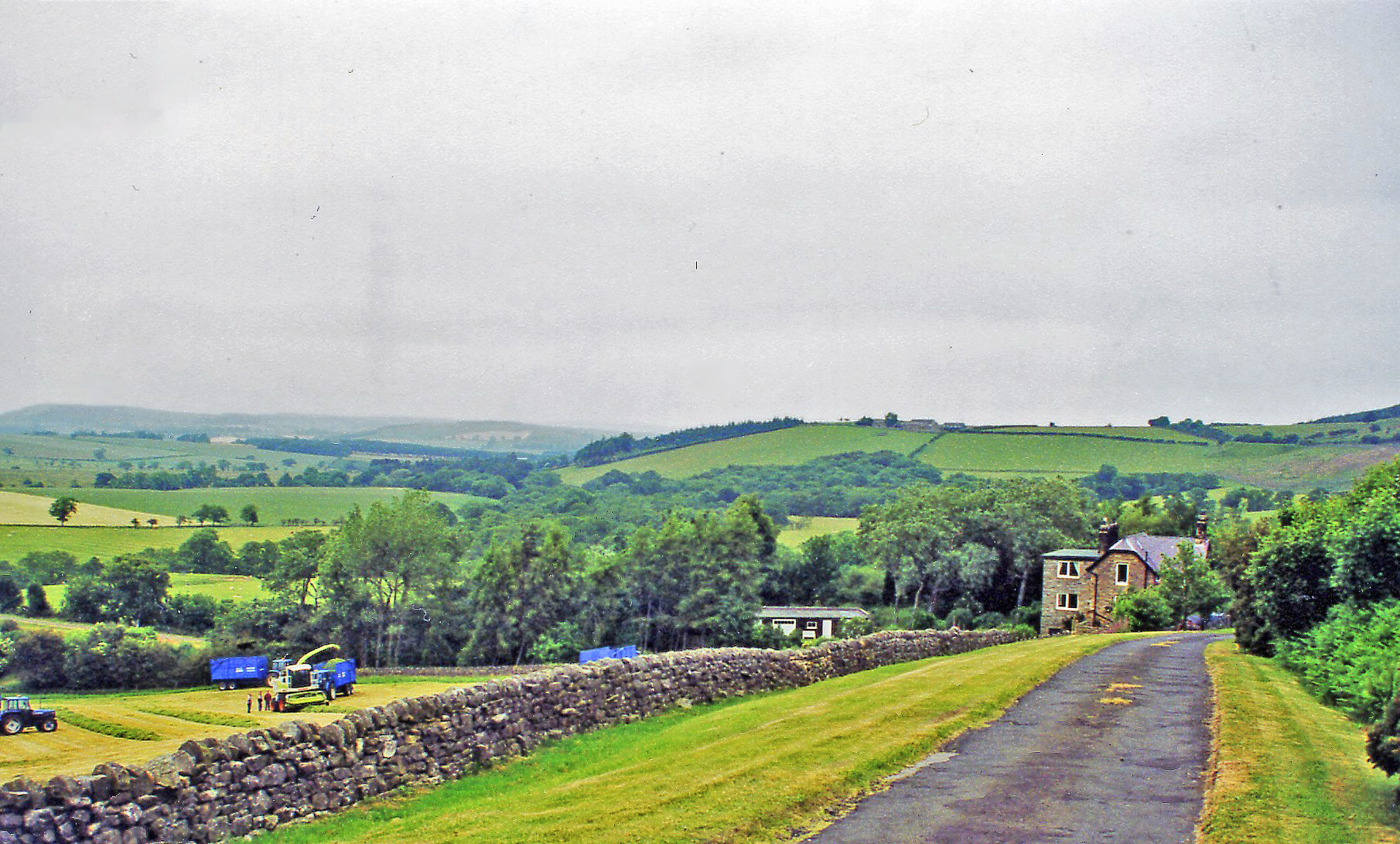
Birsley Wood is a picturesque forest located in the county of Northumberland, England. Covering an area of approximately 100 hectares, it is nestled within the stunning landscape of the Northumberland National Park. The wood is situated near the small village of Birsley, offering visitors a peaceful and natural retreat.

The woodland is predominantly composed of native tree species, including oak, birch, and beech, creating a diverse and vibrant habitat for wildlife. The forest floor is adorned with a rich carpet of wildflowers and ferns, further enhancing its natural beauty. Birsley Wood is also home to a variety of bird species, such as woodpeckers, owls, and warblers, making it a haven for birdwatchers.

Visitors to Birsley Wood can explore a network of well-maintained footpaths that wind through the forest, allowing for leisurely walks and hikes. The trails provide an opportunity to immerse oneself in the tranquil surroundings and enjoy the fresh air. There are also designated picnic areas, perfect for a relaxing break amidst the stunning scenery.

Birsley Wood is managed by the Northumberland National Park Authority, ensuring its preservation and conservation for future generations. The forest serves as an important ecological site, contributing to the overall biodiversity of the region. It also plays a vital role in maintaining the natural balance of the ecosystem.

Overall, Birsley Wood offers a serene and idyllic setting, inviting visitors to connect with nature and appreciate the beauty of Northumberland's countryside. Whether for a leisurely stroll, birdwatching, or simply unwinding amidst the peaceful environment, Birsley Wood provides a rejuvenating experience for all who visit.

If you have any feedback on the listing, please let us know in the comments section below.

Birsley Wood Images

Images are sourced within 2km of 55.382544/-1.8259198 or Grid Reference NU1109. Thanks to Geograph Open Source API. All images are credited.

St John the Baptist Church, Edlingham St John the Baptist is a mediaeval (11th century) church in Edlingham in the English county of Northumberland. The church is mostly Norman, from two periods, the late 11th – early 12th century and late 12th century. The chancel arch and the south porch, with its rare Norman tunnel vault, are late 11th century, and the north aisle arcade is from the late 12th century. The columns are circular and the capitals are scalloped with bands of nail-head. The defensible west tower may also have been begun in the late 12th century, but completed later.

<span class="nowrap"><a title="https://en.wikipedia.org/wiki/St_John_the_Baptist,_Edlingham" rel="nofollow ugc noopener" href="https://en.wikipedia.org/wiki/St_John_the_Baptist,_Edlingham">Link</a><img style="margin-left:2px;" alt="External link" title="External link - shift click to open in new window" src="https://s1.geograph.org.uk/img/external.png" width="10" height="10"/></span>
St John the Baptist Church, Edlingham
St John the Baptist is a mediaeval (11th century) church in Edlingham in the English county of Northumberland. The church is mostly Norman, from two periods, the late 11th – early 12th century and late 12th century. The chancel arch and the south porch, with its rare Norman tunnel vault, are late 11th century, and the north aisle arcade is from the late 12th century. The columns are circular and the capitals are scalloped with bands of nail-head. The defensible west tower may also have been begun in the late 12th century, but completed later. LinkExternal link
Edlingham Castle Ruin Edlingham Castle is a small castle ruin, having scheduled monument and Grade I listed building status, in the care of English Heritage.

The ruins are mostly laid low, though much of the solar tower (1340's) still stands despite an impressive crack running several stories down to ground level.

<span class="nowrap"><a title="https://en.wikipedia.org/wiki/Edlingham_Castle" rel="nofollow ugc noopener" href="https://en.wikipedia.org/wiki/Edlingham_Castle">Link</a><img style="margin-left:2px;" alt="External link" title="External link - shift click to open in new window" src="https://s1.geograph.org.uk/img/external.png" width="10" height="10"/></span>
Edlingham Castle Ruin
Edlingham Castle is a small castle ruin, having scheduled monument and Grade I listed building status, in the care of English Heritage. The ruins are mostly laid low, though much of the solar tower (1340's) still stands despite an impressive crack running several stories down to ground level. LinkExternal link
Belted Galloway cattle A pleasant, unexpected encounter, this small herd were taking the easy way up the hillside.
Belted Galloway cattle
A pleasant, unexpected encounter, this small herd were taking the easy way up the hillside.
Edlingham Castle, Northumberland Edlingham Castle was originally a manor house which was progressively fortified against the Scots during the 14th century.
Edlingham Castle, Northumberland
Edlingham Castle was originally a manor house which was progressively fortified against the Scots during the 14th century.
Edlingham, Northumberland To the left is the church of St John the Baptist, in the centre distance is a railway viaduct and to the right is Edlingham Castle. The church is medieval, dating from the late 11th century. The railway viaduct was built in c. 1885 for the North Eastern Railway Company, as part of the former Alnwick to Coldstream (Cornhill) railway, which opened in 1887. Edlingham Castle was originally a manor house which was progressively fortified against the Scots during the 14th century.
Edlingham, Northumberland
To the left is the church of St John the Baptist, in the centre distance is a railway viaduct and to the right is Edlingham Castle. The church is medieval, dating from the late 11th century. The railway viaduct was built in c. 1885 for the North Eastern Railway Company, as part of the former Alnwick to Coldstream (Cornhill) railway, which opened in 1887. Edlingham Castle was originally a manor house which was progressively fortified against the Scots during the 14th century.
Church of St John the Baptist
St John the Baptist's church, Edlingham
The path to St John the Baptist's church, Edlingham
The ruins of Edlingham Castle, with disused viaduct in the background See <a href="https://www.geograph.org.uk/photo/7267605">NU1109 : Zoom shot from churchyard of the ruined castle and disused viaduct, Edlingham</a> for closer look
The ruins of Edlingham Castle, with disused viaduct in the background
Zoom shot from churchyard of the ruined castle and disused viaduct, Edlingham See also <a href="https://www.geograph.org.uk/photo/7267602">NU1109 : The ruins of Edlingham Castle, with disused viaduct in the background</a>.
Zoom shot from churchyard of the ruined castle and disused viaduct, Edlingham
The road to Edlingham
The road to Edlingham, looking back towards the junction with the B6341
Rough lay-by on the B6341 approaching Corby's Bridge, near Edlingham
St John the Baptist, Edlingham
Interior St John the Baptist, Edlingham Possibly dating to the 1100's
Interior St John the Baptist, Edlingham
Possibly dating to the 1100's
Edlingham Castle Ruins of fortified hall-house with strong and broad stone walls, maybe dating from about 1300.
Edlingham Castle
Ruins of fortified hall-house with strong and broad stone walls, maybe dating from about 1300.
Waterfall on Corby's Letch In spate after heavy rain
Waterfall on Corby's Letch
In spate after heavy rain
Waterfall at Corby's Bridge This waterfall is normally a barely noticeable trickle of water feeding Corby's Letch.
Waterfall at Corby's Bridge
This waterfall is normally a barely noticeable trickle of water feeding Corby's Letch.
Show me another place!

Birsley Wood is located at Grid Ref: NU1109 (Lat: 55.382544, Lng: -1.8259198)

Unitary Authority: Northumberland

Police Authority: Northumbria

What 3 Words

///married.plenty.daunted. Near Whittingham, Northumberland

Related Wikis

St John the Baptist, Edlingham

St John the Baptist is a mediaeval (11th century) church in Edlingham in the English county of Northumberland. The church is mostly Norman, from two periods...
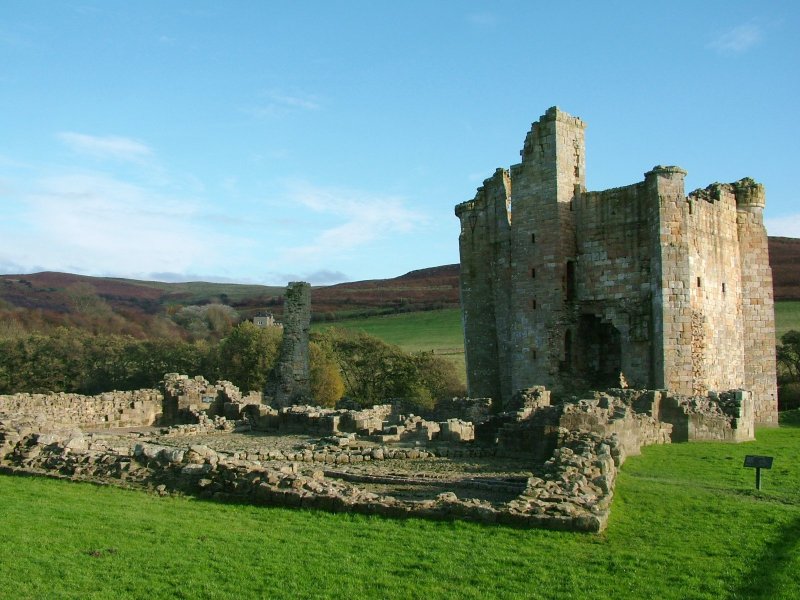
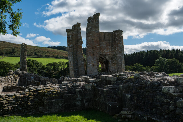
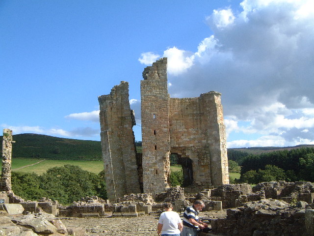
Edlingham Castle

Edlingham Castle is a small castle ruin, having scheduled monument and Grade I listed building status, in the care of English Heritage. It is located in...

Edlingham

Edlingham is a small village and civil parish in Northumberland in the north of England. At the 2001 census it had a population of 196, which had reduced...

Edlingham railway station

Edlingham railway station served the village of Edlingham, Northumberland, England from 1887 to 1953 on the Cornhill Branch. == History == The station...

Lemmington Hall

Lemmington Hall is an 18th-century country mansion incorporating a 15th-century tower house, situated near Edlingham, Northumberland, England. It is a...

Whittingham railway station (Northumberland)

Whittingham railway station served the village of Whittingham, Northumberland, England from 1887 to 1953 on the Cornhill Branch. == History == The station...

Thrunton Wood

Thrunton Wood is an area of woodland and open moor in Northumberland. It is popular with walkers, mountain bikers and horse riders, and home to two waymarked...

Bolton, Northumberland

Bolton is a small village and former civil parish, now in the parish of Hedgeley, in the county of Northumberland, England. It is situated on the north...

Nearby Amenities

Located within 500m of 55.382544,-1.8259198
Power: pole
Lat/Long: 55.3791451/-1.8234122
Power: pole
Lat/Long: 55.3800741/-1.8230664
Power: pole
Lat/Long: 55.382746/-1.8201788
Power: pole
Lat/Long: 55.3810516/-1.8203294
Power: pole
Lat/Long: 55.3834945/-1.8189841
Power: pole
Lat/Long: 55.3825935/-1.8204227
Power: pole
Lat/Long: 55.381957/-1.8215235
Power: pole
Lat/Long: 55.3813042/-1.8225926
The data included in this document is from www.openstreetmap.org. The data is made available under ODbL.

Have you been to Birsley Wood?

Leave your review of Birsley Wood below (or comments, questions and feedback).