Crow Brake

Wood, Forest in Wiltshire

England

Crow Brake

Heading east on the M4 at junction 16
Heading east on the M4 at junction 16 Credit: Rob Purvis

Crow Brake is a dense woodland located in the county of Wiltshire, England. Covering an area of approximately 100 acres, it is known for its picturesque beauty and rich biodiversity. The forest is situated in close proximity to the village of Crow, hence its name.

The woodland is predominantly composed of deciduous trees, including oak, beech, and birch, which create a lush and vibrant canopy. The forest floor is carpeted with a diverse range of flora, including bluebells, wild garlic, and ferns, adding to its natural charm throughout the year. The area is also home to a variety of wildlife, including deer, foxes, badgers, and numerous bird species, making it a popular destination for nature enthusiasts and wildlife watchers.

Crow Brake offers several well-maintained walking trails, allowing visitors to explore the beauty of the woodland at their own pace. These trails wind through the forest, offering glimpses of enchanting clearings, babbling brooks, and small ponds, adding to the allure of the area. The peaceful atmosphere and serene surroundings make it an ideal spot for those seeking a tranquil escape from the hustle and bustle of daily life.

Due to its natural beauty and ecological significance, Crow Brake has been designated as a Site of Special Scientific Interest (SSSI) by the local authorities. This status ensures the protection and preservation of the woodland's unique habitats, allowing future generations to enjoy its natural splendor. Overall, Crow Brake is a hidden gem in Wiltshire, offering a captivating experience for nature lovers and a slice of tranquility in an increasingly urbanized world.

If you have any feedback on the listing, please let us know in the comments section below.

Crow Brake Images

Images are sourced within 2km of 51.562716/-1.8462286 or Grid Reference SU1084. Thanks to Geograph Open Source API. All images are credited.

Heading east on the M4 at junction 16
Lydiard Millicent On the edge of the village of Lydiard Millicent.
Lydiard Millicent
On the edge of the village of Lydiard Millicent.
Westbound M4, 70 miles from Cardiff
All Saints, Lydiard Millicent: tower
All Saints, Lydiard Millicent: stained glass window (a) Intricate and colourful windows in churches and cathedrals greatly add to the ambience, although many early examples in England were smashed by the Puritans and replaced with plain glass. There was a huge revival in the 19th Century with many elaborate new stained glass windows created. The 20th century saw the development of new techniques, including Gemmail, which overlaps pieces of stained glass without using lead. New windows are still being commissioned today, while the oldest known ones are still in place within the Ancestors of Christ window on the south side of Canterbury Cathedral.
All Saints, Lydiard Millicent: stained glass window (a)
Intricate and colourful windows in churches and cathedrals greatly add to the ambience, although many early examples in England were smashed by the Puritans and replaced with plain glass. There was a huge revival in the 19th Century with many elaborate new stained glass windows created. The 20th century saw the development of new techniques, including Gemmail, which overlaps pieces of stained glass without using lead. New windows are still being commissioned today, while the oldest known ones are still in place within the Ancestors of Christ window on the south side of Canterbury Cathedral.
All Saints, Lydiard Millicent: stained glass window (b)
All Saints, Lydiard Millicent: stained glass window (c)
All Saints, Lydiard Millicent: stained glass window (d)
All Saints, Lydiard Millicent: stained glass window (e)
All Saints, Lydiard Millicent: porch
All Saints, Lydiard Millicent: side altar In many churches, the altar is the structure upon which the Eucharist is celebrated. It is usually centrally located in the sanctuary, and as such the focus of attention. It may have certain objects placed upon it such as a cross, candles or flowers. Many larger churches have a side altar, often used for smaller services such as Matins or by church affiliated groups such as the Mothers' Union.
All Saints, Lydiard Millicent: side altar
In many churches, the altar is the structure upon which the Eucharist is celebrated. It is usually centrally located in the sanctuary, and as such the focus of attention. It may have certain objects placed upon it such as a cross, candles or flowers. Many larger churches have a side altar, often used for smaller services such as Matins or by church affiliated groups such as the Mothers' Union.
All Saints, Lydiard Millicent: main altar In many churches, the altar is the structure upon which the Eucharist is celebrated. It is usually centrally located in the sanctuary, and as such the focus of attention. It may have certain objects placed upon it such as a cross, candles or flowers. Many larger churches have a side altar, often used for smaller services such as Matins or by church affiliated groups such as the Mothers' Union.
All Saints, Lydiard Millicent: main altar
In many churches, the altar is the structure upon which the Eucharist is celebrated. It is usually centrally located in the sanctuary, and as such the focus of attention. It may have certain objects placed upon it such as a cross, candles or flowers. Many larger churches have a side altar, often used for smaller services such as Matins or by church affiliated groups such as the Mothers' Union.
All Saints, Lydiard Millicent: war memorial (1914-1918)
All Saints, Lydiard Millicent: war memorial (1939-1945)
All Saints, Lydiard Millicent: nave
All Saints, Lydiard Millicent: war memorial (churchyard) Many war memorials appeared in British towns and cities after the South African War of 1899-1902 (known popularly as the Boer War), but most were constructed after the First World War, known to contemporaries as the Great War (1914-19). These were updated after the Second World War (1939-45), usually by adding a plaque with the names of those killed in that conflict. Almost every town and village in Britain has a memorial erected after the Great War, the commonest types taking the form of a cross, an obelisk or a statue of a soldier. Some occupy a prominent public space; others stand in the local cemetery or can be found inside the local church. Memorials usually commemorate the inhabitants of a particular locality, the former pupils of a school, or the members of a military unit or branch of the armed forces. Other memorials, often bronze plaques placed indoors, commemorate the employees of a private company or public institution.
All Saints, Lydiard Millicent: war memorial (churchyard)
Many war memorials appeared in British towns and cities after the South African War of 1899-1902 (known popularly as the Boer War), but most were constructed after the First World War, known to contemporaries as the Great War (1914-19). These were updated after the Second World War (1939-45), usually by adding a plaque with the names of those killed in that conflict. Almost every town and village in Britain has a memorial erected after the Great War, the commonest types taking the form of a cross, an obelisk or a statue of a soldier. Some occupy a prominent public space; others stand in the local cemetery or can be found inside the local church. Memorials usually commemorate the inhabitants of a particular locality, the former pupils of a school, or the members of a military unit or branch of the armed forces. Other memorials, often bronze plaques placed indoors, commemorate the employees of a private company or public institution.
All Saints, Lydiard Millicent: memorial (a) Harrison was educated at Pembroke College, Oxford <span class="nowrap"><a title="https://en.wikipedia.org/wiki/Pembroke_College,_Oxford" rel="nofollow ugc noopener" href="https://en.wikipedia.org/wiki/Pembroke_College,_Oxford">Link</a><img style="margin-left:2px;" alt="External link" title="External link - shift click to open in new window" src="https://s1.geograph.org.uk/img/external.png" width="10" height="10"/></span> and ordained in 1883. After a curacy in Brompton <span class="nowrap"><a title="https://en.wikipedia.org/wiki/Brompton,_London" rel="nofollow ugc noopener" href="https://en.wikipedia.org/wiki/Brompton,_London">Link</a><img style="margin-left:2px;" alt="External link" title="External link - shift click to open in new window" src="https://s1.geograph.org.uk/img/external.png" width="10" height="10"/></span> he was Vicar of Ixworth <a title="https://www.geograph.org.uk/photo/2102092" href="https://www.geograph.org.uk/photo/2102092">Link</a> before coming here.
All Saints, Lydiard Millicent: memorial (a)
Harrison was educated at Pembroke College, Oxford LinkExternal link and ordained in 1883. After a curacy in Brompton LinkExternal link he was Vicar of Ixworth Link before coming here.
All Saints, Lydiard Millicent: memorial (b)
Show me another place!

Crow Brake is located at Grid Ref: SU1084 (Lat: 51.562716, Lng: -1.8462286)

Unitary Authority: Wiltshire

Police Authority: Wiltshire

What 3 Words

///plastic.shops.jetliner. Near Lydiard Tregoze, Wiltshire

Related Wikis

Lydiard Tregoze

Lydiard Tregoze is a small village and civil parish on the western edge of Swindon in the county of Wiltshire, in the south-west of England. Its name has...
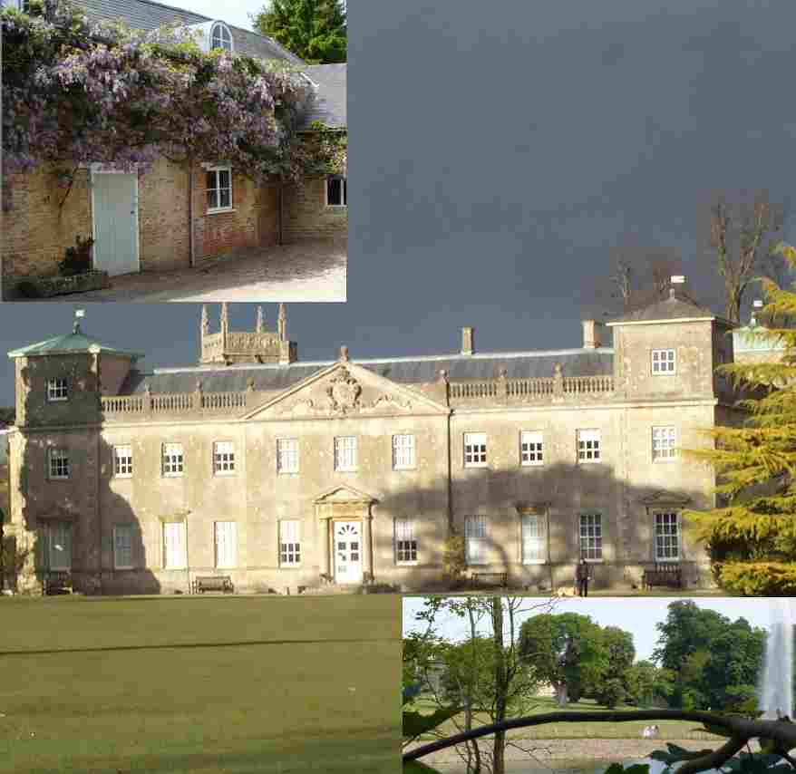
Lydiard Park

Lydiard Park is a 260-acre (110-hectare) country park at Lydiard Tregoze, which was its former name, about 3 miles (5 km) west of central Swindon, Wiltshire...

Lydiard Park Academy

Lydiard Park Academy, formerly known as Greendown Community School, is a mixed sex comprehensive secondary school for students aged between 11 and 18 years...
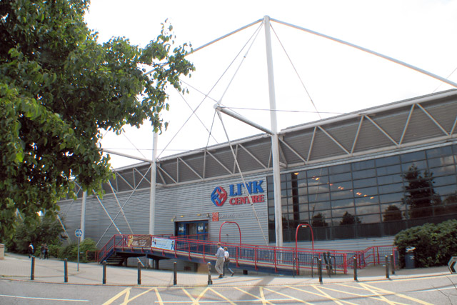
Link Centre

The Link Centre is a leisure centre in Swindon, England. The building, owned by Swindon Borough Council and operated by Greenwich Leisure under the brand...

Lydiard Millicent

Lydiard Millicent is a village and civil parish in Wiltshire, England, about 3+1⁄2 miles (6 km) west of the centre of Swindon. The parish contains the...

Renault Centre

The Renault Centre (or the Renault Distribution Centre) is a high tech building in Swindon commissioned by the French car company Renault for their UK...

South Leaze

South Leaze is a hamlet within the Borough of Swindon, Wiltshire, United Kingdom. It is south of the nearby village of Toothill and is nearby to the Mannington...

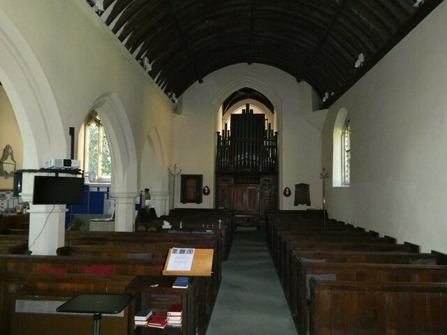
St Mary's Church, Purton

St Mary's Church in the village of Purton in north Wiltshire, England, is an active Church of England parish church in the Diocese of Bristol. A large...

Nearby Amenities

Located within 500m of 51.562716,-1.8462286
Direction: both
Surface: asphalt
Traffic Calming: choker
Lat/Long: 51.5608801/-1.8438782
Give Way
Direction: backward
Lat/Long: 51.5615367/-1.8447643
Traffic Calming: cushion
Lat/Long: 51.562669/-1.8450166
Traffic Calming: cushion
Lat/Long: 51.5630123/-1.8440331
Direction: backward
Traffic Calming: choker
Lat/Long: 51.5631676/-1.8435101
Give Way
Direction: backward
Lat/Long: 51.563214/-1.8433904
Give Way
Direction: forward
Lat/Long: 51.5635492/-1.8430813
The Prinnels
Is In: Swindon
Place: neighbourhood
Lat/Long: 51.563619/-1.8427207
Give Way
Direction: forward
Lat/Long: 51.5636027/-1.8414635
Direction: backward
Surface: asphalt
Traffic Calming: choker
Lat/Long: 51.5618871/-1.8452089
Barrier: cycle_barrier
Lat/Long: 51.5622136/-1.8454529
Fountain
Lat/Long: 51.5593364/-1.8500569
Barrier: cycle_barrier
Cycle Barrier: double
Lat/Long: 51.5662752/-1.8430332
Traffic Calming: cushion
Lat/Long: 51.5621071/-1.8452663
Bus Stop
Grandison Close
Bus: yes
Naptan AtcoCode: 4680SWA10707
Naptan Bearing: E
Naptan CommonName: Grandison Close
Naptan Indicator: E-bound
Naptan NaptanCode: swiadpt
Naptan PlusbusZoneRef: SDON
Naptan Street: Tregoze Way
Naptan Verified: no
Public Transport: platform
Source: naptan;bing
Lat/Long: 51.5635786/-1.8421466
Bus Stop
Grandison Close
Bus: yes
Naptan AtcoCode: 4680SWA10708
Naptan Bearing: W
Naptan CommonName: Grandison Close
Naptan Indicator: W-bound
Naptan NaptanCode: swiadpd
Naptan PlusbusZoneRef: SDON
Naptan Street: Tregoze Way
Naptan Verified: no
Public Transport: platform
Source: naptan;bing
Lat/Long: 51.5634665/-1.8424403
Bus Stop
Wilmot Close
Bus: yes
Naptan AtcoCode: 4680SWA10705
Naptan Bearing: N
Naptan CommonName: Wilmot Close
Naptan Indicator: N-bound
Naptan NaptanCode: swiadgp
Naptan PlusbusZoneRef: SDON
Naptan Street: Tregoze Way
Naptan Verified: no
Public Transport: platform
Source: naptan;bing
Lat/Long: 51.5624803/-1.8452782
Bus Stop
Wilmot Close
Bus: yes
Naptan AtcoCode: 4680SWA10706
Naptan Bearing: S
Naptan CommonName: Wilmot Close
Naptan Indicator: S-bound
Naptan NaptanCode: swiadgt
Naptan PlusbusZoneRef: SDON
Naptan Street: Tregoze Way
Naptan Verified: no
Public Transport: platform
Source: naptan;bing
Lat/Long: 51.5625219/-1.8450863
Give Way
Direction: backward
Lat/Long: 51.5610236/-1.844017
Bus Stop
Sleaford Close
Bus: yes
Naptan AtcoCode: 4680SWA10704
Naptan Bearing: SE
Naptan CommonName: Sleaford Close
Naptan Indicator: SE-bound
Naptan NaptanCode: swiadpa
Naptan PlusbusZoneRef: SDON
Naptan Street: Hay Lane
Naptan Verified: no
Public Transport: platform
Source: naptan;bing
Lat/Long: 51.5600108/-1.8429095
Bus Stop
Sleaford Close
Bus: yes
Naptan AtcoCode: 4680SWA10703
Naptan Bearing: NW
Naptan CommonName: Sleaford Close
Naptan Indicator: NW-bound
Naptan NaptanCode: swiadmt
Naptan PlusbusZoneRef: SDON
Naptan Street: Hay Lane
Naptan Verified: no
Public Transport: platform
Source: naptan;bing
Lat/Long: 51.5600383/-1.8430879
Bench
Backrest: yes
Material: wood
Lat/Long: 51.5667011/-1.8444227
Bench
Backrest: yes
Material: wood
Lat/Long: 51.5667535/-1.8445412
Barrier: entrance
Foot: yes
Lat/Long: 51.566804/-1.8442809
Bench
Backrest: yes
Material: wood
Lat/Long: 51.5668206/-1.8440855
Bench
Backrest: yes
Material: wood
Lat/Long: 51.5668672/-1.8444855
Bench
Backrest: yes
Material: wood
Lat/Long: 51.566914/-1.8441454
Barrier: entrance
Foot: yes
Lat/Long: 51.5669327/-1.8443778
Barrier: kissing_gate
Lat/Long: 51.5620857/-1.8477133
Addr City: Swindon
Addr Country: GB
Addr Housenumber: 24
Addr Street: Danestone Close
Lat/Long: 51.5671615/-1.8467228
Addr City: Swindon
Addr Country: GB
Addr Housenumber: 25
Addr Street: Danestone Close
Lat/Long: 51.5671881/-1.8467227
Post Box
Operator: Royal Mail
Operator Wikidata: Q638098
Post Box Type: pillar
Ref: SN5 33
Royal Cypher: EIIR
Royal Cypher Wikidata: Q33102113
Lat/Long: 51.5633937/-1.8431259
Generator Method: photovoltaic
Generator Output Electricity: yes
Generator Source: solar
Generator Type: solar_photovoltaic_panel
Location: roof
Power: generator
Lat/Long: 51.5664038/-1.8428171
Generator Method: photovoltaic
Generator Output Electricity: yes
Generator Source: solar
Generator Type: solar_photovoltaic_panel
Location: roof
Power: generator
Lat/Long: 51.5651215/-1.8401292
Generator Method: photovoltaic
Generator Output Electricity: yes
Generator Source: solar
Generator Type: solar_photovoltaic_panel
Location: roof
Power: generator
Lat/Long: 51.5649734/-1.8402159
Generator Method: photovoltaic
Generator Output Electricity: yes
Generator Source: solar
Generator Type: solar_photovoltaic_panel
Location: roof
Power: generator
Lat/Long: 51.5651215/-1.8402117
Lydiard Park Balloon Launch Site
Aeroway: airstrip
Operator: Virgin Balloon Flights
Source: http://www.ukairfieldguide.net/airfields/Lydiard-Park
Url: https://www.virginballoonflights.co.uk/location/swindon-lydiard-park
Lat/Long: 51.5618451/-1.8488562
Noexit: yes
Lat/Long: 51.5596748/-1.8429649
Direction: forward
Surface: asphalt
Traffic Calming: choker
Lat/Long: 51.5616145/-1.8448429
Give Way
Direction: backward
Lat/Long: 51.562011/-1.8452425
Crossing
Lat/Long: 51.5664977/-1.8474985
Crossing
Lat/Long: 51.5664825/-1.8474395
Cafe
Coach House Tea Rooms
Lat/Long: 51.562194/-1.8523813
Toilets
Lat/Long: 51.5622202/-1.8521962
Traffic Calming: bump
Lat/Long: 51.5617457/-1.8464751
Traffic Calming: bump
Lat/Long: 51.5619611/-1.8475337
Traffic Calming: bump
Lat/Long: 51.5621123/-1.848561
Vending Machine
Operator: Swindon Borough Council
Vending: parking_tickets
Lat/Long: 51.5620338/-1.8494102
Vending Machine
Operator: Swindon Borough Council
Vending: parking_tickets
Lat/Long: 51.5617546/-1.8494435
Turning Circle
Lat/Long: 51.5627254/-1.8404596
Life Ring
Emergency: life_ring
Lat/Long: 51.562655/-1.8416276
Crossing
Crossing: unmarked
Crossing Markings: no
Lat/Long: 51.5618843/-1.8452072
Barrier: kissing_gate
Lat/Long: 51.5626766/-1.8521394
The data included in this document is from www.openstreetmap.org. The data is made available under ODbL.

Have you been to Crow Brake?

Leave your review of Crow Brake below (or comments, questions and feedback).