Ashridge Hill Copse

Wood, Forest in Wiltshire New Forest

England

Ashridge Hill Copse

Lane to Lower Daggons
Lane to Lower Daggons Credit: David Martin

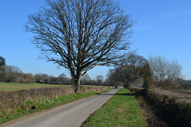
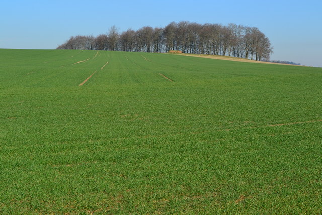
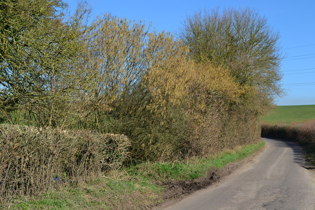
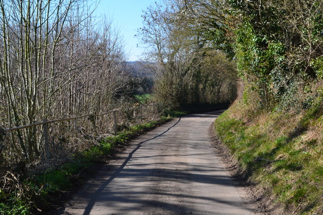
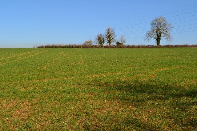
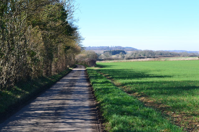
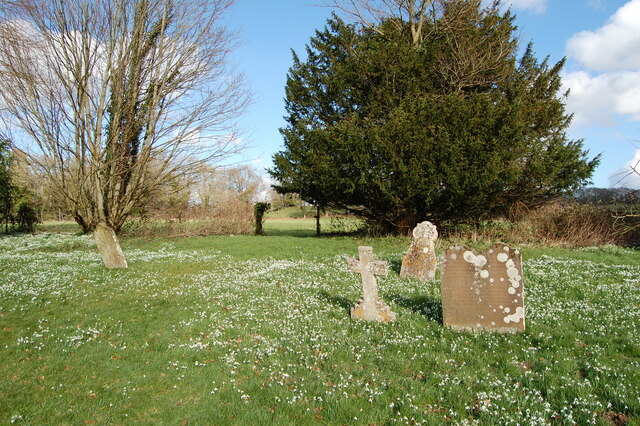
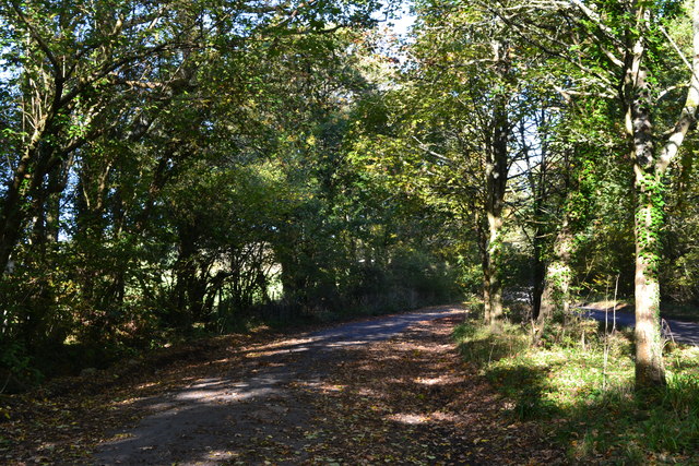
Ashridge Hill Copse is a picturesque woodland located in Wiltshire, England. Covering an area of approximately 50 acres, this ancient woodland is a haven for nature enthusiasts and offers a tranquil escape from the bustling urban life.

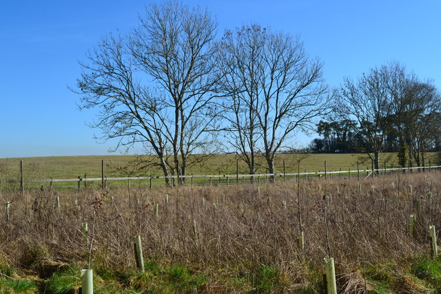
The copse is predominantly made up of native broadleaf trees, including oak, ash, beech, and birch, creating a diverse and thriving ecosystem. The dense canopy provides shade, creating a cool and inviting atmosphere, especially during the hot summer months.

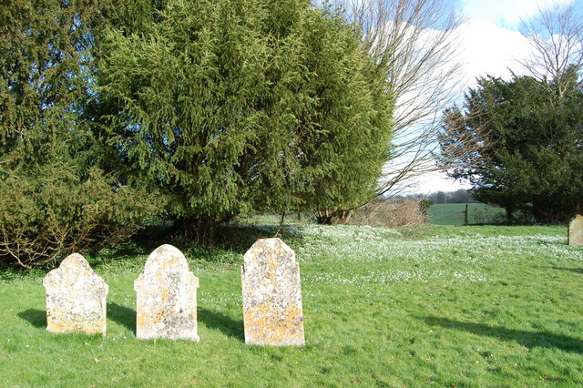
The woodland floor is covered in a rich carpet of wildflowers and ferns, adding to the enchanting beauty of the copse. Bluebells, primroses, and wood anemones adorn the forest floor during spring, painting a vibrant and colorful scene. The undergrowth is also teeming with various species of fungi, adding to the biodiversity of the area.

Ashridge Hill Copse is home to a wide variety of wildlife, including deer, foxes, badgers, and a plethora of bird species. Birdwatchers can expect to spot woodpeckers, owls, and thrushes among the treetops, while the keen-eyed observer might catch a glimpse of the elusive red squirrel darting through the branches.

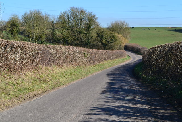
The copse is accessible via a network of footpaths, allowing visitors to explore its beauty and enjoy the peaceful surroundings. Whether it's a leisurely stroll, a picnic, or birdwatching, Ashridge Hill Copse offers a tranquil retreat for anyone seeking solace in nature.

If you have any feedback on the listing, please let us know in the comments section below.

Ashridge Hill Copse Images

Images are sourced within 2km of 50.931848/-1.854035 or Grid Reference SU1014. Thanks to Geograph Open Source API. All images are credited.

Lane to Lower Daggons
Recently planted woodland protected by deer fence
View up field to Ball Hill Copse
Descending the hill to Four Corners
Catkins at Four Corners The footpath entrance through the hedge is marked by the muddy patch on the verge.
Catkins at Four Corners
The footpath entrance through the hedge is marked by the muddy patch on the verge.
Lane at Last Post There were so many bees on the blossom directly above this spot, their buzzing was the main sound in the landscape - in February!!
Lane at Last Post
There were so many bees on the blossom directly above this spot, their buzzing was the main sound in the landscape - in February!!
Field to the skyline near Last Post
Lane to Boulsbury Farm
Shady track in Ashridge Copse
Ashridge Copse
Ashridge Copse
Snowdrops in St Georges churchyard
St George's  church yard
St George's church yard
Ordnance Survey Cut Mark This can be found on the wall of St George's Church at Damerham.
For more detail see : <span class="nowrap"><a title="http://www.bench-marks.org.uk/bm33542" rel="nofollow ugc noopener" href="http://www.bench-marks.org.uk/bm33542">Link</a><img style="margin-left:2px;" alt="External link" title="External link - shift click to open in new window" src="https://s1.geograph.org.uk/img/external.png" width="10" height="10"/></span>
Ordnance Survey Cut Mark
This can be found on the wall of St George's Church at Damerham. For more detail see : LinkExternal link
The Church of St George at Damerham Viewed from the north-east.
The Church of St George at Damerham
Viewed from the north-east.
Leafy lay-by near Sandleheath
Old Direction Sign - Signpost by Sandleheath Road, Alderholt Mill Annulus and bar finial - 3 arms; Dorset halo with NGR by the UC road, in parish of Alderholt (East Dorset District), Alderholt Mill, T-junction with UC road to Cripplestyle, on verge.

Surveyed

Milestone Society National ID: DO_SU1114
Old Direction Sign - Signpost by Sandleheath Road, Alderholt Mill
Annulus and bar finial - 3 arms; Dorset halo with NGR by the UC road, in parish of Alderholt (East Dorset District), Alderholt Mill, T-junction with UC road to Cripplestyle, on verge. Surveyed Milestone Society National ID: DO_SU1114
Alderholt Mill, Sandleheath Road, Alderholt Grade II Listed late 18th century watermill.  The iron breast shot water wheel is by W Munden of Ringwood of about 1867. There was a mill here at least as early as the 1330s and for many years the mill was known as Padner's Mill after a medieval tenant. The mill was worked commercially until 1947 and then fell into disrepair. It was restored and successfully produced flour again in 1987. Wholemeal, stone-ground flour from local wheat is available for purchase in the mill and locally. The old miller's cottage and warehouses were converted in the 1950s and are now self catering flats.
Alderholt Mill, Sandleheath Road, Alderholt
Grade II Listed late 18th century watermill. The iron breast shot water wheel is by W Munden of Ringwood of about 1867. There was a mill here at least as early as the 1330s and for many years the mill was known as Padner's Mill after a medieval tenant. The mill was worked commercially until 1947 and then fell into disrepair. It was restored and successfully produced flour again in 1987. Wholemeal, stone-ground flour from local wheat is available for purchase in the mill and locally. The old miller's cottage and warehouses were converted in the 1950s and are now self catering flats.
Sandleheath, bus shelter On Main Road, next to the crossroads; offering infrequent services to Fordingbridge and Salisbury.
Sandleheath, bus shelter
On Main Road, next to the crossroads; offering infrequent services to Fordingbridge and Salisbury.
Show me another place!

Ashridge Hill Copse is located at Grid Ref: SU1014 (Lat: 50.931848, Lng: -1.854035)

Administrative County: Hampshire

District: New Forest

Police Authority: Hampshire

What 3 Words

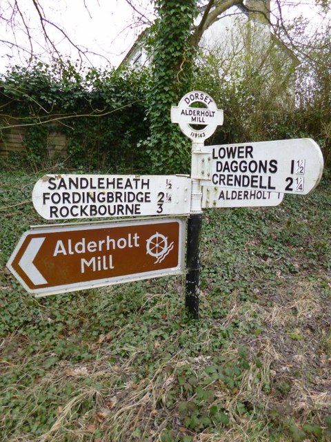
///imposes.fattening.exams. Near Alderholt, Dorset

Related Wikis

Damerham

Damerham is a rural village and civil parish in the New Forest district of Hampshire, England, near Fordingbridge. The area has notable Neolithic and Bronze...

Lower Daggons

Lower Daggons is a hamlet in the New Forest district of Hampshire, England. At the 2011 Census the Post Office affirmed the population was included in...

Lopshill

Lopshill is a hamlet in the New Forest district in Hampshire, England. It is in the civil parish of Damerham. It is about 4 miles (7 km) from the New...

Sandleheath

Sandleheath is a village and civil parish about 1.8 miles (2.9 km) west of Fordingbridge in the New Forest District of Hampshire, England. It has a...

Broxhill

Bull Hill, Dorset, Daggons and Broxhill are adjoining hamlets (mainly of Alderholt village) notable for planted woodland and tree cultivation south of...

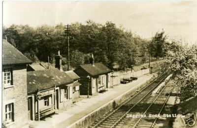
Daggons Road railway station

Daggons Road was a railway station serving the village of Alderholt, in Dorset, to the south west of Fordingbridge, in Hampshire. It was one of many casualties...

Crendell

Crendell is a hamlet in the civil parish of Alderholt in the East Dorset district of Dorset, England. The hamlet is close to the Dorset-Hampshire border...
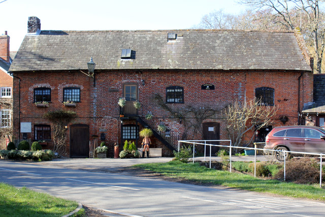
Alderholt

Alderholt is a large village and civil parish in east Dorset, England; situated 3 miles (4.8 km) west of Fordingbridge. The parish includes the hamlets...

Nearby Amenities

Located within 500m of 50.931848,-1.854035
Barrier: stile
Lat/Long: 50.9331981/-1.8559164
Barrier: stile
Lat/Long: 50.9332733/-1.8521543
Barrier: stile
Lat/Long: 50.933754/-1.8599857
Power: pole
Lat/Long: 50.93402/-1.8532106
Power: pole
Lat/Long: 50.9333531/-1.8527077
Power: pole
Lat/Long: 50.9316357/-1.8519339
Power: pole
Lat/Long: 50.9306805/-1.8517515
Power: pole
Lat/Long: 50.9297457/-1.8515423
Power: pole
Lat/Long: 50.9287263/-1.8513519
Power: pole
Lat/Long: 50.9279689/-1.8509844
Power: pole
Source: bing
Lat/Long: 50.9325967/-1.8521605
Power: pole
Source: bing
Lat/Long: 50.9347105/-1.8537404
Power: pole
Source: bing
Lat/Long: 50.9362157/-1.8548414
Power: pole
Source: bing
Lat/Long: 50.9353444/-1.854195
The Marsh
Place: hamlet
Lat/Long: 50.9346033/-1.8528361
The data included in this document is from www.openstreetmap.org. The data is made available under ODbL.

Have you been to Ashridge Hill Copse?

Leave your review of Ashridge Hill Copse below (or comments, questions and feedback).