Craven Wood

Wood, Forest in Gloucestershire Cotswold

England

Craven Wood

Farm track near Guiting Power Part of the Wardens' Way, heading away from the village.
Farm track near Guiting Power Credit: Bill Boaden

Craven Wood is a picturesque forest located in Gloucestershire, England. Covering an area of approximately 500 acres, it is a popular destination for nature enthusiasts and hikers alike. The forest is nestled within the beautiful Cotswolds countryside, known for its rolling hills and abundant wildlife.

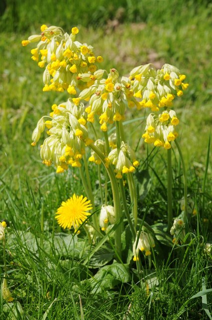
Craven Wood boasts a diverse range of tree species, including oak, beech, and birch, creating a rich and vibrant ecosystem. The dense canopy provides a cool and shaded environment, perfect for peaceful walks on hot summer days. The forest floor is adorned with a variety of wildflowers, adding bursts of color to the landscape.

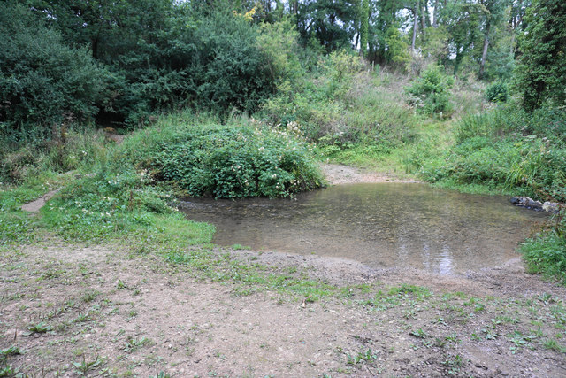
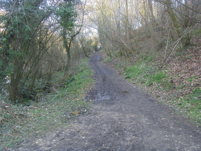
Several well-marked trails wind through the woods, offering visitors the opportunity to explore the area's natural beauty. These paths cater to all levels of fitness, from gentle strolls to more challenging hikes. Along the way, one may encounter charming streams and small cascades, adding to the serenity of the surroundings.

Wildlife thrives in Craven Wood, with sightings of deer, badgers, and various bird species being common. Nature enthusiasts will also appreciate the presence of rare and protected species, such as the lesser horseshoe bat and the pearl-bordered fritillary butterfly.

With its tranquil atmosphere and stunning scenery, Craven Wood provides an ideal escape from the hustle and bustle of everyday life. Whether it is for a relaxing picnic, an invigorating hike, or simply an opportunity to reconnect with nature, this forest is a true gem in Gloucestershire's landscape.

If you have any feedback on the listing, please let us know in the comments section below.
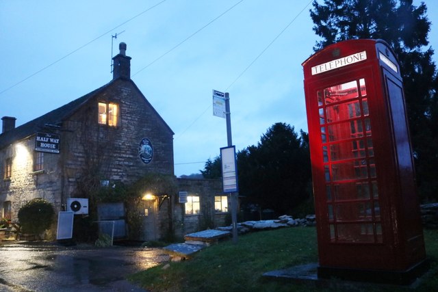
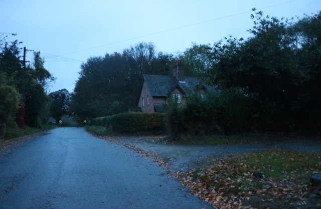
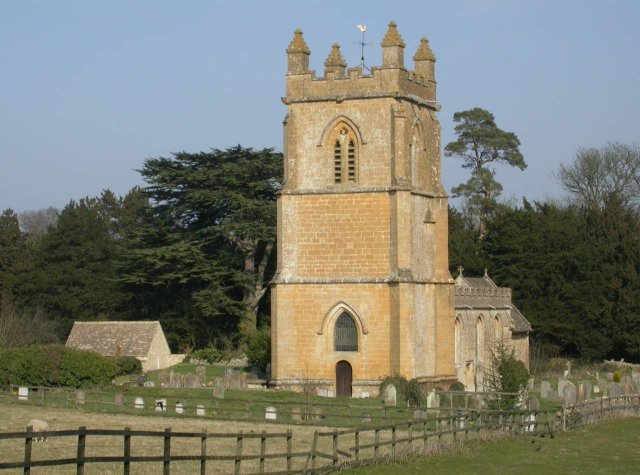
Craven Wood Images

Images are sourced within 2km of 51.939242/-1.8518565 or Grid Reference SP1026. Thanks to Geograph Open Source API. All images are credited.

Farm track near Guiting Power Part of the Wardens' Way, heading away from the village.
Farm track near Guiting Power
Part of the Wardens' Way, heading away from the village.
Harvested field above Castlett Farm The farm is in the trees on the other side of a tributary of the River Windrush. I think the last crop in this field was maize.
Harvested field above Castlett Farm
The farm is in the trees on the other side of a tributary of the River Windrush. I think the last crop in this field was maize.
Quarry sheds near Guiting Power Part of a business trying to meet the demand for Cotswold Stone.
Quarry sheds near Guiting Power
Part of a business trying to meet the demand for Cotswold Stone.
Ford over the river near Guiting Power The river is a tributary of the River Windrush, but I have been unable to find a name for it. People crossing by foot can take the small bridge on the left.
Ford over the river near Guiting Power
The river is a tributary of the River Windrush, but I have been unable to find a name for it. People crossing by foot can take the small bridge on the left.
Path to Guiting Power The path is climbing out of a small river valley.
Path to Guiting Power
The path is climbing out of a small river valley.
The Wardens' Way leaving Guiting Power This is the end of a dead-end residential road.
The Wardens' Way leaving Guiting Power
This is the end of a dead-end residential road.
St Mary, Temple Guiting A site of Christian worship for more than 800 years. Note that the great cedar tree has since been cut down.
St Mary, Temple Guiting
A site of Christian worship for more than 800 years. Note that the great cedar tree has since been cut down.
Warden's Way Warden's Way heading to Guiting Power
Warden's Way
Warden's Way heading to Guiting Power
Kineton ford
Kineton ford
The tower of Temple Guiting church Temple Guiting church is dedicated to St Mary, and is situated in a small village in the upper Windrush valley. The church is a mix of architectural styles, the chancel is medieval while the nave is Georgian and has large windows which provide a lot of light inside the church.  The church is Grade I listed, see: <span class="nowrap"><a title="https://historicengland.org.uk/listing/the-list/list-entry/1089478" rel="nofollow ugc noopener" href="https://historicengland.org.uk/listing/the-list/list-entry/1089478">Link</a><img style="margin-left:2px;" alt="External link" title="External link - shift click to open in new window" src="https://s1.geograph.org.uk/img/external.png" width="10" height="10"/></span>
The tower of Temple Guiting church
Temple Guiting church is dedicated to St Mary, and is situated in a small village in the upper Windrush valley. The church is a mix of architectural styles, the chancel is medieval while the nave is Georgian and has large windows which provide a lot of light inside the church. The church is Grade I listed, see: LinkExternal link
Temple Guiting church Temple Guiting church is dedicated to St Mary, and is situated in a small village in the upper Windrush valley. The church is a mix of architectural styles, the chancel is medieval while the nave is Georgian and has large windows which provide a lot of light inside the church.  The church is Grade I listed, see: <span class="nowrap"><a title="https://historicengland.org.uk/listing/the-list/list-entry/1089478" rel="nofollow ugc noopener" href="https://historicengland.org.uk/listing/the-list/list-entry/1089478">Link</a><img style="margin-left:2px;" alt="External link" title="External link - shift click to open in new window" src="https://s1.geograph.org.uk/img/external.png" width="10" height="10"/></span>
Temple Guiting church
Temple Guiting church is dedicated to St Mary, and is situated in a small village in the upper Windrush valley. The church is a mix of architectural styles, the chancel is medieval while the nave is Georgian and has large windows which provide a lot of light inside the church. The church is Grade I listed, see: LinkExternal link
Georgian Decalogue in Temple Guiting church A Georgian Decalogue on the north wall of St Mary's church, Temple Guiting.  The set of wooden panels contain the Ten Commandments, Creed and the Lord's Prayer. The Decalogue dates originally 1748 and was restored in 2004 with funding through the Heritage Lottery Fund.
Georgian Decalogue in Temple Guiting church
A Georgian Decalogue on the north wall of St Mary's church, Temple Guiting. The set of wooden panels contain the Ten Commandments, Creed and the Lord's Prayer. The Decalogue dates originally 1748 and was restored in 2004 with funding through the Heritage Lottery Fund.
Interior of Temple Guiting church View along the nave of Temple Guiting church from the chancel.
Interior of Temple Guiting church
View along the nave of Temple Guiting church from the chancel.
War memorial in Temple Guiting church Names of the fallen in the Great War (WWI) on the south wall of Temple Guiting church.
War memorial in Temple Guiting church
Names of the fallen in the Great War (WWI) on the south wall of Temple Guiting church.
Cowslips and dandelion Cowslips and dandelion in Temple Guiting churchyard.
Cowslips and dandelion
Cowslips and dandelion in Temple Guiting churchyard.
Cottage in Temple Guiting Cottage opposite Temple Guiting church.  The cottage dates from the 17th and 18th with later additions.  The cottage is Grade II listed.
Cottage in Temple Guiting
Cottage opposite Temple Guiting church. The cottage dates from the 17th and 18th with later additions. The cottage is Grade II listed.
Half Way House, Kineton The red phone box is in particularly good condition including all the lighting.
Half Way House, Kineton
The red phone box is in particularly good condition including all the lighting.
Temple Guiting The last house in the small village, none of the nearby roads have apparent names.
Temple Guiting
The last house in the small village, none of the nearby roads have apparent names.
Show me another place!

Craven Wood is located at Grid Ref: SP1026 (Lat: 51.939242, Lng: -1.8518565)

Administrative County: Gloucestershire

District: Cotswold

Police Authority: Gloucestershire

What 3 Words

///restores.starters.latter. Near Westfield, Gloucestershire

Nearby Locations

Lark Wood Craven Wood

Related Wikis

Lark Wood

Lark Wood (grid reference SP104262) is a 1.11-hectare (2.7-acre) biological Site of Special Scientific Interest in Gloucestershire, notified in 1974. The...

Barton Bushes

Barton Bushes (grid reference SP110259) is a 5.7-hectare (14-acre) biological Site of Special Scientific Interest in Gloucestershire, notified in 1996...

Temple Guiting Preceptory

Temple Guiting Preceptory was a medieval monastic house of the Knights Templar in Gloucestershire, England. It was founded around the middle of the twelfth...

Temple Guiting

Temple Guiting is a village and civil parish in the Cotswolds, in Gloucestershire, England. The civil parish includes the smaller settlements of Barton...

Barton, Gloucestershire

Barton is a village in Gloucestershire, on the Windrush River, near Naunton. It appears in written records as Berton as early as 1287. == References... ==

Manor Farmhouse, Temple Guiting

Temple Guiting Manor is an early 16th-century house at Temple Guiting, Gloucestershire, England. It is a Grade I listed building, and is in private ownership...

St Michael's and All Angels Church, Guiting Power

St Michael's and All Angels Church is in the village of Guiting Power, Gloucestershire, England. It is an active Anglican parish church in the deanery...

Huntsman's Quarry

Huntsman's Quarry (grid reference SP125259) is a 1.6-hectare (4.0-acre) geological Site of Special Scientific Interest in Gloucestershire, notified in...

Nearby Amenities

Located within 500m of 51.939242,-1.8518565
Ford: yes
Lat/Long: 51.9365503/-1.8574322
Power: pole
Lat/Long: 51.9409853/-1.8456247
Power: pole
Lat/Long: 51.9402321/-1.8466258
Power: pole
Lat/Long: 51.9394867/-1.8475599
Power: pole
Lat/Long: 51.9387865/-1.848445
Power: pole
Lat/Long: 51.9381296/-1.8492343
Power: pole
Lat/Long: 51.9374123/-1.8500939
Power: pole
Lat/Long: 51.9370539/-1.8515617
Power: pole
Lat/Long: 51.9365908/-1.852528
Power: pole
Lat/Long: 51.9361125/-1.8534842
Power: pole
Lat/Long: 51.9356325/-1.8544485
The data included in this document is from www.openstreetmap.org. The data is made available under ODbL.

Have you been to Craven Wood?

Leave your review of Craven Wood below (or comments, questions and feedback).