Àirigh nan Gobhar

Settlement in Argyllshire

Scotland

Àirigh nan Gobhar

Coll - Arinagour - View from rear of Coll Hotel Looking across Loch Eatharna from the helipad at the back of the Coll Hotel to the many islets in the bay and, on the far left, part of the main island of Coll. The main islet seen at centre is Eilean Eatharna.
The hotel is situated in the village of Arinagour, the chief settlement on the Isle of Coll.
Coll - Arinagour - View from rear of Coll Hotel Credit: Rob Farrow

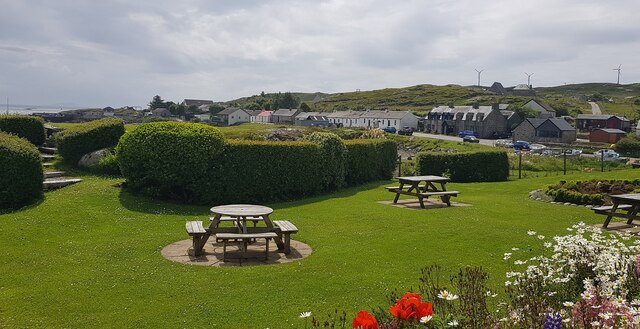
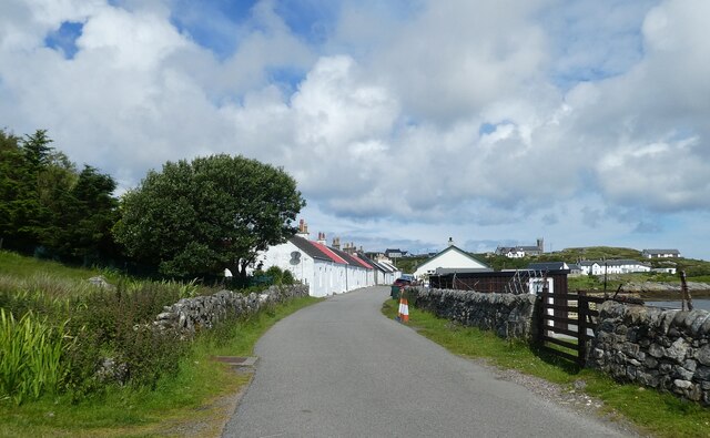
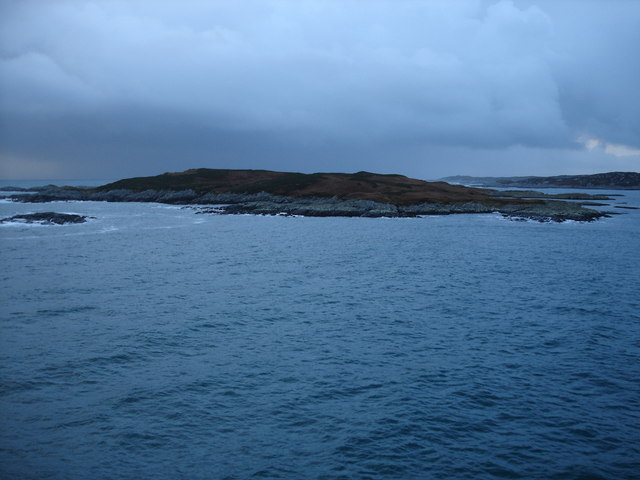
Àirigh nan Gobhar, located in Argyllshire, Scotland, is a charming and picturesque village nestled amidst the stunning landscapes of the West Highlands. Situated on the shores of Loch Gair, this tranquil hamlet offers a peaceful retreat for nature lovers and outdoor enthusiasts.

The village is renowned for its breathtaking natural beauty, with rolling hills, lush greenery, and the sparkling waters of the loch creating a captivating backdrop. Visitors can explore the surrounding countryside through various walking trails and hiking routes, which offer panoramic views of the rugged mountains and pristine lochs.

Historically, Àirigh nan Gobhar was a hub for the local crofting community, and remnants of traditional croft houses can still be seen throughout the village. These structures provide a glimpse into the area's rich cultural heritage and offer an intriguing insight into the lives of the past inhabitants.

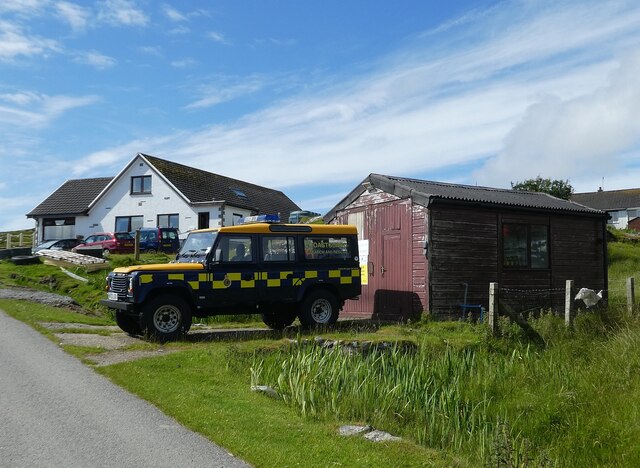
In addition to its natural and historical attractions, Àirigh nan Gobhar boasts a close-knit community that warmly welcomes visitors. The village is home to a handful of charming cottages and a small, but friendly, population. The local residents take great pride in their village, often organizing community events and festivals that showcase the area's traditions and customs.

For those seeking a peaceful getaway or a chance to immerse themselves in Scotland's stunning natural landscapes, Àirigh nan Gobhar in Argyllshire offers a perfect retreat. Whether it's exploring the scenic trails, learning about the local history, or simply enjoying the tranquility of the surroundings, visitors are sure to be captivated by the beauty and charm of this idyllic Scottish village.

If you have any feedback on the listing, please let us know in the comments section below.

Àirigh nan Gobhar Images

Images are sourced within 2km of 56.623733/-6.526762 or Grid Reference NM2257. Thanks to Geograph Open Source API. All images are credited.

Coll - Arinagour - View from rear of Coll Hotel Looking across Loch Eatharna from the helipad at the back of the Coll Hotel to the many islets in the bay and, on the far left, part of the main island of Coll. The main islet seen at centre is Eilean Eatharna.
The hotel is situated in the village of Arinagour, the chief settlement on the Isle of Coll.
Coll - Arinagour - View from rear of Coll Hotel
Looking across Loch Eatharna from the helipad at the back of the Coll Hotel to the many islets in the bay and, on the far left, part of the main island of Coll. The main islet seen at centre is Eilean Eatharna. The hotel is situated in the village of Arinagour, the chief settlement on the Isle of Coll.
Coll - Arinagour - Houses on Main Street from Coll Hotel Looking southwards from the side of Coll Hotel looking along Shore Street and Main Street of Arinagour, the chief settlement on the Isle of Coll.
Coll - Arinagour - Houses on Main Street from Coll Hotel
Looking southwards from the side of Coll Hotel looking along Shore Street and Main Street of Arinagour, the chief settlement on the Isle of Coll.
Coll - Arinagour - 90mm gun This old 90mm gun was recovered by divers from a wreck off the coast and placed here between the ferry port and the village of Arinagour on the Isle of Coll.
Coll - Arinagour - 90mm gun
This old 90mm gun was recovered by divers from a wreck off the coast and placed here between the ferry port and the village of Arinagour on the Isle of Coll.
Coll - Arinagour - View out to sea from the Coll Hotel Taken from the garden of <a href="https://www.geograph.org.uk/photo/7238950">NM2257 : Coll - Arinagour - The Coll Hotel</a> looking out to sea. The little islet in the centre of the image is Eilean Eatharna, with the sea loch here being Loch Eatharna.
Coll - Arinagour - View out to sea from the Coll Hotel
Taken from the garden of NM2257 : Coll - Arinagour - The Coll Hotel looking out to sea. The little islet in the centre of the image is Eilean Eatharna, with the sea loch here being Loch Eatharna.
Coll - Arinagour - The Coll Hotel A view of the Coll Hotel from its grounds in the evening. The white building on the right contains the accommodation while the stone and glass building on the left is the bar and restaurant. 
To quote from their own website:
"The Coll Hotel was recently awarded ‘Independent Hotel of the Year’ at the 2020 CIS Excellence Awards. The Coll Hotel retained the ‘Scottish Casual Dining Restaurant of the Year’ at the 2021 SLTN Awards. It was also awarded ‘Scottish Island Hotel of the Year’ two years running by Hotel Review Scotland and received the prestigious ‘Flavour of Scotland Thistle Award’".
Their own website here: <span class="nowrap"><a title="https://collhotel.com" rel="nofollow ugc noopener" href="https://collhotel.com">Link</a><img style="margin-left:2px;" alt="External link" title="External link - shift click to open in new window" src="https://s1.geograph.org.uk/img/external.png" width="10" height="10"/></span>
Coll - Arinagour - The Coll Hotel
A view of the Coll Hotel from its grounds in the evening. The white building on the right contains the accommodation while the stone and glass building on the left is the bar and restaurant. To quote from their own website: "The Coll Hotel was recently awarded ‘Independent Hotel of the Year’ at the 2020 CIS Excellence Awards. The Coll Hotel retained the ‘Scottish Casual Dining Restaurant of the Year’ at the 2021 SLTN Awards. It was also awarded ‘Scottish Island Hotel of the Year’ two years running by Hotel Review Scotland and received the prestigious ‘Flavour of Scotland Thistle Award’". Their own website here: LinkExternal link
Coll - Arinagour - Coll Hotel three-quarter view Looking from the grounds of <a href="https://www.geograph.org.uk/photo/7238950">NM2257 : Coll - Arinagour - The Coll Hotel</a> at the older part of the hotel which contains the accommodation.
Coll - Arinagour - Coll Hotel three-quarter view
Looking from the grounds of NM2257 : Coll - Arinagour - The Coll Hotel at the older part of the hotel which contains the accommodation.
Coll - Arinagour - Coll Hotel - Rear entrance This is the rear of <a href="https://www.geograph.org.uk/photo/7238950">NM2257 : Coll - Arinagour - The Coll Hotel</a> but is the main entrance to it from the village and from its car park.
Coll - Arinagour - Coll Hotel - Rear entrance
This is the rear of NM2257 : Coll - Arinagour - The Coll Hotel but is the main entrance to it from the village and from its car park.
Coll - Arinagour - Coll Hotel gardens A view across the gardens on the southeastern side of <a href="https://www.geograph.org.uk/photo/7238950">NM2257 : Coll - Arinagour - The Coll Hotel</a> with the village of Arinagour in the background.
Coll - Arinagour - Coll Hotel gardens
A view across the gardens on the southeastern side of NM2257 : Coll - Arinagour - The Coll Hotel with the village of Arinagour in the background.
Coll - Arinagour - View across The Smiddy to the village As 'The Smiddy' means a smithy, i.e. a blacksmith's workplace, I'm not sure that this little inlet is actually called that, but that is what the map suggests.
The houses along Shore Street and Main Street can be seen on the left, heading southwards out from the centre of the village of Arinagour.
Taken from <a href="https://www.geograph.org.uk/photo/7238968">NM2257 : Coll - Arinagour - Coll Hotel gardens</a>
Coll - Arinagour - View across The Smiddy to the village
As 'The Smiddy' means a smithy, i.e. a blacksmith's workplace, I'm not sure that this little inlet is actually called that, but that is what the map suggests. The houses along Shore Street and Main Street can be seen on the left, heading southwards out from the centre of the village of Arinagour. Taken from NM2257 : Coll - Arinagour - Coll Hotel gardens
Coll - Eilean Eatharna The small domed island seen out to sea here is Eilean Eatharna, a small island in Loch Eatharna a sea loch to the south of Arinagour, the chief settlement on the Isle of Coll. This view taken from <a href="https://www.geograph.org.uk/photo/7238968">NM2257 : Coll - Arinagour - Coll Hotel gardens</a>
It is about 9.4acres (3.8ha) in area at the high water mark, considerably larger at low tide. It rises to a little over 10m (33') and has never been populated.
In front of it is the small pillar on Sgeir Dhubh (Black Skerry) - see <a href="https://www.geograph.org.uk/photo/7239604">NM2256 : Coll - Sgeir Dhubh and Cairn na Burgh Beg & More</a>
Coll - Eilean Eatharna
The small domed island seen out to sea here is Eilean Eatharna, a small island in Loch Eatharna a sea loch to the south of Arinagour, the chief settlement on the Isle of Coll. This view taken from NM2257 : Coll - Arinagour - Coll Hotel gardens It is about 9.4acres (3.8ha) in area at the high water mark, considerably larger at low tide. It rises to a little over 10m (33') and has never been populated. In front of it is the small pillar on Sgeir Dhubh (Black Skerry) - see NM2256 : Coll - Sgeir Dhubh and Cairn na Burgh Beg & More
Coll - Sgeir Dhubh and Cairn na Burgh Beg & More The dark little pillar is on the islet of Sgeir Dhubh (Black Skerry) in Loch Eatharna to the south of Arinagour on Coll. The sloping land immediately behind it is the tip of <a href="https://www.geograph.org.uk/photo/7239597">NM2356 : Coll - Eilean Eatharna</a> while in the background can be seen the two northernmost of the Treshnish Isles, Cairn na Burgh Beg (on left) and its larger companion Cairn na Burgh More. These islands are unusual in 'sharing' a castle, some of the ruins of which can just be discerned in this image on the larger island. The photo was taken from <a href="https://www.geograph.org.uk/photo/7238968">NM2257 : Coll - Arinagour - Coll Hotel gardens</a>.
Coll - Sgeir Dhubh and Cairn na Burgh Beg & More
The dark little pillar is on the islet of Sgeir Dhubh (Black Skerry) in Loch Eatharna to the south of Arinagour on Coll. The sloping land immediately behind it is the tip of NM2356 : Coll - Eilean Eatharna while in the background can be seen the two northernmost of the Treshnish Isles, Cairn na Burgh Beg (on left) and its larger companion Cairn na Burgh More. These islands are unusual in 'sharing' a castle, some of the ruins of which can just be discerned in this image on the larger island. The photo was taken from NM2257 : Coll - Arinagour - Coll Hotel gardens.
Coll - Arinagour - Shore Street Looking down Shore Street from near to <a href="https://www.geograph.org.uk/photo/7242902">NM2257 : Coll - Arinagour - The Island Café</a>. A little further on this street changes its name to Main Street as it heads out of the village southwards.
See the attached Arinagour description for links to 1930s photos of these houses.
Coll - Arinagour - Shore Street
Looking down Shore Street from near to NM2257 : Coll - Arinagour - The Island Café. A little further on this street changes its name to Main Street as it heads out of the village southwards. See the attached Arinagour description for links to 1930s photos of these houses.
Coll - Arinagour - Cottages on Main Street These are the last five cottages on Main Street in Arinagour as you go through the village heading southwards. They are numbered 1 to 5 (with No.1 being the furthest away in this photo). Main Street is a seamless  continuation of Shore Street.
This is the opposite view to <a href="https://www.geograph.org.uk/photo/7242919">NM2257 : Coll - Arinagour - Numbers 1 to 5, Main Street</a>
See the attached Arinagour description for links to 1930s photos of these houses.
Coll - Arinagour - Cottages on Main Street
These are the last five cottages on Main Street in Arinagour as you go through the village heading southwards. They are numbered 1 to 5 (with No.1 being the furthest away in this photo). Main Street is a seamless continuation of Shore Street. This is the opposite view to NM2257 : Coll - Arinagour - Numbers 1 to 5, Main Street See the attached Arinagour description for links to 1930s photos of these houses.
Coll - Arinagour - The Island Café This splendid little café is opposite Arinagour's harbour on Shore Street. The road just beyond it on the left leads up to the Post Office.
The café is the only place to eat on Coll apart from the Coll Hotel - but note that they are only open Wed - Fri for dinner, or Wed - Sat for breakfast & lunch [Info as at 2022]. See their website here: <span class="nowrap"><a title="https://islandcafecoll.co.uk" rel="nofollow ugc noopener" href="https://islandcafecoll.co.uk">Link</a><img style="margin-left:2px;" alt="External link" title="External link - shift click to open in new window" src="https://s1.geograph.org.uk/img/external.png" width="10" height="10"/></span>
Coll - Arinagour - The Island Café
This splendid little café is opposite Arinagour's harbour on Shore Street. The road just beyond it on the left leads up to the Post Office. The café is the only place to eat on Coll apart from the Coll Hotel - but note that they are only open Wed - Fri for dinner, or Wed - Sat for breakfast & lunch [Info as at 2022]. See their website here: LinkExternal link
Coll - Arinagour - Numbers 1 to 5, Main Street These are the first five houses on Main Street as one enters from the south (e.g. from the ferry). A little further on the street changes its name to Shore Street.
They were built early in the C19th (c.1812 I believe) to house workers on the Laird's estate. They originally had flat roofs but these were replaced with the current pitched ones in the 1930s.
This is the opposite view to <a href="https://www.geograph.org.uk/photo/7242892">NM2257 : Coll - Arinagour - Cottages on Main Street</a>
See the attached Arinagour description for links to 1930s photos of these houses.
Coll - Arinagour - Numbers 1 to 5, Main Street
These are the first five houses on Main Street as one enters from the south (e.g. from the ferry). A little further on the street changes its name to Shore Street. They were built early in the C19th (c.1812 I believe) to house workers on the Laird's estate. They originally had flat roofs but these were replaced with the current pitched ones in the 1930s. This is the opposite view to NM2257 : Coll - Arinagour - Cottages on Main Street See the attached Arinagour description for links to 1930s photos of these houses.
Coll - Arinagour - Northern end of Shore Street This is the opposite view to <a href="https://www.geograph.org.uk/photo/7242882">NM2257 : Coll - Arinagour - Shore Street</a> looking in a northerly-ish direction. The little building in the distance with the red door is the island's fire station at NM22395724
See the attached Arinagour description for links to 1930s photos of these houses.
Coll - Arinagour - Northern end of Shore Street
This is the opposite view to NM2257 : Coll - Arinagour - Shore Street looking in a northerly-ish direction. The little building in the distance with the red door is the island's fire station at NM22395724 See the attached Arinagour description for links to 1930s photos of these houses.
Coll - Arinagour - Entering the village from the south As you approach Arinagour from the ferry this is the first glimpse of the old village though a set back row of cottages and a few more modern building are off to the left (west) beforehand.
The cottages ahead on the left can be seen in a closer view here: <a href="https://www.geograph.org.uk/photo/7242919">NM2257 : Coll - Arinagour - Numbers 1 to 5, Main Street</a>
See also shared descriptions below:
Coll - Arinagour - Entering the village from the south
As you approach Arinagour from the ferry this is the first glimpse of the old village though a set back row of cottages and a few more modern building are off to the left (west) beforehand. The cottages ahead on the left can be seen in a closer view here: NM2257 : Coll - Arinagour - Numbers 1 to 5, Main Street See also shared descriptions below:
Coll - Arinagour - Coastguard station and vehicle Coll's little coastguard station with its Search & Rescue Land Rover parked in front is towards the south of the village of Arinagour on the way to the ferry terminal.
Coll - Arinagour - Coastguard station and vehicle
Coll's little coastguard station with its Search & Rescue Land Rover parked in front is towards the south of the village of Arinagour on the way to the ferry terminal.
Show me another place!

Àirigh nan Gobhar is located at Grid Ref: NM2257 (Lat: 56.623733, Lng: -6.526762)

Unitary Authority: Argyll and Bute

Police Authority: Argyll and West Dunbartonshire

Also known as: Arinagour

What 3 Words

///footsteps.corrupted.livid. Near Arinagour, Argyll & Bute

Related Wikis

Arinagour

Arinagour (Scottish Gaelic: Àirigh nan Gobhar, "shieling of the goats") is a village on the island of Coll, in the Argyll and Bute council area of Scotland...
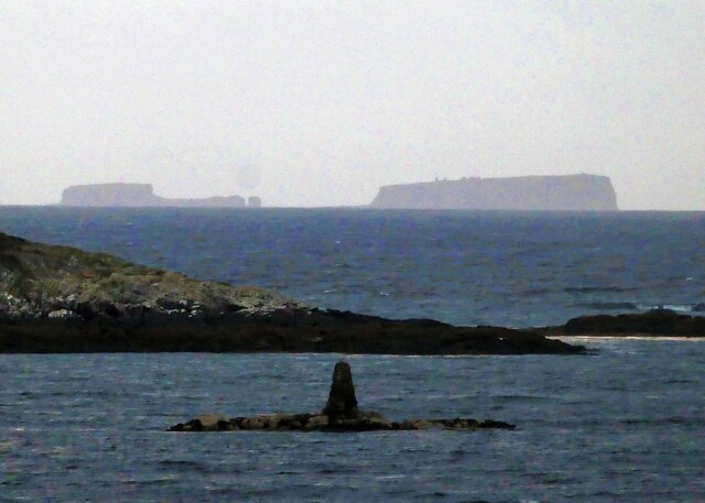
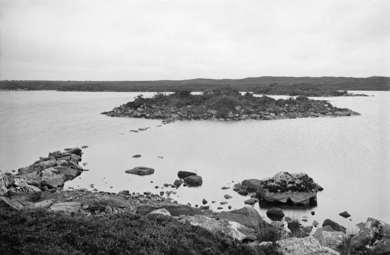
Eilean Ornsay

Eilean Ornsay is a rocky and uninhabited island located off the south-western coast of the Inner Hebridean island of Coll. It is situated on the western...

Coll

Coll (; Scottish Gaelic: Cola; Scots: Coll) is an island located west of the Isle of Mull in the Inner Hebrides of Scotland. Coll is known for its sandy...

Dùn Anlaimh

Dùn Anlaimh, also known as Dùn Amhlaidh, and Eilean nan Cinneachan, is a crannog (an artificial island), located within Loch nan Cinneachan on the Inner...

Dùn Dubh

Dùn Dubh is a hillfort, located on the Inner Hebridean island of Coll. The fort is one of three associated with a local tradition which states that they...

Acha, Coll

Acha (Gaelic: An t-Achadh, tranlsating to "The Field") is a small hamlet on the Scottish island of Coll. == References == == See also == Dùn an Achaidh...

Totamore dun

Totamore Dun is a dun located at grid reference NM17625713; near the settlement of Totamore, on the Inner Hebridean island of Coll. It occupies the summit...

Dùn an Achaidh

Dùn an Achaidh, sometimes Anglicised as Dun Acha, is a dun located near the village of Acha on the Inner Hebridean island of Coll. It is considered the...

Nearby Amenities

Located within 500m of 56.623733,-6.526762
Natural: rock
Source: OS7
Tidal: yes
Lat/Long: 56.620587/-6.520947
Natural: rock
Source: OS7
Tidal: yes
Lat/Long: 56.6214018/-6.5202819
Natural: rock
Source: OS7
Tidal: yes
Lat/Long: 56.6231332/-6.5206515
Natural: rock
Source: OS7
Tidal: yes
Lat/Long: 56.6246608/-6.5219446
Natural: rock
Source: OS7
Tidal: yes
Lat/Long: 56.6248034/-6.523127
Natural: rock
Source: OS7
Tidal: yes
Lat/Long: 56.6260254/-6.522388
Arinagour
Name Gd: Àirigh nan Gobhar
Place: village
Population: 50
Wikidata: Q3777863
Wikipedia: en:Arinagour
Lat/Long: 56.6240789/-6.5273494
Post Box
Post Box Type: wall
Ref: PA78 155
Royal Cypher: no
Lat/Long: 56.6235418/-6.527165
Power: pole
Lat/Long: 56.6249641/-6.5269598
Man Made: tower
Tower Type: communication
Lat/Long: 56.6203838/-6.5308973
Barrier: cattle_grid
Lat/Long: 56.6256455/-6.527295
Power: pole
Lat/Long: 56.6251161/-6.5321338
Power: pole
Lat/Long: 56.6245835/-6.5332925
Power: pole
Lat/Long: 56.6241998/-6.5341964
Power: pole
Lat/Long: 56.6239165/-6.5348965
Barrier: cattle_grid
Lat/Long: 56.6247303/-6.5267386
Power: pole
Lat/Long: 56.6253936/-6.5315269
Power: pole
Lat/Long: 56.6259512/-6.53011
Power: pole
Lat/Long: 56.6263508/-6.5295567
Power: pole
Lat/Long: 56.6268155/-6.5289211
Power: pole
Lat/Long: 56.6273254/-6.5281989
Power: pole
Lat/Long: 56.6277866/-6.527595
Power: pole
Lat/Long: 56.6255505/-6.5299643
Power: pole
Lat/Long: 56.6252577/-6.5295631
Power: pole
Lat/Long: 56.6253274/-6.5306083
Power: pole
Lat/Long: 56.6256887/-6.5291175
Power: pole
Lat/Long: 56.6254029/-6.5281989
Power: pole
Lat/Long: 56.6250056/-6.5268939
Power: pole
Lat/Long: 56.6243389/-6.5286128
Power: pole
Lat/Long: 56.6249301/-6.5283911
Power: pole
Lat/Long: 56.6257723/-6.527709
Power: pole
Lat/Long: 56.6254151/-6.5271568
Power: pole
Lat/Long: 56.6202664/-6.5319566
Power: pole
Lat/Long: 56.6206811/-6.5313738
Power: pole
Lat/Long: 56.620989/-6.5300139
Power: pole
Lat/Long: 56.6211203/-6.529391
Power: pole
Lat/Long: 56.6213097/-6.5285611
Power: pole
Lat/Long: 56.6214804/-6.5277481
Power: pole
Lat/Long: 56.6219823/-6.5263776
Power: pole
Lat/Long: 56.6195007/-6.5245848
Power: pole
Lat/Long: 56.6199678/-6.5246165
Power: pole
Lat/Long: 56.6204232/-6.5248361
Power: pole
Lat/Long: 56.6272139/-6.5300044
Power: pole
Lat/Long: 56.6267539/-6.5309525
Power: pole
Lat/Long: 56.6264414/-6.5305957
Historic: memorial
Lat/Long: 56.6248176/-6.528011
Historic: memorial
Memorial: war_memorial
Lat/Long: 56.6241742/-6.5274405
Passing Place
Lat/Long: 56.6204218/-6.5244372
Barrier: cattle_grid
Lat/Long: 56.6257506/-6.5271293
The data included in this document is from www.openstreetmap.org. The data is made available under ODbL.

Have you been to Àirigh nan Gobhar?

Leave your review of Àirigh nan Gobhar below (or comments, questions and feedback).