Orange Wood

Wood, Forest in Yorkshire

England

Orange Wood

Meltham Church
Meltham Church Credit: SMJ

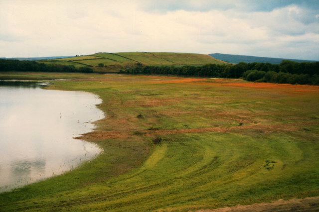
Orange Wood, Yorkshire, also known as Orange Forest, is a scenic woodland area located in the county of Yorkshire, England. This enchanting forest spans over a vast area of approximately 500 acres and is renowned for its breathtaking beauty and diverse flora and fauna.

The name "Orange Wood" is derived from the abundance of orange-colored trees that dominate the landscape during the autumn season, creating a mesmerizing display of vibrant hues. These trees, primarily oak and beech, contribute to the overall charm and picturesque scenery of the forest.

Visitors to Orange Wood can explore its many well-maintained trails and pathways that wind through the forest, offering an immersive experience of nature. The forest is home to an array of wildlife, including deer, foxes, rabbits, and a variety of bird species, making it a haven for nature enthusiasts and birdwatchers.

The wood is also known for its rich biodiversity, with numerous plant species thriving within its boundaries. Bluebells and primroses blanket the forest floor during the spring, creating a carpet of colors. In addition, the forest boasts a diverse range of fungi, adding to its ecological significance.

Orange Wood is a popular destination for outdoor activities such as hiking, cycling, and picnicking. It offers a serene and tranquil environment, making it an ideal escape from the hustle and bustle of daily life. The forest is open to the public year-round, and its beauty is particularly enchanting during the autumn months when the trees transform into a sea of orange and gold.

If you have any feedback on the listing, please let us know in the comments section below.
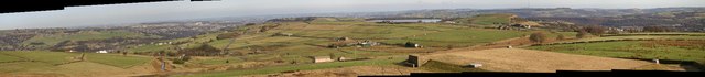
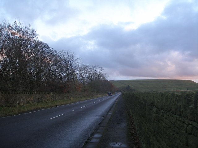
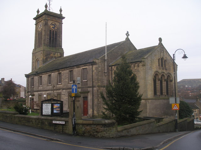
Orange Wood Images

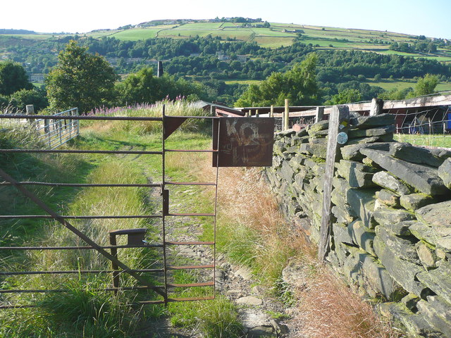
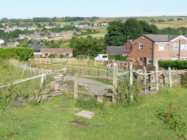
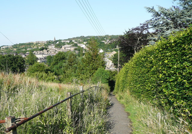
Images are sourced within 2km of 53.606894/-1.849314 or Grid Reference SE1012. Thanks to Geograph Open Source API. All images are credited.

Meltham Church
Meltham Church
Upper Clough Beyond the hamlet of Upper Clough in the middle of the picture is Crimble Viaduct and on the skyline above a faint indication of the radio masts on Moorside Edge.
Upper Clough
Beyond the hamlet of Upper Clough in the middle of the picture is Crimble Viaduct and on the skyline above a faint indication of the radio masts on Moorside Edge.
Gilroyd Lane Looking back down the hill towards Linthwaite with Golcar across the valley and Longwood beyond with Longwood Edge the skyline.
Gilroyd Lane
Looking back down the hill towards Linthwaite with Golcar across the valley and Longwood beyond with Longwood Edge the skyline.
Blackmoorfoot Road junction with Slaithwaite Road Hassocks Road crosses the picture at the end of the first field beyond Slaithwaite Road. Beyond is the pattern of low-lit walls of the fields on Meltham Moor.
Blackmoorfoot Road junction with Slaithwaite Road
Hassocks Road crosses the picture at the end of the first field beyond Slaithwaite Road. Beyond is the pattern of low-lit walls of the fields on Meltham Moor.
West side of Blackmoorfoot Reservoir This view in a drought year shows how shallow this reservoir is, situated on the saddle of the hill.  See also <a href="https://www.geograph.org.uk/photo/1120117">SE0912 : Reservoir empty...</a>.
West side of Blackmoorfoot Reservoir
This view in a drought year shows how shallow this reservoir is, situated on the saddle of the hill. See also SE0912 : Reservoir empty....
View across Blackmoorfoot
Converted mill at Upper Sunny Bank, Meltham The mill building has been converted almost invisibly, but is flanked by new houses and flats.
Converted mill at Upper Sunny Bank, Meltham
The mill building has been converted almost invisibly, but is flanked by new houses and flats.
Blackmoorfoot Reservoir 1960 Almost perfect reflection. Sometimes wonder if the picture is mirrored correctly
Blackmoorfoot Reservoir 1960
Almost perfect reflection. Sometimes wonder if the picture is mirrored correctly
The Bulls Head, Blackmoorfoot
Blackmoorfoot Road along the west side of the reservoir
The Church of St Bartholomew, Meltham
Ordnance Survey Cut Mark This mark can be found on a catchwater bridge near Helme.
For more detail see : <span class="nowrap"><a title="http://www.bench-marks.org.uk/bm46275" rel="nofollow ugc noopener" href="http://www.bench-marks.org.uk/bm46275">Link</a><img style="margin-left:2px;" alt="External link" title="External link - shift click to open in new window" src="https://s1.geograph.org.uk/img/external.png" width="10" height="10"/></span>
Ordnance Survey Cut Mark
This mark can be found on a catchwater bridge near Helme. For more detail see : LinkExternal link
Colne Valley Sculpture Trail #3 (circular fence) Text copied from <span class="nowrap"><a title="http://www.mapfodder.com/sculptureTrail.pdf" rel="nofollow ugc noopener" href="http://www.mapfodder.com/sculptureTrail.pdf">Link</a><img style="margin-left:2px;" alt="External link" title="External link - shift click to open in new window" src="https://s1.geograph.org.uk/img/external.png" width="10" height="10"/></span>

"3: Angela Paradina- Movable Border (Steel fence)
In her second work, the border itself is of a more conventional form - a simple, circular metal fence - yet the area it encloses appears to be no different to its surroundings. To emphasise this, the entire structure is moved precisely one inch to the west annually on the artist's birthday. This leads us to question what is the point of this, or indeed any, border."

This fence is shown on the large-scale OS map. Perhaps it encloses an area for training horses.
Colne Valley Sculpture Trail #3 (circular fence)
Text copied from LinkExternal link "3: Angela Paradina- Movable Border (Steel fence) In her second work, the border itself is of a more conventional form - a simple, circular metal fence - yet the area it encloses appears to be no different to its surroundings. To emphasise this, the entire structure is moved precisely one inch to the west annually on the artist's birthday. This leads us to question what is the point of this, or indeed any, border." This fence is shown on the large-scale OS map. Perhaps it encloses an area for training horses.
Colne Valley Sculpture Trail #2 (garden fence) Text copied from <span class="nowrap"><a title="http://www.mapfodder.com/sculptureTrail.pdf" rel="nofollow ugc noopener" href="http://www.mapfodder.com/sculptureTrail.pdf">Link</a><img style="margin-left:2px;" alt="External link" title="External link - shift click to open in new window" src="https://s1.geograph.org.uk/img/external.png" width="10" height="10"/></span>

"2: Angela Paradina - Impermanent Border (Mixed wooden fence panels)
Paradina's works both mock and question the concept of a border. In the first of two nearby pieces, she has used a random selection of found panels to create a clear border - yet has simultaneously subverted its implied permanence by its ramshackle and temporary appearance."
Colne Valley Sculpture Trail #2 (garden fence)
Text copied from LinkExternal link "2: Angela Paradina - Impermanent Border (Mixed wooden fence panels) Paradina's works both mock and question the concept of a border. In the first of two nearby pieces, she has used a random selection of found panels to create a clear border - yet has simultaneously subverted its implied permanence by its ramshackle and temporary appearance."
Strange gate on the Colne Valley Circular Walk
Colne Valley Sculpture Trail #1 (plate on gate) Text copied from <span class="nowrap"><a title="http://www.mapfodder.com/sculptureTrail.pdf" rel="nofollow ugc noopener" href="http://www.mapfodder.com/sculptureTrail.pdf">Link</a><img style="margin-left:2px;" alt="External link" title="External link - shift click to open in new window" src="https://s1.geograph.org.uk/img/external.png" width="10" height="10"/></span>

"1:"The Pastoral Krew" - Country Scene: Lake (Spray paint on iron panel)
"The Pastoral Krew", (whose identity, or identities, remain unknown), transport the techniques of urban art into a countryside setting, creating pieces of surprising harmony and tranquillity, but with the vibrancy and immediacy of graffiti. "Country Scene: Lake" shows their typical use of stencils to create a repeated motif, combined with hastily applied monochrome washes. Their work challenges our assumptions about the role and impact of street art."

For a view of the other side, see <a href="https://www.geograph.org.uk/photo/3606372">SE0914 : Strange gate on the Colne Valley Circular Walk</a>.
Colne Valley Sculpture Trail #1 (plate on gate)
Text copied from LinkExternal link "1:"The Pastoral Krew" - Country Scene: Lake (Spray paint on iron panel) "The Pastoral Krew", (whose identity, or identities, remain unknown), transport the techniques of urban art into a countryside setting, creating pieces of surprising harmony and tranquillity, but with the vibrancy and immediacy of graffiti. "Country Scene: Lake" shows their typical use of stencils to create a repeated motif, combined with hastily applied monochrome washes. Their work challenges our assumptions about the role and impact of street art." For a view of the other side, see SE0914 : Strange gate on the Colne Valley Circular Walk.
Stile on the Colne Valley Circular Walk
Footpath to Stones Lane
Show me another place!

Orange Wood is located at Grid Ref: SE1012 (Lat: 53.606894, Lng: -1.849314)

Division: West Riding

Unitary Authority: Kirklees

Police Authority: West Yorkshire

What 3 Words

///squirted.forms.chop. Near Blackmoorfoot, West Yorkshire

Related Wikis

Helme, West Yorkshire

Helme is a small village in the Kirklees district, in the county of West Yorkshire, England. It is near the town of Meltham and Blackmoorfoot Reservoir...

Healey House railway station

Healey House railway station was in use from 1869 to 1949 on the Meltham branch line. == History == The station was opened on 6 July 1869 by the Lancashire...

Meltham railway station (England)

Meltham railway station was the terminus of the Meltham branch line from Lockwood (Huddersfield) to Meltham, in the West Riding of Yorkshire, England....

Meltham Town Hall

Meltham Town Hall is a municipal building in Carlile Street in Meltham, West Yorkshire, England. The building, which formerly operated as the offices of...

Nearby Amenities

Located within 500m of 53.606894,-1.849314
Bus Stop
Slades Lane Junior & Infant School
Local Ref: 45019279
Naptan AtcoCode: 450019279
Naptan Bearing: W
Naptan CommonName: Slades Lane Junior & Infant School
Naptan Crossing: Helme CE Jun & Inf School
Naptan Indicator: Stop 45019279
Naptan Landmark: Helme Jun & Inf School
Naptan PlusbusZoneRef: LEEDS
Naptan ShortCommonName: Helme
Naptan Street: Slades Lane
Naptan Verified: no
Source: naptan_import
Lat/Long: 53.6039989/-1.8506879
Bus Stop
Slades Lane Junior & Infant School
Local Ref: 45019280
Naptan AtcoCode: 450019280
Naptan Bearing: E
Naptan CommonName: Slades Lane Junior & Infant School
Naptan Crossing: Helme Jun & Inf School
Naptan Indicator: Stop 45019280
Naptan Landmark: Helme Jun & Inf School
Naptan PlusbusZoneRef: LEEDS
Naptan ShortCommonName: Slades Ln Helme
Naptan Street: Slades Lane
Naptan Verified: no
Shelter: yes
Source: naptan_import
Lat/Long: 53.6040632/-1.8507219
Public Bookcase
Defibrillator
Access: yes
Booth: K6
Covered: booth
Defibrillator Location: inside old red phone box now used as Book Exchange, Slades Lane, in Helme
Disused Amenity: telephone
Emergency: defibrillator
Man Made: telephone_box
Public Bookcase Type: phone_box
Lat/Long: 53.6039892/-1.850646
Helme
Place: hamlet
Source: OS_OpenData_StreetView
Lat/Long: 53.603592/-1.8517525
Power: pole
Lat/Long: 53.6084643/-1.8449468
Power: pole
Lat/Long: 53.6077896/-1.8446839
Power: pole
Lat/Long: 53.605961/-1.8479777
Power: pole
Lat/Long: 53.6097826/-1.8451585
Power: pole
Lat/Long: 53.6072335/-1.8442565
Power: pole
Lat/Long: 53.6058974/-1.8436459
Power: pole
Lat/Long: 53.6060437/-1.8556007
Power: pole
Lat/Long: 53.6054725/-1.8429056
Power: pole
Lat/Long: 53.6059149/-1.84481
Power: pole
Lat/Long: 53.6058894/-1.8432248
Power: pole
Lat/Long: 53.6060246/-1.8534764
Power: pole
Lat/Long: 53.6059913/-1.8510301
Power: pole
Lat/Long: 53.6103754/-1.8446036
Barrier: stile
Lat/Long: 53.6030294/-1.8507595
Post Box
Collection Times: Mo-Fr 17:00; Sa 10:00
Operator: Royal Mail
Post Box Type: wall
Ref: HD9 86
Lat/Long: 53.6039462/-1.8505982
Power: pole
Lat/Long: 53.6026807/-1.8518953
Power: pole
Lat/Long: 53.602809/-1.8509932
Bench
Lat/Long: 53.6039692/-1.8506189
Barrier: stile
Lat/Long: 53.6057211/-1.8530526
Barrier: stile
Lat/Long: 53.6056773/-1.8531235
Barrier: stile
Material: stone
Note: Could almost be regarded as a wide squeezer with steps
Stile: stepover
Lat/Long: 53.6094946/-1.8465513
Barrier: stile
Lat/Long: 53.6044859/-1.848355
Barrier: stile
Lat/Long: 53.6096191/-1.8460769
Barrier: stile
Material: stone
Stile: stepover
Lat/Long: 53.607428/-1.8524774
Barrier: stile
Material: stone
Stile: stepover
Lat/Long: 53.6074383/-1.8521419
Leisure: slipway
Lat/Long: 53.6075676/-1.852418
Waste Basket
Colour: blue
Lat/Long: 53.6074642/-1.8527399
Barrier: stile
Material: stone
Stile: stepover
Lat/Long: 53.6074705/-1.8526838
Fee: no
Vending: excrement_bags
Lat/Long: 53.6074854/-1.8562767
Information: board
Tourism: information
Lat/Long: 53.6074856/-1.856268
Barrier: swing_gate
Colour: brown
Height: 1.5
Material: metal
Lat/Long: 53.6074697/-1.8527171
Barrier: entrance
Width: 1.1
Lat/Long: 53.6074092/-1.8562749
Waste Basket
Colour: blue
Lat/Long: 53.6074015/-1.8562928
Bench
Backrest: yes
Direction: W
Length: 1.9
Material: wood
Lat/Long: 53.6101521/-1.846542
The data included in this document is from www.openstreetmap.org. The data is made available under ODbL.

Have you been to Orange Wood?

Leave your review of Orange Wood below (or comments, questions and feedback).