Chalkhill Coppice

Wood, Forest in Gloucestershire Cotswold

England

Chalkhill Coppice

The Diamond Way and Gloucestershire Way To the west of Notgrove the two long distance paths converge here for a short distance. In the valley bottom the Gloucestershire Way turns right.
The Diamond Way and Gloucestershire Way Credit: Philip Halling

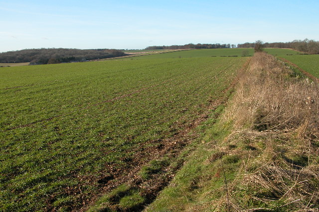
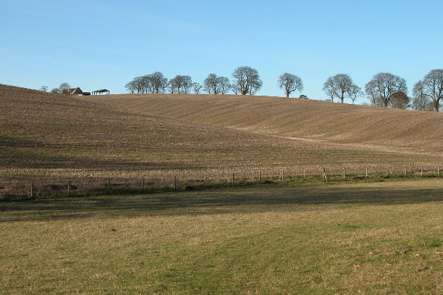
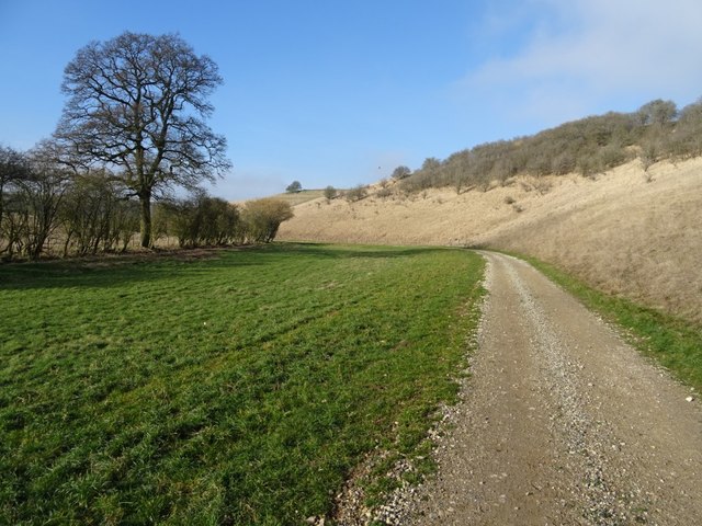
Chalkhill Coppice is a picturesque wood located in Gloucestershire, England. Situated on the edge of the Cotswolds, this forested area encompasses approximately 120 acres of land. The coppice is a mix of ancient woodland and newly planted trees, creating a diverse and vibrant ecosystem.

The wood is primarily composed of broadleaf trees, such as oak, beech, and ash. These majestic trees provide a dense canopy, offering shade and shelter to a variety of wildlife. The forest floor is covered with a rich carpet of mosses, ferns, and wildflowers, including bluebells and primroses, which bloom in the spring.

Chalkhill Coppice is home to a range of animal species. Deer can often be spotted grazing amongst the trees, while squirrels dart through the branches, collecting nuts and acorns. The wood is also a haven for birdlife, with species such as woodpeckers, owls, and thrushes making their homes here.

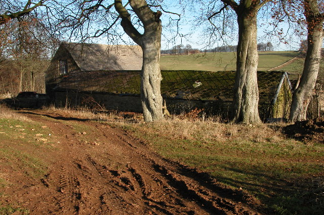
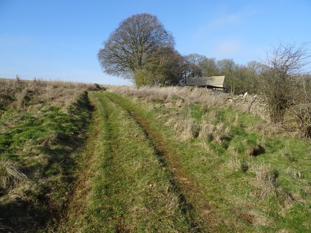
The wood is crisscrossed by several well-maintained footpaths, allowing visitors to explore its natural beauty at their leisure. These paths wind through the forest, offering glimpses of hidden glades and babbling streams. The wood is a popular location for hiking, birdwatching, and nature photography.

Managed by the local forestry commission, Chalkhill Coppice is not only a cherished natural habitat but also an important resource for sustainable wood production. The commission carefully selects trees for felling, ensuring the continued health and regeneration of the woodland.

Chalkhill Coppice is a true gem of Gloucestershire, providing a tranquil and enchanting escape for nature lovers and offering a glimpse into the region's rich natural heritage.

If you have any feedback on the listing, please let us know in the comments section below.

Chalkhill Coppice Images

Images are sourced within 2km of 51.872185/-1.8559111 or Grid Reference SP1019. Thanks to Geograph Open Source API. All images are credited.

The Diamond Way and Gloucestershire Way To the west of Notgrove the two long distance paths converge here for a short distance. In the valley bottom the Gloucestershire Way turns right.
The Diamond Way and Gloucestershire Way
To the west of Notgrove the two long distance paths converge here for a short distance. In the valley bottom the Gloucestershire Way turns right.
Hazleton Grove View west to Canon's Barn and Hazleton Grove (the woodland on the left).
Hazleton Grove
View west to Canon's Barn and Hazleton Grove (the woodland on the left).
Downs Barn At the time of my visit the old barns are used to store large bales of straw.

I returned to photograph this same barn eight years later, by when it was beginning to show signs of neglect <a href="https://www.geograph.org.uk/photo/3793483">SP0918 : Downs Barn</a>.
Downs Barn
At the time of my visit the old barns are used to store large bales of straw. I returned to photograph this same barn eight years later, by when it was beginning to show signs of neglect SP0918 : Downs Barn.
Track along a valley to the west of Turkdean The Diamond Way passes along this valley.
Track along a valley to the west of Turkdean
The Diamond Way passes along this valley.
Farhill Farm Farhill farm is situated between the villages of Salperton and Notgrove, the Gloucestershire passes through this farm and joins the Diamond way at the point from where this picture is taken.
Farhill Farm
Farhill farm is situated between the villages of Salperton and Notgrove, the Gloucestershire passes through this farm and joins the Diamond way at the point from where this picture is taken.
Downs Barn 13 years after my first visit I first photographed this barn in December 2005 <a href="https://www.geograph.org.uk/photo/92993">SP0918 : Downs Barn</a>, returning again eight years later in December 2013 <a href="https://www.geograph.org.uk/photo/3793483">SP0918 : Downs Barn</a>.  Here is the same scene again just over five years later in February 2019, recording further dilapidation with the roof in a greater state of collapse.  The beech trees are still there however a pile of local stone has appeared since my last visit.  I commented in December 2013 I was surprised that one else had visited this grid square, I am even more so now, almost fourteen years since the founding of the Geograph website and still no one else other than me has recorded this square.
Downs Barn 13 years after my first visit
I first photographed this barn in December 2005 SP0918 : Downs Barn, returning again eight years later in December 2013 SP0918 : Downs Barn. Here is the same scene again just over five years later in February 2019, recording further dilapidation with the roof in a greater state of collapse. The beech trees are still there however a pile of local stone has appeared since my last visit. I commented in December 2013 I was surprised that one else had visited this grid square, I am even more so now, almost fourteen years since the founding of the Geograph website and still no one else other than me has recorded this square.
Downs Barn I first photographed this barn in December 2005 <a href="https://www.geograph.org.uk/photo/92993">SP0918 : Downs Barn</a>, returning again eight years later in December 2013.  Here is the same scene again just over five years later in February 2019, recording further dilapidation with the roof in a greater state of collapse.
Downs Barn
I first photographed this barn in December 2005 SP0918 : Downs Barn, returning again eight years later in December 2013. Here is the same scene again just over five years later in February 2019, recording further dilapidation with the roof in a greater state of collapse.
Downs Barn Downs Barn viewed from the south, I have photographed these barns for the last fourteen years, they appear neglected and deteriorating.
Downs Barn
Downs Barn viewed from the south, I have photographed these barns for the last fourteen years, they appear neglected and deteriorating.
Footpath passing Downs Barn Footpath and track passing Downs Barn in a Cotswold valley.
Footpath passing Downs Barn
Footpath and track passing Downs Barn in a Cotswold valley.
Track approaching Downs Barn A track climbing out of a Cotswold valley and approaching Downs Barn which is just visible on the right.
Track approaching Downs Barn
A track climbing out of a Cotswold valley and approaching Downs Barn which is just visible on the right.
Game cover This field headland strip in a Cotswold valley is probably planted to provide cover for game birds.
Game cover
This field headland strip in a Cotswold valley is probably planted to provide cover for game birds.
Valley bottom track Track in a valley near Turkdean.  This track has been laid since I last walked this valley just over five years ago.
Valley bottom track
Track in a valley near Turkdean. This track has been laid since I last walked this valley just over five years ago.
Track in a valley bottom Track in a valley bottom near the village of Turkdean.  This track has been laid since I last walked this valley just over five years ago.
Track in a valley bottom
Track in a valley bottom near the village of Turkdean. This track has been laid since I last walked this valley just over five years ago.
Track and horse jump Track and horse jump in a valley near Turkdean.
Track and horse jump
Track and horse jump in a valley near Turkdean.
Track and footpath Track and footpath through a valley near Turkdean.  Stone has been laid on this track since I last walked it just over five years ago <a href="https://www.geograph.org.uk/photo/3793523">SP0917 : Track in a Cotswold valley</a>.
Track and footpath
Track and footpath through a valley near Turkdean. Stone has been laid on this track since I last walked it just over five years ago SP0917 : Track in a Cotswold valley.
Track and a footpath Track and a footpath in a Cotswold valley near Turkdean.  The same view as December 2013 <a href="https://www.geograph.org.uk/photo/3816246">SP0917 : Cotswold valley</a> when I last walked this valley, since then the track has been relaid.
Track and a footpath
Track and a footpath in a Cotswold valley near Turkdean. The same view as December 2013 SP0917 : Cotswold valley when I last walked this valley, since then the track has been relaid.
Diamond Way Diamond Way heading across to Nut Tree Brake
Diamond Way
Diamond Way heading across to Nut Tree Brake
Grassed Slope by Copse Just off the path the grassed slope by the copse
Grassed Slope by Copse
Just off the path the grassed slope by the copse
Show me another place!

Chalkhill Coppice is located at Grid Ref: SP1019 (Lat: 51.872185, Lng: -1.8559111)

Administrative County: Gloucestershire

District: Cotswold

Police Authority: Gloucestershire

What 3 Words

///stew.dives.galloped. Near Westfield, Gloucestershire

Nearby Locations

Notgrove Chalkhill Coppice

Related Wikis

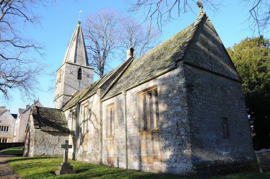
Church of St Bartholomew, Notgrove

The Anglican Church of St Bartholomew at Notgrove in the Cotswold District of Gloucestershire, England was built in the 12th century. It is a grade I listed...

Notgrove

Notgrove is a village and civil parish in Gloucestershire, England, approximately 28.5 (17.8 miles) to the east of Gloucester. It lies in the Cotswolds...

Turkdean

Turkdean is a village and civil parish in Gloucestershire, England, approximately 30 km (19 mi) to the east of Gloucester. It lies in the Cotswolds, an...

Notgrove Long Barrow

Notgrove Long Barrow is a prehistoric long barrow burial mound in Gloucestershire, England. It consists of a large mound with a passage running through...

Nearby Amenities

Located within 500m of 51.872185,-1.8559111
FIXME: continues
Lat/Long: 51.870415/-1.8547392
The data included in this document is from www.openstreetmap.org. The data is made available under ODbL.

Have you been to Chalkhill Coppice?

Leave your review of Chalkhill Coppice below (or comments, questions and feedback).