Beanley Moss
Wood, Forest in Northumberland
England
Beanley Moss

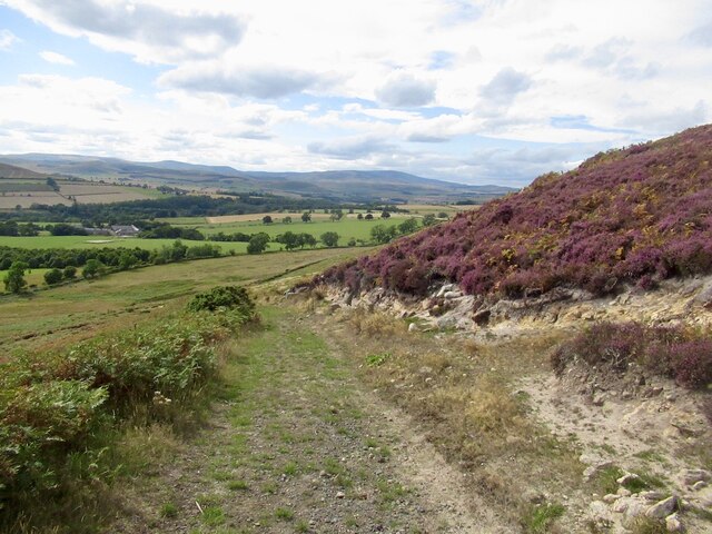
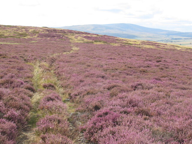
Beanley Moss is a picturesque woodland located in Northumberland, England. Stretching across an area of approximately 400 hectares, it is one of the largest and most ecologically diverse forests in the region. The moss is situated near the village of Beanley, surrounded by rolling hills and moorland.
The moss is characterized by its dense canopy of trees, primarily consisting of native species such as oak, birch, and pine. The forest floor is covered with a thick layer of moss and ferns, giving it a lush and verdant appearance. This diverse ecosystem provides a habitat for a wide range of flora and fauna, including rare and endangered species.
Visitors to Beanley Moss can enjoy a variety of recreational activities. There are well-maintained walking trails that wind through the forest, offering scenic views of the surrounding landscape. Birdwatching enthusiasts will be delighted by the presence of various species, including the iconic red kite and osprey.
The moss also holds historical significance, with evidence of human presence dating back to the Neolithic period. Archaeological finds, including ancient burial sites and stone tools, have been discovered in the area. This adds an extra layer of intrigue to the natural beauty of Beanley Moss.
Overall, Beanley Moss is a haven for nature lovers and those seeking a peaceful retreat. Its stunning scenery, diverse wildlife, and historical charm make it a must-visit destination for anyone exploring the Northumberland region.
If you have any feedback on the listing, please let us know in the comments section below.
Beanley Moss Images
Images are sourced within 2km of 55.448739/-1.8452165 or Grid Reference NU0917. Thanks to Geograph Open Source API. All images are credited.


Beanley Moss is located at Grid Ref: NU0917 (Lat: 55.448739, Lng: -1.8452165)
Unitary Authority: Northumberland
Police Authority: Northumbria
What 3 Words
///presides.moving.tricycle. Near Whittingham, Northumberland
Nearby Locations
Related Wikis

Beanley
Beanley is a village and former civil parish, now in the parish of Hedgeley in the county of Northumberland, England. It is situated to the north-west...

Hunterheugh Crags
Hunterheugh Crags are part of the Fellsandstone escarpment, 5 miles (8 km) north west of Alnwick, Northumberland, England and 9 miles (14 km) from the...

Eglingham
Eglingham is a village in Northumberland, England, situated about 7 miles (11 km) north-west of Alnwick and 10 miles (16 km) from Wooler. It lies in the...
Eglingham Hall
Eglingham Hall (grid reference NU10421954) is a former mansion house and a Grade II* listed building situated at Eglingham, near Alnwick, Northumberland...
Have you been to Beanley Moss?
Leave your review of Beanley Moss below (or comments, questions and feedback).