Clints Wood
Wood, Forest in Yorkshire Richmondshire
England
Clints Wood

Clints Wood, located in the county of Yorkshire, is an enchanting forested area that spans several acres. Nestled amidst the rolling hills and picturesque countryside, this woodland is a haven for nature enthusiasts and outdoor adventurers alike.
The forest is characterized by its diverse range of tree species, including oak, birch, and beech, which create a dense canopy overhead. The woodland floor is blanketed with a lush carpet of ferns, wildflowers, and moss, adding to the area's natural beauty. The trees provide ample shade during the summer months, making it an ideal spot for picnics and leisurely walks.
Clints Wood is home to a rich variety of wildlife, including deer, foxes, badgers, and an array of bird species. Nature lovers will delight in the opportunity to spot these creatures in their natural habitat. Birdwatchers, in particular, will be thrilled by the sight of resident species such as woodpeckers, owls, and thrushes.
There are several walking trails that crisscross the woodland, catering to all levels of fitness. These paths wind through the forest, offering stunning views of the surrounding countryside and allowing visitors to fully immerse themselves in the tranquility of nature. The trails are well-maintained and clearly signposted, ensuring a safe and enjoyable experience for all.
Clints Wood is a popular destination for locals and tourists alike, attracting visitors from far and wide. Its peaceful atmosphere and natural beauty make it an idyllic retreat for those seeking respite from the hustle and bustle of everyday life.
If you have any feedback on the listing, please let us know in the comments section below.
Clints Wood Images
Images are sourced within 2km of 54.406975/-1.849821 or Grid Reference NZ0901. Thanks to Geograph Open Source API. All images are credited.


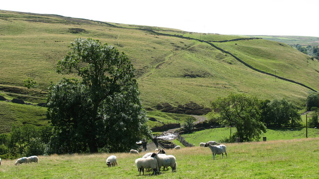
![Bridleway through Clints Wood Bridleway through woodland above Marske Beck. The mature tree on the left is of interest as it is an elm, a rare sight these days. [presumed to be a wych elm]](https://s2.geograph.org.uk/geophotos/04/57/84/4578410_b43e096b.jpg)


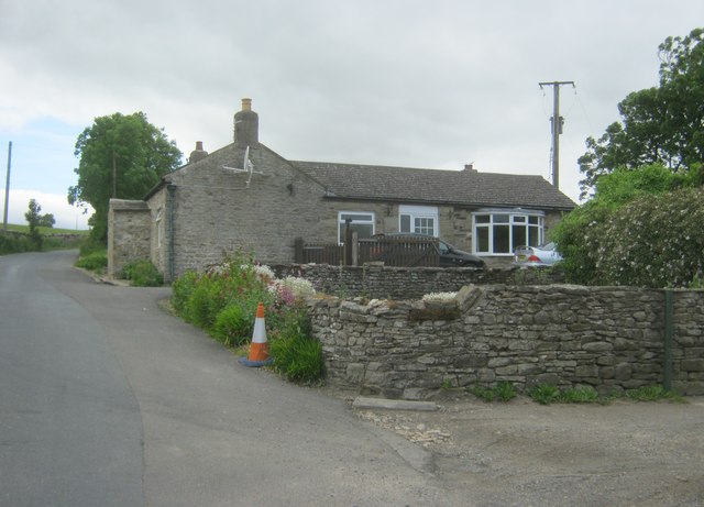
![Orgate Farm The approach to the farm along the bridleway from Marske. One wonders if the name has anything to do with the mining and transportation of lead ore [galena] which was mined nearby and once smelted at furnaces in the valley below.](https://s0.geograph.org.uk/geophotos/04/57/84/4578432_abd2b304.jpg)


Clints Wood is located at Grid Ref: NZ0901 (Lat: 54.406975, Lng: -1.849821)
Division: North Riding
Administrative County: North Yorkshire
District: Richmondshire
Police Authority: North Yorkshire
What 3 Words
///yummy.mentioned.relies. Near Richmond, North Yorkshire
Nearby Locations
Related Wikis

Skelton, west North Yorkshire
Skelton is a small hamlet in the Richmondshire district of North Yorkshire, England. It is within the Yorkshire Dales National Park near the larger village...

Marske, west North Yorkshire
Marske is a village and civil parish in the Richmondshire district of North Yorkshire, England, situated in lower Swaledale on the boundary of the Yorkshire...

Scott Trial
The Scott Trial is a British motorcycle trials competition dating from 1914 run over an off-road course of approximately 70 miles (110 km). One of the...
Helwith
Helwith is a hamlet and farm in the civil parish of New Forest, in North Yorkshire, England about 6 miles north-west of Richmond. It lies in the valley...
Nearby Amenities
Located within 500m of 54.406975,-1.849821Have you been to Clints Wood?
Leave your review of Clints Wood below (or comments, questions and feedback).