Blayshaw Plantation

Wood, Forest in Yorkshire Harrogate

England

Blayshaw Plantation

Cafe above How Stean Gorge
Cafe above How Stean Gorge Credit: don cload

Blayshaw Plantation is a picturesque woodland located in Yorkshire, England. The plantation covers a vast area of lush greenery and is home to a diverse range of trees, plants, and wildlife. The forest is known for its dense canopy of oak, beech, and birch trees, which provide a habitat for various species of birds, mammals, and insects.

Visitors to Blayshaw Plantation can enjoy a peaceful walk through the winding trails that meander through the woods, offering stunning views of the surrounding countryside. The forest is also popular among nature enthusiasts, who come to observe the native flora and fauna in their natural habitat.

Blayshaw Plantation is a designated nature reserve, and efforts are made to preserve its ecological integrity. Conservation practices are in place to protect the biodiversity of the forest and ensure the sustainability of its ecosystem.

Overall, Blayshaw Plantation is a tranquil and scenic destination for those seeking a connection with nature and a peaceful escape from the hustle and bustle of everyday life.

If you have any feedback on the listing, please let us know in the comments section below.

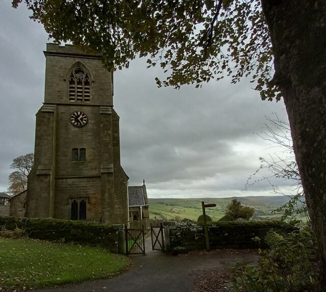
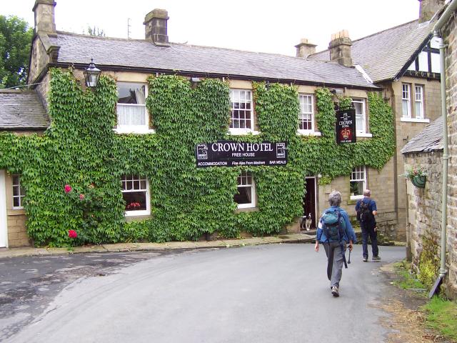
Blayshaw Plantation Images

Images are sourced within 2km of 54.149486/-1.8535086 or Grid Reference SE0972. Thanks to Geograph Open Source API. All images are credited.

Cafe above How Stean Gorge
Stone stile
Stone stile
Falls by How Stean Beck
The Crown Hotel
The Crown Hotel
St. Chad's Churchyard, Middlesmoor
Decaying barn by the Nidderdale Way A track from High Blayshaw to the south joins the track followed by the Nidderdale Way (a public bridleway at this point) just in front of this old farmhouse repurposed as a barn, but now quietly decaying and becoming overgrown.
Decaying barn by the Nidderdale Way
A track from High Blayshaw to the south joins the track followed by the Nidderdale Way (a public bridleway at this point) just in front of this old farmhouse repurposed as a barn, but now quietly decaying and becoming overgrown.
Footpath dropping to Stean Bridge From the minor road on the south side of How Stean Gorge, a less-than-obvious public footpath heads north (to be fair, it is well signposted once you have found it - and is routed carefully to avoid disturbing the occupants of the adjacent property). The bridge ahead forms a useful viewpoint for those trying to assess whether the river could be paddled (doesn't look attractive, and it is commercialised for gorge-walking lower down, so access strife would probably be encountered despite the ancient right to navigate). It's also the access for a couple of caves in the undercut walls of the gorge. The path beyond climbs steeply through open pasture to Middlesmoor.
Footpath dropping to Stean Bridge
From the minor road on the south side of How Stean Gorge, a less-than-obvious public footpath heads north (to be fair, it is well signposted once you have found it - and is routed carefully to avoid disturbing the occupants of the adjacent property). The bridge ahead forms a useful viewpoint for those trying to assess whether the river could be paddled (doesn't look attractive, and it is commercialised for gorge-walking lower down, so access strife would probably be encountered despite the ancient right to navigate). It's also the access for a couple of caves in the undercut walls of the gorge. The path beyond climbs steeply through open pasture to Middlesmoor.
Ruined barn above How Stean Gorge Standing sadly derelict, this quite substantial barn rather mars the view east from the path up from How Stean Gorge to Middlesmoor.
Ruined barn above How Stean Gorge
Standing sadly derelict, this quite substantial barn rather mars the view east from the path up from How Stean Gorge to Middlesmoor.
Graveyard below St. Chad's church, Middlesmoor Signposting leaves the route of the paths NE, SE and SE from Middlesmoor rather poorly defined, but I eventually deduced that the way NE must head up through the churchyard. Even some quite recent graves seem to be subsiding down the hill, as the slope is really a bit steep for such a use.
Graveyard below St. Chad's church, Middlesmoor
Signposting leaves the route of the paths NE, SE and SE from Middlesmoor rather poorly defined, but I eventually deduced that the way NE must head up through the churchyard. Even some quite recent graves seem to be subsiding down the hill, as the slope is really a bit steep for such a use.
How Stean Gorge View of the road bridge from a footbridge now covered by the cafe extension
How Stean Gorge
View of the road bridge from a footbridge now covered by the cafe extension
Nidderdale, track from Scar House reservoir to Middlesmoor According to the OS benchmark database there in a gatepost with a cutmark at this location. The stone gateposts have been replaced by wooden ones.
Nidderdale, track from Scar House reservoir to Middlesmoor
According to the OS benchmark database there in a gatepost with a cutmark at this location. The stone gateposts have been replaced by wooden ones.
Middlesmoor, village hall, was village school The benchmark is cut into the east facing wall of the old village school.
Middlesmoor, village hall, was village school
The benchmark is cut into the east facing wall of the old village school.
Middlesmoor, St Chad's church The benchmark is cut into the west face of the church tower.
Middlesmoor, St Chad's church
The benchmark is cut into the west face of the church tower.
Middlesmoor, St Chad's church There is a benchmark cut into the west face of the church tower.
Middlesmoor, St Chad's church
There is a benchmark cut into the west face of the church tower.
Middlesmoor, Methodist chapel The benchmark is cut into the roadside wall which borders the front of the chapel.
Middlesmoor, Methodist chapel
The benchmark is cut into the roadside wall which borders the front of the chapel.
Middlesmoor, Methodist chapel There is a benchmark cut into the roadside wall which borders the front of the chapel. The mark is to the left of the wall curve.
Middlesmoor, Methodist chapel
There is a benchmark cut into the roadside wall which borders the front of the chapel. The mark is to the left of the wall curve.
Field entrance on road leading to How Stean According to the OS benchmark database there is a benchmark cut into a gatepost at this field entrance. Nothing was found.
Field entrance on road leading to How Stean
According to the OS benchmark database there is a benchmark cut into a gatepost at this field entrance. Nothing was found.
Benchmark cut into face of barn, Nidderdale The benchmark is cut into a large stone to the left of a green barn door. The mark remains in very good condition. Wider view <a href="https://www.geograph.org.uk/photo/7551296">SE0973 : Barn at Studfold Farm, Nidderdale</a>
Benchmark cut into face of barn, Nidderdale
The benchmark is cut into a large stone to the left of a green barn door. The mark remains in very good condition. Wider view SE0973 : Barn at Studfold Farm, Nidderdale
Show me another place!

Blayshaw Plantation is located at Grid Ref: SE0972 (Lat: 54.149486, Lng: -1.8535086)

Division: West Riding

Administrative County: North Yorkshire

District: Harrogate

Police Authority: North Yorkshire

What 3 Words

///clays.bronzes.shorthand. Near Pateley Bridge, North Yorkshire

Nearby Locations

Blayshaw Plantation

Related Wikis

Lofthouse-in-Nidderdale railway station

Lofthouse-in-Nidderdale railway station was the northernmost regular passenger terminus on the Nidd Valley Light Railway (NVLR), in Lofthouse, then in...
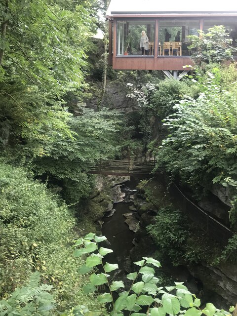
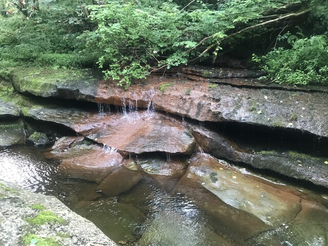
How Stean Gorge

How Stean Gorge is a limestone gorge in Nidderdale in North Yorkshire, England. It forms a unit of the Upper Nidderdale Site of Special Scientific Interest...
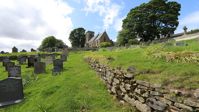
Stean

Stean is a small village in upper Nidderdale in North Yorkshire, England. It is 8 miles (13 km) north of Pateley Bridge. The village is located on Stean...

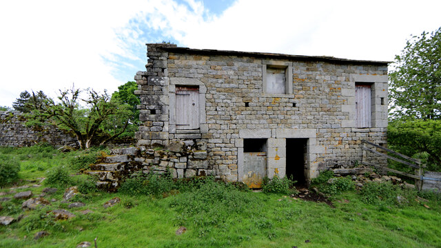
Lofthouse, North Yorkshire

Lofthouse is a small village in Nidderdale in the Harrogate district of North Yorkshire, England about a mile south of Middlesmoor. It is the principal...

Nearby Amenities

Located within 500m of 54.149486,-1.8535086
lead mines
Historic: mine
Mineral: lead
Source: OS OpenData StreetView
Lat/Long: 54.150245/-1.8609792
Historic: mine_shaft
Mineral: lead
Source: Bing
Lat/Long: 54.1505783/-1.8598228
Historic: mine_shaft
Mineral: lead
Source: Bing
Lat/Long: 54.1508425/-1.8601876
Historic: mine_shaft
Mineral: lead
Source: Bing
Lat/Long: 54.1504715/-1.8601447
Historic: mine_shaft
Mineral: lead
Source: Bing
Lat/Long: 54.1509745/-1.8602305
Power: pole
Lat/Long: 54.1504247/-1.8473389
Power: pole
Lat/Long: 54.1498404/-1.8484676
Power: pole
Lat/Long: 54.1492667/-1.8496618
Power: pole
Lat/Long: 54.1532545/-1.854292
The data included in this document is from www.openstreetmap.org. The data is made available under ODbL.

Have you been to Blayshaw Plantation?

Leave your review of Blayshaw Plantation below (or comments, questions and feedback).