Cripplestyle Plantation

Wood, Forest in Dorset

England

Cripplestyle Plantation

Frosty pine at Pistle Hill
Frosty pine at Pistle Hill Credit: Clive Perrin

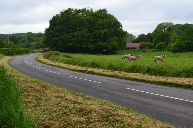
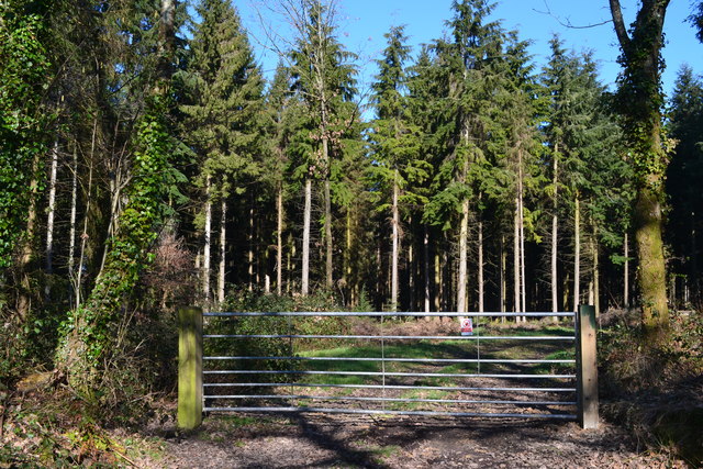
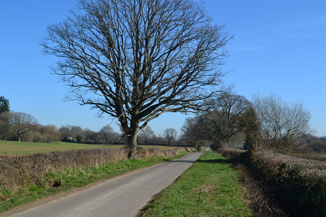
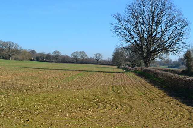
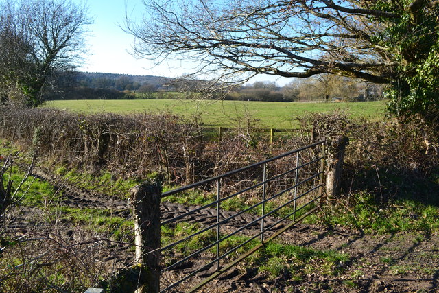
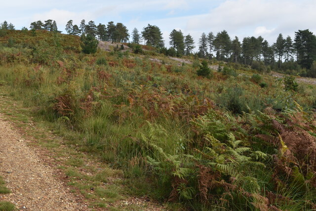
Cripplestyle Plantation is a picturesque woodland located in Dorset, England. Situated near the village of Cripplestyle, this plantation covers a vast area of lush forests and beautiful woodlands. The plantation is known for its rich biodiversity and stunning natural landscapes, making it a popular destination for nature enthusiasts and hikers.

The woodlands of Cripplestyle Plantation are predominantly composed of native tree species, including oak, beech, and birch trees. These towering trees create a dense canopy, providing a tranquil and shaded environment for visitors to explore. The forest floor is covered in a thick layer of moss and ferns, adding to the enchanting atmosphere of the plantation.

Wildlife thrives within the woodland, with a variety of bird species, such as woodpeckers and owls, calling this place home. Deer and rabbits can also be spotted, adding to the charm and natural beauty of the plantation.

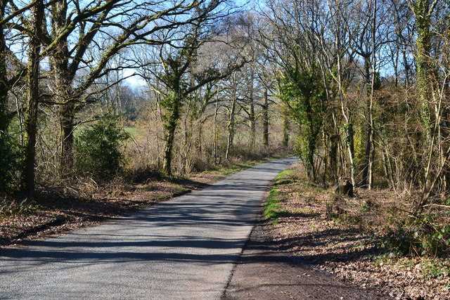
Cripplestyle Plantation offers numerous walking trails, allowing visitors to immerse themselves in the serene surroundings. These trails vary in length and difficulty, catering to both casual strollers and avid hikers. Along these paths, visitors can enjoy breathtaking views of the woodlands, discover hidden streams, and encounter diverse plant life.

The plantation is well-maintained, with designated picnic areas and benches scattered throughout the area for visitors to relax and enjoy a picnic amidst the peaceful ambiance. Additionally, there are information boards at key points, providing educational insight into the flora and fauna that inhabit the plantation.

Overall, Cripplestyle Plantation in Dorset is a serene and idyllic destination, offering a haven of natural beauty and tranquility for all who venture into its woodland depths.

If you have any feedback on the listing, please let us know in the comments section below.

Cripplestyle Plantation Images

Images are sourced within 2km of 50.908233/-1.8689431 or Grid Reference SU0912. Thanks to Geograph Open Source API. All images are credited.

Frosty pine at Pistle Hill
Rest a while on the edge of Telegraph Plantation
Ford at Lower Holwell This ford on the River Crane is found just below Mill Farm at Lower Holwell. A video of the ford can be seen at:
<span class="nowrap"><a title="https://youtu.be/FNo6zIFcZ1k" rel="nofollow ugc noopener" href="https://youtu.be/FNo6zIFcZ1k">Link</a><img style="margin-left:2px;" alt="External link" title="External link - shift click to open in new window" src="https://s1.geograph.org.uk/img/external.png" width="10" height="10"/></span>
Ford at Lower Holwell
This ford on the River Crane is found just below Mill Farm at Lower Holwell. A video of the ford can be seen at: LinkExternal link
Horses beside Hare Lane
Hare Lane
Hare Lane
Bend on the road near Gotham
Trailer on Batterley Drove, Gotham
Flooded track Not the only blockage encountered on this 'other route with public access'.
Flooded track
Not the only blockage encountered on this 'other route with public access'.
Abandoned Ford on Mill Lane Wreck on a rural byway.
Abandoned Ford on Mill Lane
Wreck on a rural byway.
View into Further Daggons Wood
Lane past the gate to Further Daggons Wood
Lane to Lower Daggons
Field beside the lane to Lower Daggons
Former Wesleyan Chapel, Crendell
Late sunlight near The Roughs
Field entrance at Gotham
Direction Sign – Signpost Located on the north side of the B3078 Hare Lane, opposite Batterley Drove in Alderholt parish. 1 worboys arm and annulus & bar finial. See also <a title="https://www.geograph.org.uk/photo/1741237" href="https://www.geograph.org.uk/photo/1741237">Link</a> and <a title="https://www.geograph.org.uk/photo/1741233" href="https://www.geograph.org.uk/photo/1741233">Link</a>.

Milestone Society National ID: DO_SU0812
Direction Sign – Signpost
Located on the north side of the B3078 Hare Lane, opposite Batterley Drove in Alderholt parish. 1 worboys arm and annulus & bar finial. See also Link and Link. Milestone Society National ID: DO_SU0812
Area cleared of trees near Mount Ararat
Show me another place!

Cripplestyle Plantation is located at Grid Ref: SU0912 (Lat: 50.908233, Lng: -1.8689431)

Unitary Authority: Dorset

Police Authority: Dorset

What 3 Words

///series.forgives.manliness. Near Alderholt, Dorset

Related Wikis

Cripplestyle

Cripplestyle is a hamlet in the civil parish of Alderholt in the county of Dorset, England. It lies close to the Dorset-Hampshire border. The nearest town...

Broxhill

Bull Hill, Dorset, Daggons and Broxhill are adjoining hamlets (mainly of Alderholt village) notable for planted woodland and tree cultivation south of...

Lower Daggons

Lower Daggons is a hamlet in the New Forest district of Hampshire, England. At the 2011 Census the Post Office affirmed the population was included in...

Crendell

Crendell is a hamlet in the civil parish of Alderholt in the East Dorset district of Dorset, England. The hamlet is close to the Dorset-Hampshire border...

Nearby Amenities

Located within 500m of 50.908233,-1.8689431
Post Box
Post Box Type: lamp
Ref: BH21 126
Ref GB Uprn: 10015479618
Lat/Long: 50.9106075/-1.8743014
Cripplestyle
Place: hamlet
Wikidata: Q5185848
Lat/Long: 50.9103543/-1.8704446
Power: pole
Source: bing
Lat/Long: 50.9103194/-1.8703746
Power: pole
Source: bing
Lat/Long: 50.9100574/-1.8713942
Power: pole
Source: bing
Lat/Long: 50.9096797/-1.872828
Power: pole
Source: bing
Lat/Long: 50.9093896/-1.8739305
Power: pole
Source: bing
Lat/Long: 50.9090649/-1.8752088
Power: pole
Source: bing
Lat/Long: 50.9083843/-1.8759263
King Barrow
Access: yes
Archaeological Site: tumulus
Ele: 90
Historic: archaeological_site
Natural: peak
Lat/Long: 50.9095816/-1.8672777
The data included in this document is from www.openstreetmap.org. The data is made available under ODbL.

Have you been to Cripplestyle Plantation?

Leave your review of Cripplestyle Plantation below (or comments, questions and feedback).