Druid's Head Wood

Wood, Forest in Wiltshire

England

Druid's Head Wood

Farmland, Winterbourne Stoke Wheat beside a line of beeches, which are marked on the 1:25000 Ordnance Survey map.
Farmland, Winterbourne Stoke Credit: Andrew Smith

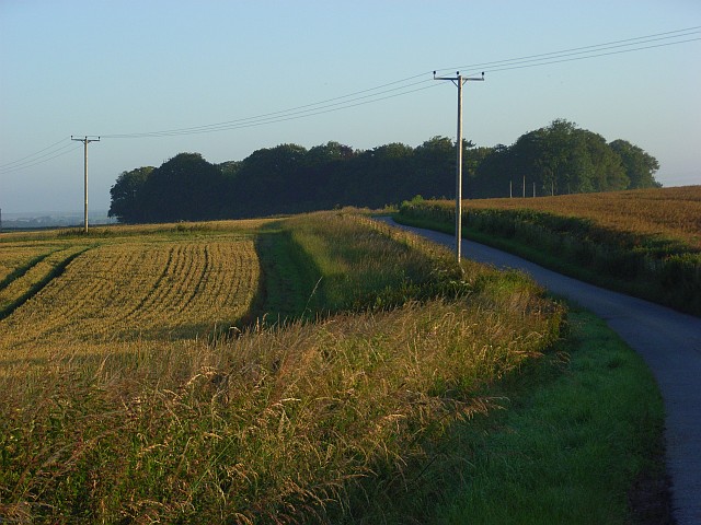
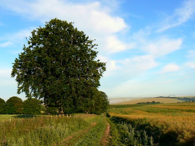
Druid's Head Wood is a picturesque woodland located in the county of Wiltshire, England. Situated near the village of West Ashton, this ancient forest covers an area of approximately 56 acres, making it a haven for nature lovers and outdoor enthusiasts.

The wood gets its intriguing name from a distinctive tree stump that resembles the head of a druid, a mystical figure from Celtic folklore. The stump is believed to have been carved by human hands centuries ago, adding an air of mystery and enchantment to the woodland.

Druid's Head Wood is primarily composed of a mixed deciduous tree canopy, including oak, ash, beech, and birch trees. The forest floor is carpeted with a diverse range of flora, including bluebells, wood anemones, and wild garlic, creating a vibrant and colorful display during the spring months.

The woodland is a designated Site of Special Scientific Interest (SSSI) due to its ecological importance. It provides a habitat for a variety of wildlife, including deer, badgers, foxes, and numerous bird species. The forest's tranquil atmosphere also attracts birdwatchers who come to observe species such as woodpeckers, buzzards, and owls.

Visitors to Druid's Head Wood can explore the network of footpaths that crisscross the forest, offering opportunities for leisurely walks and nature trails. The wood is particularly popular among families who enjoy picnicking, wildlife spotting, and immersing themselves in the serene surroundings.

Overall, Druid's Head Wood is a charming and captivating woodland that showcases the natural beauty and biodiversity of Wiltshire, providing a tranquil escape from the hustle and bustle of everyday life.

If you have any feedback on the listing, please let us know in the comments section below.

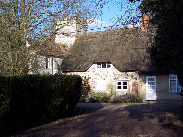
Druid's Head Wood Images

Images are sourced within 2km of 51.146152/-1.8801802 or Grid Reference SU0838. Thanks to Geograph Open Source API. All images are credited.

Farmland, Winterbourne Stoke Wheat beside a line of beeches, which are marked on the 1:25000 Ordnance Survey map.
Farmland, Winterbourne Stoke
Wheat beside a line of beeches, which are marked on the 1:25000 Ordnance Survey map.
Track on Oatlands Hill The restricted byway descending to the A360.
Track on Oatlands Hill
The restricted byway descending to the A360.
Farm road, Winterbourne Stoke The byway at Oatlands Farm heading towards Hill Farm (in the trees). Fields of rape and wheat.
Farm road, Winterbourne Stoke
The byway at Oatlands Farm heading towards Hill Farm (in the trees). Fields of rape and wheat.
Cows on Horse Down With cereal fields beyond descending to Winterbourne Stoke.
Cows on Horse Down
With cereal fields beyond descending to Winterbourne Stoke.
Brown hare near Berwick St James, Wiltshire One of several of these beautiful creatures about this morning, this one is enjoying the warmth of the early morning sun. More about Lepus europaeus here <span class="nowrap"><a title="http://www.hare-preservation-trust.co.uk/index.html" rel="nofollow ugc noopener" href="http://www.hare-preservation-trust.co.uk/index.html">Link</a><img style="margin-left:2px;" alt="External link" title="External link - shift click to open in new window" src="https://s1.geograph.org.uk/img/external.png" width="10" height="10"/></span>
Brown hare near Berwick St James, Wiltshire
One of several of these beautiful creatures about this morning, this one is enjoying the warmth of the early morning sun. More about Lepus europaeus here LinkExternal link
Farm track, near Winterbourne Stoke, Wiltshire The trees are beeches and the crop is oilseed rape. Winterbourne Stoke lies away to the west straddling the A303.
Farm track, near Winterbourne Stoke, Wiltshire
The trees are beeches and the crop is oilseed rape. Winterbourne Stoke lies away to the west straddling the A303.
Farmland near Winterbourne Stoke, Wiltshire The field in the foreground was being used as a playground by a number of brown hares and some rabbits. Beyond the fence is a crop of ripening oilseed rape.
Farmland near Winterbourne Stoke, Wiltshire
The field in the foreground was being used as a playground by a number of brown hares and some rabbits. Beyond the fence is a crop of ripening oilseed rape.
Sunrise near Winterbourne Stoke, Wiltshire In the foreground is a crop of wheat. This image was obtained five minutes after sunrise was predicted to occur.
Sunrise near Winterbourne Stoke, Wiltshire
In the foreground is a crop of wheat. This image was obtained five minutes after sunrise was predicted to occur.
Hares in a field near Winterbourne Stoke There are three of these handsome animals in this image.
Hares in a field near Winterbourne Stoke
There are three of these handsome animals in this image.
The Church of St James, Berwick St James The church has its origins in the 12th century with restoration taking place in 1871. It is built of limestone and flint.
The Church of St James, Berwick St James
The church has its origins in the 12th century with restoration taking place in 1871. It is built of limestone and flint.
Tombstone, St James's Churchyard The tombstone is covered in lichen.

Lichens do not have roots, but absorb water and gases through their upper surface, and are therefore sensitive to atmospheric pollution.  For this reason they are rarely found around cities and grow best on the wetter west side of the British Isles.  Those on trees thrive best on the sunny, south-west aspects of trunks and branches.  Disappearance of lichen species can be used to detect rising levels of air pollution.  

There are three main types.  The encrusting forms, including the bright orange/dark yellow 'Xanthoria' grow on roofs, walls, gravestones, signs and tree trunks.  Leaf-like species develop flat lobes spreading over bark or stones, and shrubby forms which grow vertically from the ground or hang from trees.  Few have common names.
Tombstone, St James's Churchyard
The tombstone is covered in lichen. Lichens do not have roots, but absorb water and gases through their upper surface, and are therefore sensitive to atmospheric pollution. For this reason they are rarely found around cities and grow best on the wetter west side of the British Isles. Those on trees thrive best on the sunny, south-west aspects of trunks and branches. Disappearance of lichen species can be used to detect rising levels of air pollution. There are three main types. The encrusting forms, including the bright orange/dark yellow 'Xanthoria' grow on roofs, walls, gravestones, signs and tree trunks. Leaf-like species develop flat lobes spreading over bark or stones, and shrubby forms which grow vertically from the ground or hang from trees. Few have common names.
Detail, St James's Church The eagle is a symbol of the resurrection or ascension of Christ due to the fact that it soars upwards.  By extension, the eagle symbolises baptised Christians, who have symbolically died and risen with Christ.
Detail, St James's Church
The eagle is a symbol of the resurrection or ascension of Christ due to the fact that it soars upwards. By extension, the eagle symbolises baptised Christians, who have symbolically died and risen with Christ.
The Boot Inn, Berwick St James An attractive stone and flint village local built in the 17th century and altered in the 1890's. It is Grade II listed and has a traditional unspoilt interior.  There is an Ordnance Survey bench mark on the north west angle of the building.
The Boot Inn, Berwick St James
An attractive stone and flint village local built in the 17th century and altered in the 1890's. It is Grade II listed and has a traditional unspoilt interior. There is an Ordnance Survey bench mark on the north west angle of the building.
Bench Mark, The Boot Inn The bench mark is to be found on the north west angle of the building.  For a view of the building <a href="https://www.geograph.org.uk/photo/2371949">SU0739 : The Boot Inn, Berwick St James</a> and for further information on the bench mark and others in the area <span class="nowrap"><a title="http://www.bench-marks.org.uk/bm37646" rel="nofollow ugc noopener" href="http://www.bench-marks.org.uk/bm37646">Link</a><img style="margin-left:2px;" alt="External link" title="External link - shift click to open in new window" src="https://s1.geograph.org.uk/img/external.png" width="10" height="10"/></span>
Bench Mark, The Boot Inn
The bench mark is to be found on the north west angle of the building. For a view of the building SU0739 : The Boot Inn, Berwick St James and for further information on the bench mark and others in the area LinkExternal link
Bench Mark, St James's Church On the northwest angle of the church tower is an Ordnance Survey bench mark.  For a view of the church <a href="https://www.geograph.org.uk/photo/333509">SU0739 : Berwick St James Church</a> and for further information on the bench mark and others in the area <span class="nowrap"><a title="http://www.bench-marks.org.uk/bm37596" rel="nofollow ugc noopener" href="http://www.bench-marks.org.uk/bm37596">Link</a><img style="margin-left:2px;" alt="External link" title="External link - shift click to open in new window" src="https://s1.geograph.org.uk/img/external.png" width="10" height="10"/></span>
Bench Mark, St James's Church
On the northwest angle of the church tower is an Ordnance Survey bench mark. For a view of the church SU0739 : Berwick St James Church and for further information on the bench mark and others in the area LinkExternal link
The Boot Inn, Berwick St James
B3083 passes The Boot Inn Here's another view of this Grade II listed pub. Although it dates from the 17th C. it was altered during 1890's but still warrants English Heritage Building ID: 320447.
B3083 passes The Boot Inn
Here's another view of this Grade II listed pub. Although it dates from the 17th C. it was altered during 1890's but still warrants English Heritage Building ID: 320447.
The High Street
The High Street
Show me another place!

Druid's Head Wood is located at Grid Ref: SU0838 (Lat: 51.146152, Lng: -1.8801802)

Unitary Authority: Wiltshire

Police Authority: Wiltshire

What 3 Words

///nametag.uniform.reclined. Near Winterbourne Stoke, Wiltshire

Related Wikis

Berwick St James

Berwick St James is a village and civil parish on the River Till in Wiltshire, England, about 7 miles (11 km) northwest of Salisbury, on the southern edge...

Stapleford, Wiltshire

Stapleford is a village and civil parish about 4 miles (6.4 km) north of Wilton, Wiltshire, England. The village is on the River Till just above its confluence...

River Till, Wiltshire

The River Till rises near Tilshead on Salisbury Plain in the English county of Wiltshire. It flows for about 14 km (9 miles) south and south-east, through...

Winterbourne Stoke

Winterbourne Stoke is a village and civil parish in Wiltshire, England, about 5 miles (8 km) west of Amesbury and 3 miles (4.8 km) west of the prehistoric...

Great Wishford

Great Wishford is a village and civil parish in the Wylye Valley in Wiltshire, England, about three miles (5 km) north of Wilton and five miles (8 km)...

Ebsbury

The site of Ebsbury, in Wiltshire, England, includes the remains of an Iron Age enclosed settlement, field system and possible hill fort, and a Romano...
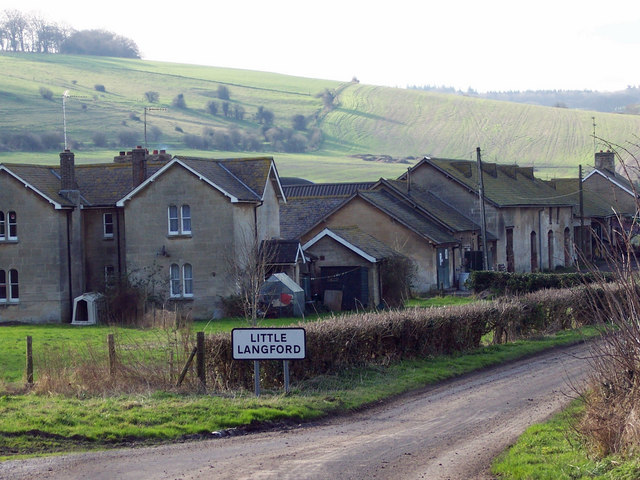
Little Langford

Little Langford is a hamlet and former civil parish, now in the parish of Steeple Langford, in Wiltshire, England. Its nearest town is Wilton, about 5...

South Newton

South Newton is a village and civil parish about 4 miles (6.4 km) north-west of Salisbury in Wiltshire, England. Topologically it lies between chalk downs...

Have you been to Druid's Head Wood?

Leave your review of Druid's Head Wood below (or comments, questions and feedback).