Vale Acre Copse

Wood, Forest in Dorset

England

Vale Acre Copse

Frosty pine at Pistle Hill
Frosty pine at Pistle Hill Credit: Clive Perrin

Vale Acre Copse is a beautiful woodland located in the county of Dorset, England. Covering an area of approximately 50 acres, this tranquil forest is a haven for nature enthusiasts and outdoor adventurers alike.

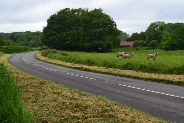
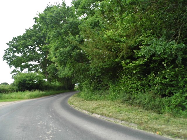
The copse is primarily composed of a diverse range of deciduous trees, including oak, beech, and ash. These towering giants create a dense canopy that provides shade and shelter for a variety of wildlife species. Visitors can expect to encounter a multitude of birds, such as woodpeckers and song thrushes, as well as small mammals like squirrels and rabbits.

A network of well-maintained footpaths winds its way through the copse, allowing visitors to explore the woodland at their own pace. Along these paths, one can discover an array of wildflowers, ferns, and mosses, adding bursts of color and texture to the forest floor.

Vale Acre Copse is also home to a small stream that meanders through the woodland, adding to the overall tranquillity of the area. This stream provides a habitat for various aquatic creatures, including frogs and small fish.

The copse is a popular destination for outdoor activities such as hiking, birdwatching, and photography. Its peaceful atmosphere and abundant wildlife make it an ideal spot for nature lovers seeking a respite from the hustle and bustle of everyday life.

Overall, Vale Acre Copse in Dorset offers a delightful retreat into nature, showcasing the beauty and diversity of the British woodland ecosystem.

If you have any feedback on the listing, please let us know in the comments section below.

Vale Acre Copse Images

Images are sourced within 2km of 50.905918/-1.8817352 or Grid Reference SU0811. Thanks to Geograph Open Source API. All images are credited.

Frosty pine at Pistle Hill
Rest a while on the edge of Telegraph Plantation
Ford at Lower Holwell This ford on the River Crane is found just below Mill Farm at Lower Holwell. A video of the ford can be seen at:
<span class="nowrap"><a title="https://youtu.be/FNo6zIFcZ1k" rel="nofollow ugc noopener" href="https://youtu.be/FNo6zIFcZ1k">Link</a><img style="margin-left:2px;" alt="External link" title="External link - shift click to open in new window" src="https://s1.geograph.org.uk/img/external.png" width="10" height="10"/></span>
Ford at Lower Holwell
This ford on the River Crane is found just below Mill Farm at Lower Holwell. A video of the ford can be seen at: LinkExternal link
Horses beside Hare Lane
Hare Lane
Hare Lane
Holwell, track Farm track and footpath between fields from Cranborne to Jordan Hill, via Holwell.
Holwell, track
Farm track and footpath between fields from Cranborne to Jordan Hill, via Holwell.
Cranborne, woodland path From Cranborne to Jordan Hill, through mature oak woodland; not a public footpath, but apparently well-used.
Cranborne, woodland path
From Cranborne to Jordan Hill, through mature oak woodland; not a public footpath, but apparently well-used.
Cranborne, stile & jump On the path to Jordan Hill. The horse jump is presumably for riders, as this is not a bridleway.
Cranborne, stile & jump
On the path to Jordan Hill. The horse jump is presumably for riders, as this is not a bridleway.
Cranborne, drove Churchill Drove, from Rushmore Farm to the lane to Cranborne. Now a bridleway and private road.
Cranborne, drove
Churchill Drove, from Rushmore Farm to the lane to Cranborne. Now a bridleway and private road.
Cranborne, conifers In a plantation on Jordan Hill, on the path to Holwell.
Cranborne, conifers
In a plantation on Jordan Hill, on the path to Holwell.
Cranborne, forestry track From Churchill Drove to Curries.
Cranborne, forestry track
From Churchill Drove to Curries.
The road by Westworth Farm, Verwood
Bend on the road near Gotham
Trailer on Batterley Drove, Gotham
Pools on a tributary of the River Crane In woodland on the Edmundsham Estate.
Pools on a tributary of the River Crane
In woodland on the Edmundsham Estate.
Flooded track Not the only blockage encountered on this 'other route with public access'.
Flooded track
Not the only blockage encountered on this 'other route with public access'.
Abandoned Ford on Mill Lane Wreck on a rural byway.
Abandoned Ford on Mill Lane
Wreck on a rural byway.
I think I am being followed I collected this herd of cows on a permissive path on the Edmundsham Estate. I knew there were quite a few but maybe not as many as this.
I think I am being followed
I collected this herd of cows on a permissive path on the Edmundsham Estate. I knew there were quite a few but maybe not as many as this.
Show me another place!

Vale Acre Copse is located at Grid Ref: SU0811 (Lat: 50.905918, Lng: -1.8817352)

Unitary Authority: Dorset

Police Authority: Dorset

What 3 Words

///merit.outlast.stun. Near Verwood, Dorset

Related Wikis

Cripplestyle

Cripplestyle is a hamlet in the civil parish of Alderholt in the county of Dorset, England. It lies close to the Dorset-Hampshire border. The nearest town...

Broxhill

Bull Hill, Dorset, Daggons and Broxhill are adjoining hamlets (mainly of Alderholt village) notable for planted woodland and tree cultivation south of...

Crendell

Crendell is a hamlet in the civil parish of Alderholt in the East Dorset district of Dorset, England. The hamlet is close to the Dorset-Hampshire border...

Lopshill

Lopshill is a hamlet in the New Forest district in Hampshire, England. It is in the civil parish of Damerham. It is about 4 miles (7 km) from the New...

Lower Daggons

Lower Daggons is a hamlet in the New Forest district of Hampshire, England. At the 2011 Census the Post Office affirmed the population was included in...

Edmondsham

Edmondsham is a village in the county of Dorset in southern England. It is situated two miles north west of Verwood and ten miles north of Bournemouth...

Edmondsham House

Edmondsham House is a Tudor home with Georgian additions in Edmondsham near Wimborne Minster in Dorset, England. It is a Grade II* listed building. �...

Boveridge

Boveridge is a hamlet in Dorset, England about 1 mile (1.6 km) north of Cranborne, 12 miles (19 km) south-west of Salisbury, Wiltshire, and 10 miles (16...

Nearby Amenities

Located within 500m of 50.905918,-1.8817352
Power: tower
Lat/Long: 50.9090988/-1.8847436
Power: tower
Lat/Long: 50.9069064/-1.8855123
Power: tower
Lat/Long: 50.9047955/-1.8862955
Power: pole
Source: bing
Lat/Long: 50.9076851/-1.8765993
Power: pole
Source: bing
Lat/Long: 50.9083843/-1.8759263
Power: pole
Source: bing
Lat/Long: 50.9067239/-1.8765509
Power: pole
Source: bing
Lat/Long: 50.9057466/-1.8765177
Power: pole
Source: bing
Lat/Long: 50.9046214/-1.8769179
Power: pole
Source: bing
Lat/Long: 50.9042099/-1.8770683
Power: pole
Source: bing
Lat/Long: 50.9034559/-1.8773207
Power: pole
Source: bing
Lat/Long: 50.9028612/-1.8775399
Joshua's Copse
Place: locality
Lat/Long: 50.9057371/-1.8847128
Fox Hill
Place: locality
Lat/Long: 50.9038335/-1.8778603
The data included in this document is from www.openstreetmap.org. The data is made available under ODbL.

Have you been to Vale Acre Copse?

Leave your review of Vale Acre Copse below (or comments, questions and feedback).