Cuxham

Settlement in Oxfordshire South Oxfordshire

England

Cuxham

Direction Sign – Signpost on the B480 in Cuxham Located in Cuxham on the northeast side of a T junction on the B480, Cuxham with Easington parish. 3 arms and annulus finial. 

Milestone Society National ID: OX_SU6695
Direction Sign – Signpost on the B480 in Cuxham Credit: John V Nicholls

Cuxham is a small village located in South Oxfordshire, England. Situated approximately 8 miles southeast of the historic city of Oxford, it falls within the Chiltern Hills Area of Outstanding Natural Beauty. With a population of around 350 residents, it is a close-knit and picturesque community.

The village's origins can be traced back to the medieval period, and it is mentioned in the Domesday Book of 1086. Cuxham is characterized by its charming thatched cottages, many of which date back to the 16th and 17th centuries, giving it a quintessentially English feel.

Cuxham boasts a rich history and several notable landmarks. St. Laurence's Church, built in the 13th century, is a prominent feature in the village. It showcases an impressive Norman doorway and beautiful stained glass windows. The village also possesses a traditional pub, The Half Moon, which serves as a social hub for locals and visitors alike.

Surrounded by rolling countryside, Cuxham offers numerous opportunities for outdoor activities. The village is blessed with scenic walking and cycling routes, allowing residents and visitors to explore the stunning landscapes of the Chiltern Hills. The nearby Aston Rowant National Nature Reserve provides a haven for wildlife enthusiasts and is home to a variety of rare plants and animals.

While Cuxham may be small in size, it exudes a strong sense of community spirit and offers a tranquil retreat for those seeking a peaceful English countryside experience.

If you have any feedback on the listing, please let us know in the comments section below.
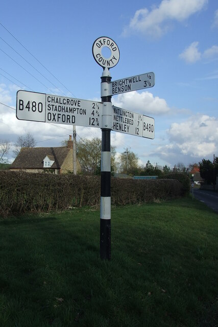
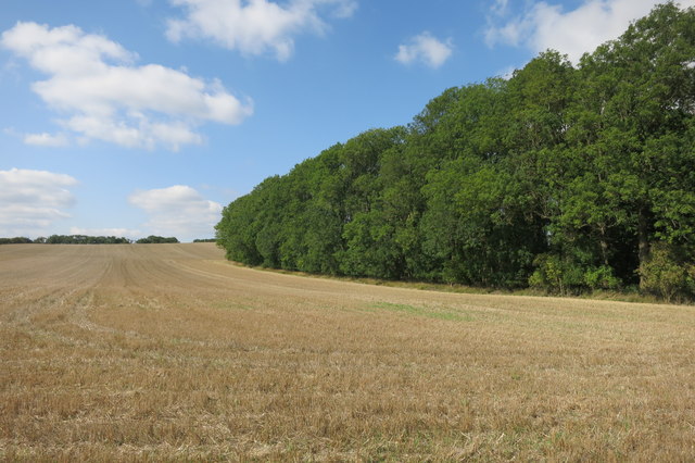
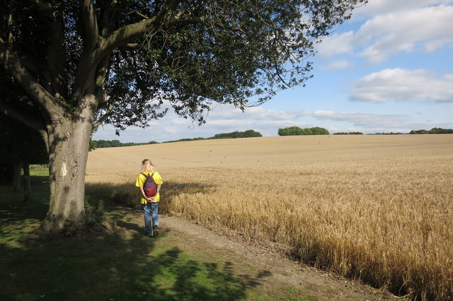
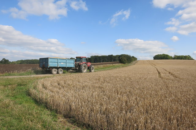
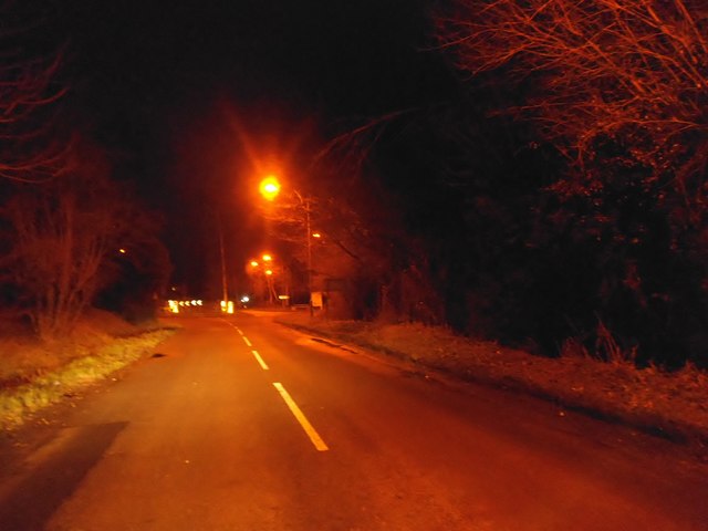
Cuxham Images

Images are sourced within 2km of 51.652619/-1.04149 or Grid Reference SU6695. Thanks to Geograph Open Source API. All images are credited.

Direction Sign – Signpost on the B480 in Cuxham Located in Cuxham on the northeast side of a T junction on the B480, Cuxham with Easington parish. 3 arms and annulus finial. 

Milestone Society National ID: OX_SU6695
Direction Sign – Signpost on the B480 in Cuxham
Located in Cuxham on the northeast side of a T junction on the B480, Cuxham with Easington parish. 3 arms and annulus finial. Milestone Society National ID: OX_SU6695
Farmland, Cuxham A footpath to the south-west of the village follows the edge of a field of maize.
Farmland, Cuxham
A footpath to the south-west of the village follows the edge of a field of maize.
Farmland, Brightwell Baldwin Fields of wheat beside the bridleway heading west towards Berrick Salome.
Farmland, Brightwell Baldwin
Fields of wheat beside the bridleway heading west towards Berrick Salome.
Edgington Wood
Edgington Wood
Near Pyrton Heath House From the bridleway which skirts around the garden of this isolated house.
Near Pyrton Heath House
From the bridleway which skirts around the garden of this isolated house.
Tractor near Mount Tree Mount Tree is either the name of this hill or the small wood on the top of it.
Tractor near Mount Tree
Mount Tree is either the name of this hill or the small wood on the top of it.
Cuxham Road, Watlington
House and phone box in Cuxham This was making use of the lowest possible amount of available light.
House and phone box in Cuxham
This was making use of the lowest possible amount of available light.
Isolated house on the B480 near Cuxham
Rural road to Cuxham
Road into Brightwell Upperton
Rural road to Cuxham
The road to Cuxham passes Lodge House
The road through Brightwell Baldwin
Rural road to Cuxham
Britwell Salome: lane leading away from the church
The Old Rectory, Britwell Salome
St Nicholas's church, Britwell Salome The war grave in the foreground is that of Private W.G. Robinson of the Royal Berkshire Regiment, who died in 1917 at the age of 33.
St Nicholas's church, Britwell Salome
The war grave in the foreground is that of Private W.G. Robinson of the Royal Berkshire Regiment, who died in 1917 at the age of 33.
Show me another place!

Cuxham is located at Grid Ref: SU6695 (Lat: 51.652619, Lng: -1.04149)

Administrative County: Oxfordshire

District: South Oxfordshire

Police Authority: Thames Valley

What 3 Words

///snippet.flagpole.struggle. Near Chalgrove, Oxfordshire

Related Wikis

Cuxham

Cuxham is a village and former civil parish, now in the parish of Cuxham with Easington, in the South Oxfordshire district, in the county of Oxfordshire...

Henley (UK Parliament constituency)

Henley is a constituency in Oxfordshire represented in the House of Commons of the UK Parliament since 2008 by John Howell, a Member of Parliament from...

South Oxfordshire

South Oxfordshire is a local government district in the ceremonial county of Oxfordshire, England. Its council is temporarily based outside the district...

Cuxham with Easington

Cuxham with Easington is a civil parish in South Oxfordshire. It includes the villages of Cuxham and Easington. The 2011 Census recorded a parish population...

Brightwell Baldwin

Brightwell Baldwin is a village and civil parish in Oxfordshire, about 4+1⁄2 miles (7 km) northeast of Wallingford. It was historically in the Hundred...

Easington, South Oxfordshire

Easington is a small village in the civil parish of Cuxham with Easington, in the South Oxfordshire district, in the county of Oxfordshire, England. It...

Britwell Salome

Britwell Salome is a village and civil parish in South Oxfordshire, England centred 4+1⁄2 miles (7 km) northeast of Wallingford. The 2011 Census recorded...

Icknield Community College

Icknield Community College is a coeducational secondary school located in Watlington, Oxfordshire, England. It offers tuition for years 7-11 (ages 11...

Nearby Amenities

Located within 500m of 51.652619,-1.04149
Cuxham
Place: village
Source Name: local knowledge
Wikidata: Q5197066
Wikipedia: en:Cuxham
Lat/Long: 51.6524151/-1.0375868
Pub
The Half Moon
Fhrs Id: 272153
Wikidata: Q26312604
Lat/Long: 51.6524282/-1.0361651
Bus Stop
Half Moon PH
Bus: yes
Local Ref: opp
Naptan AtcoCode: 340000249OPP
Naptan Bearing: W
Naptan CommonName: Half Moon PH
Naptan Indicator: Opposite
Naptan Landmark: Half Moon PH
Naptan NaptanCode: oxfajpgt
Naptan Street: B480
Naptan Verified: no
Public Transport: platform
Source: naptan_import
Lat/Long: 51.6525873/-1.0348987
Bus Stop
Half Moon PH
Bus: yes
Local Ref: o/s
Naptan AtcoCode: 340000249OUT
Naptan Bearing: E
Naptan BusStopType: CUS
Naptan CommonName: Half Moon PH
Naptan Indicator: Outside
Naptan Landmark: Half Moon PH
Naptan NaptanCode: oxfajpgp
Naptan Street: B480
Naptan Verified: no
Public Transport: platform
Source: naptan_import
Lat/Long: 51.6526606/-1.0349477
Bus Stop
Gregory Estate
Bus: yes
Local Ref: opp
Naptan AtcoCode: 340001592ETN
Naptan Bearing: S
Naptan BusStopType: CUS
Naptan CommonName: Gregory Estate
Naptan Indicator: Opposite
Naptan Landmark: No 2
Naptan NaptanCode: oxfgdwad
Naptan Street: B480
Naptan Verified: no
Public Transport: platform
Source: naptan_import
Lat/Long: 51.6530592/-1.0417595
Bus Stop
Gregory Estate
Bus: yes
Local Ref: o/s
Naptan AtcoCode: 340001592OET
Naptan Bearing: N
Naptan CommonName: Gregory Estate
Naptan Indicator: Outside
Naptan Landmark: No 2
Naptan NaptanCode: oxfgdtwt
Naptan Street: B480
Naptan Verified: no
Public Transport: platform
Source: naptan_import
Lat/Long: 51.6533306/-1.0420369
Bus Stop
Marlbrook
Bus: yes
Local Ref: opp
Naptan AtcoCode: 340001724EST
Naptan Bearing: E
Naptan CommonName: Marlbrook
Naptan Indicator: Opposite
Naptan Landmark: The Thatch
Naptan NaptanCode: oxfgdgpw
Naptan Street: B480
Naptan Verified: no
Public Transport: platform
Shelter: no
Source: naptan_import
Lat/Long: 51.6524565/-1.0383382
Bus Stop
Marlbrook
Bus: yes
Local Ref: o/s
Naptan AtcoCode: 340001724WST
Naptan Bearing: W
Naptan CommonName: Marlbrook
Naptan Indicator: Outside
Naptan Landmark: The Thatch
Naptan NaptanCode: oxfgdgpt
Naptan Street: B480
Naptan Verified: no
Public Transport: platform
Source: naptan_import
Lat/Long: 51.6525617/-1.0391165
Defibrillator
Booth: K6
Covered: booth
Defibrillator Location: in red telephone box, Cuxham
Disused Amenity: telephone
Emergency: defibrillator
Listed Status: Grade II
Man Made: telephone_box
Lat/Long: 51.6520643/-1.0370144
Post Box
Post Box Type: lamp
Ref: OX49 519
Royal Cypher: EIIR
Royal Cypher Wikidata: Q33102113
Lat/Long: 51.6521625/-1.0365638
The data included in this document is from www.openstreetmap.org. The data is made available under ODbL.

Have you been to Cuxham?

Leave your review of Cuxham below (or comments, questions and feedback).