Black Plantation

Wood, Forest in Yorkshire Richmondshire

England

Black Plantation

Bird Ridding Lane in Coverdale
Bird Ridding Lane in Coverdale Credit: peter robinson

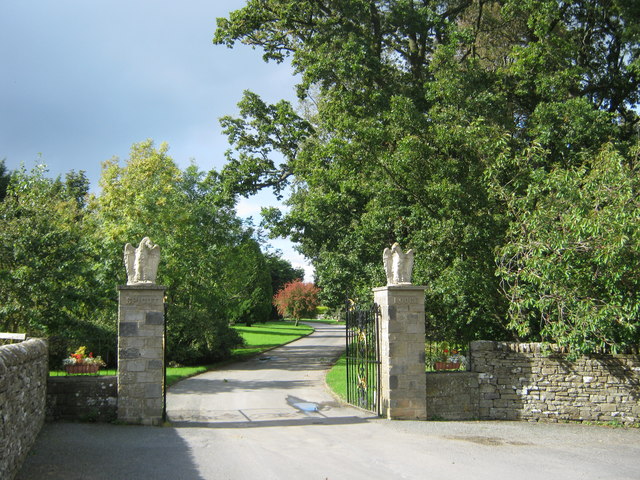
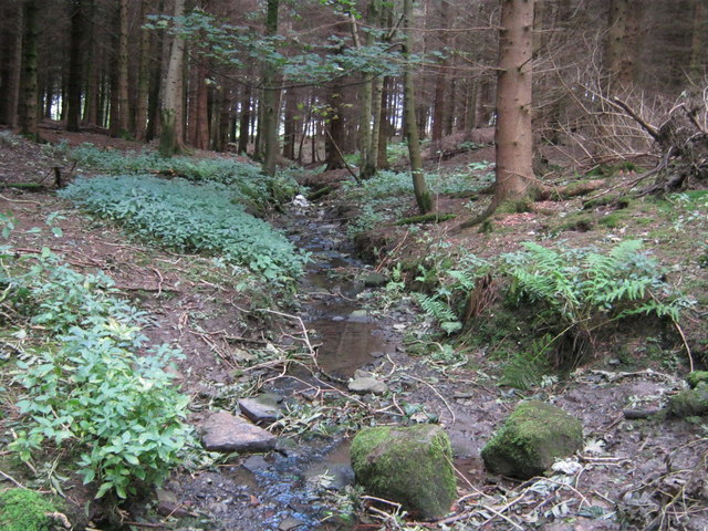
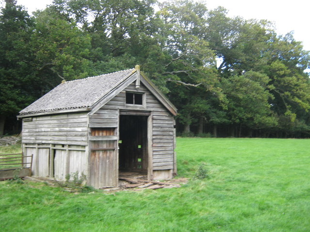
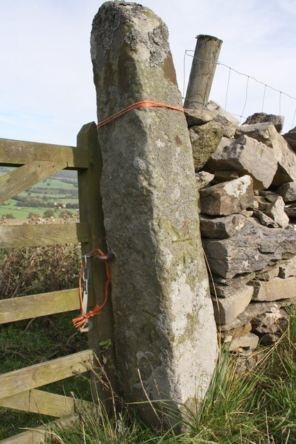
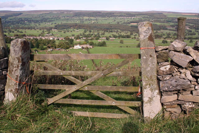
Black Plantation is a woodland area located in Yorkshire, England. Situated in the county's picturesque countryside, it covers a vast expanse of land and is known for its dense forest and rich biodiversity. The plantation is nestled within the larger Yorkshire Dales National Park, adding to its natural charm and beauty.

The woodland is predominantly composed of various species of trees, including oak, birch, beech, and pine, which create a diverse and vibrant ecosystem. This variety of tree species provides a habitat for numerous wildlife species, including squirrels, badgers, deer, and a wide range of bird species.

Black Plantation is a popular destination for nature enthusiasts and outdoor enthusiasts alike. It offers a network of well-maintained walking trails, allowing visitors to explore the woodland and discover its hidden gems. The trails cater to different levels of difficulty, ensuring that everyone can enjoy the beauty of the area.

In addition to its natural beauty, Black Plantation also holds historical significance. The woodland has been part of the local landscape for centuries and has witnessed the passing of time, making it an important cultural and heritage site.

Overall, Black Plantation in Yorkshire is a captivating woodland that offers a peaceful retreat for both locals and tourists. With its diverse wildlife, well-maintained trails, and historical significance, it is a must-visit destination for those seeking a connection with nature and a glimpse into the region's past.

If you have any feedback on the listing, please let us know in the comments section below.

Black Plantation Images

Images are sourced within 2km of 54.280078/-1.8749324 or Grid Reference SE0887. Thanks to Geograph Open Source API. All images are credited.

Bird Ridding Lane in Coverdale
Green's Beck in Coverham
Entrance drive to Spigot Lodge, Coverham
Unnamed watercourse in Millers Gill Plantation
Derelict hut north of Millers Gill Plantation
Benchmarks on gatepost on Witton Steeps There is a cancelled cut mark benchmark on the front face of the gatepost and a replacement cut mark benchmark on its inside face. These are described on the Bench Mark Database at <span class="nowrap"><a title="http://www.bench-marks.org.uk/bm39660" rel="nofollow ugc noopener" href="http://www.bench-marks.org.uk/bm39660">Link</a><img style="margin-left:2px;" alt="External link" title="External link - shift click to open in new window" src="https://s1.geograph.org.uk/img/external.png" width="10" height="10"/></span> and <span class="nowrap"><a title="http://www.bench-marks.org.uk/bm39659" rel="nofollow ugc noopener" href="http://www.bench-marks.org.uk/bm39659">Link</a><img style="margin-left:2px;" alt="External link" title="External link - shift click to open in new window" src="https://s1.geograph.org.uk/img/external.png" width="10" height="10"/></span> respectively.
Benchmarks on gatepost on Witton Steeps
There is a cancelled cut mark benchmark on the front face of the gatepost and a replacement cut mark benchmark on its inside face. These are described on the Bench Mark Database at LinkExternal link and LinkExternal link respectively.
View north through gateway on Witton Steeps There is a cancelled cut mark benchmark <a href="https://www.geograph.org.uk/photo/2633747">SE0687 : Benchmarks on gatepost on Witton Steeps</a> on the road face of the right hand gatepost
View north through gateway on Witton Steeps
There is a cancelled cut mark benchmark SE0687 : Benchmarks on gatepost on Witton Steeps on the road face of the right hand gatepost
Benchmark on gatepost near Penhill Farm Ordnance Survey cut mark benchmark described on the Bench Mark Database at <span class="nowrap"><a title="http://www.bench-marks.org.uk/bm39662" rel="nofollow ugc noopener" href="http://www.bench-marks.org.uk/bm39662">Link</a><img style="margin-left:2px;" alt="External link" title="External link - shift click to open in new window" src="https://s1.geograph.org.uk/img/external.png" width="10" height="10"/></span>
Benchmark on gatepost near Penhill Farm
Ordnance Survey cut mark benchmark described on the Bench Mark Database at LinkExternal link
Gateway near Penhill Farm The left gatepost has an OS benchmark <a href="https://www.geograph.org.uk/photo/2633858">SE0687 : Benchmark on gatepost near Penhill Farm</a>
Gateway near Penhill Farm
The left gatepost has an OS benchmark SE0687 : Benchmark on gatepost near Penhill Farm
Benchmark on barn at Penhill Farm Ordnance Survey cut mark benchmark described on the Bench Mark Database at <span class="nowrap"><a title="http://www.bench-marks.org.uk/bm39663" rel="nofollow ugc noopener" href="http://www.bench-marks.org.uk/bm39663">Link</a><img style="margin-left:2px;" alt="External link" title="External link - shift click to open in new window" src="https://s1.geograph.org.uk/img/external.png" width="10" height="10"/></span>
Benchmark on barn at Penhill Farm
Ordnance Survey cut mark benchmark described on the Bench Mark Database at LinkExternal link
Penhill Farm The barn has an OS benchmark <a href="https://www.geograph.org.uk/photo/2634611">SE0687 : Benchmark on barn at Penhill Farm</a> on the angle facing the camera
Penhill Farm
The barn has an OS benchmark SE0687 : Benchmark on barn at Penhill Farm on the angle facing the camera
Benchmark on gatepost south of Penhill Farm Ordnance Survey cut mark benchmark described on the Bench Mark Database at <span class="nowrap"><a title="http://www.bench-marks.org.uk/bm39664" rel="nofollow ugc noopener" href="http://www.bench-marks.org.uk/bm39664">Link</a><img style="margin-left:2px;" alt="External link" title="External link - shift click to open in new window" src="https://s1.geograph.org.uk/img/external.png" width="10" height="10"/></span>
Benchmark on gatepost south of Penhill Farm
Ordnance Survey cut mark benchmark described on the Bench Mark Database at LinkExternal link
View through gateway of Penhill Park The left hand side gatepost has an OS benchmark <a href="https://www.geograph.org.uk/photo/2634722">SE0687 : Benchmark on gatepost south of Penhill Farm</a>
View through gateway of Penhill Park
The left hand side gatepost has an OS benchmark SE0687 : Benchmark on gatepost south of Penhill Farm
Benchmark on roadside wall Middleham High Moor Ordnance Survey cut mark benchmark described on the Bench Mark Database at <span class="nowrap"><a title="http://www.bench-marks.org.uk/bm39665" rel="nofollow ugc noopener" href="http://www.bench-marks.org.uk/bm39665">Link</a><img style="margin-left:2px;" alt="External link" title="External link - shift click to open in new window" src="https://s1.geograph.org.uk/img/external.png" width="10" height="10"/></span>
Benchmark on roadside wall Middleham High Moor
Ordnance Survey cut mark benchmark described on the Bench Mark Database at LinkExternal link
Dry stone wall and road at western edge of Middleham High Moor On the right side of the road are gallops fences.
Dry stone wall and road at western edge of Middleham High Moor
On the right side of the road are gallops fences.
Benchmark on wall near Wraykeld Well Ordnance Survey rivet benchmark described on the Bench Mark Database at <span class="nowrap"><a title="http://www.bench-marks.org.uk/bm39666" rel="nofollow ugc noopener" href="http://www.bench-marks.org.uk/bm39666">Link</a><img style="margin-left:2px;" alt="External link" title="External link - shift click to open in new window" src="https://s1.geograph.org.uk/img/external.png" width="10" height="10"/></span>
Benchmark on wall near Wraykeld Well
Ordnance Survey rivet benchmark described on the Bench Mark Database at LinkExternal link
View north at start of footpath to Carlton There is an OS benchmark <a href="https://www.geograph.org.uk/photo/2634807">SE0686 : Benchmark on wall near Wraykeld Well</a> on the wall angle to left of cattle grid gate
View north at start of footpath to Carlton
There is an OS benchmark SE0686 : Benchmark on wall near Wraykeld Well on the wall angle to left of cattle grid gate
Benchmark on gatepost on Flint Lane Ordnance Survey cut mark benchmark described on the Bench Mark Database at <span class="nowrap"><a title="http://www.bench-marks.org.uk/bm39657" rel="nofollow ugc noopener" href="http://www.bench-marks.org.uk/bm39657">Link</a><img style="margin-left:2px;" alt="External link" title="External link - shift click to open in new window" src="https://s1.geograph.org.uk/img/external.png" width="10" height="10"/></span>
Benchmark on gatepost on Flint Lane
Ordnance Survey cut mark benchmark described on the Bench Mark Database at LinkExternal link
Show me another place!

Black Plantation is located at Grid Ref: SE0887 (Lat: 54.280078, Lng: -1.8749324)

Division: North Riding

Administrative County: North Yorkshire

District: Richmondshire

Police Authority: North Yorkshire

What 3 Words

///measuring.plodded.ants. Near Leyburn, North Yorkshire

Related Wikis

Coverham with Agglethorpe

Coverham with Agglethorpe is a civil parish in North Yorkshire, England. It includes the villages of Coverham and Agglethorpe. The population of the civil...

Agglethorpe

Agglethorpe is a hamlet in the Richmondshire district of North Yorkshire, England, it lies in northern Coverdale, approximately 4 miles (6.4 km) south...

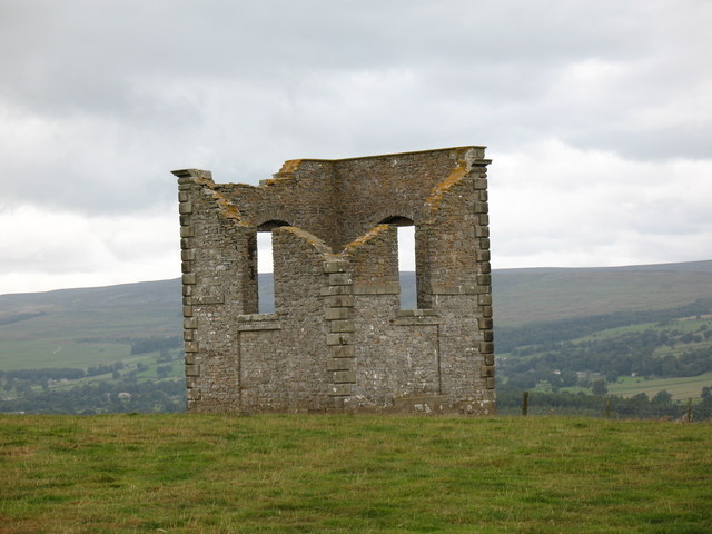
The Mount, North Yorkshire

The Mount, or Polly Peachum's Tower, is a hunting tower near Wensley and about a mile south-east of Bolton Hall, in North Yorkshire, England. It is a Grade...

Forbidden Corner

The Forbidden Corner is a folly garden located in the Tupgill Park Estate, at Coverham in Coverdale, in the Yorkshire Dales National Park. It is open to...

Melmerby in Coverdale

Melmerby is a village and civil parish in North Yorkshire, England. It lies in Coverdale in the Yorkshire Dales about 3 miles (4.8 km) south-west of Leyburn...

Caldbergh with East Scrafton

Caldbergh with East Scrafton is a civil parish in the Richmondshire district of North Yorkshire, England. The parish includes the settlements of Caldbergh...

Caldbergh

Caldbergh (Caldeber in the Domesday Book) is a hamlet within the Yorkshire Dales, North Yorkshire, England. It lies about four miles south of Leyburn....
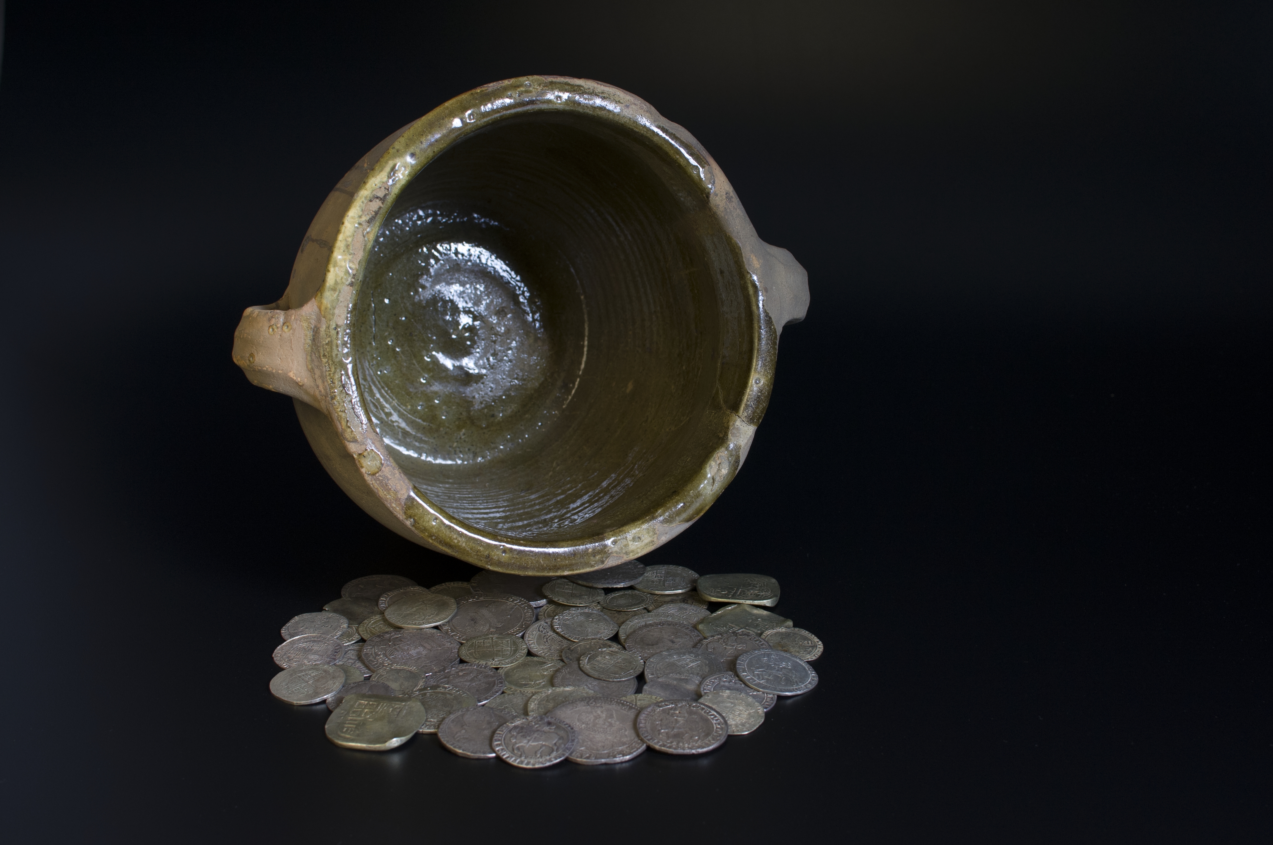
Middleham Hoard

The Middleham Hoard is a coin hoard found near Middleham, North Yorkshire in England. It dates from the period of the English Civil War, and consists of...

Nearby Amenities

Located within 500m of 54.280078,-1.8749324
Limekiln Hill
Is In Country Code: GB
Man Made: survey_point
Natural: peak
Source: OS 1:25k
Lat/Long: 54.2825227/-1.87743
Power: pole
Lat/Long: 54.2766824/-1.8706304
Power: pole
Lat/Long: 54.277736/-1.86993
Power: pole
Lat/Long: 54.2785937/-1.8687073
Power: pole
Lat/Long: 54.2794474/-1.8674686
The data included in this document is from www.openstreetmap.org. The data is made available under ODbL.

Have you been to Black Plantation?

Leave your review of Black Plantation below (or comments, questions and feedback).