Cutteslowe

Settlement in Oxfordshire Oxford

England

Cutteslowe

Houses on Elsfield Way, Cutteslowe
Houses on Elsfield Way, Cutteslowe Credit: David Howard

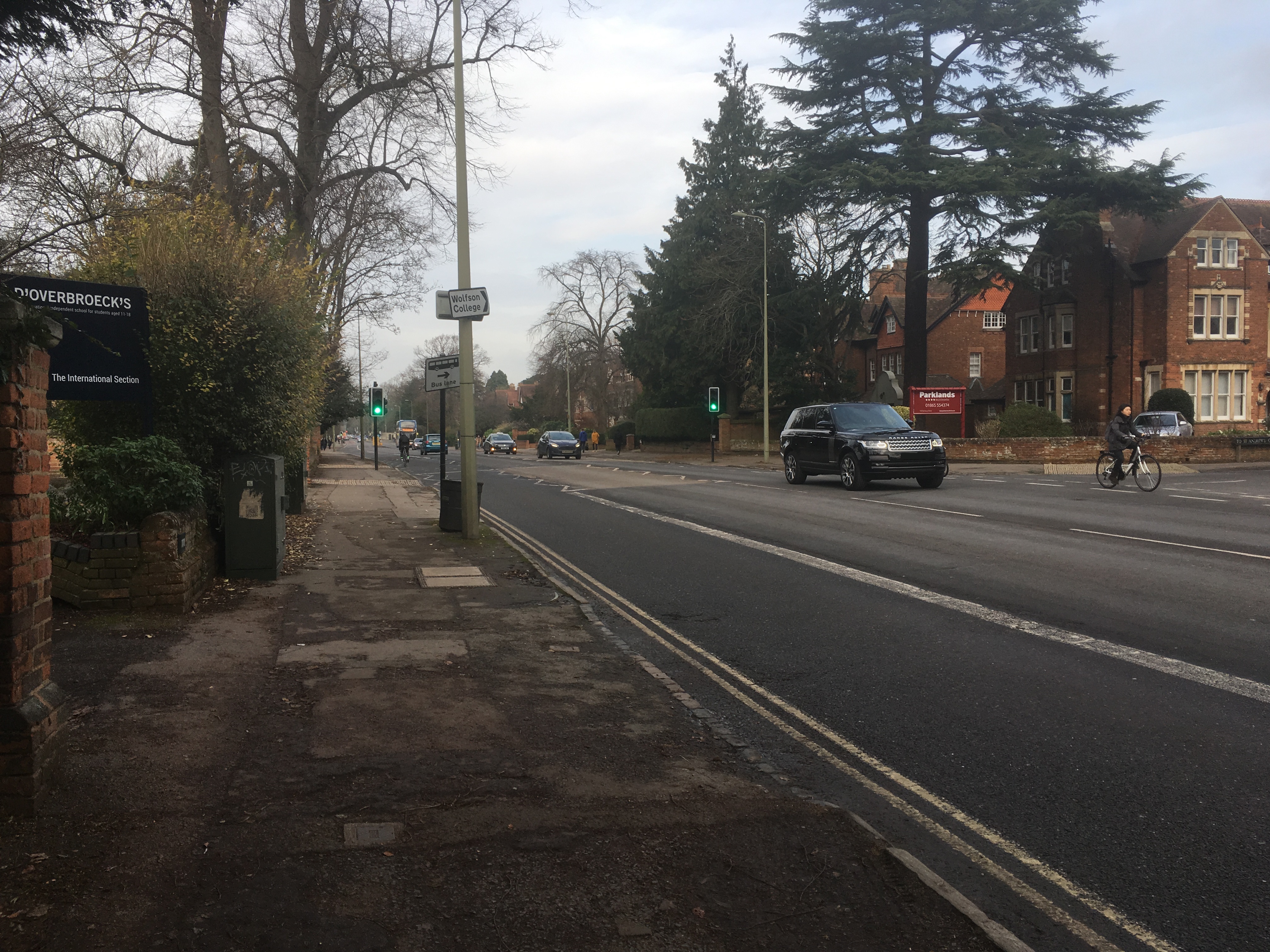
Cutteslowe is a residential area located in the city of Oxford, within the county of Oxfordshire, England. It is situated approximately 2 miles north of the city center and is bordered by the neighborhoods of Wolvercote, Sunnymead, and Summertown.

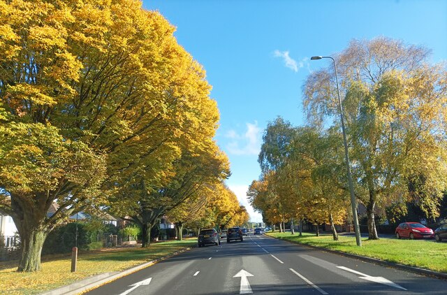
The area is known for its tranquil and leafy surroundings, offering a peaceful escape from the hustle and bustle of the city. Cutteslowe Park, a large public park, is one of the notable attractions in the area. The park features vast open spaces, a lake, playgrounds, and sports facilities, making it a popular spot for picnics, walks, and outdoor activities.

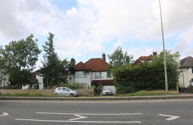
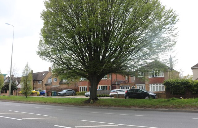
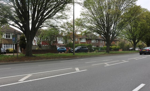
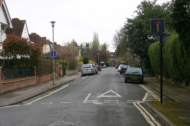
Cutteslowe is primarily a residential area, consisting of a mix of housing types, including detached houses, semi-detached houses, and apartments. The properties range from traditional Victorian and Edwardian homes to more modern constructions. The area attracts a diverse range of residents, including families, young professionals, and students attending the nearby University of Oxford.

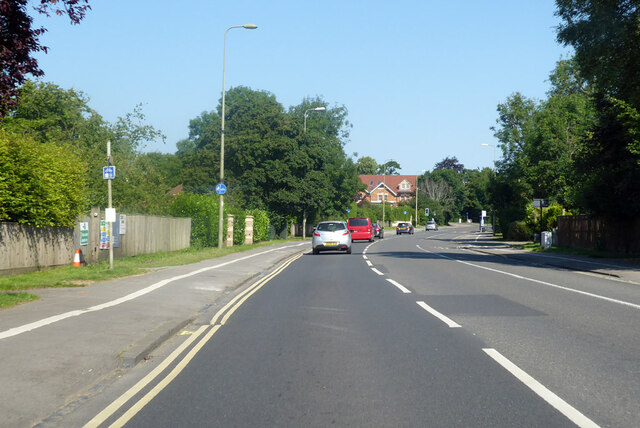
In terms of amenities, Cutteslowe offers a range of local shops, including convenience stores, cafes, and restaurants, catering to the daily needs of its residents. Additionally, nearby Summertown provides a wider range of shops, supermarkets, and services.

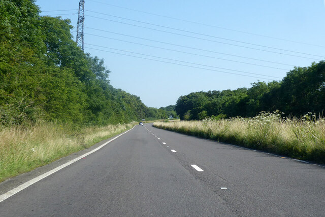
Transportation in Cutteslowe is well-served, with regular bus services connecting the area to Oxford city center and surrounding neighborhoods. The nearby A40 road provides easy access to the wider road network, making commuting to other parts of Oxfordshire and beyond convenient.

Overall, Cutteslowe offers a peaceful residential environment, with its proximity to green spaces, amenities, and transport links making it an attractive place to live in Oxfordshire.

If you have any feedback on the listing, please let us know in the comments section below.
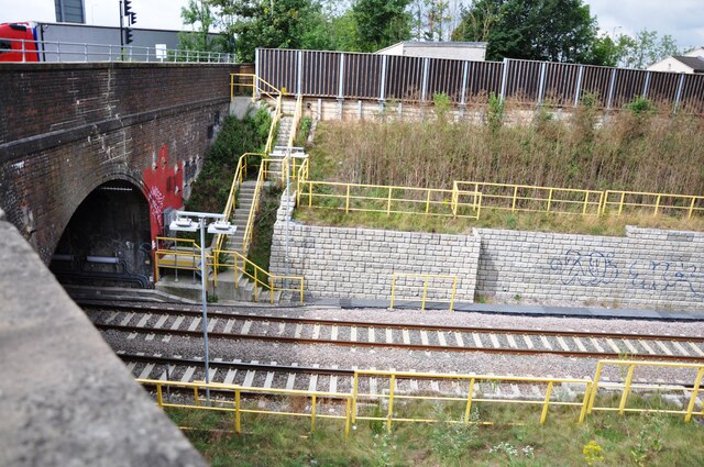
Cutteslowe Images

Images are sourced within 2km of 51.790261/-1.261818 or Grid Reference SP5110. Thanks to Geograph Open Source API. All images are credited.

Houses on Elsfield Way, Cutteslowe
Autumnal trees along the A40 Trees turning yellow along the A40 near Oxford.
Autumnal trees along the A40
Trees turning yellow along the A40 near Oxford.
A4260 Frieze Way towards Kidlington
Northbound A44 Woodstock Road Heading away from Oxford.
Northbound A44 Woodstock Road
Heading away from Oxford.
A4144 Woodstock Road, Oxford Heading north out of town.
A4144 Woodstock Road, Oxford
Heading north out of town.
Wolvercote Tunnel north entrance Wolvercote Tunnel passes under Wolvercote Roundabout in the north of Oxford.  The ex LNWR Bletchley to Oxford railway passes through the tunnel.  When the line became less used, it made a perfect roosting place for bats.  On reconstruction of the line for the Chiltern Railways new services to Oxford, the tunnel was refurbished and equipped with 'Bat Lights' which are triggered by the passing of trains.  This is to persuade the nocturnal animals to remain at roost when a train passes and not fly off and possibly get injured in the process.  The 'Bat lights' are fitted along the tunnel walls and on posts at the entrances to the tunnel, as seen here.
Wolvercote Tunnel north entrance
Wolvercote Tunnel passes under Wolvercote Roundabout in the north of Oxford. The ex LNWR Bletchley to Oxford railway passes through the tunnel. When the line became less used, it made a perfect roosting place for bats. On reconstruction of the line for the Chiltern Railways new services to Oxford, the tunnel was refurbished and equipped with 'Bat Lights' which are triggered by the passing of trains. This is to persuade the nocturnal animals to remain at roost when a train passes and not fly off and possibly get injured in the process. The 'Bat lights' are fitted along the tunnel walls and on posts at the entrances to the tunnel, as seen here.
Inn at Night The view of the Holiday Inn hotel on the Service area at Peartree Hill roundabout for the A34, Oxford.
Inn at Night
The view of the Holiday Inn hotel on the Service area at Peartree Hill roundabout for the A34, Oxford.
Car Park View The view on the car park of the Oxford Travelodge on the Service area next to the Peartree Hill roundabout on the A34.
Car Park View
The view on the car park of the Oxford Travelodge on the Service area next to the Peartree Hill roundabout on the A34.
Wolvercote Common near Oxford
North Road, Cutteslowe
Narrow boat moored on the Oxford Canal The 78 mile Oxford  Canal links Oxford with the Coventry  Canal near Bedworth, via Banbury and Rugby. It connects to the River Thames at Oxford, and even combines with the Grand Union Canal for 5 miles near Braunston.
 
The canal was constructed in stages over about twenty years from 1769 to 1790. James Brindley surveyed and began the work with Samuel Simcock, but following Brindley's  death,  Simcock took over.  By 1774 the canal had reached Napton, and by 1778, Banbury. Lack of money meant that the final stretch to Oxford was not started until 1786. That took three years and the completed canal was finally opened on 1 January 1790.

Being an early canal, it was built to be contour hugging, avoiding  changes of water level wherever possible. As a result of increasing competition from the Grand Union Canal, by the late 1820s it was decided that the meandering course needed reducing in mileage, so the northern section was to be reduced by more than 14 miles. Construction, supervised by Sir William Cubitt, started in 1829, and was finished by 1834. A parallel doubling up of the lock flight at Hillmorton was built and the route was straightened in many places, and a new tunnel at Newbold was dug. Not all the planned improvements were made; the final reduction in mileage being nearer 11 miles. 
Evidence of the original course can still be seen by perusing aerial images and OS 1:25000 maps. The section south of Napton was never straightened. The railways had arrived and canal decline had started.

Information reduced from Wikipedia <span class="nowrap"><a title="https://en.wikipedia.org/wiki/Oxford_Canal" rel="nofollow ugc noopener" href="https://en.wikipedia.org/wiki/Oxford_Canal">Link</a><img style="margin-left:2px;" alt="External link" title="External link - shift click to open in new window" src="https://s1.geograph.org.uk/img/external.png" width="10" height="10"/></span>
Narrow boat moored on the Oxford Canal
The 78 mile Oxford Canal links Oxford with the Coventry Canal near Bedworth, via Banbury and Rugby. It connects to the River Thames at Oxford, and even combines with the Grand Union Canal for 5 miles near Braunston. The canal was constructed in stages over about twenty years from 1769 to 1790. James Brindley surveyed and began the work with Samuel Simcock, but following Brindley's death, Simcock took over. By 1774 the canal had reached Napton, and by 1778, Banbury. Lack of money meant that the final stretch to Oxford was not started until 1786. That took three years and the completed canal was finally opened on 1 January 1790. Being an early canal, it was built to be contour hugging, avoiding changes of water level wherever possible. As a result of increasing competition from the Grand Union Canal, by the late 1820s it was decided that the meandering course needed reducing in mileage, so the northern section was to be reduced by more than 14 miles. Construction, supervised by Sir William Cubitt, started in 1829, and was finished by 1834. A parallel doubling up of the lock flight at Hillmorton was built and the route was straightened in many places, and a new tunnel at Newbold was dug. Not all the planned improvements were made; the final reduction in mileage being nearer 11 miles. Evidence of the original course can still be seen by perusing aerial images and OS 1:25000 maps. The section south of Napton was never straightened. The railways had arrived and canal decline had started. Information reduced from Wikipedia LinkExternal link
The Oxford Canal The 78 mile Oxford  Canal links Oxford with the Coventry  Canal near Bedworth, via Banbury and Rugby. It connects to the River Thames at Oxford, and even combines with the Grand Union Canal for 5 miles near Braunston.
 
The canal was constructed in stages over about twenty years from 1769 to 1790. James Brindley surveyed and began the work with Samuel Simcock, but following Brindley's  death,  Simcock took over.  By 1774 the canal had reached Napton, and by 1778, Banbury. Lack of money meant that the final stretch to Oxford was not started until 1786. That took three years and the completed canal was finally opened on 1 January 1790.

Being an early canal, it was built to be contour hugging, avoiding  changes of water level wherever possible. As a result of increasing competition from the Grand Union Canal, by the late 1820s it was decided that the meandering course needed reducing in mileage, so the northern section was to be reduced by more than 14 miles. Construction, supervised by Sir William Cubitt, started in 1829, and was finished by 1834. A parallel doubling up of the lock flight at Hillmorton was built and the route was straightened in many places, and a new tunnel at Newbold was dug. Not all the planned improvements were made; the final reduction in mileage being nearer 11 miles. 
Evidence of the original course can still be seen by perusing aerial images and OS 1:25000 maps. The section south of Napton was never straightened. The railways had arrived and canal decline had started.

Information reduced from Wikipedia <span class="nowrap"><a title="https://en.wikipedia.org/wiki/Oxford_Canal" rel="nofollow ugc noopener" href="https://en.wikipedia.org/wiki/Oxford_Canal">Link</a><img style="margin-left:2px;" alt="External link" title="External link - shift click to open in new window" src="https://s1.geograph.org.uk/img/external.png" width="10" height="10"/></span>
The Oxford Canal
The 78 mile Oxford Canal links Oxford with the Coventry Canal near Bedworth, via Banbury and Rugby. It connects to the River Thames at Oxford, and even combines with the Grand Union Canal for 5 miles near Braunston. The canal was constructed in stages over about twenty years from 1769 to 1790. James Brindley surveyed and began the work with Samuel Simcock, but following Brindley's death, Simcock took over. By 1774 the canal had reached Napton, and by 1778, Banbury. Lack of money meant that the final stretch to Oxford was not started until 1786. That took three years and the completed canal was finally opened on 1 January 1790. Being an early canal, it was built to be contour hugging, avoiding changes of water level wherever possible. As a result of increasing competition from the Grand Union Canal, by the late 1820s it was decided that the meandering course needed reducing in mileage, so the northern section was to be reduced by more than 14 miles. Construction, supervised by Sir William Cubitt, started in 1829, and was finished by 1834. A parallel doubling up of the lock flight at Hillmorton was built and the route was straightened in many places, and a new tunnel at Newbold was dug. Not all the planned improvements were made; the final reduction in mileage being nearer 11 miles. Evidence of the original course can still be seen by perusing aerial images and OS 1:25000 maps. The section south of Napton was never straightened. The railways had arrived and canal decline had started. Information reduced from Wikipedia LinkExternal link
Lift bridge 234 on the Oxford Canal The 78 mile Oxford  Canal links Oxford with the Coventry  Canal near Bedworth, via Banbury and Rugby. It connects to the River Thames at Oxford, and even combines with the Grand Union Canal for 5 miles near Braunston.
 
The canal was constructed in stages over about twenty years from 1769 to 1790. James Brindley surveyed and began the work with Samuel Simcock, but following Brindley's  death,  Simcock took over.  By 1774 the canal had reached Napton, and by 1778, Banbury. Lack of money meant that the final stretch to Oxford was not started until 1786. That took three years and the completed canal was finally opened on 1 January 1790.

Being an early canal, it was built to be contour hugging, avoiding  changes of water level wherever possible. As a result of increasing competition from the Grand Union Canal, by the late 1820s it was decided that the meandering course needed reducing in mileage, so the northern section was to be reduced by more than 14 miles. Construction, supervised by Sir William Cubitt, started in 1829, and was finished by 1834. A parallel doubling up of the lock flight at Hillmorton was built and the route was straightened in many places, and a new tunnel at Newbold was dug. Not all the planned improvements were made; the final reduction in mileage being nearer 11 miles. 
Evidence of the original course can still be seen by perusing aerial images and OS 1:25000 maps. The section south of Napton was never straightened. The railways had arrived and canal decline had started.

Information reduced from Wikipedia <span class="nowrap"><a title="https://en.wikipedia.org/wiki/Oxford_Canal" rel="nofollow ugc noopener" href="https://en.wikipedia.org/wiki/Oxford_Canal">Link</a><img style="margin-left:2px;" alt="External link" title="External link - shift click to open in new window" src="https://s1.geograph.org.uk/img/external.png" width="10" height="10"/></span>
Lift bridge 234 on the Oxford Canal
The 78 mile Oxford Canal links Oxford with the Coventry Canal near Bedworth, via Banbury and Rugby. It connects to the River Thames at Oxford, and even combines with the Grand Union Canal for 5 miles near Braunston. The canal was constructed in stages over about twenty years from 1769 to 1790. James Brindley surveyed and began the work with Samuel Simcock, but following Brindley's death, Simcock took over. By 1774 the canal had reached Napton, and by 1778, Banbury. Lack of money meant that the final stretch to Oxford was not started until 1786. That took three years and the completed canal was finally opened on 1 January 1790. Being an early canal, it was built to be contour hugging, avoiding changes of water level wherever possible. As a result of increasing competition from the Grand Union Canal, by the late 1820s it was decided that the meandering course needed reducing in mileage, so the northern section was to be reduced by more than 14 miles. Construction, supervised by Sir William Cubitt, started in 1829, and was finished by 1834. A parallel doubling up of the lock flight at Hillmorton was built and the route was straightened in many places, and a new tunnel at Newbold was dug. Not all the planned improvements were made; the final reduction in mileage being nearer 11 miles. Evidence of the original course can still be seen by perusing aerial images and OS 1:25000 maps. The section south of Napton was never straightened. The railways had arrived and canal decline had started. Information reduced from Wikipedia LinkExternal link
Narrow boats on the Oxford Canal The 78 mile Oxford  Canal links Oxford with the Coventry  Canal near Bedworth, via Banbury and Rugby. It connects to the River Thames at Oxford, and even combines with the Grand Union Canal for 5 miles near Braunston.
 
The canal was constructed in stages over about twenty years from 1769 to 1790. James Brindley surveyed and began the work with Samuel Simcock, but following Brindley's  death,  Simcock took over.  By 1774 the canal had reached Napton, and by 1778, Banbury. Lack of money meant that the final stretch to Oxford was not started until 1786. That took three years and the completed canal was finally opened on 1 January 1790.

Being an early canal, it was built to be contour hugging, avoiding  changes of water level wherever possible. As a result of increasing competition from the Grand Union Canal, by the late 1820s it was decided that the meandering course needed reducing in mileage, so the northern section was to be reduced by more than 14 miles. Construction, supervised by Sir William Cubitt, started in 1829, and was finished by 1834. A parallel doubling up of the lock flight at Hillmorton was built and the route was straightened in many places, and a new tunnel at Newbold was dug. Not all the planned improvements were made; the final reduction in mileage being nearer 11 miles. 
Evidence of the original course can still be seen by perusing aerial images and OS 1:25000 maps. The section south of Napton was never straightened. The railways had arrived and canal decline had started.

Information reduced from Wikipedia <span class="nowrap"><a title="https://en.wikipedia.org/wiki/Oxford_Canal" rel="nofollow ugc noopener" href="https://en.wikipedia.org/wiki/Oxford_Canal">Link</a><img style="margin-left:2px;" alt="External link" title="External link - shift click to open in new window" src="https://s1.geograph.org.uk/img/external.png" width="10" height="10"/></span>
Narrow boats on the Oxford Canal
The 78 mile Oxford Canal links Oxford with the Coventry Canal near Bedworth, via Banbury and Rugby. It connects to the River Thames at Oxford, and even combines with the Grand Union Canal for 5 miles near Braunston. The canal was constructed in stages over about twenty years from 1769 to 1790. James Brindley surveyed and began the work with Samuel Simcock, but following Brindley's death, Simcock took over. By 1774 the canal had reached Napton, and by 1778, Banbury. Lack of money meant that the final stretch to Oxford was not started until 1786. That took three years and the completed canal was finally opened on 1 January 1790. Being an early canal, it was built to be contour hugging, avoiding changes of water level wherever possible. As a result of increasing competition from the Grand Union Canal, by the late 1820s it was decided that the meandering course needed reducing in mileage, so the northern section was to be reduced by more than 14 miles. Construction, supervised by Sir William Cubitt, started in 1829, and was finished by 1834. A parallel doubling up of the lock flight at Hillmorton was built and the route was straightened in many places, and a new tunnel at Newbold was dug. Not all the planned improvements were made; the final reduction in mileage being nearer 11 miles. Evidence of the original course can still be seen by perusing aerial images and OS 1:25000 maps. The section south of Napton was never straightened. The railways had arrived and canal decline had started. Information reduced from Wikipedia LinkExternal link
The Oxford Canal The 78 mile Oxford  Canal links Oxford with the Coventry  Canal near Bedworth, via Banbury and Rugby. It connects to the River Thames at Oxford, and even combines with the Grand Union Canal for 5 miles near Braunston.
 
The canal was constructed in stages over about twenty years from 1769 to 1790. James Brindley surveyed and began the work with Samuel Simcock, but following Brindley's  death,  Simcock took over.  By 1774 the canal had reached Napton, and by 1778, Banbury. Lack of money meant that the final stretch to Oxford was not started until 1786. That took three years and the completed canal was finally opened on 1 January 1790.

Being an early canal, it was built to be contour hugging, avoiding  changes of water level wherever possible. As a result of increasing competition from the Grand Union Canal, by the late 1820s it was decided that the meandering course needed reducing in mileage, so the northern section was to be reduced by more than 14 miles. Construction, supervised by Sir William Cubitt, started in 1829, and was finished by 1834. A parallel doubling up of the lock flight at Hillmorton was built and the route was straightened in many places, and a new tunnel at Newbold was dug. Not all the planned improvements were made; the final reduction in mileage being nearer 11 miles. 
Evidence of the original course can still be seen by perusing aerial images and OS 1:25000 maps. The section south of Napton was never straightened. The railways had arrived and canal decline had started.

Information reduced from Wikipedia <span class="nowrap"><a title="https://en.wikipedia.org/wiki/Oxford_Canal" rel="nofollow ugc noopener" href="https://en.wikipedia.org/wiki/Oxford_Canal">Link</a><img style="margin-left:2px;" alt="External link" title="External link - shift click to open in new window" src="https://s1.geograph.org.uk/img/external.png" width="10" height="10"/></span>
The Oxford Canal
The 78 mile Oxford Canal links Oxford with the Coventry Canal near Bedworth, via Banbury and Rugby. It connects to the River Thames at Oxford, and even combines with the Grand Union Canal for 5 miles near Braunston. The canal was constructed in stages over about twenty years from 1769 to 1790. James Brindley surveyed and began the work with Samuel Simcock, but following Brindley's death, Simcock took over. By 1774 the canal had reached Napton, and by 1778, Banbury. Lack of money meant that the final stretch to Oxford was not started until 1786. That took three years and the completed canal was finally opened on 1 January 1790. Being an early canal, it was built to be contour hugging, avoiding changes of water level wherever possible. As a result of increasing competition from the Grand Union Canal, by the late 1820s it was decided that the meandering course needed reducing in mileage, so the northern section was to be reduced by more than 14 miles. Construction, supervised by Sir William Cubitt, started in 1829, and was finished by 1834. A parallel doubling up of the lock flight at Hillmorton was built and the route was straightened in many places, and a new tunnel at Newbold was dug. Not all the planned improvements were made; the final reduction in mileage being nearer 11 miles. Evidence of the original course can still be seen by perusing aerial images and OS 1:25000 maps. The section south of Napton was never straightened. The railways had arrived and canal decline had started. Information reduced from Wikipedia LinkExternal link
Godstow Road bridge over the Oxford Canal The 78 mile Oxford  Canal links Oxford with the Coventry  Canal near Bedworth, via Banbury and Rugby. It connects to the River Thames at Oxford, and even combines with the Grand Union Canal for 5 miles near Braunston.
 
The canal was constructed in stages over about twenty years from 1769 to 1790. James Brindley surveyed and began the work with Samuel Simcock, but following Brindley's  death,  Simcock took over.  By 1774 the canal had reached Napton, and by 1778, Banbury. Lack of money meant that the final stretch to Oxford was not started until 1786. That took three years and the completed canal was finally opened on 1 January 1790.

Being an early canal, it was built to be contour hugging, avoiding  changes of water level wherever possible. As a result of increasing competition from the Grand Union Canal, by the late 1820s it was decided that the meandering course needed reducing in mileage, so the northern section was to be reduced by more than 14 miles. Construction, supervised by Sir William Cubitt, started in 1829, and was finished by 1834. A parallel doubling up of the lock flight at Hillmorton was built and the route was straightened in many places, and a new tunnel at Newbold was dug. Not all the planned improvements were made; the final reduction in mileage being nearer 11 miles. 
Evidence of the original course can still be seen by perusing aerial images and OS 1:25000 maps. The section south of Napton was never straightened. The railways had arrived and canal decline had started.

Information reduced from Wikipedia <span class="nowrap"><a title="https://en.wikipedia.org/wiki/Oxford_Canal" rel="nofollow ugc noopener" href="https://en.wikipedia.org/wiki/Oxford_Canal">Link</a><img style="margin-left:2px;" alt="External link" title="External link - shift click to open in new window" src="https://s1.geograph.org.uk/img/external.png" width="10" height="10"/></span>
Godstow Road bridge over the Oxford Canal
The 78 mile Oxford Canal links Oxford with the Coventry Canal near Bedworth, via Banbury and Rugby. It connects to the River Thames at Oxford, and even combines with the Grand Union Canal for 5 miles near Braunston. The canal was constructed in stages over about twenty years from 1769 to 1790. James Brindley surveyed and began the work with Samuel Simcock, but following Brindley's death, Simcock took over. By 1774 the canal had reached Napton, and by 1778, Banbury. Lack of money meant that the final stretch to Oxford was not started until 1786. That took three years and the completed canal was finally opened on 1 January 1790. Being an early canal, it was built to be contour hugging, avoiding changes of water level wherever possible. As a result of increasing competition from the Grand Union Canal, by the late 1820s it was decided that the meandering course needed reducing in mileage, so the northern section was to be reduced by more than 14 miles. Construction, supervised by Sir William Cubitt, started in 1829, and was finished by 1834. A parallel doubling up of the lock flight at Hillmorton was built and the route was straightened in many places, and a new tunnel at Newbold was dug. Not all the planned improvements were made; the final reduction in mileage being nearer 11 miles. Evidence of the original course can still be seen by perusing aerial images and OS 1:25000 maps. The section south of Napton was never straightened. The railways had arrived and canal decline had started. Information reduced from Wikipedia LinkExternal link
Lock on the Oxford Canal The 78 mile Oxford  Canal links Oxford with the Coventry  Canal near Bedworth, via Banbury and Rugby. It connects to the River Thames at Oxford, and even combines with the Grand Union Canal for 5 miles near Braunston.
 
The canal was constructed in stages over about twenty years from 1769 to 1790. James Brindley surveyed and began the work with Samuel Simcock, but following Brindley's  death,  Simcock took over.  By 1774 the canal had reached Napton, and by 1778, Banbury. Lack of money meant that the final stretch to Oxford was not started until 1786. That took three years and the completed canal was finally opened on 1 January 1790.

Being an early canal, it was built to be contour hugging, avoiding  changes of water level wherever possible. As a result of increasing competition from the Grand Union Canal, by the late 1820s it was decided that the meandering course needed reducing in mileage, so the northern section was to be reduced by more than 14 miles. Construction, supervised by Sir William Cubitt, started in 1829, and was finished by 1834. A parallel doubling up of the lock flight at Hillmorton was built and the route was straightened in many places, and a new tunnel at Newbold was dug. Not all the planned improvements were made; the final reduction in mileage being nearer 11 miles. 
Evidence of the original course can still be seen by perusing aerial images and OS 1:25000 maps. The section south of Napton was never straightened. The railways had arrived and canal decline had started.

Information reduced from Wikipedia <span class="nowrap"><a title="https://en.wikipedia.org/wiki/Oxford_Canal" rel="nofollow ugc noopener" href="https://en.wikipedia.org/wiki/Oxford_Canal">Link</a><img style="margin-left:2px;" alt="External link" title="External link - shift click to open in new window" src="https://s1.geograph.org.uk/img/external.png" width="10" height="10"/></span>
Lock on the Oxford Canal
The 78 mile Oxford Canal links Oxford with the Coventry Canal near Bedworth, via Banbury and Rugby. It connects to the River Thames at Oxford, and even combines with the Grand Union Canal for 5 miles near Braunston. The canal was constructed in stages over about twenty years from 1769 to 1790. James Brindley surveyed and began the work with Samuel Simcock, but following Brindley's death, Simcock took over. By 1774 the canal had reached Napton, and by 1778, Banbury. Lack of money meant that the final stretch to Oxford was not started until 1786. That took three years and the completed canal was finally opened on 1 January 1790. Being an early canal, it was built to be contour hugging, avoiding changes of water level wherever possible. As a result of increasing competition from the Grand Union Canal, by the late 1820s it was decided that the meandering course needed reducing in mileage, so the northern section was to be reduced by more than 14 miles. Construction, supervised by Sir William Cubitt, started in 1829, and was finished by 1834. A parallel doubling up of the lock flight at Hillmorton was built and the route was straightened in many places, and a new tunnel at Newbold was dug. Not all the planned improvements were made; the final reduction in mileage being nearer 11 miles. Evidence of the original course can still be seen by perusing aerial images and OS 1:25000 maps. The section south of Napton was never straightened. The railways had arrived and canal decline had started. Information reduced from Wikipedia LinkExternal link
Show me another place!

Cutteslowe is located at Grid Ref: SP5110 (Lat: 51.790261, Lng: -1.261818)

Administrative County: Oxfordshire

District: Oxford

Police Authority: Thames Valley

What 3 Words

///rang.detail.soccer. Near Wolvercote, Oxfordshire

Nearby Locations

Cutteslowe

Related Wikis

Cutteslowe Park, Oxford

Cutteslowe Park is a public park in Cutteslowe in North Oxford, England. It was established in 1936 when Oxford City Council acquired land of the former...

Cutteslowe

Cutteslowe is a suburb of North Oxford, England, between Sunnymead and Water Eaton. == Archaeology and toponym == The toponym "Cutteslowe" is derived from...

Sunnymead

Sunnymead is a suburb in the northern part of Oxford, England, just south of the Oxford Ring Road (A40). Close by are the suburbs of Cutteslowe to the...

Wolvercote Cemetery

Wolvercote Cemetery is a cemetery in the parish of Wolvercote and district of Cutteslowe in Oxford, England. Its main entrance is on Banbury Road and it...

Oxford Ring Road

The Oxford Ring Road circles the city of Oxford, England. It is a dual carriageway ring road for most of its length apart from a short section between...

Banbury Road

Banbury Road is a major arterial road in Oxford, England, running from St Giles' at the south end, north towards Banbury through the leafy suburb of North...

Lonsdale Road

Lonsdale Road is a residential road in Summertown, north Oxford, England.The road runs between Banbury Road to the west and the River Cherwell to the east...

Woodstock Road, Oxford

Woodstock Road is a major road in Oxford, England, running from St Giles' in the south, north towards Woodstock through the leafy suburb of North Oxford...

Nearby Amenities

Located within 500m of 51.790261,-1.261818
Cutteslowe Wall
Historic Barrier: wall
Lat/Long: 51.7870685/-1.2659218
Turning Circle
Turning Circle: hammer
Lat/Long: 51.7889094/-1.2631174
Cutteslowe
Is In: Oxford, Oxfordshire, England, UK
Place: suburb
Wikidata: Q5196957
Wikipedia: en:Cutteslowe
Lat/Long: 51.7909469/-1.2679997
Barrier: kissing_gate
Lat/Long: 51.7899961/-1.2631744
Barrier: cycle_barrier
Bicycle: dismount
Cycle Barrier: diagonal
Cycle Barrier Installation: fixed
Lat/Long: 51.7896603/-1.2630811
Toilets
Unisex: yes
Lat/Long: 51.7922341/-1.2632603
Post Office
Oxford Convenience Store
Addr City: Oxford
Addr Country: GB
Addr Housenumber: 3
Addr Postcode: OX2 8NE
Addr Street: Kendall Crescent
Fhrs Id: 932827
Opening Hours Post Office: Mo-Fr 09:00-17:30; Sa 09:00-12:30
Ref Pol Id: 2339
Shop: convenience
Lat/Long: 51.7899669/-1.2647397
Barrier: stile
Lat/Long: 51.7927705/-1.2563399
Barrier: cycle_barrier
Bicycle: yes
Cycle Barrier: triple
Cycle Barrier Installation: fixed
Foot: yes
Note: not as severe as a normal cycle barrier
Lat/Long: 51.7882699/-1.2613828
Access: no
Barrier: swing_gate
Bicycle: yes
Foot: yes
Source: photograph
Swing Gate Type: single
Lat/Long: 51.7887545/-1.2628525
Toilets
Source: local_knowledge
Lat/Long: 51.789658/-1.2622263
Note: Seasonal. Open only during summer months?
Shop: kiosk
Lat/Long: 51.7898481/-1.2622266
Bicycle Parking
Source: photograph
Lat/Long: 51.7897658/-1.2624104
Barrier: swing_gate
Bicycle: yes
Foot: yes
Lat/Long: 51.7883037/-1.2621406
Barrier: cycle_barrier
Bicycle: yes
Cycle Barrier: triple
Cycle Barrier Installation: fixed
Foot: yes
Lat/Long: 51.7870482/-1.2600255
Barrier: cycle_barrier
Bicycle: yes
Cycle Barrier: triple
Cycle Barrier Installation: fixed
Foot: yes
Note: not as severe as a normal cycle barrier
Lat/Long: 51.7874005/-1.2602584
Barrier: cycle_barrier
Bicycle: yes
Cycle Barrier: triple
Cycle Barrier Installation: fixed
Foot: yes
Lat/Long: 51.788329/-1.2620588
Barrier: cycle_barrier
Bicycle: no
Foot: yes
Layer: -1
Source: Bing;photograph;local_knowledge
Lat/Long: 51.7882912/-1.2644287
Post Box
Collection Times: Mo-Fr 17:15; Sa 12:00
Post Box Type: pillar
Ref: OX2 781
Royal Cypher: EIIR
Lat/Long: 51.7899951/-1.2646029
Bus Stop
Wren Road
Bench: yes
Bin: yes
Bus: yes
Naptan AtcoCode: 340001064SOU
Naptan Bearing: S
Naptan CommonName: Wren Road
Naptan Indicator: Outside Green
Naptan Landmark: Green
Naptan NaptanCode: oxfatdmp
Naptan Street: Wren Road
Naptan Verified: no
Public Transport: platform
Shelter: yes
Source: naptan_import
Tactile Paving: no
Lat/Long: 51.7861987/-1.2608669
Shelter
Bench: yes
Bin: no
Bus: yes
Disused Highway: bus_stop
Disused Naptan AtcoCode: 340001068CNR
Disused Naptan Bearing: S
Disused Naptan CommonName: Kendal Cresent Shops
Disused Naptan Indicator: Sparsey Place Corner
Disused Naptan Landmark: Post Office
Disused Naptan NaptanCode: oxfagatj
Disused Naptan PlusbusZoneRef: OXFD
Disused Naptan Street: Templar Road
Disused Public Transport: platform
Disused Route Ref: 17
Lit: yes
Old Name: Kendal Cresent Shops bus stop
Shelter: yes
Source: Survey;naptan_import
Tactile Paving: no
Lat/Long: 51.7901411/-1.2644822
Doctors
Kendall Crescent Medical Centre
Addr City: Oxford
Addr Housenumber: 9
Addr Postcode: OX2 8NA
Addr Street: Kendall Crescent
Fax: +44-1865-310046
Healthcare: doctor
Opening Hours: Mo,Tu,Th 12:00-19:00; Fr 12:00-20:00
Phone: +44 1865 512288
Lat/Long: 51.7899055/-1.2651044
Whispers
Shop: hairdresser
Lat/Long: 51.7899238/-1.2649972
Oxford Electrical
Shop: electronics
Lat/Long: 51.7899404/-1.2648925
Bicycle Parking
Bicycle Parking: stands
Capacity: 6
Covered: no
Lat/Long: 51.7900339/-1.264767
Old Phone: +44 1865 515648
Removed Amenity: telephone
Lat/Long: 51.7900449/-1.2646297
Bicycle Parking
Bicycle Parking: stands
Capacity: 6
Covered: no
Lat/Long: 51.7899554/-1.2651716
Post Box
Collection Times: Mo-Fr 09:00; Sa 07:00
Ref: OX2 663
Lat/Long: 51.7870403/-1.2629304
Barrier: entrance
Bicycle: no
Foot: yes
Lat/Long: 51.7882666/-1.2644905
Barrier: cycle_barrier
Bicycle: no
Foot: yes
Layer: -1
Source: Bing;photograph;local_knowledge
Lat/Long: 51.7882938/-1.2645542
Barrier: entrance
Bicycle: no
Foot: yes
Lat/Long: 51.788304/-1.2665062
Barrier: cycle_barrier
Bicycle: no
Foot: yes
Layer: -1
Lat/Long: 51.7879865/-1.2643849
Barrier: cycle_barrier
Lat/Long: 51.7904427/-1.2655892
Barrier: cycle_barrier
Lat/Long: 51.7906287/-1.2655943
Addr Housenumber: 24a
Addr Street: Carlton Road
Lat/Long: 51.7870345/-1.2667266
Waste Basket
Lat/Long: 51.7862051/-1.2608615
Barrier: bollard
Bollard: removable
Lat/Long: 51.7883849/-1.2629383
Leisure: picnic_table
Lat/Long: 51.7887135/-1.2618653
Waste Basket
Lat/Long: 51.7887131/-1.2619438
Barrier: swing_gate
Swing Gate Type: double
Lat/Long: 51.7882662/-1.2604972
Leisure: pitch
Sport: table_tennis
Lat/Long: 51.7907477/-1.2625508
Crossing Barrier: no
Railway: crossing
Lat/Long: 51.7906283/-1.2618936
Crossing Barrier: no
Railway: crossing
Lat/Long: 51.790758/-1.2623473
Crossing Barrier: no
Railway: crossing
Lat/Long: 51.7915328/-1.2625153
Crossing Barrier: no
Railway: crossing
Lat/Long: 51.7910067/-1.2621973
Leisure: pitch
Sport: table_tennis
Lat/Long: 51.7898445/-1.2613411
Community Centre
Chatterville Care Community Garden Centre
Website: https://chartervillecare.co.uk/cutteslowe-park/
Lat/Long: 51.7909239/-1.2598314
Barrier: bollard
Bollard: removable
Lat/Long: 51.7912728/-1.2623935
Barrier: bollard
Bollard: removable
Lat/Long: 51.791003/-1.2622214
Leisure: fitness_station
Sport: fitness
Lat/Long: 51.7869783/-1.2596691
Leisure: pitch
Sport: table_tennis
Lat/Long: 51.7873683/-1.2597557
Shelter
Playground: teenshelter
Lat/Long: 51.7871508/-1.2592394
Direction: 250
Generator Method: photovoltaic
Generator Output Electricity: yes
Generator Solar Modules: 3
Generator Source: solar
Generator Type: solar_photovoltaic_panel
Location: roof
Power: generator
Lat/Long: 51.786193/-1.2647749
Direction: 160
Generator Method: photovoltaic
Generator Output Electricity: yes
Generator Solar Modules: 8
Generator Source: solar
Generator Type: solar_photovoltaic_panel
Location: roof
Power: generator
Lat/Long: 51.7861874/-1.2647109
Traffic Calming: island
Lat/Long: 51.786982/-1.2629434
Traffic Calming: island
Lat/Long: 51.7865277/-1.260716
Turning Circle
Turning Circle: knuckle
Lat/Long: 51.7898712/-1.2666212
Addr Housenumber: 37
Addr Street: Carlton Road
Entrance: yes
Lat/Long: 51.7872029/-1.2671499
Addr Housenumber: 53
Addr Street: Carlton Road
Entrance: yes
Lat/Long: 51.7871663/-1.2663096
Addr Housenumber: 55
Addr Street: Carlton Road
Entrance: yes
Lat/Long: 51.7871659/-1.266205
Addr Housenumber: 88
Addr Street: Carlton Road
Entrance: yes
Lat/Long: 51.7872006/-1.2655891
Addr Housenumber: 49
Addr Street: Carlton Road
Entrance: yes
Lat/Long: 51.7871737/-1.2665116
Addr Housenumber: 39
Addr Street: Carlton Road
Entrance: yes
Lat/Long: 51.7872015/-1.267047
Addr Housenumber: 59
Addr Street: Carlton Road
Entrance: yes
Lat/Long: 51.7871632/-1.2659882
Addr Housenumber: 57
Addr Street: Carlton Road
Entrance: yes
Lat/Long: 51.7871647/-1.2660962
Addr Housenumber: 92
Addr Street: Carlton Road
Entrance: yes
Lat/Long: 51.7871766/-1.2658143
Addr Housenumber: 45
Addr Street: Carlton Road
Entrance: yes
Lat/Long: 51.7871734/-1.2667164
Addr Housenumber: 90
Addr Street: Carlton Road
Entrance: yes
Lat/Long: 51.7871762/-1.2657497
Addr Housenumber: 43
Addr Street: Carlton Road
Entrance: yes
Lat/Long: 51.7871906/-1.2668311
Addr Housenumber: 47
Addr Street: Carlton Road
Entrance: yes
Lat/Long: 51.7871706/-1.2666262
Addr Housenumber: 41
Addr Street: Carlton Road
Entrance: yes
Lat/Long: 51.7871902/-1.2669378
Addr Housenumber: 51
Addr Street: Carlton Road
Entrance: yes
Lat/Long: 51.7871724/-1.2664166
Bowls Pavilion
Entrance: yes
Lat/Long: 51.7897143/-1.262118
Defibrillator
Access: yes
Emergency: defibrillator
Level: 0
Wheelchair: limited
Lat/Long: 51.7897718/-1.2623266
Barrier: cycle_barrier
Bicycle: yes
Cycle Barrier: single
Cycle Barrier Installation: fixed
Lat/Long: 51.7894968/-1.2630359
Bicycle Parking
Bicycle Parking: stands
Capacity: 10
Covered: no
Lit: no
Lat/Long: 51.7916757/-1.2656854
Bicycle Parking
Bicycle Parking: stands
Capacity: 10
Covered: no
Lit: no
Lat/Long: 51.7916521/-1.2658672
Bench
Lat/Long: 51.7890704/-1.2679072
Waste Basket
Lat/Long: 51.78907/-1.2679366
Defibrillator
Defibrillator Location: Outside wall Upper Pavilion
Emergency: defibrillator
Indoor: no
Ref GB The Circuit: 2A7EF4EA-BBF7-4CB2-8BC2-AE46017ACDF8
Lat/Long: 51.7921825/-1.2633559
The data included in this document is from www.openstreetmap.org. The data is made available under ODbL.

Have you been to Cutteslowe?

Leave your review of Cutteslowe below (or comments, questions and feedback).