Castlett Wood

Wood, Forest in Gloucestershire Cotswold

England

Castlett Wood

Guiting Power Baptist Church The church was closed and put on the market earlier this year, but I don't know whether a sale successfully went through. The building is Grade II listed.
Guiting Power Baptist Church Credit: Bill Boaden

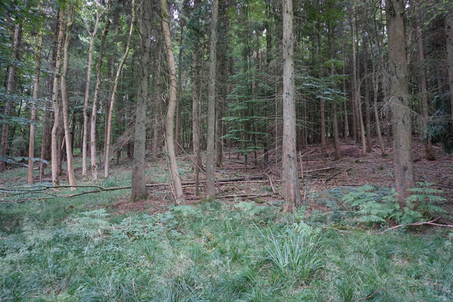
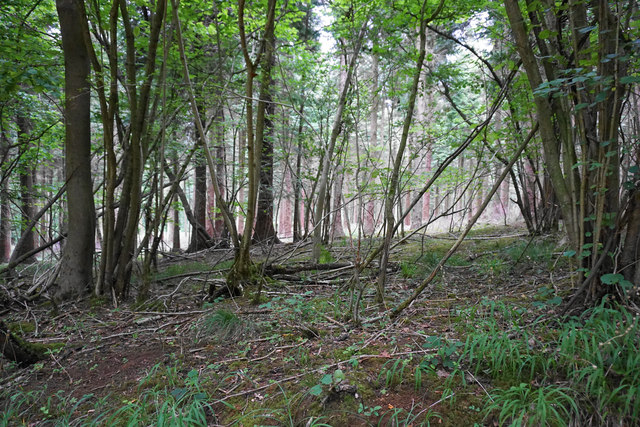
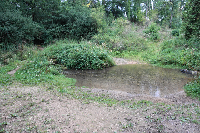
Castlett Wood is a picturesque woodland located in Gloucestershire, England. Spanning an area of approximately 100 acres, this forest is known for its natural beauty and diverse range of flora and fauna. It is situated within the enchanting Forest of Dean, a region renowned for its ancient woodlands and rich biodiversity.

The wood comprises a mixture of broadleaf and coniferous trees, creating a unique and varied habitat for wildlife. Oak, beech, and ash trees dominate the landscape, while Douglas fir and pine trees provide a contrasting evergreen backdrop. This blend of trees offers a delightful array of colors throughout the year, with vibrant greens in the spring and summer, and warm hues of red and orange in the autumn.

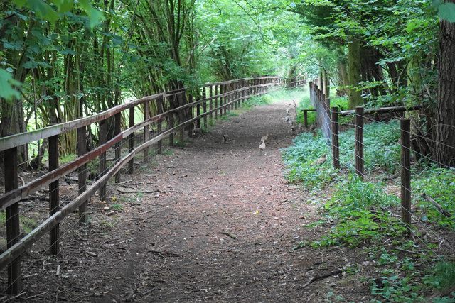
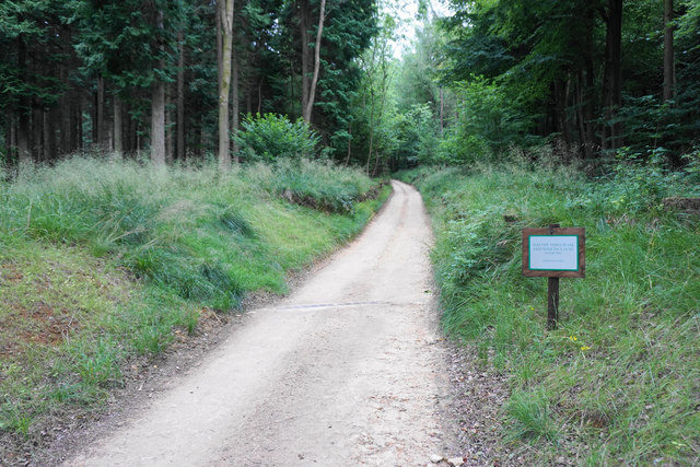
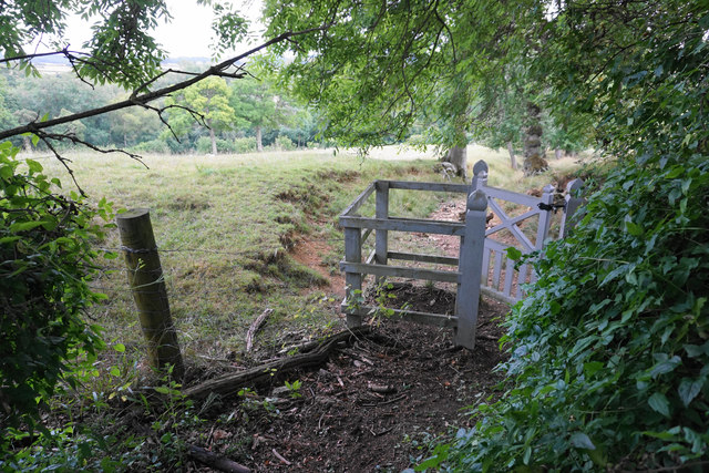
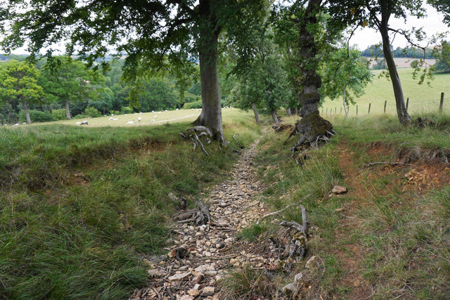
Visitors to Castlett Wood can enjoy a network of well-maintained footpaths that wind their way through the forest, allowing them to explore its hidden treasures. The wood is home to a diverse range of wildlife, including deer, foxes, badgers, and a variety of bird species. Nature enthusiasts can often spot woodpeckers, owls, and various songbirds within the canopy.

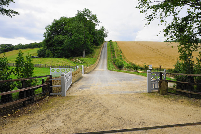
The tranquil atmosphere and natural beauty of Castlett Wood make it a popular destination for outdoor activities such as walking, hiking, and birdwatching. The wood also features picnic areas, providing a perfect spot for visitors to relax and immerse themselves in the peaceful surroundings.

Overall, Castlett Wood offers a captivating experience for nature lovers and those seeking a peaceful retreat amidst the stunning landscapes of Gloucestershire.

If you have any feedback on the listing, please let us know in the comments section below.

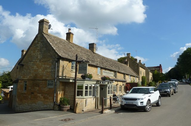
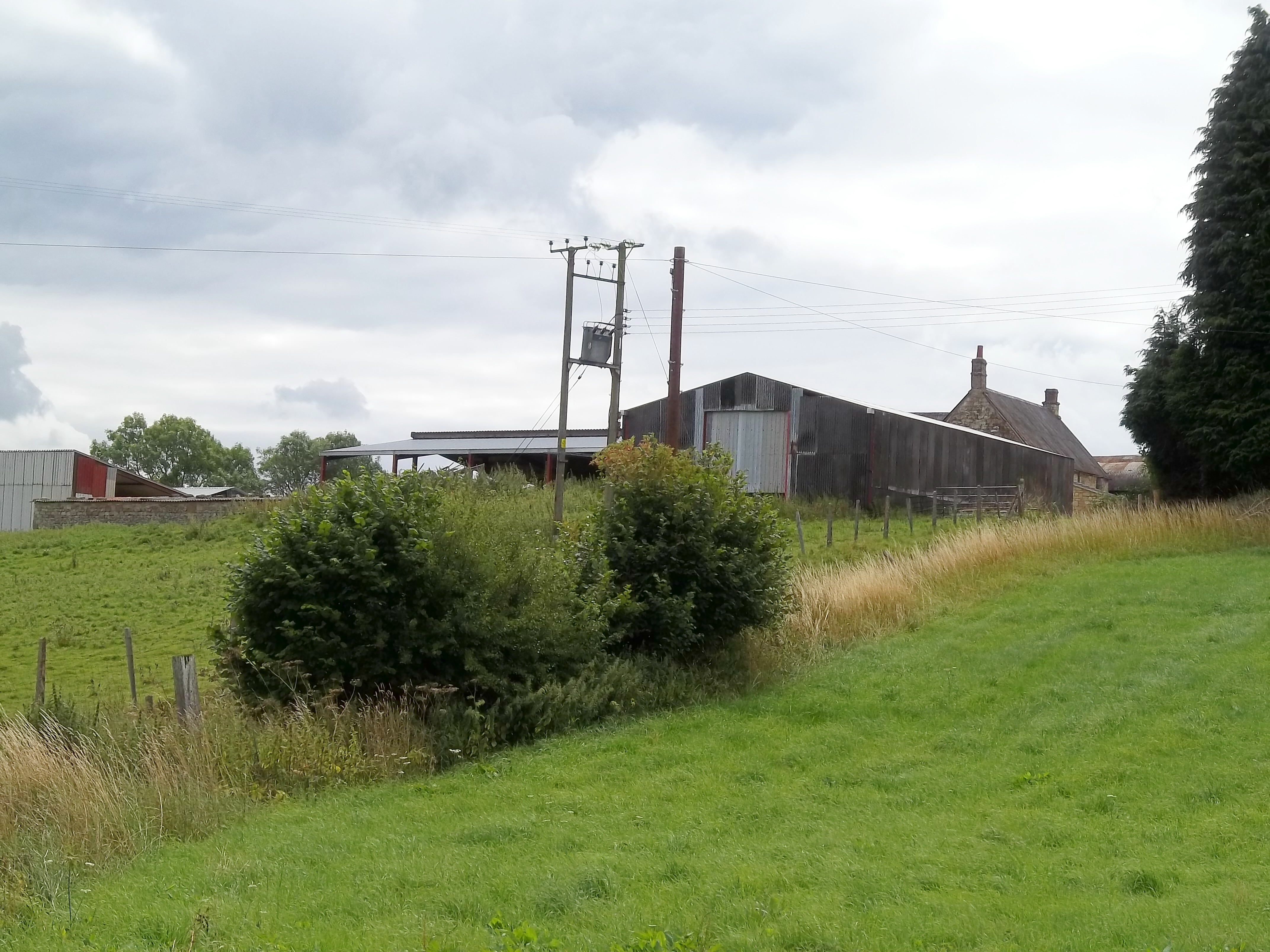
Castlett Wood Images

Images are sourced within 2km of 51.936186/-1.8844483 or Grid Reference SP0826. Thanks to Geograph Open Source API. All images are credited.

Guiting Power Baptist Church The church was closed and put on the market earlier this year, but I don't know whether a sale successfully went through. The building is Grade II listed.
Guiting Power Baptist Church
The church was closed and put on the market earlier this year, but I don't know whether a sale successfully went through. The building is Grade II listed.
Forest in Guiting Wood Looking up from the Wardens' Way.
Forest in Guiting Wood
Looking up from the Wardens' Way.
Path by Guiting Wood The path runs by the edge of the wood but there are still only limited opportunities to look out to the left. Ahead on the path are numerous pheasants scuttling away, and they provide an almost continuous rustling sound in the undergrowth.
Path by Guiting Wood
The path runs by the edge of the wood but there are still only limited opportunities to look out to the left. Ahead on the path are numerous pheasants scuttling away, and they provide an almost continuous rustling sound in the undergrowth.
Estate road by Guiting Wood Part of the Farmcote Estate. The road has been fairly recently constructed and does not appear on the OS map.
Estate road by Guiting Wood
Part of the Farmcote Estate. The road has been fairly recently constructed and does not appear on the OS map.
Track through Guiting Wood This part of the track is used by the Wardens' Way and the Winchcombe Way. The sign warns of electric fences but there are none in sight here.
Track through Guiting Wood
This part of the track is used by the Wardens' Way and the Winchcombe Way. The sign warns of electric fences but there are none in sight here.
Woodland in Guiting Wood The woodland is not thick here, but there are no views of any distance available.
Woodland in Guiting Wood
The woodland is not thick here, but there are no views of any distance available.
Sheep by Guiting Wood A rare view of open land from the path through the wood.
Sheep by Guiting Wood
A rare view of open land from the path through the wood.
Wardens' Way emerging from Guiting Wood The gate is in the locally universal Farmcote Estate livery.
Wardens' Way emerging from Guiting Wood
The gate is in the locally universal Farmcote Estate livery.
Path to Guiting Power The path is following a rough stream bed and it is much easier to walk on the grass up on the left.
Path to Guiting Power
The path is following a rough stream bed and it is much easier to walk on the grass up on the left.
Sheep above Castlett Wood Looking from the Wardens' Way across the hillside above a tributary of the River Windrush.
Sheep above Castlett Wood
Looking from the Wardens' Way across the hillside above a tributary of the River Windrush.
Road towards Farmcote The road is signed as unsuitable for motors though it is marked as yellow on the OS map. Top left is Wood House also known as Manor House, a Grade II listed building.
Road towards Farmcote
The road is signed as unsuitable for motors though it is marked as yellow on the OS map. Top left is Wood House also known as Manor House, a Grade II listed building.
Farm track near Guiting Power Part of the Wardens' Way, heading away from the village.
Farm track near Guiting Power
Part of the Wardens' Way, heading away from the village.
Harvested field above Castlett Farm The farm is in the trees on the other side of a tributary of the River Windrush. I think the last crop in this field was maize.
Harvested field above Castlett Farm
The farm is in the trees on the other side of a tributary of the River Windrush. I think the last crop in this field was maize.
Quarry sheds near Guiting Power Part of a business trying to meet the demand for Cotswold Stone.
Quarry sheds near Guiting Power
Part of a business trying to meet the demand for Cotswold Stone.
Ford over the river near Guiting Power The river is a tributary of the River Windrush, but I have been unable to find a name for it. People crossing by foot can take the small bridge on the left.
Ford over the river near Guiting Power
The river is a tributary of the River Windrush, but I have been unable to find a name for it. People crossing by foot can take the small bridge on the left.
Path to Guiting Power The path is climbing out of a small river valley.
Path to Guiting Power
The path is climbing out of a small river valley.
The Wardens' Way leaving Guiting Power This is the end of a dead-end residential road.
The Wardens' Way leaving Guiting Power
This is the end of a dead-end residential road.
The Hollow Bottom, Guiting Power This pub in the Cotswold village of Guiting Power has the unusual name "The Hollow Bottom". It has quite a horse-racing theme inside and is distinctly contemporary in décor. Their own website here <span class="nowrap"><a title="http://hollowbottom.com" rel="nofollow ugc noopener" href="http://hollowbottom.com">Link</a><img style="margin-left:2px;" alt="External link" title="External link - shift click to open in new window" src="https://s1.geograph.org.uk/img/external.png" width="10" height="10"/></span>
The Hollow Bottom, Guiting Power
This pub in the Cotswold village of Guiting Power has the unusual name "The Hollow Bottom". It has quite a horse-racing theme inside and is distinctly contemporary in décor. Their own website here LinkExternal link
Show me another place!

Castlett Wood is located at Grid Ref: SP0826 (Lat: 51.936186, Lng: -1.8844483)

Administrative County: Gloucestershire

District: Cotswold

Police Authority: Gloucestershire

What 3 Words

///blocks.retail.twee. Near Winchcombe, Gloucestershire

Nearby Locations

Castlett Wood

Related Wikis

Temple Guiting Preceptory

Temple Guiting Preceptory was a medieval monastic house of the Knights Templar in Gloucestershire, England. It was founded around the middle of the twelfth...

Barton, Gloucestershire

Barton is a village in Gloucestershire, on the Windrush River, near Naunton. It appears in written records as Berton as early as 1287. The manor was acquired...

Pinnock and Hyde

Pinnock and Hyde was a township and civil parish in the Cotswolds in Gloucestershire, England. It lies 4 miles (6.4 km) east of the town of Winchcombe...

Manor Farmhouse, Temple Guiting

Temple Guiting Manor is an early 16th-century house at Temple Guiting, Gloucestershire, England. It is a Grade I listed building, and is in private ownership...

Nearby Amenities

Located within 500m of 51.936186,-1.8844483
Barrier: kissing_gate
Lat/Long: 51.9330299/-1.8825332
Barrier: kissing_gate
Lat/Long: 51.9338355/-1.8839239
Pump Bottom
Power: pole
Transformer: distribution
Voltage Primary: 11000
Lat/Long: 51.9328652/-1.8824366
Power: pole
Lat/Long: 51.932223/-1.8833464
The data included in this document is from www.openstreetmap.org. The data is made available under ODbL.

Have you been to Castlett Wood?

Leave your review of Castlett Wood below (or comments, questions and feedback).