Millmoorhead Wood

Wood, Forest in Staffordshire Staffordshire Moorlands

England

Millmoorhead Wood

Access Lane leading to Folds End Farm Adopted by the Manifold Trail long distance footpath, this access lane heads off the High Street in Longnor towards Folds End Farm
Access Lane leading to Folds End Farm Credit: Chris Heaton

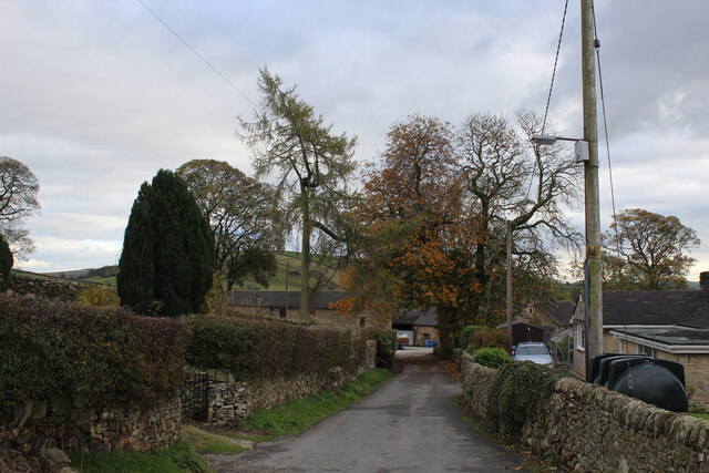
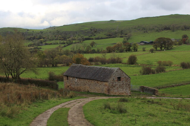
Millmoorhead Wood is a picturesque woodland located in the county of Staffordshire, England. Covering an area of approximately 50 acres, it is a popular destination for nature enthusiasts and outdoor enthusiasts alike. The wood is situated near the town of Stafford and is easily accessible by road.

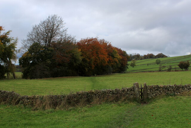
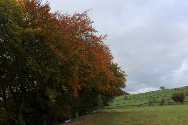
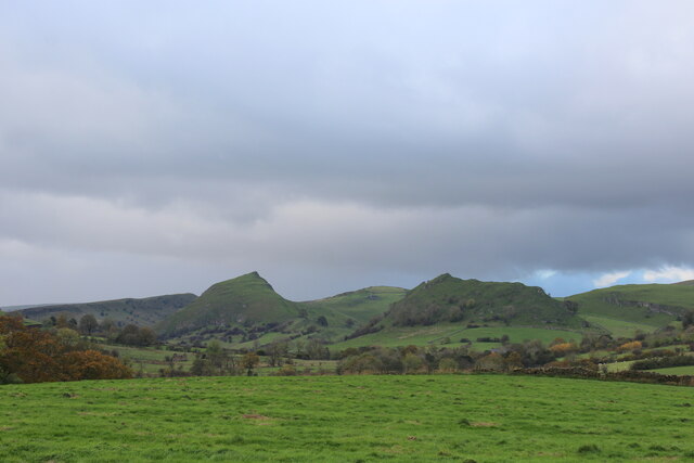
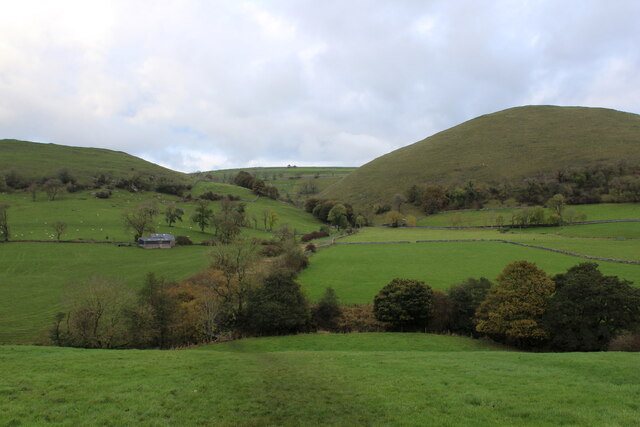
The woodland is characterized by its diverse range of tree species, including oak, beech, birch, and pine. These majestic trees provide a rich canopy, creating a tranquil and shady environment. The forest floor is adorned with an array of wildflowers and ferns, adding to the natural beauty of the area.

Millmoorhead Wood is home to a variety of wildlife, making it an ideal spot for wildlife enthusiasts and bird watchers. Visitors may be fortunate enough to spot deer, squirrels, rabbits, and a wide range of bird species including woodpeckers and owls.

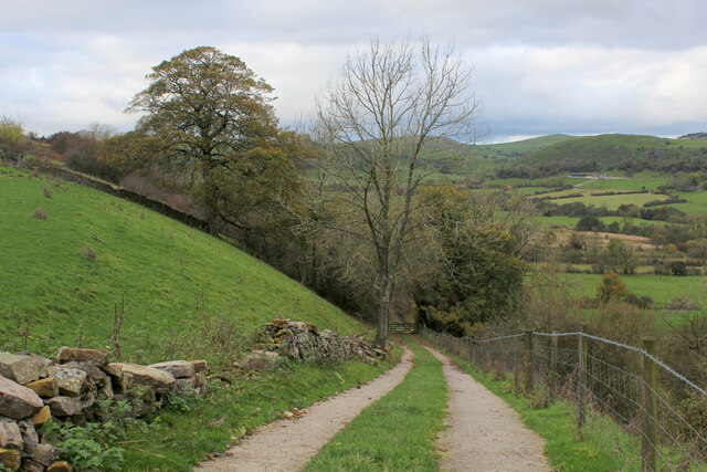
The wood features a network of well-maintained walking trails, allowing visitors to explore and appreciate the natural surroundings at their own pace. These paths wind through the forest, offering breathtaking views and opportunities for peaceful reflection. Additionally, there is a designated picnic area where visitors can relax and enjoy a meal amidst the tranquil setting.

The wood is managed by local authorities, ensuring its conservation and protection for future generations. Regular maintenance activities such as tree thinning and path clearing are carried out to preserve the natural balance of the ecosystem.

Overall, Millmoorhead Wood is a hidden gem in Staffordshire, providing a haven of peace and tranquility for those seeking a break from the hustle and bustle of everyday life.

If you have any feedback on the listing, please let us know in the comments section below.

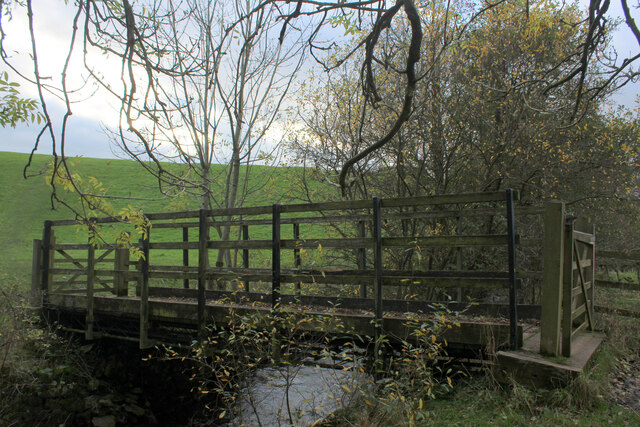
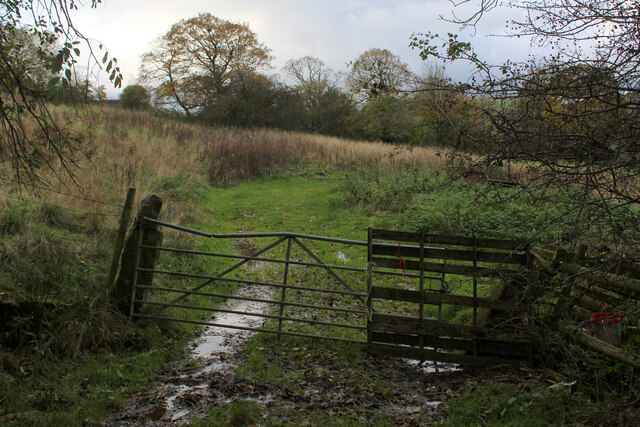
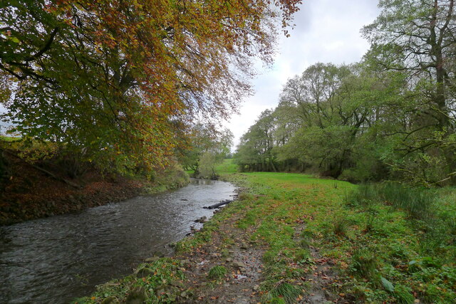
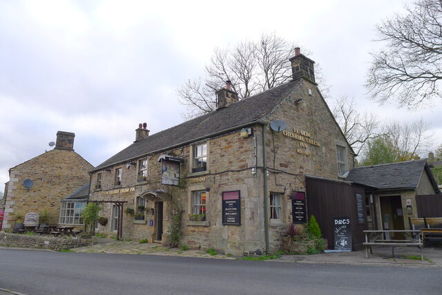
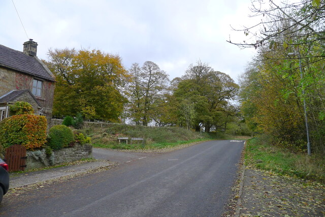
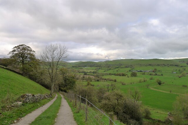
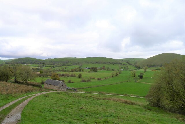
Millmoorhead Wood Images

Images are sourced within 2km of 53.178395/-1.8857987 or Grid Reference SK0764. Thanks to Geograph Open Source API. All images are credited.

Access Lane leading to Folds End Farm Adopted by the Manifold Trail long distance footpath, this access lane heads off the High Street in Longnor towards Folds End Farm
Access Lane leading to Folds End Farm
Adopted by the Manifold Trail long distance footpath, this access lane heads off the High Street in Longnor towards Folds End Farm
The Farmyard at Folds End The Manifold Trail long distance footpath passes through here
The Farmyard at Folds End
The Manifold Trail long distance footpath passes through here
Manifold Trail South of Longnor Long Distance Footpath that starts at Manifold Head near the village of Flash, following the river downstream through Longnor, Brund, Hulme End, Ilam to its confluence with the River Dove - a distance of 23 miles.
Manifold Trail South of Longnor
Long Distance Footpath that starts at Manifold Head near the village of Flash, following the river downstream through Longnor, Brund, Hulme End, Ilam to its confluence with the River Dove - a distance of 23 miles.
Line of Trees beside the River Manifold The Manifold Trail passes by these trees, south of Longnor Village
Line of Trees beside the River Manifold
The Manifold Trail passes by these trees, south of Longnor Village
High Street, Longnor
Barn in Upper Dovedale Passed by on Green Lane, traversing across the Dove Valley.
Barn in Upper Dovedale
Passed by on Green Lane, traversing across the Dove Valley.
Descending from Top o' th' Edge Descending into the Dove Valley from Longnor
Descending from Top o' th' Edge
Descending into the Dove Valley from Longnor
Looking up Dovedale Looking towards the upper reaches of the Dove Valley, with the distinctive lines of Chrome Hill clearly visible.
Looking up Dovedale
Looking towards the upper reaches of the Dove Valley, with the distinctive lines of Chrome Hill clearly visible.
Crossing Dovedale Traversing the breadth of Dovedale on Green Lane
Crossing Dovedale
Traversing the breadth of Dovedale on Green Lane
Beggar's Bridge Wooden bridge spanning the River Dove - crossing the county boundary between Staffordshire and Derbyshire
Beggar's Bridge
Wooden bridge spanning the River Dove - crossing the county boundary between Staffordshire and Derbyshire
Rough Pasture near Underhill Farm
The River Manifold below Longnor Straightening of the river channel (deliberately reducing natural bends), in the upper sections of the Manifold, has reduced its value as a fishery habitat <span class="nowrap"><a title="https://www.wildtrout.org/assets/reports/Manifold_DCAC_2019_comp.pdf" rel="nofollow ugc noopener" href="https://www.wildtrout.org/assets/reports/Manifold_DCAC_2019_comp.pdf">Link</a><img style="margin-left:2px;" alt="External link" title="External link - shift click to open in new window" src="https://s1.geograph.org.uk/img/external.png" width="10" height="10"/></span>
The River Manifold below Longnor
Straightening of the river channel (deliberately reducing natural bends), in the upper sections of the Manifold, has reduced its value as a fishery habitat LinkExternal link
Ye Olde Cheshire Cheese Inn, Longnor
The Market Hall, Longnor Dated 1873. "Of eclectic style ..." <span class="nowrap"><a title="https://historicengland.org.uk/listing/the-list/list-entry/1262213" rel="nofollow ugc noopener" href="https://historicengland.org.uk/listing/the-list/list-entry/1262213">Link</a><img style="margin-left:2px;" alt="External link" title="External link - shift click to open in new window" src="https://s1.geograph.org.uk/img/external.png" width="10" height="10"/></span>
The Market Hall, Longnor
Dated 1873. "Of eclectic style ..." LinkExternal link
High Street leading east out of Longnor Longnor sits on a prominent ridge between the valleys of the River Manifold and the River Dove. The lane to the left, Dove Ridge, leads to Top o' th' Edge, an escarpment overlooking the Dove valley.
High Street leading east out of Longnor
Longnor sits on a prominent ridge between the valleys of the River Manifold and the River Dove. The lane to the left, Dove Ridge, leads to Top o' th' Edge, an escarpment overlooking the Dove valley.
Track down to the Dove valley from Top o' th' Edge, Longnor Longnor (to the left) sits atop a ridge of sandstone ('millstone grit'); the Dove flows through softer shale.
Track down to the Dove valley from Top o' th' Edge, Longnor
Longnor (to the left) sits atop a ridge of sandstone ('millstone grit'); the Dove flows through softer shale.
Upper Dovedale The River Dove flows along a dale underlain by the softer lithology of Bowland Shale, bounded by ridges of harder rocks: on this side by millstone grit (Longnor Sandstone), and on the far side by  reef limestones
Upper Dovedale
The River Dove flows along a dale underlain by the softer lithology of Bowland Shale, bounded by ridges of harder rocks: on this side by millstone grit (Longnor Sandstone), and on the far side by reef limestones
Farmland below the road east of Longnor
Show me another place!

Millmoorhead Wood is located at Grid Ref: SK0764 (Lat: 53.178395, Lng: -1.8857987)

Administrative County: Staffordshire

District: Staffordshire Moorlands

Police Authority: Staffordshire

What 3 Words

///erase.scope.trembles. Near Buxton, Derbyshire

Nearby Locations

Millmoorhead Wood

Related Wikis

Fawfieldhead

Fawfieldhead is a civil parish in Staffordshire, England. It is situated north-east of Leek and south of Buxton, in the Peak District National Park....

St Bartholomew's Church, Longnor

The Church of St Bartholomew is a Grade II* listed Anglican church in the village of Longnor in north-east Staffordshire. It was built in the late 18th...

Longnor, Staffordshire

Longnor is a village in the Staffordshire Peak District, England. The settlement dates from early times, the first recorded church building being in the...

Hollinsclough

Hollinsclough is a small rural village in the county of Staffordshire in the English Midlands. It is within the Peak District National Park. == Location... ==

Parkhouse Hill

Parkhouse Hill is a small but distinctive hill in the Peak District National Park of the Hartington Middle Quarter civil parish, in the English county...

Crowdecote

Crowdecote (sometimes spelled Crowdicote) is a small village in Derbyshire, England. It is situated on the border between Derbyshire and Staffordshire...

High Wheeldon

High Wheeldon is a distinctive dome-shaped hill near the Staffordshire border in Hartington Middle Quarter civil parish, Derbyshire, in the Peak District...

Earl Sterndale

Earl Sterndale is a village in the Upper Dove Valley in the Peak District, Derbyshire, England, situated near the River Dove, 5 miles south of Buxton,...

Nearby Amenities

Located within 500m of 53.178395,-1.8857987
Barrier: stile
Material: stone
Source: survey;gps
Stile: stepover
Lat/Long: 53.1750131/-1.8825625
Barrier: stile
Material: stone
Source: survey;gps
Stile: stepover
Lat/Long: 53.1774516/-1.8818844
The data included in this document is from www.openstreetmap.org. The data is made available under ODbL.

Have you been to Millmoorhead Wood?

Leave your review of Millmoorhead Wood below (or comments, questions and feedback).