Bog Plantation

Wood, Forest in Northumberland

England

Bog Plantation

Garleigh Hill
Garleigh Hill Credit: David Brown

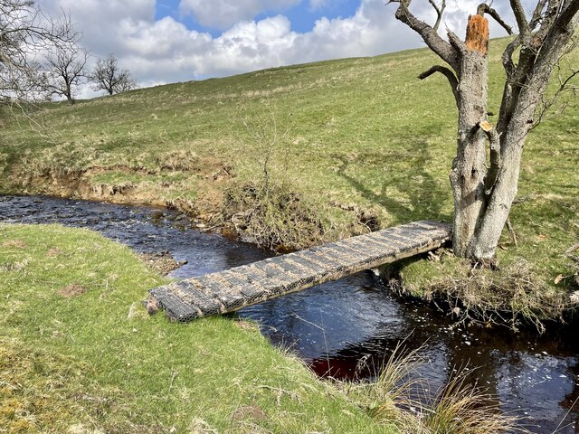
Bog Plantation is a stunning woodland located in the county of Northumberland, England. Spanning over a vast area, this plantation is known for its unique bog environment and diverse range of plant and animal species. It is situated near the village of Bog, which is surrounded by picturesque countryside and rolling hills.

The main feature of Bog Plantation is its extensive bog habitat, which is a type of wetland characterized by acidic and waterlogged conditions. This environment supports a rich variety of plant life, including mosses, sedges, and carnivorous plants like sundews and bladderworts. The bogs also provide a habitat for numerous bird species, such as curlews and snipes, which find food and nesting sites in the wetland areas.

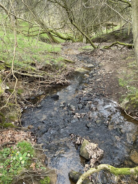
In addition to the bog, the plantation consists of a mixed woodland, featuring a range of tree species such as oak, beech, and birch. These trees provide a canopy cover, creating a cool and shaded environment beneath. The woodland is home to a wide array of wildlife, including deer, foxes, squirrels, and a variety of bird species like woodpeckers and owls.

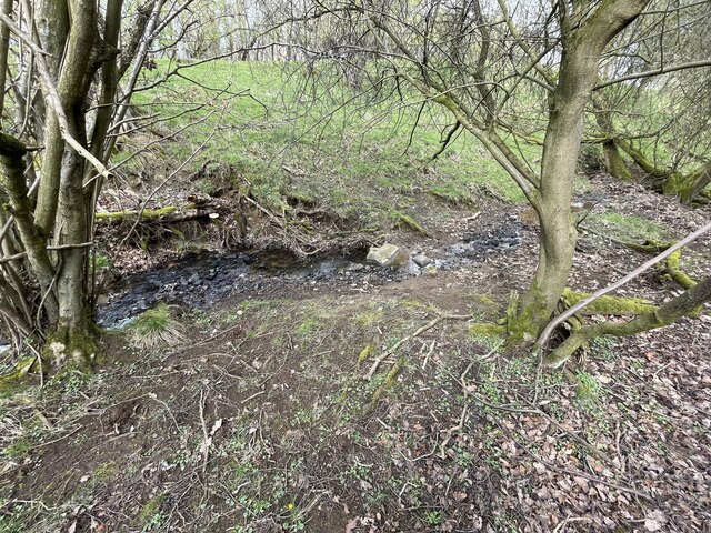
Bog Plantation offers visitors a chance to explore its natural beauty through a network of well-maintained trails and footpaths. The plantation is popular among nature enthusiasts, hikers, and birdwatchers, who can enjoy the tranquility and serenity of this unique woodland. The site also provides educational opportunities, with guided tours and information boards available to learn more about the flora and fauna that call Bog Plantation their home.

Overall, Bog Plantation in Northumberland is a remarkable destination for those seeking to immerse themselves in the beauty of a bog habitat and explore the wonders of a diverse woodland ecosystem.

If you have any feedback on the listing, please let us know in the comments section below.

Bog Plantation Images

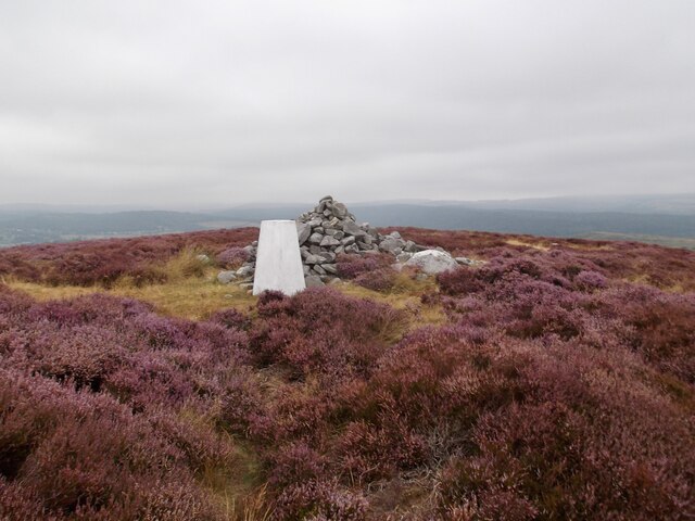
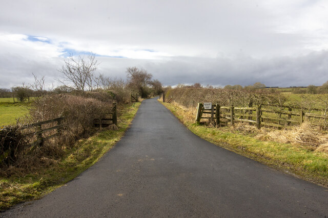
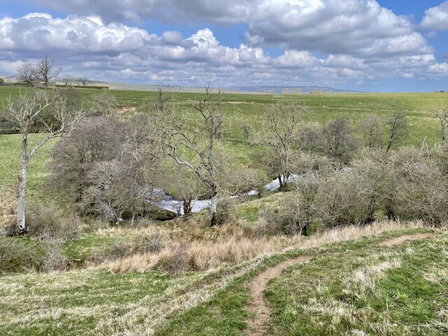
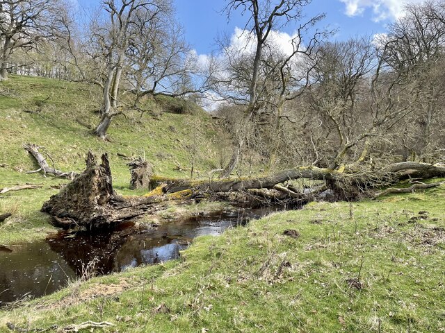
Images are sourced within 2km of 55.276102/-1.8810204 or Grid Reference NZ0798. Thanks to Geograph Open Source API. All images are credited.

Garleigh Hill
Garleigh Hill
The new Lordenshaw This woodland surrounding Lordenshaw, extensively damaged a year ago by Storm Arwen, is in the final stages of being cleared and harvested.  It will transform the outlook from the farm.
The new Lordenshaw
This woodland surrounding Lordenshaw, extensively damaged a year ago by Storm Arwen, is in the final stages of being cleared and harvested. It will transform the outlook from the farm.
Farm track
Farm track
Moorland
Moorland
Gateway to field with public footpath
Brockley Hall Farm Vernacular farm buildings at Brockley Hall Farm
Brockley Hall Farm
Vernacular farm buildings at Brockley Hall Farm
Forest Burn valley and flood plain
Ash Dieback and Storm Arwen A deadly combination.
Ash Dieback and Storm Arwen
A deadly combination.
New bridge across the Forest Burn
Curious disappearing stream This stream is a relatively short one, only some 900m in length, but despite beginning life as quite a profuse spring at its main source <a href="https://www.geograph.org.uk/photo/7583026">NZ0795 : Iron rich spring</a>, by the time it reaches the Forest Burn it has become a dry valley, <a href="https://www.geograph.org.uk/photo/6506740">NZ0796 : Forest Burn tributary</a>.  The large rock near the centre of the picture is where it disappears into the stream bed.  This might possibly be a consequence of past mine workings in this area.
Curious disappearing stream
This stream is a relatively short one, only some 900m in length, but despite beginning life as quite a profuse spring at its main source NZ0795 : Iron rich spring, by the time it reaches the Forest Burn it has become a dry valley, NZ0796 : Forest Burn tributary. The large rock near the centre of the picture is where it disappears into the stream bed. This might possibly be a consequence of past mine workings in this area.
Curious disappearing stream This stream is a relatively short one, only some 900m in length, but despite beginning life as quite a profuse spring at its main source, by the time it reaches the Forest Burn it has become a dry valley, <a href="https://www.geograph.org.uk/photo/6506740">NZ0796 : Forest Burn tributary</a>. The large rock near the centre of the picture is where it disappears into the stream bed. This might possibly be a consequence of past mine workings in this area.
Curious disappearing stream
This stream is a relatively short one, only some 900m in length, but despite beginning life as quite a profuse spring at its main source, by the time it reaches the Forest Burn it has become a dry valley, NZ0796 : Forest Burn tributary. The large rock near the centre of the picture is where it disappears into the stream bed. This might possibly be a consequence of past mine workings in this area.
Moorland below Garleigh Crags The Simonside Hills in the distance.
Moorland below Garleigh Crags
The Simonside Hills in the distance.
Roadside bush below Garleigh Crags
Garleigh Hill
Garleigh Hill
Sheep on rough grazing land To the east of the B6342 Rothbury road.
Sheep on rough grazing land
To the east of the B6342 Rothbury road.
Industrial relic On Wards Hill, which was once a hive of industrial activity, but now is home to well bred sheep and cattle. Cattle feeders are seen standing behind the concrete block. The block has steel rope running through it. The round cattle feeder stands on a concrete base that once served a far different purpose.
Industrial relic
On Wards Hill, which was once a hive of industrial activity, but now is home to well bred sheep and cattle. Cattle feeders are seen standing behind the concrete block. The block has steel rope running through it. The round cattle feeder stands on a concrete base that once served a far different purpose.
Broken but still up Evidence can be seen on this rock outcrop that an attempt was made to break it from the upper level of the Quarry. The rock won the fight.
Broken but still up
Evidence can be seen on this rock outcrop that an attempt was made to break it from the upper level of the Quarry. The rock won the fight.
Remains of an industrial past It is remarkable how nature has taken over, with a little help from man.

Just peeking over the top of the quarry edge can be seen the range of Simonside hills.
Remains of an industrial past
It is remarkable how nature has taken over, with a little help from man. Just peeking over the top of the quarry edge can be seen the range of Simonside hills.
Show me another place!

Bog Plantation is located at Grid Ref: NZ0798 (Lat: 55.276102, Lng: -1.8810204)

Unitary Authority: Northumberland

Police Authority: Northumbria

What 3 Words

///capers.occupiers.slide. Near Rothbury, Northumberland

Nearby Locations

Bog Plantation

Related Wikis

Hesleyhurst

Hesleyhurst is a civil parish in the county of Northumberland in England. At the 2011 Census the population was only minimal. It is served by a joint parish...

Brinkburn railway station

Brinkburn was a weatherboard- and corrugated-iron-built railway station in Northumberland on the Rothbury Branch built to serve the Healy Coate Colliery...
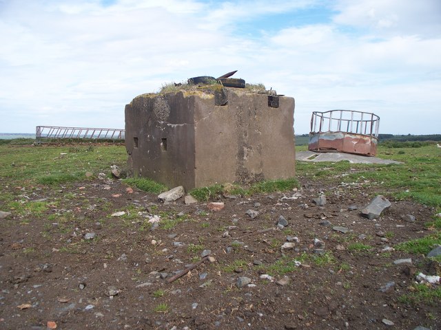
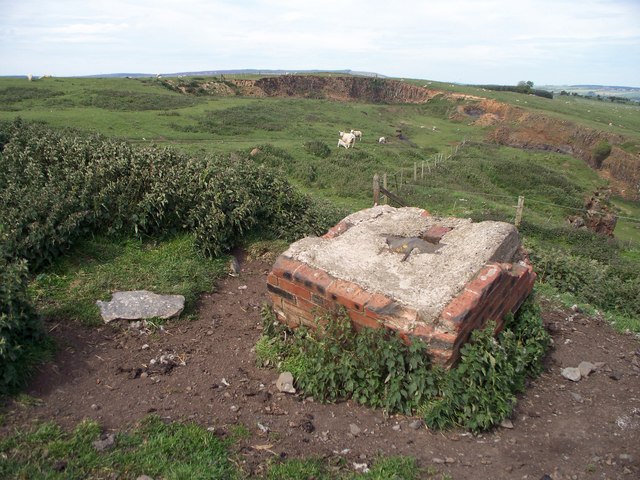
Cragend Silo

Cragend Silo is a Grade II* listed building located at Cragend Farm near the town of Rothbury in Northumberland, England. It was designed and built by...

Thrum Mill, Rothbury, Northumberland

The Thrum Mill is a grade II-listed water mill in Rothbury, Northumberland, England. The water mill dates back to 1665. == Media == The renovation of Thrum...

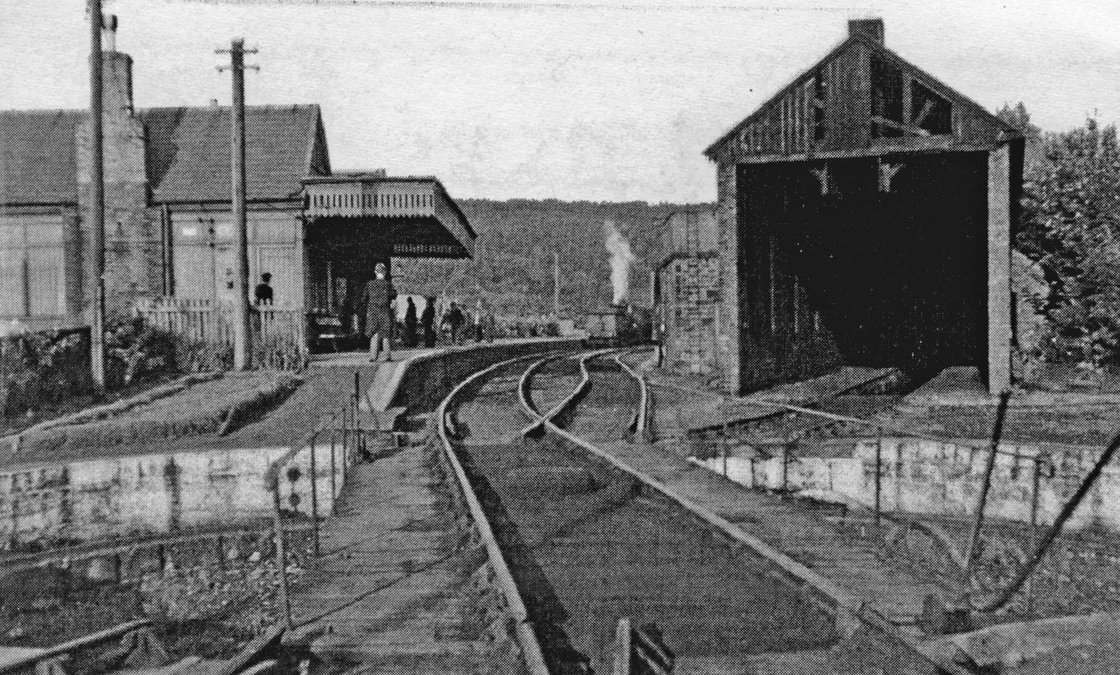
Rothbury railway station

Rothbury was a railway station in Northumberland, England at the end of the single-track Rothbury Branch that served the town of Rothbury. Rothbury was...

Brinkburn

Brinkburn is a civil parish in Northumberland, England. It is divided by the River Coquet. The parish includes the hamlet of Pauperhaugh. == History... ==

Rothbury Community Hospital

Rothbury Community Hospital in Rothbury, Northumberland, England, is managed by the Northumbria Healthcare NHS Foundation Trust. == History == === Prior... ===

Brinkburn Priory

Brinkburn Priory is a former monastery built, starting in the 12th century, on a bend of the River Coquet, about 4 miles (6 km) east of Rothbury, Northumberland...

Nearby Amenities

Located within 500m of 55.276102,-1.8810204
Power: pole
Lat/Long: 55.2737628/-1.8745242
Power: pole
Lat/Long: 55.2749057/-1.8747019
Power: pole
Lat/Long: 55.2790122/-1.8808198
Power: pole
Lat/Long: 55.2794003/-1.8793605
Power: pole
Lat/Long: 55.2798236/-1.8777723
The data included in this document is from www.openstreetmap.org. The data is made available under ODbL.

Have you been to Bog Plantation?

Leave your review of Bog Plantation below (or comments, questions and feedback).