Hillhead Plantation
Wood, Forest in Derbyshire High Peak
England
Hillhead Plantation

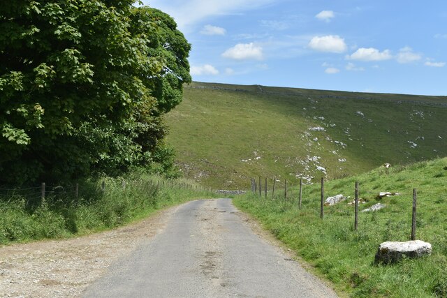
Hillhead Plantation is a picturesque woodland located in the county of Derbyshire, England. Nestled in the heart of the Peak District National Park, this enchanting forest covers an area of approximately 100 hectares.
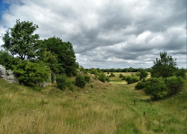
The plantation is predominantly composed of native broadleaf trees such as oak, beech, and birch, which create a stunning canopy that provides shade and shelter to the various species of wildlife that call this woodland home. The forest floor is adorned with a vibrant tapestry of wildflowers, ferns, and mosses, adding to the natural beauty of the area.
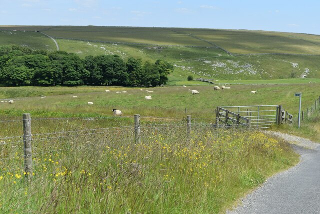
Hillhead Plantation offers visitors a tranquil and serene escape from the bustling city life, making it a popular destination for nature enthusiasts, hikers, and birdwatchers. The diverse ecosystem supports a wide range of fauna, including deer, foxes, badgers, and numerous species of birds such as woodpeckers and owls.
The woodland is crisscrossed by a network of well-maintained walking trails, allowing visitors to explore the plantation at their own pace. These paths meander through the forest, offering breathtaking views of the surrounding landscape and providing ample opportunities for photography or simply enjoying the peaceful ambiance.
Hillhead Plantation is also home to a variety of recreational activities, including picnic areas and designated spots for camping. It is a popular destination for families, offering a chance to reconnect with nature and indulge in outdoor activities.
Overall, Hillhead Plantation is a natural haven that showcases the beauty of Derbyshire's woodlands. With its diverse flora and fauna, picturesque trails, and range of recreational facilities, it is a must-visit destination for anyone seeking solace in nature.
If you have any feedback on the listing, please let us know in the comments section below.
Hillhead Plantation Images
Images are sourced within 2km of 53.226947/-1.8892798 or Grid Reference SK0769. Thanks to Geograph Open Source API. All images are credited.


Hillhead Plantation is located at Grid Ref: SK0769 (Lat: 53.226947, Lng: -1.8892798)
Administrative County: Derbyshire
District: High Peak
Police Authority: Derbyshire
What 3 Words
///uplifting.jolt.tiger. Near Buxton, Derbyshire
Nearby Locations
Related Wikis
Harpur Hill Quarry
Harpur Hill Quarry is a disused limestone quarry on Harpur Hill, Derbyshire, England. Limestone was extracted there from 1835 to 1952 for lime burning...

Hindlow railway station
Hindlow railway station was opened for goods in 1833 near to Hindlow near King Sterndale to the south east of Buxton, Derbyshire on the Cromford and High...
Harpur Hill
Harpur Hill is a small village on the outskirts of Buxton, Derbyshire, England. It is in the Cote Heath ward of the High Peak Borough Council. It has...

High Edge
High Edge is a limestone hill overlooking Harpur Hill, Buxton in Derbyshire, in the Peak District. The summit is 472 metres (1,549 ft) above sea level...
Health and Safety Laboratory
The Health and Safety Laboratory (HSE Laboratory or HSL Buxton) is a large 550-acre research site in rural High Peak, Derbyshire, south of Buxton. It researches...

RAF Harpur Hill
RAF Harpur Hill is a former Royal Air Force station, situated at Harpur Hill near Buxton, Derbyshire in England. The site was operational from 1938 to...

Hollins Hill
Hollins Hill is a gritstone hill in the Derbyshire Peak District near the village of Hollinsclough. The summit is 450 metres (1,480 ft) above sea level...

Deep Dale
Deep Dale is a short steep-sided gorge near Buxton, Derbyshire, in the Peak District of England. It is distinct from another Deep Dale, near Sheldon, 4...
Nearby Amenities
Located within 500m of 53.226947,-1.8892798Have you been to Hillhead Plantation?
Leave your review of Hillhead Plantation below (or comments, questions and feedback).