Currie

Settlement in Midlothian

Scotland

Currie

28 Weaver's Knowe Crescent, Currie 1960s Wimpey private housing on an estate to the west of Edinburgh. Semi-detached, three bedrooms, two 'public' rooms and kitchen. Gas fire but no central heating. See <a href="https://www.geograph.org.uk/photo/479755">NT1768 : 1960s housing estate, Currie, suburban Edinburgh</a> for an aerial view of the estate; this house is the one to the left of the pylon visible in that picture. For information, it cost us £3650.
28 Weaver's Knowe Crescent, Currie Credit: M J Richardson

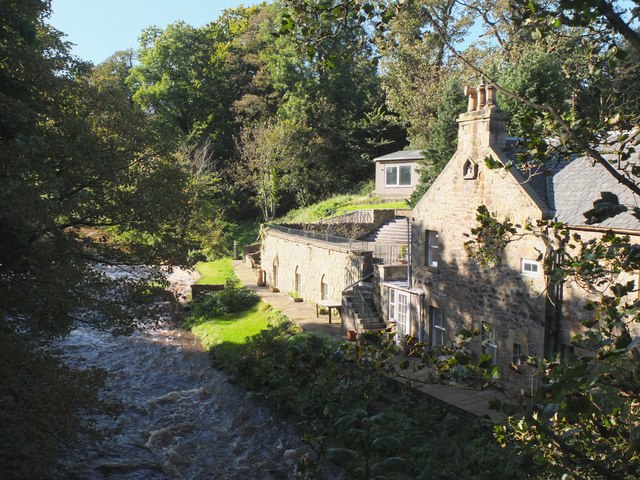
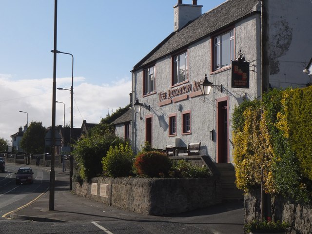
Currie is a charming suburban village located in Midlothian, Scotland. Situated on the southwestern outskirts of Edinburgh, it lies along the Water of Leith, offering residents picturesque views and a peaceful atmosphere. With a population of around 8,000, Currie is a close-knit community known for its strong sense of community spirit.

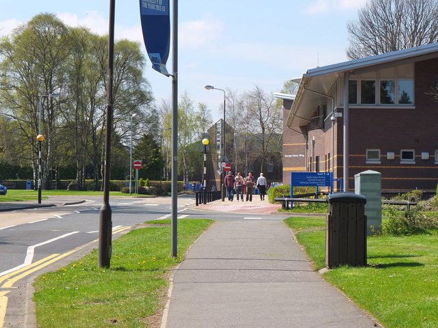
The village is well-connected to the surrounding areas, with regular bus services and a nearby railway station providing easy access to Edinburgh and other towns in Midlothian. Additionally, it benefits from its proximity to major roads such as the A70 and Edinburgh City Bypass, making it an ideal location for commuters.

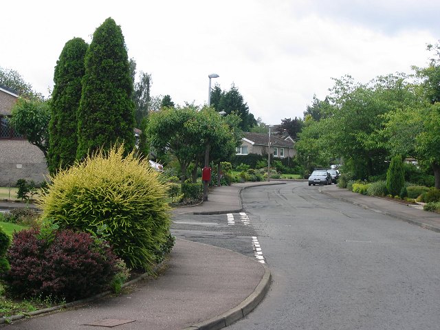
Currie boasts a range of amenities, including several local shops, cafes, and restaurants, providing residents with convenient options for their daily needs. The village also has a primary school and a high school, ensuring that families have access to quality education.

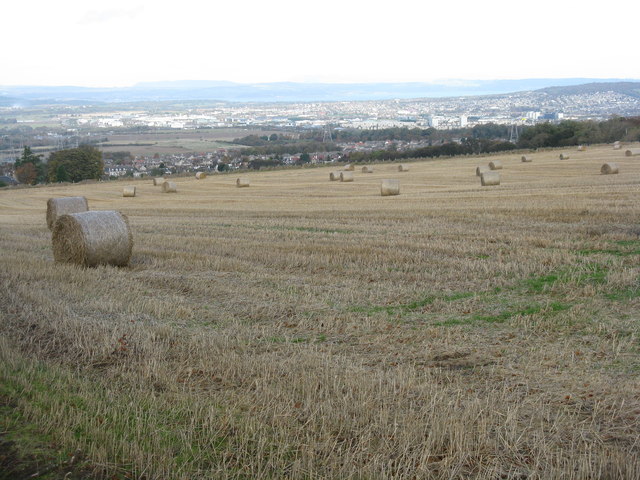
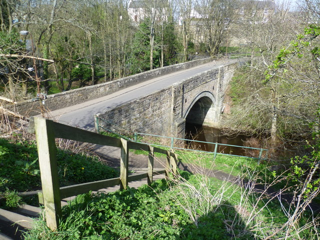
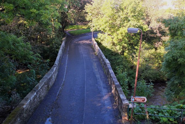
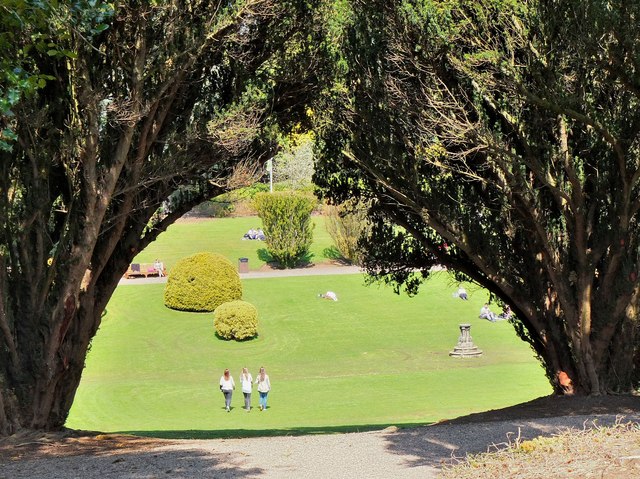
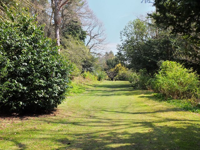
Nature enthusiasts will find plenty to explore in Currie, with nearby attractions like the Pentland Hills Regional Park, offering beautiful hiking trails and stunning landscapes. The Water of Leith Walkway, a scenic path that stretches from Balerno to Leith, passes through Currie, providing residents with an opportunity to enjoy tranquil strolls along the riverbank.

Overall, Currie offers a peaceful and family-friendly environment with easy access to both urban and natural attractions. Its strong community spirit, coupled with its convenient location, makes it an attractive place to live for individuals and families seeking a balance between countryside living and urban convenience.

If you have any feedback on the listing, please let us know in the comments section below.
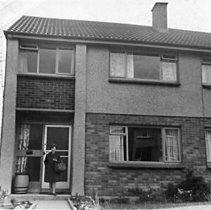
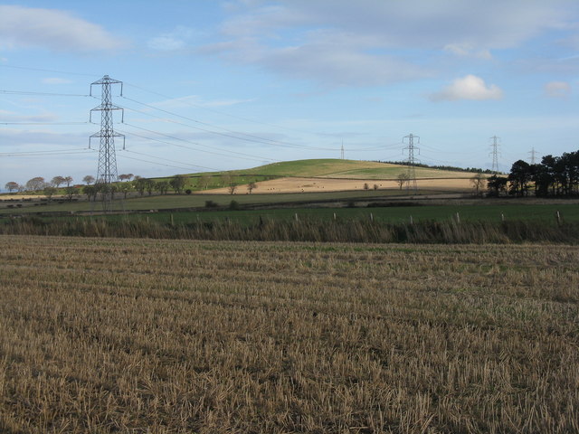
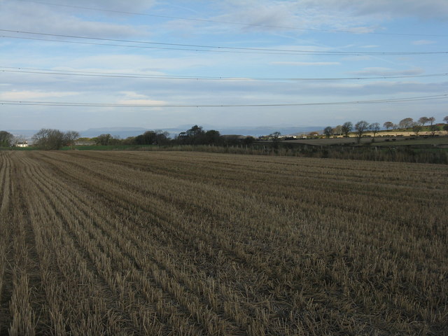
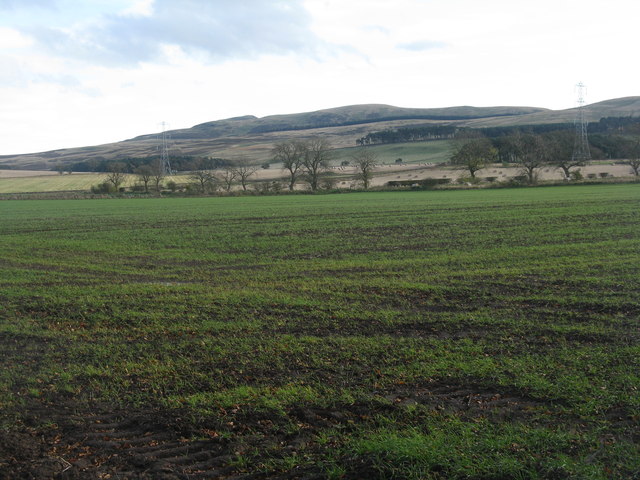
Currie Images

Images are sourced within 2km of 55.897431/-3.313337 or Grid Reference NT1767. Thanks to Geograph Open Source API. All images are credited.

28 Weaver's Knowe Crescent, Currie 1960s Wimpey private housing on an estate to the west of Edinburgh. Semi-detached, three bedrooms, two 'public' rooms and kitchen. Gas fire but no central heating. See <a href="https://www.geograph.org.uk/photo/479755">NT1768 : 1960s housing estate, Currie, suburban Edinburgh</a> for an aerial view of the estate; this house is the one to the left of the pylon visible in that picture. For information, it cost us £3650.
28 Weaver's Knowe Crescent, Currie
1960s Wimpey private housing on an estate to the west of Edinburgh. Semi-detached, three bedrooms, two 'public' rooms and kitchen. Gas fire but no central heating. See NT1768 : 1960s housing estate, Currie, suburban Edinburgh for an aerial view of the estate; this house is the one to the left of the pylon visible in that picture. For information, it cost us £3650.
Farmland at Easter Kinleith Barley stubbles and pasture, leading up to Warklaw Hill.
Farmland at Easter Kinleith
Barley stubbles and pasture, leading up to Warklaw Hill.
Barley stubble at Easter Kinleith. Looking north to the Lomond Hills of Fife, just visible on the centre horizon 40km away.
Barley stubble at Easter Kinleith.
Looking north to the Lomond Hills of Fife, just visible on the centre horizon 40km away.
Winter cereals at Kinleith Looking across the trees lining the Kinleith Burn towards Capelaw Hill.
Winter cereals at Kinleith
Looking across the trees lining the Kinleith Burn towards Capelaw Hill.
The view from the top of Currie Kirkgate A good viewpoint for the whole of western Edinburgh, with Currie in the valley of the Water of Leith beyond the field. Corstorphine Hill is the wooded hump on the right, and the Gyle and Hermiston Gait business and shopping areas provide most of the whiteness on the left.
The view from the top of Currie Kirkgate
A good viewpoint for the whole of western Edinburgh, with Currie in the valley of the Water of Leith beyond the field. Corstorphine Hill is the wooded hump on the right, and the Gyle and Hermiston Gait business and shopping areas provide most of the whiteness on the left.
Footbridge on the Water of Leith
Currie Brig on the Water of Leith A bridge crossed by General Dalziel at the head of his dragoons on their way to crush the Covenanters at the battle of Rullion Green in 1666. <span class="nowrap"><a title="http://en.wikipedia.org/wiki/Battle_of_Rullion_Green" rel="nofollow ugc noopener" href="http://en.wikipedia.org/wiki/Battle_of_Rullion_Green">Link</a><img style="margin-left:2px;" alt="External link" title="External link - shift click to open in new window" src="https://s1.geograph.org.uk/img/external.png" width="10" height="10"/></span>
Currie Brig on the Water of Leith
A bridge crossed by General Dalziel at the head of his dragoons on their way to crush the Covenanters at the battle of Rullion Green in 1666. LinkExternal link
House by the Water of Leith From the location and the weir upstream, this is probably a former mill, downstream from East Mills Bridge.
House by the Water of Leith
From the location and the weir upstream, this is probably a former mill, downstream from East Mills Bridge.
Kirkgate and bridge, Currie Currie Kirk is behind the photographer in this view to the bridge crossing the Water of Leith, taken from the path on the old railway line.
Kirkgate and bridge, Currie
Currie Kirk is behind the photographer in this view to the bridge crossing the Water of Leith, taken from the path on the old railway line.
The Riccarton Arms, Currie Inn by the A70 Lanark Road, named after the former Riccarton House, now the campus of Heriot Watt University.
The Riccarton Arms, Currie
Inn by the A70 Lanark Road, named after the former Riccarton House, now the campus of Heriot Watt University.
George Heriot Wing, Heriot-Watt University The Edinburgh Campus occupies the parkland that once surrounded Riccarton House, demolished in 1956. The University acquired the site in the late 1960s and the first departments moved out of Edinburgh city centre in 1973. George Heriot (1563-1634) was jeweller and financier to the Royal Family, and the trust established in his name helped to fund the transition in 1885 from the original Watt Institution and School of Arts to Heriot Watt College. The College became a university in 1966.

The George Heriot Wing houses university administration, plus the Health Centre in the part of the building nearest the camera. In the background is the Lord Balerno Building, also home to university administration.
George Heriot Wing, Heriot-Watt University
The Edinburgh Campus occupies the parkland that once surrounded Riccarton House, demolished in 1956. The University acquired the site in the late 1960s and the first departments moved out of Edinburgh city centre in 1973. George Heriot (1563-1634) was jeweller and financier to the Royal Family, and the trust established in his name helped to fund the transition in 1885 from the original Watt Institution and School of Arts to Heriot Watt College. The College became a university in 1966. The George Heriot Wing houses university administration, plus the Health Centre in the part of the building nearest the camera. In the background is the Lord Balerno Building, also home to university administration.
Main entrance, Heriot-Watt University The statue of James Watt used to stand outside the university's Chambers Street building in central Edinburgh.
Main entrance, Heriot-Watt University
The statue of James Watt used to stand outside the university's Chambers Street building in central Edinburgh.
The Lawn, Heriot-Watt University A view down to the lawn between two yew trees, part of the formal gardens laid out in 1755 for Riccarton House which used to stand not far from this point. The gardens include a collection of trees and shrubs planted in the 19th century by the owners of the estate, the Gibson-Craig family. The centre of the lawn was once used as a curling green, flooded and frozen in winter. (Source: the nearby information board.)
The Lawn, Heriot-Watt University
A view down to the lawn between two yew trees, part of the formal gardens laid out in 1755 for Riccarton House which used to stand not far from this point. The gardens include a collection of trees and shrubs planted in the 19th century by the owners of the estate, the Gibson-Craig family. The centre of the lawn was once used as a curling green, flooded and frozen in winter. (Source: the nearby information board.)
The Velvet Walk, Heriot-Watt University A grassy level walk between shrubs and trees in the formal gardens laid out in 1755 for the estate around Riccarton House.
The Velvet Walk, Heriot-Watt University
A grassy level walk between shrubs and trees in the formal gardens laid out in 1755 for the estate around Riccarton House.
Cameron Smail Library, Heriot-Watt University The library occupies the site of Riccarton House, which was requisitioned as a  military headquarters in the Second World War. Post-war the house fell into disrepair and was demolished in 1956. The Riccarton Estate was chosen as suitable for relocation of the university from its central Edinburgh buildings, which began in the early 1970s.

The library is named after James Cameron Smail, principal of the then Heriot Watt College from 1928 to 1950.
Cameron Smail Library, Heriot-Watt University
The library occupies the site of Riccarton House, which was requisitioned as a military headquarters in the Second World War. Post-war the house fell into disrepair and was demolished in 1956. The Riccarton Estate was chosen as suitable for relocation of the university from its central Edinburgh buildings, which began in the early 1970s. The library is named after James Cameron Smail, principal of the then Heriot Watt College from 1928 to 1950.
Demolition site, Heriot-Watt University Behind the hoarding, some of the older student residences are being demolished as newer accommodation has been opened on the SW corner of the Riccarton site.
Demolition site, Heriot-Watt University
Behind the hoarding, some of the older student residences are being demolished as newer accommodation has been opened on the SW corner of the Riccarton site.
Heriot-Watt University, Edinburgh Campus The footpath and cycleway leading towards the Hugh Nisbet Building, a central part of the university complex with lecture theatres, shops and refectory. To the right is the John Muir Building (Life Sciences) and the William Perkin Building (Chemistry).
Heriot-Watt University, Edinburgh Campus
The footpath and cycleway leading towards the Hugh Nisbet Building, a central part of the university complex with lecture theatres, shops and refectory. To the right is the John Muir Building (Life Sciences) and the William Perkin Building (Chemistry).
The track to Glencorse Start of the track over the Pentland moors to Glencorse reservoir
The track to Glencorse
Start of the track over the Pentland moors to Glencorse reservoir
Show me another place!

Currie is located at Grid Ref: NT1767 (Lat: 55.897431, Lng: -3.313337)

Unitary Authority: City of Edinburgh

Police Authority: Edinburgh

What 3 Words

///lied.wing.fault. Near Currie, Edinburgh

Related Wikis

Currie railway station

Currie railway station was opened in 1874 and served the area of the village of Currie that now forms part of the city of Edinburgh. Although primarily...

Curriehill

Curriehill (Scots: Curriehull, Scottish Gaelic: Cnoc a' Churraich) is a suburb of Edinburgh, the capital of Scotland. It is north-west of Currie. Curriehill...

Currie High School

Currie Community High School is a six-year comprehensive school serving the south-west of the City of Edinburgh, Scotland. The school roll currently stands...

Currie

Currie (Scottish Gaelic: Currach, IPA:[ˈkʰuːᵲəx]) is a village and suburb on the outskirts of Edinburgh, Scotland, situated 7 miles (11 kilometres) south...

Curriehill railway station

Curriehill railway station is located in Currie, a southwestern suburb of the city of Edinburgh, Scotland, not far from the main campus of Heriot-Watt...

Lennox Tower

Lennox Tower is a ruinous fifteenth-century tower house at Lymphoy, near the Water of Leith, between Balerno and Currie, 11 kilometres (6.8 mi) south-west...

Riccarton, Edinburgh

Riccarton is an area in Edinburgh's Green Belt, in Scotland. It is mainly undeveloped, with much farmland and few houses. Riccarton is to the west of the...

Renewable Energy Institute

The Renewable Energy Institute is the global professional and educational body for the renewable energy and low carbon sectors. Its focus is education...

Nearby Amenities

Located within 500m of 55.897431,-3.313337
Curriehill
Name Gd: Croc Churraich
Public Transport: stop_position
Railway: stop
Train: yes
Lat/Long: 55.9003555/-3.3189438
Traffic Calming: hump
Lat/Long: 55.8992609/-3.3093309
Created By: YahooApplet 1.0
Lat/Long: 55.8984194/-3.3090075
Traffic Calming: hump
Lat/Long: 55.8995979/-3.3104725
Created By: YahooApplet 1.0
Lat/Long: 55.8993638/-3.3113142
Created By: YahooApplet 1.0
Lat/Long: 55.900657/-3.3108529
Traffic Calming: hump
Lat/Long: 55.9002569/-3.3110126
Created By: YahooApplet 1.0
Lat/Long: 55.8976492/-3.3183445
Created By: YahooApplet 1.0
Lat/Long: 55.8962493/-3.3188834
Created By: YahooApplet 1.0
Lat/Long: 55.896141/-3.3192267
Created By: YahooApplet 1.0
Lat/Long: 55.8954853/-3.3204927
Created By: YahooApplet 1.0
Lat/Long: 55.8960928/-3.3189049
Crossing
Crossing: traffic_signals
Lat/Long: 55.895251/-3.3126459
Traffic Calming: hump
Lat/Long: 55.8965917/-3.3084829
Traffic Calming: hump
Lat/Long: 55.8972596/-3.3084956
Created By: YahooApplet 1.0
Lat/Long: 55.8979907/-3.3088251
Created By: YahooApplet 1.0
Lat/Long: 55.8983697/-3.3115717
Created By: YahooApplet 1.0
Lat/Long: 55.8983697/-3.3143856
Traffic Calming: bump
Lat/Long: 55.8944971/-3.3176914
Traffic Calming: bump
Lat/Long: 55.8954446/-3.3164066
Traffic Calming: bump
Lat/Long: 55.8952445/-3.3155073
Created By: YahooApplet 1.0
Lat/Long: 55.8956912/-3.3174348
Created By: YahooApplet 1.0
Lat/Long: 55.8956371/-3.318218
Created By: YahooApplet 1.0
Lat/Long: 55.8967591/-3.3154025
Traffic Calming: hump
Lat/Long: 55.8968644/-3.3147771
Disused Amenity: post_office
Old Name: Currie Post Office
Lat/Long: 55.8966045/-3.3087404
Traffic Calming: hump
Lat/Long: 55.8981472/-3.3057117
Created By: YahooApplet 1.0
Lat/Long: 55.8984824/-3.3060086
Traffic Calming: hump
Lat/Long: 55.8988132/-3.3066308
Traffic Calming: hump
Lat/Long: 55.8977031/-3.3060372
Traffic Calming: hump
Lat/Long: 55.8980621/-3.3070035
Currie
Is In: Edinburgh
Name Gd: Curraich
Place: suburb
Wikidata: Q1144879
Wikipedia: en:Currie
Lat/Long: 55.8964331/-3.308693
Post Box
Brand: Royal Mail
Brand Wikidata: Q638098
Brand Wikipedia: en:Royal Mail
Collection Times: Mo-Fr 17:15; Sa 11:45
Operator: Royal Mail
Operator Wikidata: Q638098
Post Box Design: type_a
Post Box Type: pillar
Ref: EH14 575
Royal Cypher: scottish_crown
Lat/Long: 55.8965246/-3.3086269
Traffic Calming: bump
Lat/Long: 55.8955728/-3.3189544
Traffic Calming: hump
Lat/Long: 55.8980933/-3.3200825
Traffic Calming: hump
Lat/Long: 55.8974811/-3.3171659
Bus Stop
Pentland View Court
Bin: yes
Bus: yes
Naptan AdministrativeAreaCode: 124
Naptan Area Name: Edinburgh
Naptan AtcoAreaCode: 620
Naptan AtcoCode: 6200200190
Naptan Bearing: NE
Naptan CommonName: Pentland View Court
Naptan Indicator: at
Naptan Landmark: at 3-4
Naptan LocalityName: Currie
Naptan NaptanCode: 36237538
Naptan NptgLocalityCode: ES000952
Naptan PlusbusZoneRef: EDINBUR
Naptan SourceLocalityType: Pa
Naptan StopAreaCode: 620G200190
Naptan StopAreaType: GPBS
Naptan StopArea Name: CURRIE Pentland View Court
Naptan Street: Lanark Road West
Naptan Verified: yes
Public Transport: platform
Shelter: yes
Source: NaPTAN + Survey
Lat/Long: 55.8954397/-3.3124141
Scotmid
Addr City: Currie
Addr Housenumber: 7
Addr Postcode: EH14 5NP
Addr Street: Pentland View Court
Brand: Scotmid
Brand Wikidata: Q7435719
Brand Wikipedia: en:Scotmid
Fhrs Id: 661837
Shop: supermarket
Source Addr: FHRS Open Data
Website: https://scotmid.coop/store/currie/
Lat/Long: 55.8956823/-3.3127216
Fast Food
Sofia's
Addr City: Currie
Addr Housenumber: 1
Addr Postcode: EH14 5NP
Addr Street: Pentland View Court
Fhrs Id: 662402
Source Addr: FHRS Open Data
Lat/Long: 55.895585/-3.3122288
Pub
The Riccarton Arms
Addr City: Edinburgh
Addr Housenumber: 198
Addr Postcode: EH14 5NX
Addr Street: Lanark Road West
Fhrs Id: 662442
Food: yes
Source Addr: FHRS Open Data
Lat/Long: 55.8964438/-3.3094739
Addr City: Currie
Addr Housenumber: 156
Addr Postcode: EH14 5NZ
Addr Street: Lanark Road West
Entrance: main
Lat/Long: 55.8969718/-3.3060965
Power: tower
Lat/Long: 55.9017569/-3.3134771
Traffic Calming: hump
Lat/Long: 55.8985284/-3.3192555
Traffic Calming: hump
Lat/Long: 55.8988307/-3.3183377
Bus Stop
Dolphin Avenue
Bin: yes
Bus: yes
Naptan AdministrativeAreaCode: 124
Naptan Area Name: Edinburgh
Naptan AtcoAreaCode: 620
Naptan AtcoCode: 6200200180
Naptan Bearing: NE
Naptan CommonName: Dolphin Avenue
Naptan Indicator: after
Naptan Landmark: Youth Club
Naptan LocalityName: Currie
Naptan NaptanCode: 36237542
Naptan NptgLocalityCode: ES000952
Naptan PlusbusZoneRef: EDINBUR
Naptan SourceLocalityType: Pa
Naptan StopAreaCode: 620G200180
Naptan StopAreaType: GPBS
Naptan StopArea Name: CURRIE Dolphin Avenue
Naptan Street: Lanark Road West
Naptan Verified: yes
Note: NaPTAN Bus Stop location not correct
Public Transport: platform
Shelter: yes
Source: NaPTAN + Survey
Lat/Long: 55.8944927/-3.3148824
Bus Stop
Currie Library
Bin: yes
Bus: yes
Mapillary: 264706845396404
Naptan AdministrativeAreaCode: 124
Naptan Area Name: Edinburgh
Naptan AtcoAreaCode: 620
Naptan AtcoCode: 6200200200
Naptan Bearing: NE
Naptan CommonName: Currie Library
Naptan Indicator: after
Naptan Landmark: Riccarton Mains Road
Naptan LocalityName: Currie
Naptan NaptanCode: 36245236
Naptan NptgLocalityCode: ES000952
Naptan PlusbusZoneRef: EDINBUR
Naptan SourceLocalityType: Pa
Naptan StopAreaCode: 620G200200
Naptan StopAreaType: GPBS
Naptan StopArea Name: CURRIE Currie Library
Naptan Street: Lanark Road West
Naptan Verified: yes
Public Transport: platform
Shelter: yes
Source: NaPTAN + Survey
Survey Date: 2018-02-18
Lat/Long: 55.8964194/-3.3089047
Bus Stop
Forth View Crescent
Naptan AtcoCode: 6200200210
Naptan Bearing: N
Naptan CommonName: Forth View Crescent
Naptan Indicator: Opp Primary School
Naptan Landmark: Forth View Crescent
Naptan NaptanCode: 36234936
Naptan PlusbusZoneRef: EDINBUR
Naptan Street: Curriehill Road
Naptan Verified: no
Public Transport: platform
Source: naptan_import
Lat/Long: 55.8977443/-3.3138562
Bus Stop
Weaver's Knowe Crescent
Naptan AtcoCode: 6200200220
Naptan Bearing: E
Naptan CommonName: Weaver's Knowe Crescent
Naptan Indicator: Opp 10
Naptan Landmark: Weaver's Knowe Crescent
Naptan NaptanCode: 36237537
Naptan PlusbusZoneRef: EDINBUR
Naptan Street: Riccarton Avenue
Naptan Verified: no
Public Transport: platform
Source: naptan_import
Lat/Long: 55.898691/-3.3135523
Bus Stop
Corslet Road
Bus: yes
Naptan AtcoCode: 6200200240
Naptan Bearing: N
Naptan CommonName: Power Station
Naptan Indicator: Opp
Naptan Landmark: Weaver's Knowe Crescent
Naptan NaptanCode: 36237535
Naptan PlusbusZoneRef: EDINBUR
Naptan Street: Riccarton Mains Road
Naptan Verified: no
Public Transport: platform
Shelter: yes
Source: naptan_import
Lat/Long: 55.9011462/-3.3101518
Bus Stop
Easter Currie
Bin: yes
Bus: yes
Naptan AdministrativeAreaCode: 124
Naptan Area Name: Edinburgh
Naptan AtcoAreaCode: 620
Naptan AtcoCode: 6200200650
Naptan Bearing: NE
Naptan CommonName: Easter Currie
Naptan Indicator: o/s
Naptan Landmark: Gibson Craig Memorial Hall
Naptan LocalityName: Currie
Naptan NaptanCode: 36237425
Naptan NptgLocalityCode: ES000952
Naptan PlusbusZoneRef: EDINBUR
Naptan SourceLocalityType: Pa
Naptan StopAreaCode: 620G200650
Naptan StopAreaType: GPBS
Naptan StopArea Name: CURRIE Easter Currie
Naptan Street: Lanark Road West
Naptan Verified: yes
Public Transport: platform
Shelter: yes
Source: NaPTAN
Lat/Long: 55.8968105/-3.3063809
Bus Stop
Easter Currie
Bus: yes
Naptan AdministrativeAreaCode: 124
Naptan Area Name: Edinburgh
Naptan AtcoAreaCode: 620
Naptan AtcoCode: 6200249350
Naptan Bearing: SW
Naptan CommonName: Easter Currie
Naptan Indicator: opp
Naptan Landmark: Gibson Craig Memorial Hall
Naptan LocalityName: Currie
Naptan NaptanCode: 36237563
Naptan NptgLocalityCode: ES000952
Naptan PlusbusZoneRef: EDINBUR
Naptan SourceLocalityType: Pa
Naptan StopAreaCode: 620G200650
Naptan StopAreaType: GPBS
Naptan StopArea Name: CURRIE Easter Currie
Naptan Street: Lanark Road West
Naptan Verified: yes
Public Transport: platform
Shelter: yes
Source: NaPTAN + Survey
Lat/Long: 55.896816/-3.3059641
Bus Stop
Riccarton Mains Road
Bus: yes
Naptan AtcoCode: 6200249760
Naptan Bearing: S
Naptan CommonName: Weaver's Knowe Crescent
Naptan Indicator: At 76
Naptan Landmark: Power Station
Naptan NaptanCode: 36237534
Naptan PlusbusZoneRef: EDINBUR
Naptan Street: Riccarton Mains Road
Naptan Verified: no
Public Transport: platform
Shelter: yes
Source: naptan_import
Lat/Long: 55.9007886/-3.3098165
Bus Stop
Weaver's Knowe Crescent
Mapillary: 1150858722003715
Naptan AtcoCode: 6200249780
Naptan Bearing: W
Naptan CommonName: Weaver's Knowe Crescent
Naptan Indicator: At 12
Naptan Landmark: Weaversknowe Crescent
Naptan NaptanCode: 36237536
Naptan PlusbusZoneRef: EDINBUR
Naptan Street: Riccarton Avenue
Naptan Verified: no
Pole: yes
Public Transport: platform
Shelter: no
Source: naptan_import
Survey Date: 2019-03-09
Lat/Long: 55.8987034/-3.3132329
Bus Stop
Forth View Road
Naptan AtcoCode: 6200249790
Naptan Bearing: S
Naptan CommonName: Forth View Road
Naptan Indicator: Primary School
Naptan Landmark: Forth View Crescent
Naptan NaptanCode: 36234935
Naptan PlusbusZoneRef: EDINBUR
Naptan Street: Curriehill Road
Naptan Verified: no
Public Transport: platform
Source: naptan_import
Lat/Long: 55.8967963/-3.3125927
Bus Stop
Pentland View
Bench: no
Bin: no
Naptan AtcoCode: 6200249792
Naptan Bearing: NE
Naptan CommonName: Pentland View
Naptan Indicator: Opp 8-9
Naptan Landmark: Opp 8-9
Naptan NaptanCode: 36234937
Naptan PlusbusZoneRef: EDINBUR
Naptan Street: Pentland View
Naptan Verified: no
Passenger Information Display: no
Public Transport: platform
Shelter: no
Source: naptan_import
Lat/Long: 55.8957425/-3.3139442
Pentland View
Historic Highway: bus_stop
Historic Public Transport: platform
Naptan AtcoCode: 6200249794
Naptan Bearing: NE
Naptan CommonName: Pentland View
Naptan Indicator: At 1-2 opp 37
Naptan Landmark: Dolphin Avenue
Naptan NaptanCode: 36238364
Naptan PlusbusZoneRef: EDINBUR
Naptan Street: Pentland View
Naptan Verified: no
Source: naptan_import
Lat/Long: 55.8949415/-3.3162705
Bus Stop
Currie Library
Bin: yes
Bus: yes
Naptan AdministrativeAreaCode: 124
Naptan Area Name: Edinburgh
Naptan AtcoAreaCode: 620
Naptan AtcoCode: 6200249800
Naptan Bearing: SW
Naptan CommonName: Currie Library
Naptan Indicator: opp
Naptan Landmark: Riccarton Mains Road
Naptan LocalityName: Currie
Naptan NaptanCode: 36242659
Naptan NptgLocalityCode: ES000952
Naptan PlusbusZoneRef: EDINBUR
Naptan SourceLocalityType: Pa
Naptan StopAreaCode: 620G200200
Naptan StopAreaType: GPBS
Naptan StopArea Name: CURRIE Currie Library
Naptan Street: Lanark Road West
Naptan Verified: yes
Public Transport: platform
Shelter: yes
Source: NaPTAN + Survey
Lat/Long: 55.8961027/-3.3100282
Bus Stop
Pentland View Court
Bin: yes
Bus: yes
Naptan AdministrativeAreaCode: 124
Naptan Area Name: Edinburgh
Naptan AtcoAreaCode: 620
Naptan AtcoCode: 6200249810
Naptan Bearing: SW
Naptan CommonName: Pentland View Court
Naptan Indicator: opp
Naptan Landmark: at 225
Naptan LocalityName: Currie
Naptan NaptanCode: 36237539
Naptan NptgLocalityCode: ES000952
Naptan PlusbusZoneRef: EDINBUR
Naptan SourceLocalityType: Pa
Naptan StopAreaCode: 620G200190
Naptan StopAreaType: GPBS
Naptan StopArea Name: CURRIE Pentland View Court
Naptan Street: Lanark Road West
Naptan Verified: yes
Public Transport: platform
Shelter: yes
Source: NaPTAN + Survey
Lat/Long: 55.8950069/-3.3131604
School: entrance
Lat/Long: 55.8962187/-3.3190402
Entrance: yes
Lat/Long: 55.896748/-3.3193257
School: entrance
Lat/Long: 55.8974982/-3.313319
School: entrance
Lat/Long: 55.896471/-3.3184964
Traffic Calming: bump
Lat/Long: 55.8958991/-3.3155318
Bicycle Parking
Capacity: 30
Note: approx capacity based on memory
Lat/Long: 55.896748/-3.3189972
Bench
Lat/Long: 55.8956831/-3.3081959
Bicycle Parking
Bicycle Parking: stands
Capacity: 12
Covered: no
Mapillary: 845052252809437
Source: survey
Survey Date: 2021-07-10
Lat/Long: 55.9005835/-3.318768
Telephone
Lat/Long: 55.9005757/-3.318728
Generator Method: thermal
Generator Output Hot Water: 30 kW
Lat/Long: 55.8969185/-3.3196099
Crossing
Crossing: unmarked
Crossing Island: no
Crossing Markings: no
Kerb: yes
Tactile Paving: no
Lat/Long: 55.8955416/-3.3146473
Traffic Calming: bump
Lat/Long: 55.8956664/-3.3178478
Barrier: stile
Lat/Long: 55.9003492/-3.31872
Crossing
Button Operated: yes
Crossing: traffic_signals
Kerb: lowered
Tactile Paving: yes
Lat/Long: 55.8942847/-3.3152567
Veterinary
Pentland Veterinary Clinic
Lat/Long: 55.8970163/-3.3086957
Bench
Lat/Long: 55.8949628/-3.3130098
Co-op Food
Addr City: Currie
Addr Housenumber: 8-9
Addr Postcode: EH14 5LS
Addr Street: Corslet Place
Brand: Co-op Food
Brand Wikidata: Q3277439
Brand Wikipedia: en:Co-op Food
Fhrs Id: 663559
Opening Hours: Mo-Su 06:00-22:00
Operator: The Co-operative Group
Operator Wikidata: Q117202
Shop: convenience
Website: https://www.coop.co.uk/store-finder/EH14-5LS/9-11-corslet-place
Lat/Long: 55.9001832/-3.3074057
Post Box
Brand: Royal Mail
Brand Wikidata: Q638098
Brand Wikipedia: en:Royal Mail
Collection Times: Mo-Fr 16:15; Sa 11:45
Operator: Royal Mail
Operator Wikidata: Q638098
Post Box Type: pillar
Ref: EH14 572
Royal Cypher: scottish_crown
Lat/Long: 55.8998077/-3.3073064
Pharmacy
Lindsay & Gilmour
Addr City: Currie
Dispensing: yes
Healthcare: pharmacy
Lat/Long: 55.8955528/-3.3123195
Pharmacy
Lloyds Pharmacy
Addr City: Currie
Addr Housenumber: 162
Addr Postcode: EH14 5NY
Addr Street: Lanark Road West
Brand: Lloyds Pharmacy
Brand Wikidata: Q6662870
Dispensing: yes
Healthcare: pharmacy
Operator: Lloyds Chemist
Lat/Long: 55.8968321/-3.3066439
Historic Amenity: telephone
Source: survey
Lat/Long: 55.896566/-3.3083674
Barrier: bollard
Lat/Long: 55.8939411/-3.3160041
Traffic Calming: bump
Lat/Long: 55.894243/-3.3186771
Traffic Calming: bump
Lat/Long: 55.8948958/-3.3165188
Addr City: Currie
Addr Housenumber: 44
Addr Postcode: EH14 5QB
Addr Street: Pentland View
Entrance: main
Lat/Long: 55.8955819/-3.3131203
Traffic Calming: bump
Lat/Long: 55.8956215/-3.3144156
Traffic Calming: hump
Lat/Long: 55.8963352/-3.3142432
Traffic Calming: hump
Lat/Long: 55.8968097/-3.3160679
Traffic Calming: hump
Lat/Long: 55.8968405/-3.3141075
Traffic Calming: hump
Lat/Long: 55.8970519/-3.3167467
Traffic Calming: hump
Lat/Long: 55.8974313/-3.3166299
Traffic Calming: hump
Lat/Long: 55.8978823/-3.3158167
Traffic Calming: hump
Lat/Long: 55.9006879/-3.3111901
Traffic Calming: hump
Lat/Long: 55.9008011/-3.3102002
Traffic Calming: hump
Lat/Long: 55.8984237/-3.3078402
Traffic Calming: hump
Lat/Long: 55.8985846/-3.3090795
Traffic Calming: hump
Lat/Long: 55.8994184/-3.3072615
Traffic Calming: hump
Lat/Long: 55.8978388/-3.3210206
Grit Bin
Lat/Long: 55.8991058/-3.3073454
Curriehill
Name Gd: Cnoc Churraich
Naptan AtcoCode: 9100CURRIEH
Network: National Rail
Network Website: https://www.nationalrail.co.uk/stations/cuh/
Network Wikidata: Q26334
Operator: ScotRail
Operator Website: https://www.scotrail.co.uk/plan-your-journey/stations-and-facilities/cuh
Operator Wikidata: Q18356161
Public Transport: station
Railway: station
Ref Crs: CUH
Wikidata: Q2495359
Wikipedia: en:Curriehill railway station
Lat/Long: 55.9006276/-3.3184177
Curriehill
Public Transport: stop_position
Railway: stop
Train: yes
Lat/Long: 55.9008906/-3.3179251
Addr City: Currie
Addr Housenumber: 162
Addr Postcode: EH14 5NY
Addr Street: Lanark Road West
Lat/Long: 55.896809/-3.3066205
Give Way
Direction: backward
Lat/Long: 55.899608/-3.3066176
Post Box
Brand: Royal Mail
Brand Wikidata: Q638098
Brand Wikipedia: en:Royal Mail
Collection Times: Mo-Fr 09:00; Sa 07:00
Operator: Royal Mail
Operator Wikidata: Q638098
Post Box Type: pillar
Ref: EH14 577D
Royal Cypher: scottish_crown
Lat/Long: 55.8936369/-3.317627
Post Box
Brand: Royal Mail
Brand Wikidata: Q638098
Brand Wikipedia: en:Royal Mail
Collection Times: Mo-Fr 09:00; Sa 07:00
Operator: Royal Mail
Operator Wikidata: Q638098
Post Box Type: lamp
Ref: EH14 576D
Royal Cypher: scottish_crown
Lat/Long: 55.8975697/-3.3160607
Traffic Calming: bump
Lat/Long: 55.8945543/-3.3183472
Traffic Calming: bump
Lat/Long: 55.8952117/-3.3185226
Social Centre
Currie Bowling Club Pavilion
Addr City: Edinburgh
Addr Postcode: EH14 5RT
Addr Street: Lanark Road West
Club: sport
Phone: +44 131 449 2668
Source: survey
Sport: bowls
Lat/Long: 55.8934078/-3.3149606
Entrance: yes
Lat/Long: 55.8999045/-3.3075407
Entrance: yes
Lat/Long: 55.9000676/-3.3074001
Addr City: Currie
Addr Housenumber: 8-9
Addr Postcode: EH14 5LS
Addr Street: Corslet Place
Entrance: yes
Lat/Long: 55.9001706/-3.3073347
Atm
Brand: Cashzone
Brand Wikidata: Q110738461
Network: Allpoint
Network Wikidata: Q4733264
Opening Hours: 24/7
Wheelchair: yes
Lat/Long: 55.900156/-3.3073445
Hairtech
Addr City: Currie
Addr Housenumber: 17
Addr Street: Bryce Road
Phone: +44 1314492991
Shop: hairdresser
Lat/Long: 55.8999114/-3.3076484
Edinburgh Currie Driving Test Centre
Addr City: Currie
Addr Housenumber: 13-15
Addr Postcode: EH14 5LT
Addr Street: Bryce Road
Government: transportation
Office: government
Operator: Driver and Vehicle Standards Agency
Operator Short: DVSA
Operator Wikidata: Q16974184
Lat/Long: 55.8999009/-3.3078134
Restaurant
The Rannaghor
Addr City: Currie
Addr Housenumber: 8
Addr Postcode: EH14 5NP
Addr Street: Pentland View Court
Cuisine: indian
Fhrs Id: 661938
Phone: +44 131 449 7736
Source Addr: FHRS Open Data
Takeaway: yes
Lat/Long: 55.8959604/-3.3129767
Fast Food
Golden Chopstick
Addr City: Currie
Addr Housenumber: 9
Addr Postcode: EH14 5NP
Addr Street: Pentland View Court
Cuisine: chinese
Phone: +44 131 449 9215
Takeaway: only
Lat/Long: 55.8959882/-3.312899
Fast Food
Domino's
Addr City: Currie
Addr Housenumber: 4-5
Addr Postcode: EH14 5NP
Addr Street: Pentland View Court
Brand: Domino's
Brand Wikidata: Q839466
Cuisine: pizza
Drive Through: no
Opening Hours: Mo-Su 11:00-23:00
Phone: +44 131 526 5555
Source Addr: FHRS Open Data
Takeaway: yes
Was Name: The Abbot's Choice
Was Shop: pub
Website: https://www.dominos.co.uk/pizza-near-me/currie/4-5-pentland-view-court
Lat/Long: 55.8954756/-3.3125522
Bayne's
Addr City: Currie
Addr Housenumber: 6
Addr Postcode: EH14 5NP
Addr Street: Pentland View Court
Fhrs Id: 662450
Shop: bakery
Source Addr: FHRS Open Data
Lat/Long: 55.8955403/-3.3126514
Addr City: Currie
Addr Housenumber: 49
Addr Street: Currievale Drive
Lat/Long: 55.8974778/-3.3201831
Addr City: Currie
Addr Housenumber: 12
Addr Street: Easter Currie Crescent
Lat/Long: 55.8982475/-3.3075003
Addr City: Edinburgh
Addr Housenumber: 9
Addr Street: Pentland View
Addr Suburb: Currie
Lat/Long: 55.8958733/-3.3140629
Cafe
Blossom Tree cafe
Lat/Long: 55.8999822/-3.3075534
Bus Stop
Dolphin Avenue
Bus: yes
Mapillary: 178205470850246
Naptan AdministrativeAreaCode: 124
Naptan Area Name: Edinburgh
Naptan AtcoAreaCode: 620
Naptan AtcoCode: 6200249815
Naptan Bearing: SW
Naptan CommonName: Dolphin Avenue
Naptan Indicator: before
Naptan Landmark: Youth Club
Naptan LocalityName: Currie
Naptan NaptanCode: 36237543
Naptan NptgLocalityCode: ES000952
Naptan PlusbusZoneRef: EDINBUR
Naptan SourceLocalityType: Pa
Naptan StopAreaCode: 620G200180
Naptan StopAreaType: GPBS
Naptan StopArea Name: CURRIE Dolphin Avenue
Naptan Street: Lanark Road West
Naptan Verified: yes
Pole: yes
Public Transport: platform
Shelter: no
Source: NaPTAN
Survey Date: 2019-01-19
Lat/Long: 55.8940662/-3.3157561
Crossing
Button Operated: yes
Crossing: traffic_signals
Crossing Island: no
Kerb: lowered
Tactile Paving: yes
Lat/Long: 55.8966386/-3.3068224
Give Way
Direction: backward
Lat/Long: 55.9014133/-3.3102536
Give Way
Direction: backward
Lat/Long: 55.8995396/-3.30939
Give Way
Direction: forward
Lat/Long: 55.899714/-3.3098003
Give Way
Direction: backward
Lat/Long: 55.8997817/-3.3090735
Give Way
Direction: forward
Lat/Long: 55.8999486/-3.3094811
Traffic Calming: hump
Lat/Long: 55.9002419/-3.309626
Addr City: Currie
Addr Housenumber: 64
Addr Street: Riccarton Mains Road
Lat/Long: 55.900222/-3.3094116
Addr City: Currie
Addr Housenumber: 62
Addr Street: Riccarton Mains Road
Lat/Long: 55.9001869/-3.3093842
Addr City: Currie
Addr Housenumber: 60
Addr Street: Riccarton Mains Road
Lat/Long: 55.9000973/-3.309338
Addr City: Currie
Addr Housename: Fourways
Addr Housenumber: 58
Addr Street: Riccarton Mains Road
Lat/Long: 55.9000563/-3.3093157
Addr City: Currie
Addr Housenumber: 110
Addr Street: Weaver's Knowe Crescent
Lat/Long: 55.9007128/-3.3101786
Addr City: Currie
Addr Housenumber: 76
Addr Street: Corslet Road
Lat/Long: 55.9008318/-3.3097426
Addr City: Currie
Addr Housenumber: 74
Addr Street: Corslet Road
Lat/Long: 55.9007621/-3.3097051
Addr City: Currie
Addr Housenumber: 72
Addr Street: Corslet Road
Lat/Long: 55.9006018/-3.3095952
Addr City: Currie
Addr Housenumber: 1
Addr Street: Corslet Road
Lat/Long: 55.9005501/-3.3094764
Give Way
Lat/Long: 55.9003997/-3.3096246
Traffic Calming: hump
Lat/Long: 55.9005692/-3.3087961
Addr City: Currie
Addr Housenumber: 59
Addr Street: Riccarton Mains Road
Lat/Long: 55.9000313/-3.3097518
Addr City: Currie
Addr Housenumber: 61
Addr Street: Riccarton Mains Road
Lat/Long: 55.9001034/-3.3097567
Addr City: Currie
Addr Housenumber: 63
Addr Street: Riccarton Mains Road
Lat/Long: 55.9001865/-3.3097957
Addr City: Currie
Addr Housenumber: 65
Addr Street: Riccarton Mains Road
Lat/Long: 55.9002341/-3.3098088
Addr City: Currie
Addr Housenumber: 67
Addr Street: Riccarton Mains Road
Lat/Long: 55.9003214/-3.3098497
Addr City: Currie
Addr Housenumber: 69
Addr Street: Riccarton Mains Road
Lat/Long: 55.9003734/-3.3098623
Addr City: Currie
Addr Housenumber: 71
Addr Street: Riccarton Mains Road
Lat/Long: 55.9004542/-3.3099002
Addr City: Currie
Addr Housenumber: 73
Addr Street: Riccarton Mains Road
Lat/Long: 55.9005356/-3.3099414
Addr City: Currie
Addr Housenumber: 75
Addr Street: Riccarton Mains Road
Lat/Long: 55.9006753/-3.3100394
Addr City: Currie
Addr Housenumber: 77
Addr Street: Riccarton Mains Road
Lat/Long: 55.9009725/-3.3102033
Give Way
Direction: backward
Lat/Long: 55.9008584/-3.3100042
Addr City: Currie
Addr Housenumber: 11
Addr Street: Christie Road
Lat/Long: 55.9013578/-3.3118694
Addr City: Currie
Addr Housenumber: 12
Addr Street: Christie Road
Lat/Long: 55.9012412/-3.3119252
Addr City: Currie
Addr Housenumber: 13
Addr Street: Christie Road
Lat/Long: 55.9012678/-3.3121948
Addr City: Currie
Addr Housenumber: 10
Addr Street: Christie Road
Lat/Long: 55.901605/-3.3117007
Addr City: Currie
Addr Housenumber: 9
Addr Street: Christie Road
Lat/Long: 55.9015957/-3.3115868
Addr City: Currie
Addr Housenumber: 8
Addr Street: Christie Road
Lat/Long: 55.9015862/-3.3114754
Addr City: Currie
Addr Housenumber: 7
Addr Street: Christie Road
Lat/Long: 55.901576/-3.3113525
Addr City: Currie
Addr Housenumber: 6
Addr Street: Christie Road
Lat/Long: 55.9015672/-3.3112463
Addr City: Currie
Addr Housenumber: 5
Addr Street: Christie Road
Lat/Long: 55.9015586/-3.3111429
Addr City: Currie
Addr Housenumber: 2
Addr Street: Christie Road
Lat/Long: 55.9012657/-3.3108218
Addr City: Currie
Addr Housenumber: 1
Addr Street: Christie Road
Lat/Long: 55.9013026/-3.3104078
Addr City: Currie
Addr Housenumber: 3
Addr Street: Christie Road
Lat/Long: 55.9011871/-3.3112319
Addr City: Currie
Addr Housenumber: 4
Addr Street: Christie Road
Lat/Long: 55.9012739/-3.311174
Addr City: Currie
Addr Housenumber: 17
Addr Street: Christie Road
Lat/Long: 55.9015654/-3.3108172
Addr City: Currie
Addr Housenumber: 16
Addr Street: Christie Road
Lat/Long: 55.9015815/-3.3107092
Addr City: Currie
Addr Housenumber: 15
Addr Street: Christie Road
Lat/Long: 55.9015987/-3.3105658
Addr City: Currie
Addr Housenumber: 14
Addr Street: Christie Road
Lat/Long: 55.901613/-3.3104636
Entrance: yes
Lat/Long: 55.8969925/-3.3060026
Addr City: Currie
Addr Housenumber: 9
Addr Street: Bryce Road
Lat/Long: 55.8998876/-3.3081695
Addr City: Currie
Addr Housenumber: 1
Addr Street: Bryce Road
Lat/Long: 55.8999056/-3.3089698
Addr City: Currie
Addr Housenumber: 3
Addr Street: Bryce Road
Lat/Long: 55.8999033/-3.3087178
Addr City: Currie
Addr Housenumber: 5
Addr Street: Bryce Road
Lat/Long: 55.899898/-3.3085356
Addr City: Currie
Addr Housenumber: 7
Addr Street: Bryce Road
Lat/Long: 55.8998956/-3.3083449
Addr City: Currie
Addr Housenumber: 11
Addr Street: Bryce Road
Lat/Long: 55.8998765/-3.3080836
Addr City: Currie
Addr Housenumber: 2
Addr Street: Bryce Road
Lat/Long: 55.8996724/-3.3088884
Addr City: Currie
Addr Housenumber: 4
Addr Street: Bryce Road
Lat/Long: 55.8996464/-3.308758
Addr City: Currie
Addr Housenumber: 6
Addr Street: Bryce Road
Lat/Long: 55.8996494/-3.3085092
Addr City: Currie
Addr Housenumber: 8
Addr Street: Bryce Road
Lat/Long: 55.8996479/-3.3084188
Addr City: Currie
Addr Housenumber: 10
Addr Street: Bryce Road
Lat/Long: 55.8996494/-3.308167
Addr City: Currie
Addr Housenumber: 12
Addr Street: Bryce Road
Lat/Long: 55.8996417/-3.3080731
Addr City: Currie
Addr Housenumber: 14
Addr Street: Bryce Road
Lat/Long: 55.8996163/-3.3078203
Addr City: Currie
Addr Housenumber: 13-15
Addr Street: Bryce Road
Lat/Long: 55.8998695/-3.3078278
Addr City: Currie
Addr Housenumber: 17
Addr Street: Bryce Road
Lat/Long: 55.8998631/-3.3076779
Grit Bin
Lat/Long: 55.8999719/-3.3074527
Fast Food
Mary's The Hatch
Takeaway: yes
Lat/Long: 55.900081/-3.3074809
Colour: gray
Man Made: street_cabinet
Lat/Long: 55.8997689/-3.3072626
Colour: green
Man Made: street_cabinet
Lat/Long: 55.8997806/-3.3072737
Colour: green
Man Made: street_cabinet
Lat/Long: 55.8997883/-3.3072807
Colour: green
Man Made: street_cabinet
Lat/Long: 55.8997952/-3.3072861
Grit Bin
Lat/Long: 55.8998321/-3.3073059
Addr City: Currie
Addr Housenumber: 1
Addr Street: Bryce Place
Lat/Long: 55.8995277/-3.3074065
Addr City: Currie
Addr Housenumber: 2
Addr Street: Bryce Place
Lat/Long: 55.8994503/-3.3069995
Addr City: Currie
Addr Housenumber: 16
Addr Street: Bryce Road
Lat/Long: 55.8995941/-3.3074762
Addr City: Currie
Addr Housenumber: 18
Addr Street: Bryce Road
Lat/Long: 55.8994921/-3.3068829
Addr City: Currie
Addr Housenumber: 20
Addr Street: Bryce Road
Lat/Long: 55.8994432/-3.3065723
Addr City: Currie
Addr Housenumber: 22
Addr Street: Bryce Road
Lat/Long: 55.8993717/-3.3063558
Give Way
Direction: backward
Lat/Long: 55.89977/-3.3074464
Give Way
Direction: forward
Lat/Long: 55.8996313/-3.3071262
Addr City: Currie
Addr Housenumber: 19
Addr Street: Bryce Road
Lat/Long: 55.8996368/-3.3063477
Addr City: Currie
Addr Housenumber: 24
Addr Street: Bryce Road
Lat/Long: 55.8993255/-3.3062431
Addr City: Currie
Addr Housenumber: 26
Addr Street: Bryce Road
Lat/Long: 55.8992747/-3.3061148
Addr City: Currie
Addr Housenumber: 28
Addr Street: Bryce Road
Lat/Long: 55.8992266/-3.3060122
Addr Housenumber: 125
Addr Street: Forth View Crescent
Lat/Long: 55.8986636/-3.316319
Addr Housenumber: 43
Addr Street: Currievale Drive
Lat/Long: 55.8978128/-3.3205819
Addr Housenumber: 6
Addr Street: Forth View Crescent
Lat/Long: 55.8970939/-3.3137819
Addr City: Edinburgh
Addr Housenumber: 21
Addr Street: Pentland View
Lat/Long: 55.8953462/-3.3155396
Addr Housenumber: 4
Addr Street: Corslet Road
Lat/Long: 55.9004153/-3.3090647
Currie
Historic Railway: station
Railway: site
Wikidata: Q63781193
Wikipedia: en:Currie railway station
Lat/Long: 55.8950555/-3.3102636
Entrance: yes
Lat/Long: 55.8947134/-3.309042
Addr City: Currie
Addr Housenumber: 14
Addr Postcode: EH14 6AN
Addr Street: Kirkgate
Lat/Long: 55.8948731/-3.309802
Addr City: Currie
Addr Housenumber: 12
Addr Street: Kirkgate
Lat/Long: 55.8949751/-3.309011
Addr City: Currie
Addr Housenumber: 10
Addr Street: Kirkgate
Lat/Long: 55.8950728/-3.3090481
Addr City: Currie
Addr Housenumber: 8
Addr Street: Kirkgate
Lat/Long: 55.8951465/-3.309111
Addr City: Currie
Addr Housenumber: 6
Addr Street: Kirkgate
Lat/Long: 55.8952278/-3.3092259
Addr City: Currie
Addr Housenumber: 4
Addr Street: Kirkgate
Lat/Long: 55.8952888/-3.3091021
Entrance: main
Lat/Long: 55.8950957/-3.3080683
Entrance: yes
Lat/Long: 55.8951048/-3.3078601
Addr City: Currie
Addr Housename: The Old Schoolhouse
Addr Street: Kirkgate
Lat/Long: 55.8953356/-3.3079692
Addr City: Currie
Addr Housenumber: 3
Addr Street: Kirkgate
Lat/Long: 55.8953929/-3.3077941
Addr City: Currie
Addr Housenumber: 1
Addr Street: Kirkgate
Lat/Long: 55.8952728/-3.3072349
Communication Mobile Phone: yes
Man Made: mast
Tower Construction: freestanding
Tower Type: communication
Lat/Long: 55.8945768/-3.3142729
Addr City: Currie
Addr Housenumber: 280
Addr Postcode: EH14 5RU
Addr Street: Lanark Road West
Lat/Long: 55.8942744/-3.3157912
Kindergarten
The Bees Knees Nursery
Addr City: Currie
Addr Housenumber: 280
Addr Postcode: EH14 5RU
Addr Street: Lanark Road West
Fhrs Id: 1198380
Lat/Long: 55.8942746/-3.3160123
Addr City: Currie
Addr Housenumber: 282
Addr Street: Lanark Road West
Lat/Long: 55.894147/-3.3161041
Addr City: Currie
Addr Housenumber: 284
Addr Street: Lanark Road West
Lat/Long: 55.8940847/-3.3162737
Addr City: Currie
Addr Housenumber: 286
Addr Street: Lanark Road West
Lat/Long: 55.8940265/-3.3163613
Addr City: Currie
Addr Housenumber: 288
Addr Street: Lanark Road West
Lat/Long: 55.8939741/-3.3165191
Addr City: Currie
Addr Housenumber: 290
Addr Street: Lanark Road West
Lat/Long: 55.8939373/-3.3166313
Addr City: Currie
Addr Housenumber: 292
Addr Street: Lanark Road West
Lat/Long: 55.8938857/-3.3167803
Addr City: Currie
Addr Housenumber: 294
Addr Street: Lanark Road West
Lat/Long: 55.8938633/-3.3169161
Addr City: Currie
Addr Housenumber: 296
Addr Street: Lanark Road West
Lat/Long: 55.8937929/-3.3170886
Addr City: Currie
Addr Housenumber: 298
Addr Street: Lanark Road West
Lat/Long: 55.8937279/-3.3172314
Addr City: Currie
Addr Housenumber: 300
Addr Street: Lanark Road West
Lat/Long: 55.8936917/-3.31734
Addr City: Currie
Addr Housenumber: 285
Addr Street: Lanark Road West
Lat/Long: 55.8938589/-3.3161845
Addr City: Currie
Addr Housenumber: 287
Addr Street: Lanark Road West
Lat/Long: 55.8938092/-3.3163295
Addr City: Currie
Addr Housenumber: 289
Addr Street: Lanark Road West
Lat/Long: 55.8937966/-3.3163659
Addr City: Currie
Addr Housenumber: 291
Addr Street: Lanark Road West
Lat/Long: 55.8937444/-3.316518
Addr City: Currie
Addr Housenumber: 293
Addr Street: Lanark Road West
Lat/Long: 55.8936891/-3.3166864
Addr City: Currie
Addr Housenumber: 297
Addr Street: Lanark Road West
Lat/Long: 55.8936638/-3.3167589
Addr City: Currie
Addr Housenumber: 299
Addr Street: Lanark Road West
Lat/Long: 55.8935936/-3.3169762
Addr City: Currie
Addr Housename: Thorcleugh
Addr Housenumber: 301
Addr Street: Lanark Road West
Lat/Long: 55.8935868/-3.3169961
Addr City: Currie
Addr Housenumber: 295
Addr Street: Lanark Road West
Lat/Long: 55.8936753/-3.3167253
Addr City: Currie
Addr Housenumber: 303
Addr Street: Lanark Road West
Lat/Long: 55.8935114/-3.3172141
Crossing
Crossing: unmarked
Crossing Island: no
Crossing Markings: no
Kerb: lowered
Tactile Paving: yes
Lat/Long: 55.8943889/-3.3183016
Give Way
Direction: forward
Lat/Long: 55.894352/-3.3182855
Give Way
Direction: backward
Lat/Long: 55.894287/-3.3182453
Traffic Calming: cushion
Lat/Long: 55.893867/-3.3177933
Addr City: Currie
Addr Housenumber: 302
Addr Street: Lanark Road West
Lat/Long: 55.8936559/-3.3176995
Addr City: Edinburgh
Addr Housenumber: 3
Addr Street: Easter Currie Court
Addr Suburb: Currie
Lat/Long: 55.8966098/-3.3081723
Addr City: Edinburgh
Addr Housenumber: 4
Addr Street: Easter Currie Court
Addr Suburb: Currie
Lat/Long: 55.8966655/-3.3082049
Addr City: Edinburgh
Addr Housenumber: 5
Addr Street: Easter Currie Court
Addr Suburb: Currie
Lat/Long: 55.8966829/-3.3082061
Addr City: Edinburgh
Addr Housenumber: 6
Addr Street: Easter Currie Court
Addr Suburb: Currie
Lat/Long: 55.8966866/-3.3081339
Addr City: Edinburgh
Addr Housenumber: 8
Addr Street: Easter Currie Court
Addr Suburb: Currie
Lat/Long: 55.8967343/-3.3079276
Addr City: Edinburgh
Addr Housenumber: 9
Addr Street: Easter Currie Court
Addr Suburb: Currie
Lat/Long: 55.896881/-3.3080944
Addr City: Edinburgh
Addr Housenumber: 10
Addr Street: Easter Currie Court
Addr Suburb: Currie
Lat/Long: 55.8969248/-3.308119
Addr City: Edinburgh
Addr Housenumber: 11
Addr Street: Easter Currie Court
Addr Suburb: Currie
Lat/Long: 55.8969661/-3.3081423
Addr City: Edinburgh
Addr Housenumber: 12
Addr Street: Easter Currie Court
Addr Suburb: Currie
Lat/Long: 55.8969779/-3.30813
Addr City: Edinburgh
Addr Housenumber: 13
Addr Street: Easter Currie Court
Addr Suburb: Currie
Lat/Long: 55.8969856/-3.3080864
Addr City: Edinburgh
Addr Housenumber: 15
Addr Street: Easter Currie Court
Addr Suburb: Currie
Lat/Long: 55.8970336/-3.3077909
Addr City: Edinburgh
Addr Housenumber: 16
Addr Street: Easter Currie Court
Addr Suburb: Currie
Lat/Long: 55.8970407/-3.307751
Addr City: Edinburgh
Addr Housenumber: 17
Addr Street: Easter Currie Court
Addr Suburb: Currie
Lat/Long: 55.8970667/-3.3076053
Addr City: Edinburgh
Addr Housenumber: 18
Addr Street: Easter Currie Court
Addr Suburb: Currie
Lat/Long: 55.8970749/-3.3075589
Addr City: Edinburgh
Addr Housenumber: 19
Addr Street: Easter Currie Court
Addr Suburb: Currie
Lat/Long: 55.8971014/-3.3074104
Addr City: Edinburgh
Addr Housenumber: 20
Addr Street: Easter Currie Court
Addr Suburb: Currie
Lat/Long: 55.8971091/-3.3073672
Give Way
Direction: forward
Lat/Long: 55.8964342/-3.3084565
Location: indoor
Power: substation
Substation: minor_distribution
Lat/Long: 55.8965673/-3.3122592
Addr City: Currie
Addr Housenumber: 1
Addr Street: Langwill Place
Entrance: staircase
Lat/Long: 55.8965435/-3.3120955
Addr City: Currie
Addr Flats: 1-6
Addr Housenumber: 2
Addr Street: Langwill Place
Entrance: staircase
Lat/Long: 55.8966701/-3.311946
Addr City: Currie
Addr Flats: 1-6
Addr Housenumber: 3
Addr Street: Langwill Place
Entrance: staircase
Lat/Long: 55.8967482/-3.3117189
Addr City: Currie
Addr Housenumber: 4
Addr Street: Langwill Place
Lat/Long: 55.896887/-3.3113336
Addr City: Currie
Addr Housenumber: 5
Addr Street: Langwill Place
Lat/Long: 55.8968058/-3.3112455
Addr City: Currie
Addr Housenumber: 6
Addr Street: Langwill Place
Lat/Long: 55.8969055/-3.3109735
Addr City: Currie
Addr Housenumber: 7
Addr Street: Langwill Place
Lat/Long: 55.8970352/-3.3110888
Addr City: Currie
Addr Housenumber: 19
Addr Street: Tweedie Way
Lat/Long: 55.896261/-3.3119511
Addr City: Currie
Addr Housenumber: 18
Addr Street: Tweedie Way
Lat/Long: 55.8962718/-3.3118156
Addr City: Currie
Addr Housenumber: 17
Addr Street: Tweedie Way
Lat/Long: 55.8963106/-3.3117029
Addr City: Currie
Addr Housenumber: 16
Addr Street: Tweedie Way
Lat/Long: 55.8963696/-3.3116205
Addr City: Currie
Addr Housenumber: 15
Addr Street: Tweedie Way
Lat/Long: 55.8963885/-3.3115766
Addr City: Currie
Addr Housenumber: 14
Addr Street: Tweedie Way
Lat/Long: 55.8964074/-3.3114575
Addr City: Currie
Addr Housenumber: 13
Addr Street: Tweedie Way
Lat/Long: 55.8964541/-3.3113415
Addr City: Currie
Addr Housenumber: 12
Addr Street: Tweedie Way
Lat/Long: 55.8965215/-3.3112761
Addr City: Currie
Addr Housenumber: 11
Addr Street: Tweedie Way
Lat/Long: 55.8966025/-3.3110077
Addr City: Currie
Addr Housenumber: 10
Addr Street: Tweedie Way
Lat/Long: 55.8966231/-3.3110297
Addr City: Currie
Addr Housenumber: 9
Addr Street: Tweedie Way
Lat/Long: 55.8966678/-3.3110774
Addr City: Currie
Addr Housenumber: 8
Addr Street: Tweedie Way
Lat/Long: 55.8967482/-3.310791
Addr City: Currie
Addr Housenumber: 7
Addr Street: Tweedie Way
Lat/Long: 55.8966611/-3.3107038
Addr City: Currie
Addr Housenumber: 6
Addr Street: Tweedie Way
Lat/Long: 55.8965741/-3.3106095
Addr City: Currie
Addr Housenumber: 5
Addr Street: Tweedie Way
Lat/Long: 55.8963991/-3.3107788
Addr City: Currie
Addr Housenumber: 4
Addr Street: Tweedie Way
Lat/Long: 55.8964452/-3.3108386
Addr City: Currie
Addr Housenumber: 3
Addr Street: Tweedie Way
Lat/Long: 55.896461/-3.3108592
Bench
Backrest: yes
Material: wood
Lat/Long: 55.8963094/-3.3111267
Bench
Backrest: yes
Material: wood
Lat/Long: 55.8962861/-3.3111924
Bench
Backrest: yes
Material: wood
Lat/Long: 55.8962612/-3.3112487
Bench
Backrest: yes
Material: wood
Lat/Long: 55.8962357/-3.3113171
Addr City: Currie
Addr Housenumber: 2
Addr Street: Tweedie Way
Entrance: staircase
Lat/Long: 55.89603/-3.3113791
Addr City: Currie
Addr Flats: 1-6
Addr Housenumber: 1
Addr Street: Tweedie Way
Entrance: staircase
Lat/Long: 55.8961157/-3.3116373
Give Way
Direction: forward
Lat/Long: 55.8964863/-3.3073508
Give Way
Direction: forward
Lat/Long: 55.8965157/-3.307661
Bench
Backrest: yes
Material: wood
Seats: 4
Lat/Long: 55.89655/-3.3083385
Addr City: Currie
Addr Housenumber: 190
Addr Street: Lanark Road West
Lat/Long: 55.8965789/-3.3086124
Addr City: Currie
Addr Housenumber: 192
Addr Street: Lanark Road West
Lat/Long: 55.896541/-3.3086906
The Gift Stop
Addr City: Currie
Addr Housenumber: 190
Addr Street: Lanark Road West
Contact Facebook: https://www.facebook.com/thegiftstopcurrie
Shop: gift
Lat/Long: 55.8966071/-3.3086376
Addr City: Currie
Addr Housenumber: 194
Addr Street: Lanark Road West
Lat/Long: 55.8964979/-3.3088251
Addr City: Currie
Addr Housenumber: 196
Addr Street: Lanark Road West
Lat/Long: 55.8964973/-3.3090206
Entrance: yes
Lat/Long: 55.8964811/-3.3093574
Addr City: Currie
Addr Housenumber: 200
Addr Street: Lanark Road West
Lat/Long: 55.8963977/-3.3097083
Addr City: Edinburgh
Addr Housenumber: 198
Addr Postcode: EH14 5NX
Addr Street: Lanark Road West
Lat/Long: 55.8964117/-3.3093265
Addr City: Currie
Addr Housenumber: 202
Addr Street: Lanark Road West
Lat/Long: 55.8962689/-3.3099781
Addr City: Currie
Addr Housenumber: 204
Addr Street: Lanark Road West
Lat/Long: 55.8962593/-3.3100636
Currie Village
Location: indoor
Operator: SP Energy Networks
Operator Wikidata: Q116022116
Power: substation
Substation: minor_distribution
Lat/Long: 55.8962597/-3.3102167
Format: irregular
Height: 2
Historic: stone
Moved: yes
Lat/Long: 55.8960285/-3.310265
Recycling
Recycling Cans: yes
Recycling Cardboard: yes
Recycling Magazines: yes
Recycling Newspaper: yes
Recycling Paper: yes
Recycling Paper Packaging: yes
Recycling Plastic: yes
Recycling Plastic Bottles: yes
Recycling Plastic Packaging: yes
Recycling Type: container
Lat/Long: 55.8960507/-3.3107612
Entrance: main
Lat/Long: 55.8960284/-3.3110392
Addr City: Currie
Addr Housenumber: 213
Addr Street: Lanark Road West
Lat/Long: 55.8957463/-3.3109214
Addr City: Currie
Addr Housename: River House
Addr Housenumber: 215
Addr Street: Lanark Road West
Lat/Long: 55.8957079/-3.3110925
Give Way
Direction: backward
Lat/Long: 55.8956934/-3.3115984
Addr City: Currie
Addr Housenumber: 219
Addr Street: Lanark Road West
Lat/Long: 55.8955841/-3.3114395
Addr City: Currie
Addr Housenumber: 222
Addr Street: Lanark Road West
Lat/Long: 55.8957672/-3.3119903
Addr City: Currie
Addr Housenumber: 223
Addr Street: Lanark Road West
Lat/Long: 55.8953239/-3.3121706
Addr City: Currie
Addr Housenumber: 9
Addr Postcode: EH14 5NP
Addr Street: Pentland View Court
Lat/Long: 55.8960102/-3.3129208
Addr City: Currie
Addr Housenumber: 8
Addr Postcode: EH14 5NP
Addr Street: Pentland View Court
Lat/Long: 55.8959801/-3.3130046
Addr City: Currie
Addr Housenumber: 6
Addr Postcode: EH14 5NP
Addr Street: Pentland View Court
Lat/Long: 55.8955205/-3.3127008
Addr City: Currie
Addr Housenumber: 4-5
Addr Postcode: EH14 5NP
Addr Street: Pentland View Court
Lat/Long: 55.8954655/-3.3124751
Pentland Carpets
Addr City: Currie
Addr Housenumber: 3
Addr Postcode: EH14 5NP
Addr Street: Pentland View Court
Shop: carpet
Lat/Long: 55.8955296/-3.3124061
Addr City: Currie
Addr Housenumber: 3
Addr Postcode: EH14 5NP
Addr Street: Pentland View Court
Lat/Long: 55.8955001/-3.3123786
Addr City: Currie
Addr Housenumber: 2
Addr Postcode: EH14 5NP
Addr Street: Pentland View Court
Lat/Long: 55.8955305/-3.3122942
Addr City: Currie
Addr Housenumber: 1
Addr Postcode: EH14 5NP
Addr Street: Pentland View Court
Lat/Long: 55.8955623/-3.3122054
Addr City: Currie
Addr Housenumber: 7
Addr Postcode: EH14 5NP
Addr Street: Pentland View Court
Lat/Long: 55.8956246/-3.3127833
Bicycle Parking
Access: yes
Bicycle Parking: stands
Capacity: 10
Covered: no
Lit: yes
Lat/Long: 55.895333/-3.312738
Addr City: Currie
Addr Housename: Ashgrove
Addr Housenumber: 225
Addr Street: Lanark Road West
Lat/Long: 55.8951111/-3.3127196
Recycling
Recycling Cans: yes
Recycling Cardboard: yes
Recycling Clothes: yes
Recycling Glass: yes
Recycling Glass Bottles: yes
Recycling Magazines: yes
Recycling Newspaper: yes
Recycling Paper: yes
Recycling Paper Packaging: yes
Recycling Plastic: yes
Recycling Plastic Bottles: yes
Recycling Plastic Packaging: yes
Recycling Type: container
Lat/Long: 55.8951912/-3.3131585
Addr City: Currie
Addr Housenumber: 140
Addr Street: Lanark Road West
Lat/Long: 55.8971535/-3.3054272
Addr City: Currie
Addr Housename: Woodhall
Addr Housenumber: 142
Addr Street: Lanark Road West
Lat/Long: 55.8970826/-3.3056127
Addr City: Currie
Addr Housenumber: 143
Addr Street: Lanark Road West
Lat/Long: 55.896853/-3.3053938
Addr City: Currie
Addr Housenumber: 145
Addr Street: Lanark Road West
Lat/Long: 55.8968474/-3.3054182
Addr City: Currie
Addr Housenumber: 147
Addr Street: Lanark Road West
Lat/Long: 55.8968286/-3.3054996
Addr City: Currie
Addr Housenumber: 155
Addr Street: Lanark Road West
Lat/Long: 55.896703/-3.3056818
Addr City: Currie
Addr Housenumber: 149
Addr Street: Lanark Road West
Lat/Long: 55.8967899/-3.3056677
Addr City: Currie
Addr Housenumber: 157
Addr Street: Lanark Road West
Lat/Long: 55.8967202/-3.3059591
Addr City: Currie
Addr Housenumber: 158
Addr Postcode: EH14 5NY
Addr Street: Lanark Road West
Lat/Long: 55.8968848/-3.3063082
Addr City: Currie
Addr Housenumber: 160
Addr Postcode: EH14 5NY
Addr Street: Lanark Road West
Level: 1
Lat/Long: 55.8968626/-3.3065982
Splash Bathrooms
Addr City: Currie
Addr Housenumber: 164
Addr Postcode: EH14 5NY
Addr Street: Lanark Road West
Phone: +44 131 449 9585
Shop: bathroom_furnishing
Website: https://www.splashbathroomdesign.com/
Lat/Long: 55.8968042/-3.3067828
Addr City: Currie
Addr Housenumber: 164
Addr Postcode: EH14 5NY
Addr Street: Lanark Road West
Lat/Long: 55.8967784/-3.3067594
Addr City: Currie
Addr Housenumber: 166
Addr Postcode: EH14 5NY
Addr Street: Lanark Road West
Level: 1
Lat/Long: 55.8968057/-3.3068727
Addr City: Currie
Addr Housenumber: 161
Addr Street: Lanark Road West
Lat/Long: 55.8965849/-3.3065419
Addr City: Currie
Addr Housenumber: 163
Addr Street: Lanark Road West
Lat/Long: 55.8965577/-3.306655
Addr City: Currie
Addr Housenumber: 165
Addr Street: Lanark Road West
Lat/Long: 55.8965261/-3.3067859
Addr City: Currie
Addr Housenumber: 167
Addr Postcode: EH14 5NY
Addr Street: Lanark Road West
Lat/Long: 55.8963735/-3.306912
Addr City: Currie
Addr Housenumber: 2
Addr Street: Kirkgate
Lat/Long: 55.895934/-3.3093796
Give Way
Direction: forward
Lat/Long: 55.8987687/-3.3133022
Give Way
Direction: forward
Lat/Long: 55.8970051/-3.3142794
Addr City: Edinburgh
Addr Housenumber: 8
Addr Street: Pentland Place
Addr Suburb: Currie
Lat/Long: 55.8963336/-3.3137726
Addr City: Edinburgh
Addr Housenumber: 6
Addr Street: Pentland Place
Addr Suburb: Currie
Lat/Long: 55.8962606/-3.3136918
Addr City: Edinburgh
Addr Housenumber: 4
Addr Street: Pentland Place
Addr Suburb: Currie
Lat/Long: 55.8962025/-3.3136329
Addr City: Edinburgh
Addr Housenumber: 2
Addr Street: Pentland Place
Addr Suburb: Currie
Lat/Long: 55.8961347/-3.3135577
Addr City: Edinburgh
Addr Housenumber: 23
Addr Street: Pentland Place
Addr Suburb: Currie
Lat/Long: 55.8969212/-3.3139961
Addr City: Edinburgh
Addr Housenumber: 21
Addr Street: Pentland Place
Addr Suburb: Currie
Lat/Long: 55.896854/-3.3139215
Addr City: Edinburgh
Addr Housenumber: 19
Addr Street: Pentland Place
Addr Suburb: Currie
Lat/Long: 55.8968144/-3.3138261
Addr City: Edinburgh
Addr Housenumber: 17
Addr Street: Pentland Place
Addr Suburb: Currie
Lat/Long: 55.8967418/-3.3137455
Addr City: Edinburgh
Addr Housenumber: 15
Addr Street: Pentland Place
Addr Suburb: Currie
Lat/Long: 55.8966927/-3.3136894
Addr City: Edinburgh
Addr Housenumber: 13
Addr Street: Pentland Place
Addr Suburb: Currie
Lat/Long: 55.8966153/-3.31361
Addr City: Edinburgh
Addr Housenumber: 11
Addr Street: Pentland Place
Addr Suburb: Currie
Lat/Long: 55.8965919/-3.3135859
Addr City: Edinburgh
Addr Housenumber: 9
Addr Street: Pentland Place
Addr Suburb: Currie
Lat/Long: 55.896512/-3.3135038
Give Way
Direction: forward
Lat/Long: 55.8963611/-3.3123012
Traffic Calming: hump
Lat/Long: 55.8963517/-3.313597
Addr City: Edinburgh
Addr Housenumber: 7
Addr Street: Pentland Place
Addr Suburb: Currie
Lat/Long: 55.896445/-3.3134553
Addr City: Edinburgh
Addr Housenumber: 5
Addr Street: Pentland Place
Addr Suburb: Currie
Lat/Long: 55.8963817/-3.3133688
Addr City: Edinburgh
Addr Housenumber: 3
Addr Street: Pentland Place
Addr Suburb: Currie
Lat/Long: 55.8963089/-3.3133396
Addr City: Edinburgh
Addr Housenumber: 1
Addr Street: Pentland View
Addr Suburb: Currie
Lat/Long: 55.8963264/-3.3126974
Addr City: Edinburgh
Addr Housenumber: 2
Addr Street: Pentland View
Addr Suburb: Currie
Lat/Long: 55.8962794/-3.3128383
Addr City: Edinburgh
Addr Housenumber: 3
Addr Street: Pentland View
Addr Suburb: Currie
Lat/Long: 55.8962688/-3.3128701
Addr City: Edinburgh
Addr Housenumber: 4
Addr Street: Pentland View
Addr Suburb: Currie
Lat/Long: 55.8962184/-3.3130212
Addr City: Edinburgh
Addr Housenumber: 1
Addr Street: Pentland Place
Addr Suburb: Currie
Lat/Long: 55.8962329/-3.3132554
Addr City: Edinburgh
Addr Housenumber: 5
Addr Street: Pentland View
Addr Suburb: Currie
Lat/Long: 55.8960003/-3.313599
Addr City: Edinburgh
Addr Housenumber: 6
Addr Street: Pentland View
Addr Suburb: Currie
Lat/Long: 55.8959621/-3.3137485
Addr City: Edinburgh
Addr Housenumber: 7
Addr Street: Pentland View
Addr Suburb: Currie
Lat/Long: 55.8959454/-3.3137966
Addr City: Edinburgh
Addr Housenumber: 8
Addr Street: Pentland View
Addr Suburb: Currie
Lat/Long: 55.8958951/-3.313941
Waste Basket
Lat/Long: 55.8959582/-3.3132966
Give Way
Direction: backward
Lat/Long: 55.8960576/-3.31329
Addr City: Edinburgh
Addr Housenumber: 10
Addr Street: Pentland View
Lat/Long: 55.895815/-3.3142307
Addr City: Edinburgh
Addr Housenumber: 11
Addr Street: Pentland View
Lat/Long: 55.8957619/-3.3143325
Addr City: Edinburgh
Addr Housenumber: 12
Addr Street: Pentland View
Lat/Long: 55.895713/-3.3144731
Addr City: Edinburgh
Addr Housenumber: 13
Addr Street: Pentland View
Lat/Long: 55.8956993/-3.3145125
Addr City: Edinburgh
Addr Housenumber: 14
Addr Street: Pentland View
Lat/Long: 55.8956489/-3.3146575
Addr City: Edinburgh
Addr Housenumber: 15
Addr Street: Pentland View
Lat/Long: 55.8955935/-3.3148292
Addr City: Edinburgh
Addr Housenumber: 16
Addr Street: Pentland View
Lat/Long: 55.8955455/-3.3149672
Addr City: Edinburgh
Addr Housenumber: 17
Addr Street: Pentland View
Lat/Long: 55.8955293/-3.3150137
Addr City: Edinburgh
Addr Housenumber: 18
Addr Street: Pentland View
Lat/Long: 55.8954829/-3.315147
Addr City: Edinburgh
Addr Housenumber: 19
Addr Street: Pentland View
Lat/Long: 55.8954486/-3.3152958
Addr City: Edinburgh
Addr Housenumber: 20
Addr Street: Pentland View
Lat/Long: 55.8954078/-3.315413
Addr City: Edinburgh
Addr Housenumber: 22
Addr Street: Pentland View
Lat/Long: 55.8952982/-3.3156807
Addr City: Edinburgh
Addr Housenumber: 23
Addr Street: Pentland View
Lat/Long: 55.8952847/-3.3157202
Addr City: Edinburgh
Addr Housenumber: 24
Addr Street: Pentland View
Lat/Long: 55.8952375/-3.3158589
Give Way
Direction: forward
Lat/Long: 55.8957356/-3.3165327
Give Way
Direction: backward
Lat/Long: 55.8951099/-3.31604
Addr City: Edinburgh
Addr Housenumber: 9
Addr Street: Pentland Avenue
Lat/Long: 55.8956234/-3.3162746
Addr City: Edinburgh
Addr Housenumber: 7
Addr Street: Pentland Avenue
Lat/Long: 55.8955163/-3.3162924
Addr City: Edinburgh
Addr Housenumber: 5
Addr Street: Pentland Avenue
Lat/Long: 55.8954383/-3.3162207
Addr City: Edinburgh
Addr Housenumber: 3
Addr Street: Pentland Avenue
Lat/Long: 55.8953617/-3.3161531
Addr City: Edinburgh
Addr Housenumber: 1
Addr Street: Pentland Avenue
Lat/Long: 55.8952645/-3.3160782
Addr City: Edinburgh
Addr Housenumber: 16
Addr Street: Pentland Avenue
Lat/Long: 55.8956067/-3.3166638
Addr City: Edinburgh
Addr Housenumber: 14
Addr Street: Pentland Avenue
Lat/Long: 55.8955296/-3.3166203
Addr City: Edinburgh
Addr Housenumber: 12
Addr Street: Pentland Avenue
Lat/Long: 55.8954645/-3.3165802
Addr City: Edinburgh
Addr Housenumber: 10
Addr Street: Pentland Avenue
Lat/Long: 55.8953917/-3.3165295
Addr City: Edinburgh
Addr Housenumber: 8
Addr Street: Pentland Avenue
Lat/Long: 55.8953276/-3.3164758
Addr City: Edinburgh
Addr Housenumber: 6
Addr Street: Pentland Avenue
Lat/Long: 55.8952582/-3.3164199
Addr City: Edinburgh
Addr Housenumber: 4
Addr Street: Pentland Avenue
Lat/Long: 55.8951638/-3.3163716
Addr City: Edinburgh
Addr Housenumber: 2
Addr Street: Pentland Avenue
Lat/Long: 55.8950849/-3.3163868
Waste Basket
Lat/Long: 55.8949765/-3.3159526
Addr City: Edinburgh
Addr Housenumber: 26
Addr Street: Pentland View
Lat/Long: 55.8948534/-3.3161002
Grit Bin
Lat/Long: 55.8950222/-3.3160338
Crossing
Crossing: unmarked
Crossing Island: no
Crossing Markings: no
Kerb: lowered
Tactile Paving: yes
Lat/Long: 55.895024/-3.3161528
Bench
Lat/Long: 55.8952333/-3.3171375
Bench
Lat/Long: 55.8950051/-3.3168586
Addr City: Edinburgh
Addr Housenumber: 25
Addr Street: Pentland View
Lat/Long: 55.8947881/-3.3162431
Waste Basket
Lat/Long: 55.8949726/-3.3167392
Barrier: bollard
Lat/Long: 55.8949226/-3.3167147
Addr City: Edinburgh
Addr Housenumber: 37
Addr Street: Dolphin Road
Lat/Long: 55.8948572/-3.3170202
Addr City: Edinburgh
Addr Housenumber: 38
Addr Street: Dolphin Road
Lat/Long: 55.8948452/-3.3170561
Addr City: Edinburgh
Addr Housenumber: 39
Addr Street: Dolphin Road
Lat/Long: 55.8947708/-3.3172916
Addr City: Edinburgh
Addr Housenumber: 40
Addr Street: Dolphin Road
Lat/Long: 55.8947557/-3.3173334
Addr City: Edinburgh
Addr Housenumber: 41
Addr Street: Dolphin Road
Lat/Long: 55.8946777/-3.3175627
Addr City: Edinburgh
Addr Housenumber: 42
Addr Street: Dolphin Road
Lat/Long: 55.8946608/-3.3176098
Addr City: Edinburgh
Addr Housenumber: 43
Addr Street: Dolphin Road
Lat/Long: 55.8945836/-3.3178338
Addr City: Edinburgh
Addr Housenumber: 44
Addr Street: Dolphin Road
Lat/Long: 55.8945678/-3.3178805
Addr City: Edinburgh
Addr Housenumber: 1
Addr Street: Dolphin Road
Lat/Long: 55.8946558/-3.3166868
Addr City: Edinburgh
Addr Housenumber: 2
Addr Street: Dolphin Road
Level: 1
Lat/Long: 55.8946289/-3.316657
Addr City: Edinburgh
Addr Housenumber: 3
Addr Street: Dolphin Road
Lat/Long: 55.8945529/-3.3169945
Addr City: Edinburgh
Addr Housenumber: 4
Addr Street: Dolphin Road
Level: 1
Lat/Long: 55.8945253/-3.3169641
Addr City: Edinburgh
Addr Housenumber: 5
Addr Street: Dolphin Road
Lat/Long: 55.8945267/-3.3170635
Addr City: Edinburgh
Addr Housenumber: 6
Addr Street: Dolphin Road
Level: 1
Lat/Long: 55.8945012/-3.3170361
Addr City: Edinburgh
Addr Housenumber: 7
Addr Street: Dolphin Road
Lat/Long: 55.8944464/-3.317307
Addr City: Edinburgh
Addr Housenumber: 8
Addr Street: Dolphin Road
Level: 1
Lat/Long: 55.8944202/-3.3172789
Addr City: Edinburgh
Addr Housenumber: 9
Addr Street: Dolphin Road
Lat/Long: 55.8944244/-3.3173956
Addr City: Edinburgh
Addr Housenumber: 10
Addr Street: Dolphin Road
Level: 1
Lat/Long: 55.8944023/-3.3173719
Addr City: Edinburgh
Addr Housenumber: 11
Addr Street: Dolphin Road
Lat/Long: 55.8943386/-3.317635
Addr City: Edinburgh
Addr Housenumber: 12
Addr Street: Dolphin Road
Level: 1
Lat/Long: 55.8943177/-3.3176125
Addr City: Edinburgh
Addr Housenumber: 13
Addr Street: Dolphin Road
Lat/Long: 55.89431/-3.3177158
Addr City: Edinburgh
Addr Housenumber: 14
Addr Street: Dolphin Road
Level: 1
Lat/Long: 55.8942804/-3.3176851
Addr City: Edinburgh
Addr Housenumber: 15
Addr Street: Dolphin Road
Lat/Long: 55.894212/-3.3180054
Addr City: Edinburgh
Addr Housenumber: 16
Addr Street: Dolphin Road
Level: 1
Lat/Long: 55.8941891/-3.3179817
Addr City: Edinburgh
Addr Housenumber: 45
Addr Street: Dolphin Road
Lat/Long: 55.8943497/-3.3187681
Addr City: Edinburgh
Addr Housenumber: 46
Addr Street: Dolphin Road
Lat/Long: 55.8943401/-3.318826
Addr City: Edinburgh
Addr Housenumber: 47
Addr Street: Dolphin Road
Lat/Long: 55.894291/-3.3190767
Crossing
Crossing: unmarked
Crossing Island: no
Crossing Markings: no
Kerb: lowered
Tactile Paving: yes
Lat/Long: 55.8942621/-3.3182258
Addr City: Edinburgh
Addr Housenumber: 17
Addr Street: Dolphin Road
Lat/Long: 55.8941501/-3.3182749
Addr City: Edinburgh
Addr Housenumber: 18
Addr Street: Dolphin Road
Level: 1
Lat/Long: 55.8941264/-3.3182625
Addr City: Edinburgh
Addr Housenumber: 19
Addr Street: Dolphin Road
Lat/Long: 55.8940927/-3.3186111
Addr City: Edinburgh
Addr Housenumber: 20
Addr Street: Dolphin Road
Level: 1
Lat/Long: 55.8940703/-3.3185994
Crossing
Crossing: unmarked
Crossing Island: no
Crossing Markings: no
Kerb: lowered
Tactile Paving: yes
Lat/Long: 55.8943588/-3.3181078
Crossing
Crossing: unmarked
Crossing Island: no
Crossing Markings: no
Kerb: lowered
Tactile Paving: yes
Lat/Long: 55.8942862/-3.3184337
Addr City: Edinburgh
Addr Housenumber: 14
Addr Street: Easter Currie Court
Addr Suburb: Currie
Lat/Long: 55.897/-3.3079516
Addr City: Edinburgh
Addr Housenumber: 7
Addr Street: Easter Currie Court
Addr Suburb: Currie
Lat/Long: 55.8967006/-3.3080501
Addr City: Edinburgh
Addr Housenumber: 2
Addr Street: Easter Currie Court
Addr Suburb: Currie
Lat/Long: 55.89657/-3.3079772
Addr City: Edinburgh
Addr Housenumber: 1
Addr Street: Easter Currie Court
Addr Suburb: Currie
Lat/Long: 55.8965762/-3.3079808
Defibrillator
Access: yes
Defibrillator Location: Outside Riccaton Arms to right of front entrance
Emergency: defibrillator
Indoor: no
Lat/Long: 55.8964301/-3.3093037
Bench
Lat/Long: 55.8958706/-3.3114237
Bench
Lat/Long: 55.8958484/-3.3114734
The data included in this document is from www.openstreetmap.org. The data is made available under ODbL.

Have you been to Currie?

Leave your review of Currie below (or comments, questions and feedback).