Reed Wood

Wood, Forest in Gloucestershire Tewkesbury

England

Reed Wood

Campden Lane heading towards Stumps Cross The track gives more than just farm access, and links Stumps Cross with Lynes Barn.
Campden Lane heading towards Stumps Cross Credit: Bill Boaden

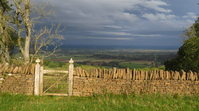
Reed Wood is a beautiful forest located in Gloucestershire, England. Covering an area of approximately 100 hectares, it is a popular destination for nature enthusiasts and outdoor adventurers. The wood is situated in close proximity to the charming village of Reed, adding to its appeal.

This woodland area is predominantly made up of deciduous trees such as oak, beech, and birch, creating a diverse and vibrant ecosystem. The forest floor is adorned with a variety of plants and wildflowers, enhancing the natural beauty of the surroundings. Reed Wood is also home to a wide range of wildlife, including birds, squirrels, foxes, and deer, making it an ideal spot for birdwatching and animal spotting.

Visitors to Reed Wood can enjoy a network of well-maintained trails and paths that wind through the forest, allowing for leisurely walks and hikes. The paths are often shaded by the thick foliage, providing a cool respite during warm summer days. The wood is also equipped with picnic areas and benches, perfect for those looking to relax and enjoy the peaceful ambiance.

Reed Wood is a haven for nature lovers, offering a tranquil escape from the hustle and bustle of everyday life. Its proximity to the village of Reed makes it easily accessible for locals and tourists alike. Whether it's exploring the woodland trails, observing wildlife, or simply immersing oneself in the beauty of nature, Reed Wood offers a truly enchanting experience.

If you have any feedback on the listing, please let us know in the comments section below.

Reed Wood Images

Images are sourced within 2km of 51.984524/-1.8977496 or Grid Reference SP0731. Thanks to Geograph Open Source API. All images are credited.

Campden Lane heading towards Stumps Cross The track gives more than just farm access, and links Stumps Cross with Lynes Barn.
Campden Lane heading towards Stumps Cross
The track gives more than just farm access, and links Stumps Cross with Lynes Barn.
From Campden Lane looking towards the top of the hill An unnamed hill with a rounded top, it rises to 951 feet above sea level. There are several higher places in the Cotswolds, but they aren't a lot higher.
From Campden Lane looking towards the top of the hill
An unnamed hill with a rounded top, it rises to 951 feet above sea level. There are several higher places in the Cotswolds, but they aren't a lot higher.
Wheat field above Coscombe Corner Looking down the slope in the direction of Stumps Cross.
Wheat field above Coscombe Corner
Looking down the slope in the direction of Stumps Cross.
Large grassy expanse The plateau at the top of the Cotswolds escarpment. There are not many features, and many of the former field boundaries have been removed.
Large grassy expanse
The plateau at the top of the Cotswolds escarpment. There are not many features, and many of the former field boundaries have been removed.
Avenue of trees near Coscombe Corner The trees here have been recently planted, but they help to form an avenue across the Stanway Estate that starts in the north not far short of Stanton. I don't know how far south it goes.
Avenue of trees near Coscombe Corner
The trees here have been recently planted, but they help to form an avenue across the Stanway Estate that starts in the north not far short of Stanton. I don't know how far south it goes.
Rampart at Beckbury Camp One of a line of Iron Age hillforts along the Cotswold escarpment.
Rampart at Beckbury Camp
One of a line of Iron Age hillforts along the Cotswold escarpment.
On Cotswold Way near Coscombe Corner above Hailes
On Cotswold Way - Campden Lane leading towards Stumps Cross
Gate in wall & views over the Vale of Evesham from Beckbury Hill Fort
Snow covered field Snow covered field near Upper Coscombe near Stumps Cross.
Snow covered field
Snow covered field near Upper Coscombe near Stumps Cross.
Avenue of trees Avenue of trees above the Cotswold escarpment near Beckbury Camp.  This avenue has been planted in the last ten years, the avenue continues down the hillside and is aligned with the pool in the gardens at Stanway House.
Avenue of trees
Avenue of trees above the Cotswold escarpment near Beckbury Camp. This avenue has been planted in the last ten years, the avenue continues down the hillside and is aligned with the pool in the gardens at Stanway House.
Stone wall, near Upper Coscombe Running beside the Cotswold Way between Hailes and Wood Stanway.
Stone wall, near Upper Coscombe
Running beside the Cotswold Way between Hailes and Wood Stanway.
Track to Stumps Cross This track which is also a bridleway and the route of the Cotswold Way passes through the north-west corner of this square. Upper Coscombe Farm can be seen over the wall on the right, and beyond it Guiting Quarry.
Track to Stumps Cross
This track which is also a bridleway and the route of the Cotswold Way passes through the north-west corner of this square. Upper Coscombe Farm can be seen over the wall on the right, and beyond it Guiting Quarry.
Farm track to Stumps Cross Heading north-east to Stumps Cross at the woodland on the left. The cliff face at Guiting Quarry is just in view above the stone wall on the right.
Farm track to Stumps Cross
Heading north-east to Stumps Cross at the woodland on the left. The cliff face at Guiting Quarry is just in view above the stone wall on the right.
Cromwell's Clump The Cotswold Way long distance footpath passes through Cromwell's Clump where he is said to have stood and watched Hailes Abbey being dissolved.
Cromwell's Clump
The Cotswold Way long distance footpath passes through Cromwell's Clump where he is said to have stood and watched Hailes Abbey being dissolved.
Beckbury Camp Part of the earthworks around two sides of the camp, the other two sides being protected with natural steep slopes.  As a promontory fortification, the site would be hard to beat.  The camp, through which the Cotswold Way long distance footpath passes, is a scheduled ancient monument.
Beckbury Camp
Part of the earthworks around two sides of the camp, the other two sides being protected with natural steep slopes. As a promontory fortification, the site would be hard to beat. The camp, through which the Cotswold Way long distance footpath passes, is a scheduled ancient monument.
Long avenue [2] The alignment of trees seen in <a href="https://www.geograph.org.uk/photo/2486961">SP0630 : Long avenue [1]</a> continues above the footpath to the very top of the escarpment.
Long avenue [2]
The alignment of trees seen in SP0630 : Long avenue [1] continues above the footpath to the very top of the escarpment.
Change sides Just before the footpath makes a 'T' junction with the track named Campden Lane, it passes through this gate to the opposite side of the wall.  The lambs have, as usual, escaped from the field.
Change sides
Just before the footpath makes a 'T' junction with the track named Campden Lane, it passes through this gate to the opposite side of the wall. The lambs have, as usual, escaped from the field.
Show me another place!

Reed Wood is located at Grid Ref: SP0731 (Lat: 51.984524, Lng: -1.8977496)

Administrative County: Gloucestershire

District: Tewkesbury

Police Authority: Gloucestershire

What 3 Words

///muffin.something.tile. Near Winchcombe, Gloucestershire

Related Wikis

Jackdaw Quarry

Jackdaw Quarry (grid reference SP077309) is a 4.78-hectare (11.8-acre) geological Site of Special Scientific Interest in Gloucestershire, notified in 1985...

Stanway House

Stanway House is a Jacobean manor house near the village of Stanway in Gloucestershire, England. The manor of Stanway was owned by Tewkesbury Abbey for...

Stanway, Gloucestershire

Stanway is a small village and civil parish in the county of Gloucestershire, England, and about 1 mile south of Stanton: both villages are on the Cotswold...

Didbrook

Didbrook is a small village and former civil parish, now in the parish of Stanway, in the Tewkesbury district, in Gloucestershire, England, 8 miles (13...

Toddington railway station

Toddington railway station serves the village of Toddington in Gloucestershire, England. Since 1984 it has been the main base of operations for the heritage...

Gloucestershire Warwickshire Railway

The Gloucestershire Warwickshire Steam Railway (GWR, GWSR or Gloucs-Warks Steam Railway) is a volunteer-run heritage railway which runs along the Gloucestershire/Worcestershire...

Toddington Narrow Gauge Railway

The Toddington Narrow Gauge Railway (TNGR) is a 2 ft (610 mm) narrow-gauge railway running alongside the Gloucestershire and Warwickshire Railway at Toddington...

Stanway Viaduct

Stanway Viaduct is a viaduct located in Gloucestershire, UK. It carries the Gloucestershire Warwickshire Railway == History == During construction on 13...

Nearby Amenities

Located within 500m of 51.984524,-1.8977496
Fixme: incomplete
Lat/Long: 51.9805207/-1.8975529
The data included in this document is from www.openstreetmap.org. The data is made available under ODbL.

Have you been to Reed Wood?

Leave your review of Reed Wood below (or comments, questions and feedback).