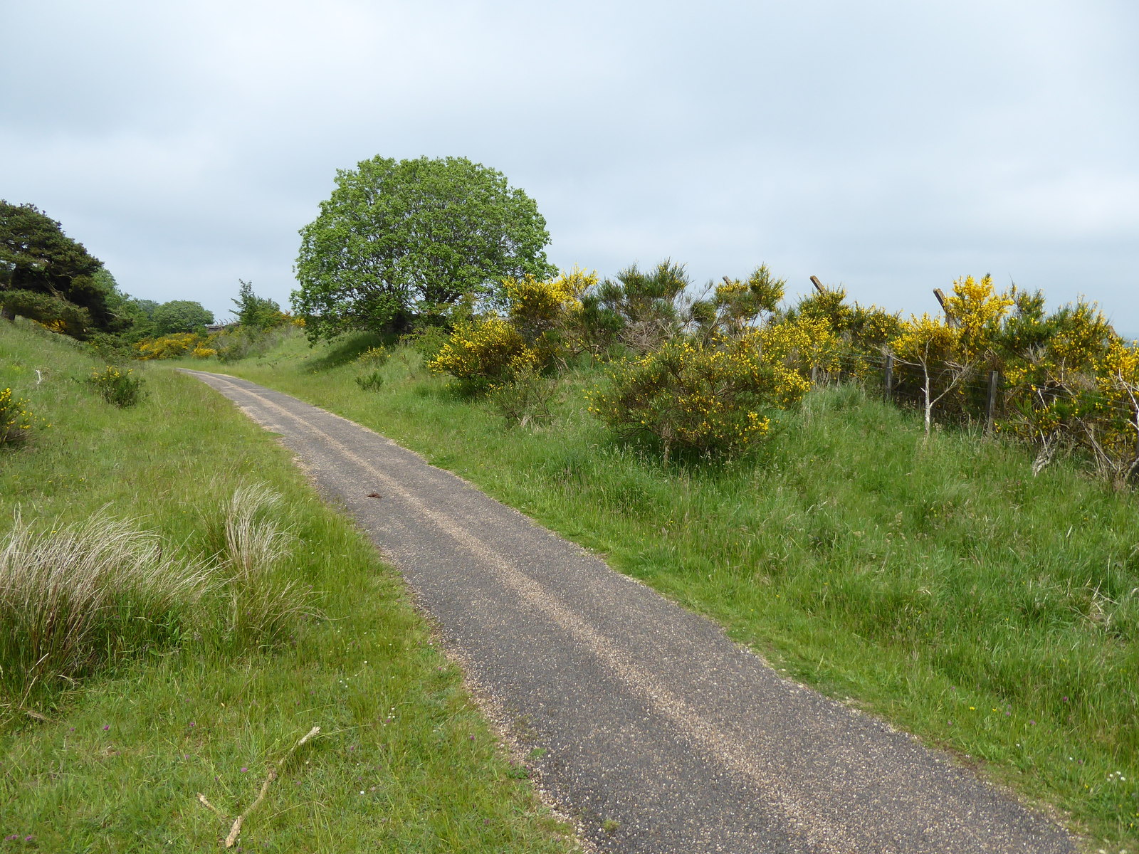
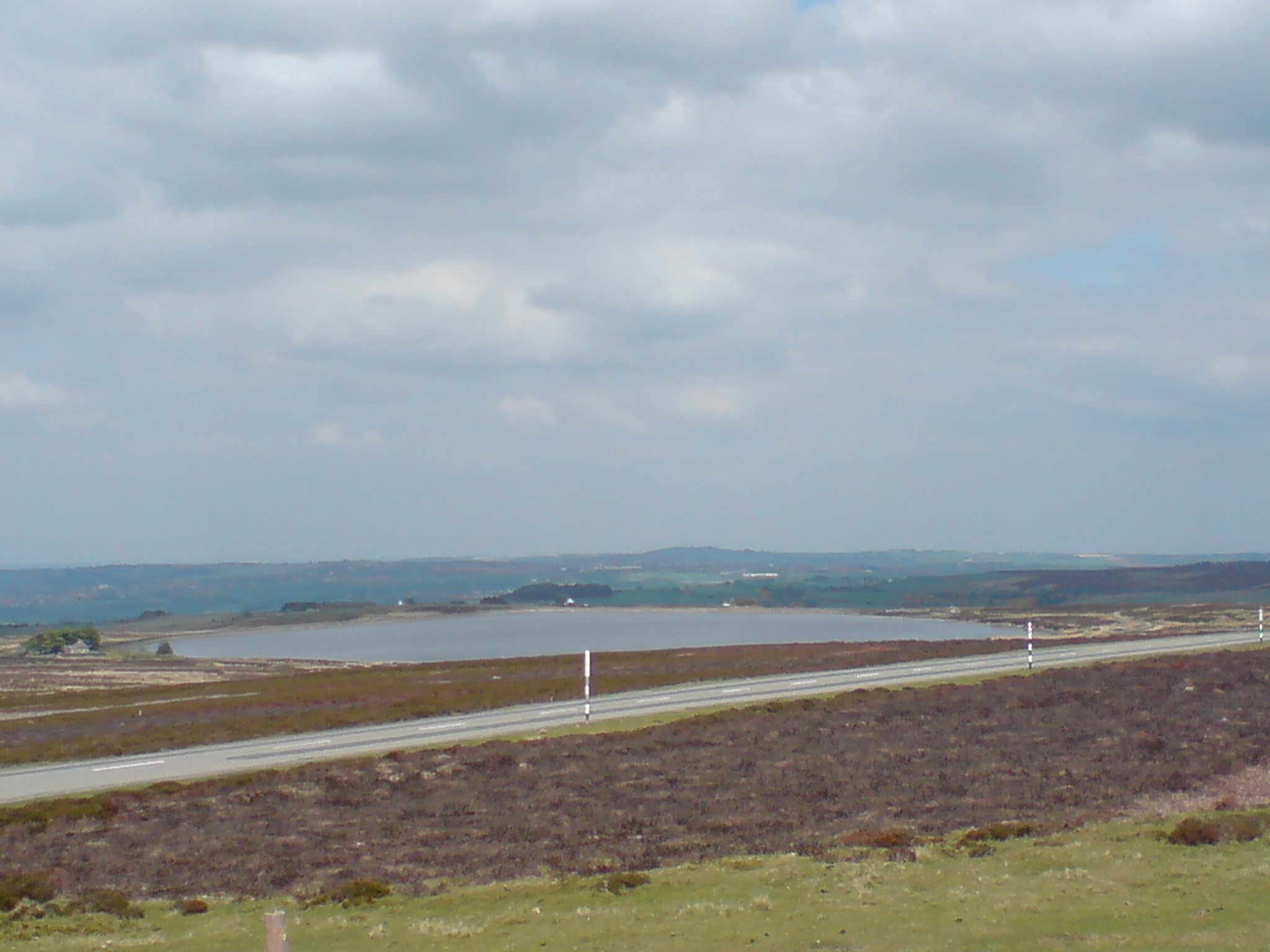
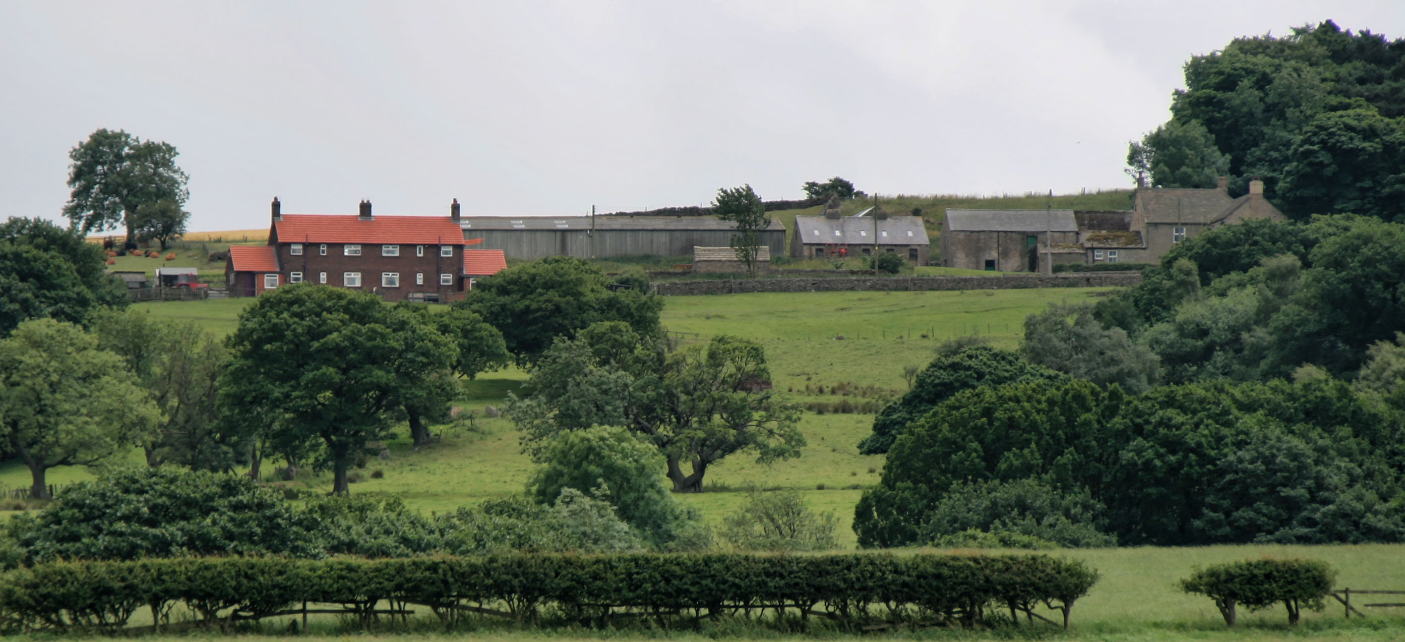
Bonner's Plantation

Wood, Forest in Durham

England

Bonner's Plantation

Waskerley Way
Waskerley Way Credit: Clive Nicholson

Bonner's Plantation, located in Durham, is a historic site that showcases the rich history of the Wood and Forest area. Spread over a vast area, this plantation holds immense significance in the region's agricultural and cultural heritage.

The plantation dates back to the 18th century when it was established by the Bonner family, who were prominent landowners and farmers. The plantation's main focus was on cultivating tobacco, a cash crop that dominated the region's economy at the time. The Bonners utilized slave labor to work on the plantation, a common practice during that era.

Today, Bonner's Plantation stands as a testament to the plantation system and its impact on the local community. The preserved plantation buildings, including the main house, slave quarters, and tobacco barns, provide visitors with a glimpse into the past and serve as a reminder of the region's complex history.

The plantation also offers educational tours and programs that delve into the social and economic aspects of plantation life. Visitors can explore the grounds and learn about the daily lives of both the Bonner family and enslaved individuals who toiled on the plantation.

In addition to the historical significance, Bonner's Plantation boasts scenic beauty with its sprawling fields, majestic trees, and serene atmosphere. The plantation serves as a popular destination for nature lovers, history enthusiasts, and those seeking a tranquil escape from the bustle of city life.

Overall, Bonner's Plantation in Durham is a captivating destination where visitors can immerse themselves in the history, culture, and natural beauty of the Wood and Forest area.

If you have any feedback on the listing, please let us know in the comments section below.

Bonner's Plantation Images

Images are sourced within 2km of 54.79764/-1.8939833 or Grid Reference NZ0644. Thanks to Geograph Open Source API. All images are credited.

Waskerley Way
Waskerley Way
Waskerley Way The uturn on top of Burn Hill
Waskerley Way
The uturn on top of Burn Hill
Waskerley Way Just entering the pine wood at Waskerley village.
Waskerley Way
Just entering the pine wood at Waskerley village.
Waskerley Village
Waskerley Village
Near Salters Gate The wall supported the platform edge on the railway which ran between Consett and Tow Law. Beyond the gate leads to Salter's Gate.
Near Salters Gate
The wall supported the platform edge on the railway which ran between Consett and Tow Law. Beyond the gate leads to Salter's Gate.
Farmland at Bees Cottage Farmland at Bees Cottage looking towards the Bonner Plantation
Farmland at Bees Cottage
Farmland at Bees Cottage looking towards the Bonner Plantation
Old farm building Building a little to the north of Springwell Farm.
Old farm building
Building a little to the north of Springwell Farm.
Cat Beck Cat Beck lies across the valley of the Waskerley Beck. On the skyline is Parkhead Plantation, once much more extensive than it is now, according to the 1940s map.
Cat Beck
Cat Beck lies across the valley of the Waskerley Beck. On the skyline is Parkhead Plantation, once much more extensive than it is now, according to the 1940s map.
Parkhead Plantation Parkhead Plantation was obviously once much more extensive than it is now, according to the 1940s map. Not the same Parkhead as the famous cafe and old station <a href="https://www.geograph.org.uk/gridref/NZ0043">NZ0043</a> 6 km to the west (Waskerley Park <a href="https://www.geograph.org.uk/gridref/NZ0143">NZ0143</a>). Was there a Tunstall Park in the valley now occupied by the Tunstall Reservoir? The tall concrete fence posts are the remains of the perimeter fence of the Burnhill Junction munitions dump closed in 1969 (the old Stanhope and Tyne railway ran across the top of the plantation) but the present fence is only two strands high.
Parkhead Plantation
Parkhead Plantation was obviously once much more extensive than it is now, according to the 1940s map. Not the same Parkhead as the famous cafe and old station NZ0043 6 km to the west (Waskerley Park NZ0143). Was there a Tunstall Park in the valley now occupied by the Tunstall Reservoir? The tall concrete fence posts are the remains of the perimeter fence of the Burnhill Junction munitions dump closed in 1969 (the old Stanhope and Tyne railway ran across the top of the plantation) but the present fence is only two strands high.
Edge of the moor above Waskerley village
Sheep's breakfast, Waskerley village Waskerley village now consists of just a couple of houses, but at one time was an important railway settlement housing several hundred people. <span class="nowrap"><a title="http://www.durham.gov.uk/miner/projects.nsf/581cd74a9c6aa8b080256d48003758cb/bb96ba295948449580256e8a004f0ba8?OpenDocument" rel="nofollow ugc noopener" href="http://www.durham.gov.uk/miner/projects.nsf/581cd74a9c6aa8b080256d48003758cb/bb96ba295948449580256e8a004f0ba8?OpenDocument">Link</a><img style="margin-left:2px;" alt="External link" title="External link - shift click to open in new window" src="https://s1.geograph.org.uk/img/external.png" width="10" height="10"/></span>
Sheep's breakfast, Waskerley village
Waskerley village now consists of just a couple of houses, but at one time was an important railway settlement housing several hundred people. LinkExternal link
Bee Cottage Guesthouse A farmhouse which has been converted into a stylish guesthouse. <span class="nowrap"><a title="http://www.beecottage.co.uk" rel="nofollow ugc noopener" href="http://www.beecottage.co.uk">Link</a><img style="margin-left:2px;" alt="External link" title="External link - shift click to open in new window" src="https://s1.geograph.org.uk/img/external.png" width="10" height="10"/></span> Located near to and originally conceived as a service for the C2C cycle route. However, the current publicity makes no mention of the proximity to the C2C and is making its appeal to a much wider, car-borne clientele.
Bee Cottage Guesthouse
A farmhouse which has been converted into a stylish guesthouse. LinkExternal link Located near to and originally conceived as a service for the C2C cycle route. However, the current publicity makes no mention of the proximity to the C2C and is making its appeal to a much wider, car-borne clientele.
Woodland near Salter's Gate
World War II bunkers at Burn Hill Disused bunkers on the Burnhill Junction munitions dump closed in 1969. The Stanhope and Tyne railway ran just this side of the plantation in the distance. The boundary fence of the dump can also be seen at the western edge of the plantation <a href="https://www.geograph.org.uk/photo/297838">NZ0544 : Parkhead Plantation</a>.
World War II bunkers at Burn Hill
Disused bunkers on the Burnhill Junction munitions dump closed in 1969. The Stanhope and Tyne railway ran just this side of the plantation in the distance. The boundary fence of the dump can also be seen at the western edge of the plantation NZ0544 : Parkhead Plantation.
Wartime fence near Greenfield Farm The tall concrete fenceposts are the remains of the perimeter fence of the Burnhill Junction munitions dump closed in 1969 (the Stanhope and Tyne railway ran a short distance to the left). The fence can also be seen at the western edge of the plantation <a href="https://www.geograph.org.uk/photo/297838">NZ0544 : Parkhead Plantation</a>. Other military installations in the area are a possible airstrip at <a href="https://www.geograph.org.uk/photo/357610">NZ0742 : Parallel walls,  Saltersgate Lane</a> and bunkers at <a href="https://www.geograph.org.uk/photo/357621">NZ0744 : World War II bunkers at Burn Hill</a>. This length of fence is now being supplemented by a carefully laid hedge.
Wartime fence near Greenfield Farm
The tall concrete fenceposts are the remains of the perimeter fence of the Burnhill Junction munitions dump closed in 1969 (the Stanhope and Tyne railway ran a short distance to the left). The fence can also be seen at the western edge of the plantation NZ0544 : Parkhead Plantation. Other military installations in the area are a possible airstrip at NZ0742 : Parallel walls, Saltersgate Lane and bunkers at NZ0744 : World War II bunkers at Burn Hill. This length of fence is now being supplemented by a carefully laid hedge.
Greenfield Farm
Greenfield Farm
Mud! Near Burn Hill.
Mud!
Near Burn Hill.
"Are we nearly there yet?" Bee Cottage Guesthouse <span class="nowrap"><a title="http://www.beecottage.co.uk" rel="nofollow ugc noopener" href="http://www.beecottage.co.uk">Link</a><img style="margin-left:2px;" alt="External link" title="External link - shift click to open in new window" src="https://s1.geograph.org.uk/img/external.png" width="10" height="10"/></span> lies a good 3 km off the A68 on a switchback single-track lane. The sign has been put up to reassure guests that they are nearly there! The hamlet of Oxen Law can be seen on the skyine.
"Are we nearly there yet?"
Bee Cottage Guesthouse LinkExternal link lies a good 3 km off the A68 on a switchback single-track lane. The sign has been put up to reassure guests that they are nearly there! The hamlet of Oxen Law can be seen on the skyine.
Show me another place!

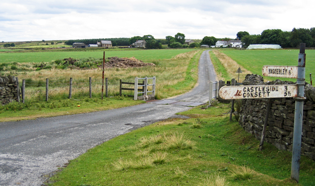
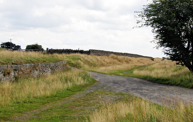
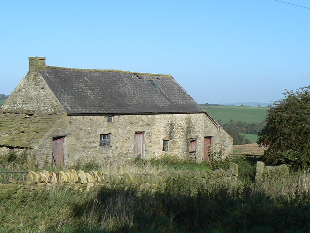
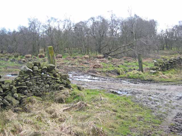
Bonner's Plantation is located at Grid Ref: NZ0644 (Lat: 54.79764, Lng: -1.8939833)

Unitary Authority: County Durham

Police Authority: Durham

What 3 Words

///collide.assemble.convey. Near Castleside, Co. Durham

Nearby Locations

Bonner's Plantation

Related Wikis

Burnhill railway station

Burnhill railway station served the village of Waskerley, County Durham, England, from 1859 to 1939 on the Stanhope and Tyne Railway. == History == The...

Waskerley

Waskerley is a village in County Durham, England. It is situated six miles to the southwest of Consett and three miles southwest of Castleside and the...

Waskerley railway station

Waskerley railway station, also known as Waskerley Park, served the village of Waskerley, County Durham, England from 1845 to 1859 on the Stanhope and...

River Browney

The River Browney is a river in County Durham, England, and the largest tributary of the River Wear. The River Browney rises from a spring in Head Plantation...

Horsleyhope

Horsleyhope is a village in County Durham, England. It is situated a few miles to the south-west of Consett. == References ==

Murder of Harry Collinson

The murder of Harry Collinson, the planning officer for Derwentside District Council, occurred on 20 June 1991 at Butsfield, County Durham, England. At...

Healeyfield

Healeyfield is a village and civil parish in County Durham, England. The population of the civil parish taken from the 2011 census was 1,544. It is situated...

Rowley railway station (England)

Rowley railway station served the hamlet of Rowley and the village of Castleside in County Durham, England from 1845 to 1966 on the Derwent Railway....

Nearby Amenities

Located within 500m of 54.79764,-1.8939833
Bee Cottage Farm
Addr City: Consett
Addr Postcode: DH8 9HW
Place: farm
Source Name: OS OpenData StreetView
Source Postcode: CodePoint Open
Lat/Long: 54.8013528/-1.8963111
Greenfield Farm
Place: farm
Source Name: OS OpenData StreetView
Lat/Long: 54.7990955/-1.8894446
Leisure: nature_reserve
Lat/Long: 54.7993336/-1.9007404
Power: pole
Lat/Long: 54.8007065/-1.8883073
Power: pole
Lat/Long: 54.801001/-1.8893574
Power: pole
Lat/Long: 54.8012144/-1.8901004
Power: pole
Lat/Long: 54.8014308/-1.8908528
Power: pole
Lat/Long: 54.801611/-1.8914804
Power: pole
Lat/Long: 54.8017864/-1.8921214
Power: pole
Lat/Long: 54.8019635/-1.8927504
Power: pole
Lat/Long: 54.8020176/-1.8949592
Power: pole
Lat/Long: 54.8016566/-1.8955868
Burnhill Nature Reserve
Leisure: nature_reserve
Website: http://burnhill-conservation.co.uk/home/nature-reserve/
Lat/Long: 54.7956969/-1.897341
Burnhill
Historic Railway: station
Railway: site
Source: NPE
Wikidata: Q105063533
Wikipedia: en:Burnhill railway station
Lat/Long: 54.7969895/-1.9012625
The data included in this document is from www.openstreetmap.org. The data is made available under ODbL.

Have you been to Bonner's Plantation?

Leave your review of Bonner's Plantation below (or comments, questions and feedback).