Bog Wood

Wood, Forest in Durham

England

Bog Wood

The Lone Tree at Harvest Time The old cow byre can just be seen above the lone tree.

Photograph was taken facing due west towards A68
The Lone Tree at Harvest Time Credit: Dennis Lovett

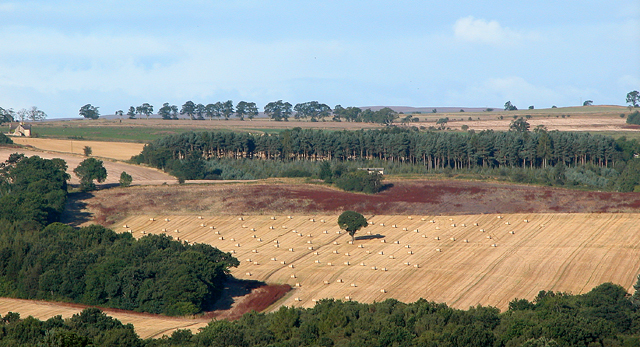
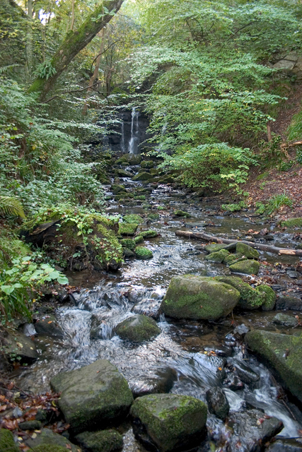
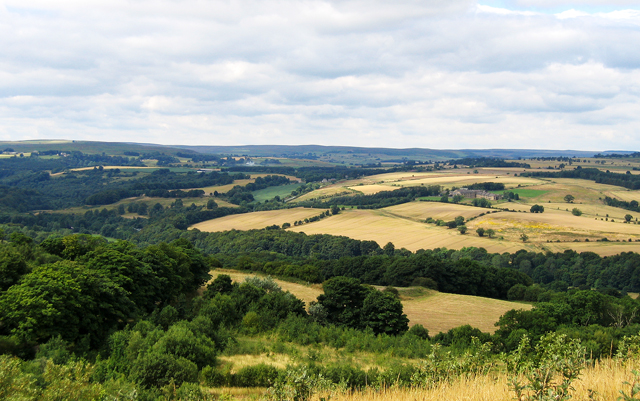
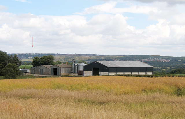
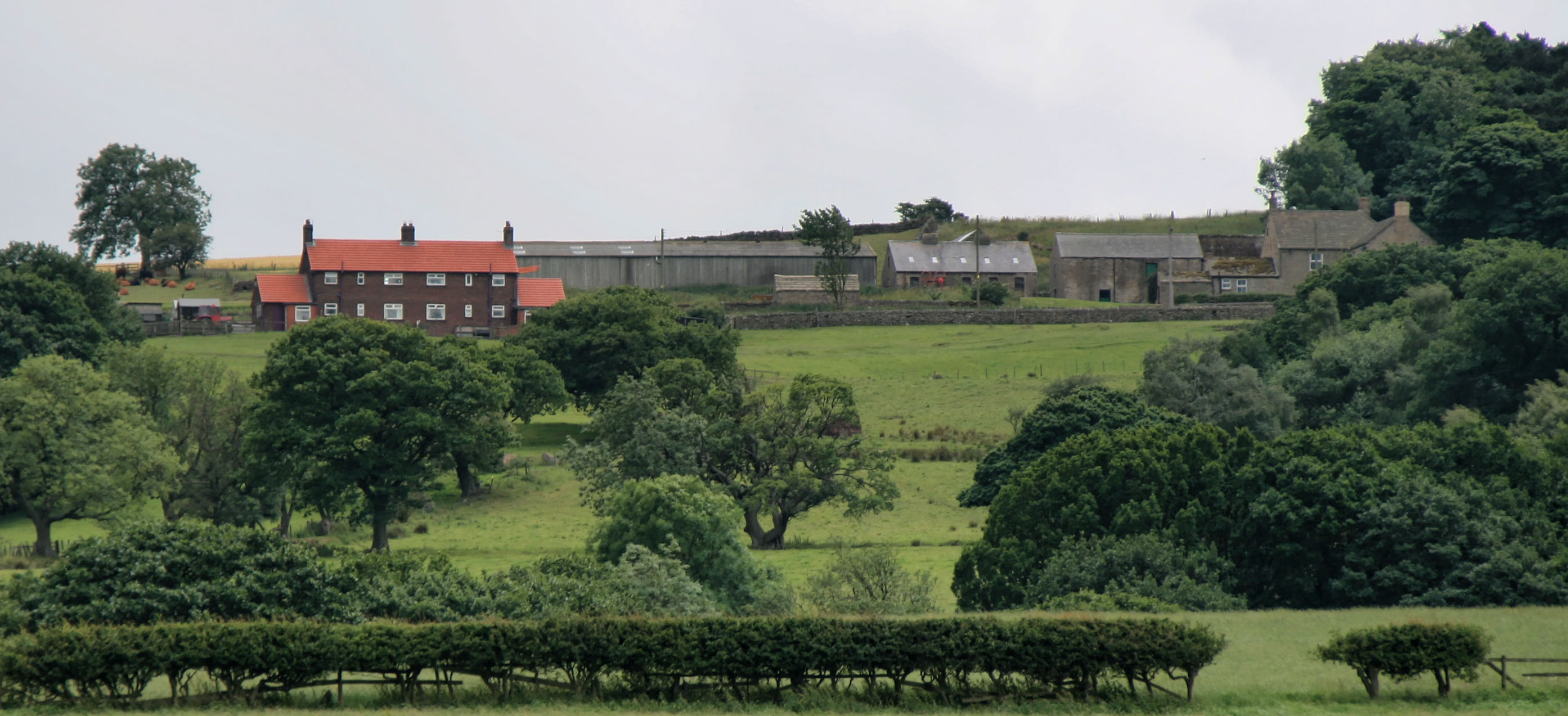
Bog Wood, located in Durham, England, is a captivating woodland area known for its unique features and rich biodiversity. Spanning over a vast expanse of land, this forest offers a diverse range of natural habitats and intriguing geological formations.

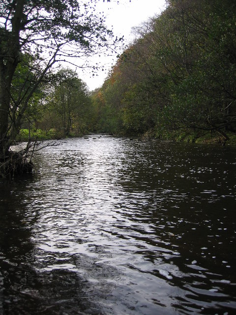
One of the most distinctive aspects of Bog Wood is its wetland environment. The area is characterized by waterlogged soil and a high water table, creating a perfect habitat for a variety of plant and animal species. Mosses, ferns, and reeds thrive in this damp environment, forming a lush green carpet throughout the forest floor.

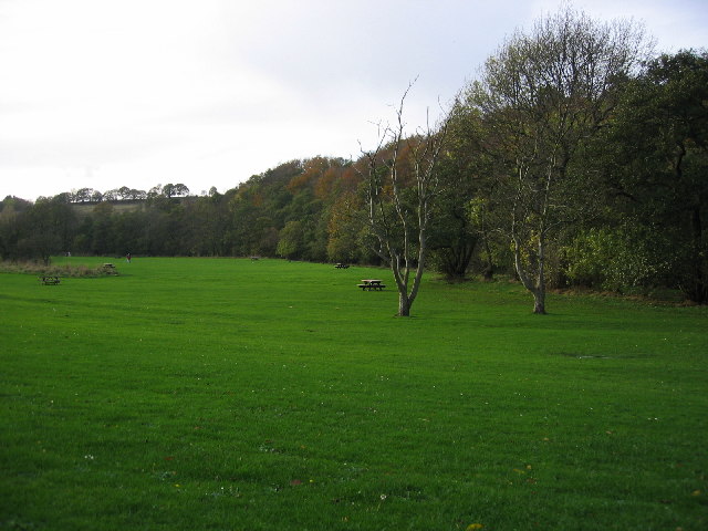
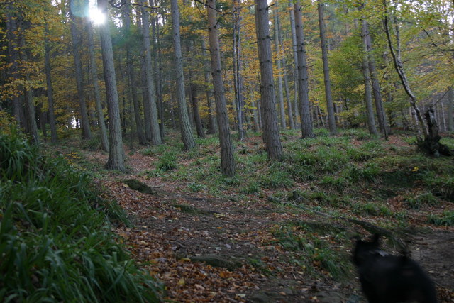
The woodland is also home to a range of tree species, including oak, birch, and ash. These towering trees provide ample shade and shelter for the numerous bird species that inhabit the area. Visitors to Bog Wood may be lucky enough to spot woodpeckers, jays, or even the elusive tawny owl.

In addition to its diverse flora and fauna, Bog Wood boasts a number of intriguing geological features. The forest is dotted with ancient peat bogs, formed over thousands of years as decaying plant matter accumulates. These bogs not only contribute to the unique ecosystem of the area but also offer a glimpse into the region's geological history.

Bog Wood is a picturesque destination for nature enthusiasts and offers an opportunity to connect with the natural world. Whether exploring the network of walking trails or simply immersing oneself in the peaceful atmosphere, visitors to Bog Wood are sure to be captivated by its beauty and tranquility.

If you have any feedback on the listing, please let us know in the comments section below.

Bog Wood Images

Images are sourced within 2km of 54.843031/-1.8940982 or Grid Reference NZ0649. Thanks to Geograph Open Source API. All images are credited.

The Lone Tree at Harvest Time The old cow byre can just be seen above the lone tree.

Photograph was taken facing due west towards A68
The Lone Tree at Harvest Time
The old cow byre can just be seen above the lone tree. Photograph was taken facing due west towards A68
Wharnley Burn Water Fall
The Smelters Arms at Castleside crossroads The road running left to right is the A68
The Smelters Arms at Castleside crossroads
The road running left to right is the A68
The Fleece Inn On A68 facing North
The Fleece Inn
On A68 facing North
Derwent Valley ( Northumberland/Durham) The Hamlet of Mosswood is beside the visible road (A68). To the right is Derwent Manor hotel.  The River Derwent flows from the left through the valley hidden by the horizontal band of trees.
Derwent Valley ( Northumberland/Durham)
The Hamlet of Mosswood is beside the visible road (A68). To the right is Derwent Manor hotel. The River Derwent flows from the left through the valley hidden by the horizontal band of trees.
Crooked Oak At the end of the road
Crooked Oak
At the end of the road
Wallish Walls Pontop Pike  TV transmitter mast can be seen on the horizon.
Wallish Walls
Pontop Pike TV transmitter mast can be seen on the horizon.
Mosswood
Mosswood
Castleside
Castleside
Derwent River at Allensford View of the derwent river at allensford running alongside the main picnic area and past allensford park.
Derwent River at Allensford
View of the derwent river at allensford running alongside the main picnic area and past allensford park.
Allensford Picnic Area View along the main picnic area, the trees following along derwent river.
Allensford Picnic Area
View along the main picnic area, the trees following along derwent river.
Signpost on A68
Signpost on A68
Dene Howl Farm Built around 1700 by a Mr Shirley. Legend says that Mr Shirley and others brought the body of the Earl of Derwentwater back after losing his head in the Jacobite Rebellion of 1715, to be buried in nearby Dilston.
Dene Howl Farm
Built around 1700 by a Mr Shirley. Legend says that Mr Shirley and others brought the body of the Earl of Derwentwater back after losing his head in the Jacobite Rebellion of 1715, to be buried in nearby Dilston.
Engine House Once this derelict building housed the engine that moved the cage up and down the mine shaft.  It used to have a large chimney which has now been lost to time as sadly, has the engine.
Engine House
Once this derelict building housed the engine that moved the cage up and down the mine shaft. It used to have a large chimney which has now been lost to time as sadly, has the engine.
Ancient Larch Tree Under this tree, John Wesley preached to the lead miners in 1772. Struck by lightning but still flourishing after more than 200 years.
Ancient Larch Tree
Under this tree, John Wesley preached to the lead miners in 1772. Struck by lightning but still flourishing after more than 200 years.
Bog Wood Mixed woodland. Mainly Beech and a conifer which I can't name
but will endeavour to do so.
Bog Wood
Mixed woodland. Mainly Beech and a conifer which I can't name but will endeavour to do so.
Durhamfield Farm
Durhamfield Farm
Durhamfield Farm
Durhamfield Farm
Show me another place!

Bog Wood is located at Grid Ref: NZ0649 (Lat: 54.843031, Lng: -1.8940982)

Unitary Authority: County Durham

Police Authority: Durham

What 3 Words

///staring.helped.bottled. Near Castleside, Co. Durham

Nearby Locations

Bog Wood

Related Wikis

Allensford

Allensford is a small country park and hamlet in County Durham, in England. It is on the River Derwent, about 2 miles SW of Consett, and 1 mile north...

Castleside

Castleside is a village in County Durham, England. It is situated a short distance to the south-west of Consett. Castleside is covered by the civil parish...

Healeyfield

Healeyfield is a village and civil parish in County Durham, England. The population of the civil parish taken from the 2011 census was 1,544. It is situated...

Consett Academy

Consett Academy is a secondary academy school in Consett, the result of a merger between Consett Community Sports College and Moorside Community Technology...

Derwent Gorge and Horsleyhope Ravine

Derwent Gorge and Horsleyhope Ravine is a Site of Special Scientific Interest in the Derwentside district of north County Durham and the Tynedale district...

The Grove, County Durham

The Grove is a village in County Durham, in England. It is situated to the south of Consett. The Grove is a post-World War II housing estate. Originally...

Rowley railway station (England)

Rowley railway station served the hamlet of Rowley and the village of Castleside in County Durham, England from 1845 to 1966 on the Derwent Railway....

Horsleyhope

Horsleyhope is a village in County Durham, England. It is situated a few miles to the south-west of Consett. == References ==

Nearby Amenities

Located within 500m of 54.843031,-1.8940982
Derwent Grange Farm
Fixme: Trace this farm complex from StreetView.
Place: farm
Source: OS Opendata StreetView
Source Name: OS Opendata StreetView
Lat/Long: 54.8387979/-1.8962782
The data included in this document is from www.openstreetmap.org. The data is made available under ODbL.

Have you been to Bog Wood?

Leave your review of Bog Wood below (or comments, questions and feedback).