Cupid Green

Settlement in Hertfordshire Dacorum

England

Cupid Green

Overhead transmission cables in  Cupid Green Lane Unusual to see two parallel lines of the same capacity.
Overhead transmission cables in Cupid Green Lane Credit: Jack Hill

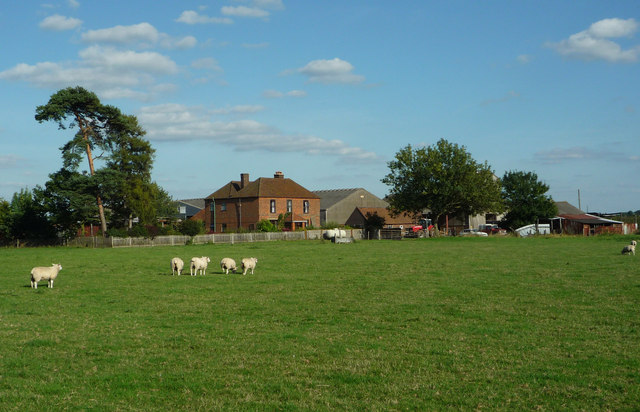
Cupid Green is a small village located in the county of Hertfordshire, England. Situated approximately 30 miles north of London, it is part of the borough of Dacorum. The village is nestled amidst picturesque countryside, offering residents and visitors a tranquil and scenic environment.

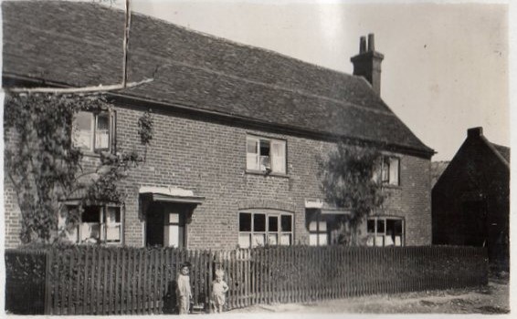
Cupid Green is primarily a residential area, with a mix of housing options ranging from quaint cottages to modern family homes. The village is known for its close-knit community and friendly atmosphere, making it an attractive place to live for families and professionals alike.

Despite its rural setting, Cupid Green benefits from excellent transport links. The nearby A41 road provides easy access to the neighboring towns of Hemel Hempstead and Watford, while the M1 motorway is only a short drive away. The village also benefits from several bus routes, connecting it to surrounding areas.

The amenities in Cupid Green are limited, but residents can find essential services such as a convenience store and a post office. For a wider range of shopping and entertainment options, the bustling town of Hemel Hempstead is just a short distance away.

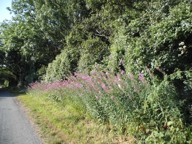
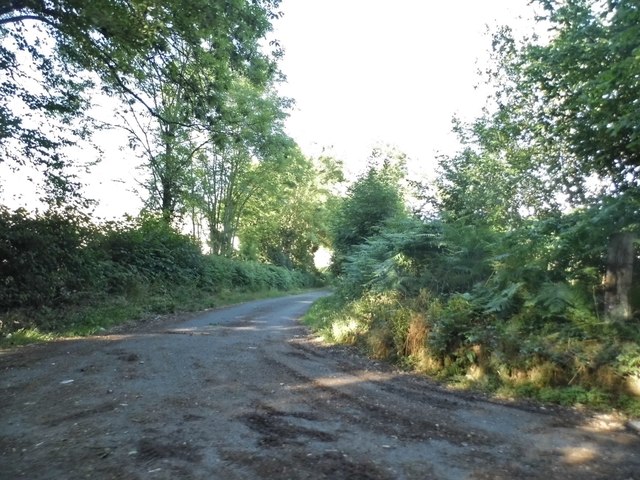
Nature enthusiasts will appreciate the village's proximity to beautiful countryside, including Boxmoor and Berkhamsted Common, which offer ample opportunities for outdoor activities such as hiking and cycling.

In summary, Cupid Green is a peaceful village with a strong sense of community, picturesque surroundings, and convenient transport links, making it an appealing place to call home for those seeking a quieter, countryside lifestyle within easy reach of urban amenities.

If you have any feedback on the listing, please let us know in the comments section below.
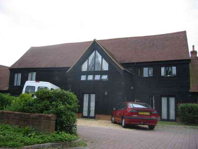
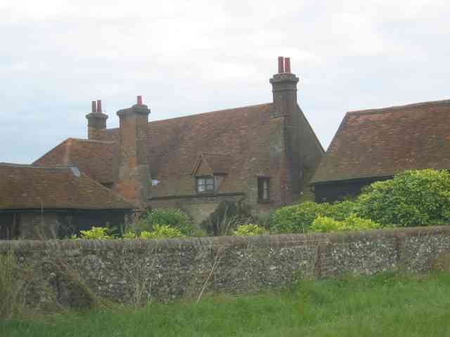
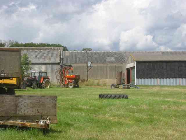
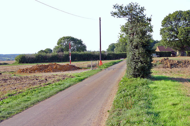
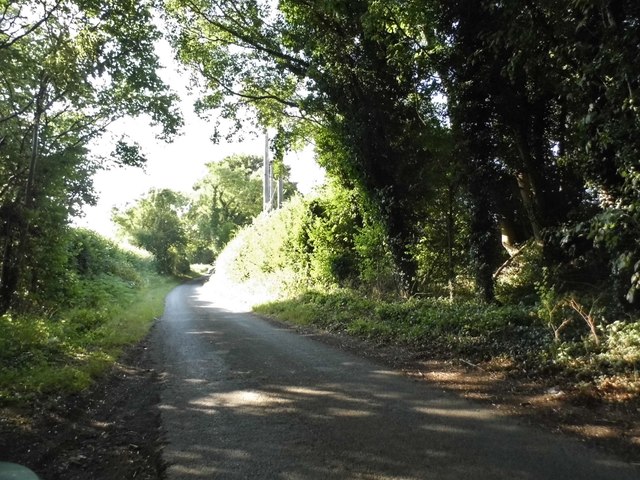
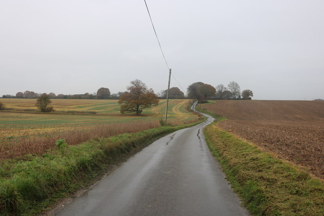
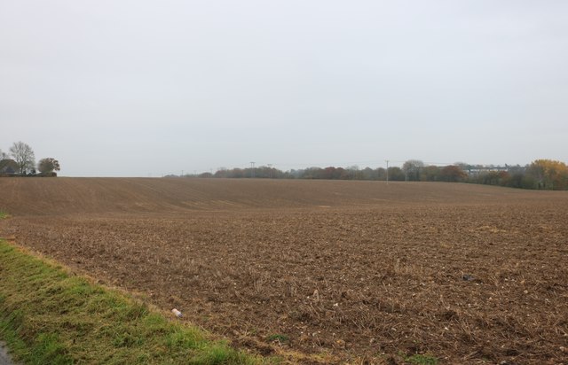
Cupid Green Images

Images are sourced within 2km of 51.770321/-0.451417 or Grid Reference TL0609. Thanks to Geograph Open Source API. All images are credited.

Overhead transmission cables in  Cupid Green Lane Unusual to see two parallel lines of the same capacity.
Overhead transmission cables in Cupid Green Lane
Unusual to see two parallel lines of the same capacity.
Houses in Cupid Green Lane Being very close to the edge of the development they were intended to look like barn conversions.
Houses in Cupid Green Lane
Being very close to the edge of the development they were intended to look like barn conversions.
Eastbrook Hay Farm Looks to be a well built structure
Eastbrook Hay Farm
Looks to be a well built structure
Eastbrook Hay Farm The concrete paving makes for easy cleansing but where are the signs of cattle?
Eastbrook Hay Farm
The concrete paving makes for easy cleansing but where are the signs of cattle?
Wood Farm  off Dodds Lane High hedges prevented me seeing more of the farmhouse
Wood Farm off Dodds Lane
High hedges prevented me seeing more of the farmhouse
Wood Farm  Machinery Why do farmers like to scatter their equipment about in random fashion
Wood Farm Machinery
Why do farmers like to scatter their equipment about in random fashion
Wood Farm Wood Farm enjoys a lofty position high above the valley. However, behind the photographer's position, is one of the large Housing Estate's which make up Hemel Hempstead.
Wood Farm
Wood Farm enjoys a lofty position high above the valley. However, behind the photographer's position, is one of the large Housing Estate's which make up Hemel Hempstead.
Eastbrook Hay Farm, Cupid Green Lane Horses have long since replaced cattle and pigs here.
Eastbrook Hay Farm, Cupid Green Lane
Horses have long since replaced cattle and pigs here.
Cupid Green Lane Looking East from Public Footpath, February 2009.
Cupid Green Lane
Looking East from Public Footpath, February 2009.
Cupid Green Lane Looking South towards Woodhall Farm and Grovehill housing estates, December 2009.
Cupid Green Lane
Looking South towards Woodhall Farm and Grovehill housing estates, December 2009.
Wood Farm across the fields Wood Farm commands a fine view across the Gade Valley and down into Hemel Hempstead.
Wood Farm across the fields
Wood Farm commands a fine view across the Gade Valley and down into Hemel Hempstead.
Eastbrookhay Farm, Cupid Green Lane Eastbrookhay Farm, Cupid Green Lane, Hemel Hempstead. Photo taken in the mid 1930's with Peter Stanbridge (the smaller of the two boys) with his brother Roy.
Eastbrookhay Farm, Cupid Green Lane
Eastbrookhay Farm, Cupid Green Lane, Hemel Hempstead. Photo taken in the mid 1930's with Peter Stanbridge (the smaller of the two boys) with his brother Roy.
Eastbrookhay Farm The Barn at Eastbrookhay Farm. This barn is a listed building and over 300 years old
Eastbrookhay Farm
The Barn at Eastbrookhay Farm. This barn is a listed building and over 300 years old
Rosebay Willowherb on Holtsmere End Lane
Track off Holtsmere End Lane
Holtsmere End Lane
Holtsmere End Lane
Dodds Lane near Grovehill
Field by Dodds Lane
Field by Dodds Lane
Show me another place!

Cupid Green is located at Grid Ref: TL0609 (Lat: 51.770321, Lng: -0.451417)

Administrative County: Hertfordshire

District: Dacorum

Police Authority: Hertfordshire

What 3 Words

///scarf.dated.landed. Near Hemel Hempstead, Hertfordshire

Related Wikis

Pennine Way Stadium

The Pennine Way Stadium is a multi-use sports facility in Hemel Hempstead, Hertfordshire, and home of Hemel Stags rugby league club. == History == Hemel...

Godwin's Halt railway station

Godwin's Halt railway station served the area of Highfield, Hertfordshire, England from 1905 to 1964 on the Nickey Line. == History == The station opened...

The Astley Cooper School

The Astley Cooper School is an English 11–18 comprehensive school on the edge of Hemel Hempstead in Hertfordshire, England. == History == The school was...

Highfield, Hertfordshire

Highfield is a neighbourhood district in Hemel Hempstead, Hertfordshire, United Kingdom. It was constructed on a green field site as part of the construction...

Nearby Amenities

Located within 500m of 51.770321,-0.451417
Odbl: clean
Lat/Long: 51.772001/-0.4457178
Mini Roundabout
Direction: clockwise
Lat/Long: 51.7734351/-0.4490441
Godwin's
Historic Railway: halt
Railway: site
Wikidata: Q104869722
Wikipedia: en:Godwin's Halt railway station
Lat/Long: 51.7676911/-0.452213
Mini Roundabout
Direction: clockwise
Lat/Long: 51.7715413/-0.44901
Noexit: yes
Lat/Long: 51.7712883/-0.448179
Recycling
Hemel Hempstead Household Waste Recycling Centre
Recycling Type: centre
Lat/Long: 51.7697266/-0.4459863
Recycling
Lat/Long: 51.7661037/-0.4496783
Bus Stop
St Agnells Lane
Bench: yes
Bus: yes
Naptan AtcoCode: 210021400340
Naptan Bearing: SW
Naptan CommonName: St Agnells Lane
Naptan Crossing: opp St Agnells Lane
Naptan Indicator: opp
Naptan Landmark: opp St Agnells Lane
Naptan NaptanCode: hrtdmatd
Naptan PlusbusZoneRef: HEMLHMP
Naptan ShortCommonName: NA
Naptan Street: Redbourn Road
Naptan Verified: no
Public Transport: platform
Shelter: yes
Source: naptan_import
Lat/Long: 51.7713385/-0.4475323
Bus Stop
Basildon Square
Bench: yes
Bus: yes
Naptan AtcoCode: 210021400440
Naptan Bearing: E
Naptan CommonName: Basildon Square
Naptan Crossing: Two Beeches
Naptan Indicator: opp
Naptan Landmark: Two Beeches
Naptan NaptanCode: hrtdmajw
Naptan PlusbusZoneRef: HEMLHMP
Naptan ShortCommonName: NA
Naptan Street: Washington Avenue
Naptan Verified: no
Public Transport: platform
Shelter: yes
Source: naptan_import
Lat/Long: 51.7735904/-0.4532819
Bus Stop
Dawley Court
Bench: no
Bus: yes
Naptan AtcoCode: 210021400620
Naptan Bearing: S
Naptan CommonName: Dawley Court
Naptan Crossing: opp Harlow Court
Naptan Indicator: opp
Naptan Landmark: opp Harlow Court
Naptan NaptanCode: hrtdmamj
Naptan PlusbusZoneRef: HEMLHMP
Naptan ShortCommonName: NA
Naptan Street: St Agnells Lane
Naptan Verified: no
Public Transport: platform
Shelter: no
Source: naptan_import
Lat/Long: 51.7728948/-0.4489428
Bus Stop
Pennine Way
Bus: yes
Naptan AtcoCode: 210021400640
Naptan Bearing: S
Naptan CommonName: Pennine Way
Naptan Crossing: Nicky Line Cycle Path
Naptan Indicator: opp
Naptan Landmark: Nicky Line Cycle Path
Naptan NaptanCode: hrtdmamp
Naptan PlusbusZoneRef: HEMLHMP
Naptan ShortCommonName: NA
Naptan Street: Redbourn Road
Naptan Verified: no
Public Transport: platform
Source: naptan_import
Lat/Long: 51.7692403/-0.4486623
Bus Stop
Henry Wells Square
Bench: yes
Bus: yes
Local Ref: NR
Naptan AtcoCode: 210021400660
Naptan Bearing: S
Naptan CommonName: Henry Wells Square
Naptan Crossing: Runcorn Crescent
Naptan Indicator: nr
Naptan Landmark: Runcorn Crescent
Naptan NaptanCode: hrtdmamt
Naptan PlusbusZoneRef: HEMLHMP
Naptan ShortCommonName: NA
Naptan Street: Aycliffe Drive
Naptan Verified: no
Public Transport: platform
Shelter: yes
Source: naptan_import
Lat/Long: 51.7720836/-0.4580054
Bus Stop
Crawley Drive
Bench: yes
Bus: yes
Local Ref: NR
Naptan AtcoCode: 210021400680
Naptan Bearing: SE
Naptan CommonName: Crawley Drive
Naptan Crossing: A4147
Naptan Indicator: nr
Naptan Landmark: A4147
Naptan NaptanCode: hrtdmadt
Naptan PlusbusZoneRef: HEMLHMP
Naptan ShortCommonName: NA
Naptan Street: Aycliffe Drive
Naptan Verified: no
Public Transport: platform
Shelter: yes
Source: naptan_import
Lat/Long: 51.7697194/-0.4570521
Bus Stop
Wensleydale
Bench: yes
Bus: yes
Naptan AtcoCode: 210021400700
Naptan Bearing: SW
Naptan CommonName: Wensleydale
Naptan Crossing: Pennine Way
Naptan Indicator: opp
Naptan Landmark: Pennine Way
Naptan NaptanCode: hrtdmadw
Naptan PlusbusZoneRef: HEMLHMP
Naptan ShortCommonName: NA
Naptan Street: Cambrian Way
Naptan Verified: no
Public Transport: platform
Shelter: yes
Source: naptan_import
Lat/Long: 51.7672602/-0.4567157
Bus Stop
Crawley Drive
Bench: yes
Bus: yes
Naptan AtcoCode: 210021412240
Naptan Bearing: NW
Naptan CommonName: Crawley Drive
Naptan Crossing: Marlborough Rise
Naptan Indicator: opp
Naptan Landmark: Marlborough Rise
Naptan NaptanCode: hrtdgmwg
Naptan PlusbusZoneRef: HEMLHMP
Naptan ShortCommonName: NA
Naptan Street: Aycliffe Drive
Naptan Verified: no
Public Transport: platform
Shelter: yes
Source: naptan_import
Lat/Long: 51.7703547/-0.4574942
Bus Stop
Pennine Way
Bench: no
Bus: yes
Local Ref: NR
Naptan AtcoCode: 210021412280
Naptan Bearing: N
Naptan CommonName: Pennine Way
Naptan Crossing: Corner Farm
Naptan Indicator: nr
Naptan Landmark: Corner Farm
Naptan NaptanCode: hrtdgmwp
Naptan PlusbusZoneRef: HEMLHMP
Naptan ShortCommonName: NA
Naptan Street: Redbourn Road
Naptan Verified: no
Public Transport: platform
Shelter: no
Source: naptan_import
Lat/Long: 51.7699817/-0.4489702
Bus Stop
Dawley Court
Bench: yes
Bus: yes
Local Ref: NR
Naptan AtcoCode: 210021412300
Naptan Bearing: N
Naptan CommonName: Dawley Court
Naptan Crossing: Harlow Court
Naptan Indicator: nr
Naptan Landmark: Harlow Court
Naptan NaptanCode: hrtdgmwt
Naptan PlusbusZoneRef: HEMLHMP
Naptan ShortCommonName: NA
Naptan Street: St Agnells Lane
Naptan Verified: no
Public Transport: platform
Shelter: yes
Source: naptan_import
Lat/Long: 51.7725911/-0.4490982
Bus Stop
Eastbrook Schools
Bus: yes
Local Ref: NR
Naptan AtcoCode: 210021412320
Naptan Bearing: N
Naptan CommonName: Eastbrook Schools
Naptan Crossing: opp Methodist Church
Naptan Indicator: nr
Naptan Landmark: opp Methodist Church
Naptan NaptanCode: hrtdgpad
Naptan PlusbusZoneRef: HEMLHMP
Naptan ShortCommonName: NA
Naptan Street: St Agnells Lane
Naptan Verified: no
Public Transport: platform
Source: naptan_import
Lat/Long: 51.774305/-0.449155
Bus Stop
Basildon Square
Bench: yes
Bus: yes
Local Ref: NR
Naptan AtcoCode: 210021412440
Naptan Bearing: W
Naptan CommonName: Basildon Square
Naptan Crossing: Craigavon Road
Naptan Indicator: nr
Naptan Landmark: Craigavon Road
Naptan NaptanCode: hrtdgmpj
Naptan PlusbusZoneRef: HEMLHMP
Naptan ShortCommonName: NA
Naptan Street: Washington Avenue
Naptan Verified: no
Public Transport: platform
Shelter: yes
Source: naptan_import
Lat/Long: 51.7734518/-0.4529967
Bus Stop
St Agnells Lane
Bench: no
Bus: yes
Local Ref: NR
Naptan AtcoCode: 210021412580
Naptan Bearing: NE
Naptan CommonName: St Agnells Lane
Naptan Crossing: St Agnells Lane
Naptan Indicator: nr
Naptan Landmark: St Agnells Lane
Naptan NaptanCode: hrtdgmtd
Naptan PlusbusZoneRef: HEMLHMP
Naptan ShortCommonName: NA
Naptan Street: Redbourn Road
Naptan Verified: no
Public Transport: platform
Shelter: no
Source: naptan_import
Lat/Long: 51.7714546/-0.4474703
Cupid Green
Place: neighbourhood
Lat/Long: 51.7706045/-0.446935
Post Box
Brand: Royal Mail
Brand Wikidata: Q638098
Brand Wikipedia: en:Royal Mail
Collection Times: Mo-Fr 16:45; Sa 12:00
Operator: Royal Mail
Operator Wikidata: Q638098
Post Box Type: pillar
Ref: HP2 5
Royal Cypher: EIIR
Royal Cypher Wikidata: Q33102113
Source: survey
Survey Date: 2015-09-13
Lat/Long: 51.770508/-0.4569016
Post Box
Brand: Royal Mail
Brand Wikidata: Q638098
Brand Wikipedia: en:Royal Mail
Collection Times: Mo-Fr 09:00; Sa 07:00
Operator: Royal Mail
Operator Wikidata: Q638098
Post Box Type: lamp
Ref: HP2 4D
Royal Cypher: EIIR
Royal Cypher Wikidata: Q33102113
Source: survey
Survey Date: 2015-09-13
Lat/Long: 51.7732364/-0.4507202
Place Of Worship
St Thomas’ Indian Orthodox Church
Religion: christian
Lat/Long: 51.7742037/-0.4487688
Communication Microwave: yes
Communication Mobile Phone: yes
Man Made: mast
Tower Construction: lattice_steel
Lat/Long: 51.7694585/-0.4481888
Communication Microwave: yes
Man Made: mast
Tower Type: communication
Lat/Long: 51.7708799/-0.448079
Subcon Drilling Ltd
Addr City: Hemel Hempstead
Addr Housename: Subcon drilling
Addr Housenumber: 6
Addr Postcode: HP2 7FW
Addr Street: Eastman way
Lat/Long: 51.7704788/-0.4449801
Crossing
Crossing: unmarked
Crossing Island: no
Tactile Paving: yes
Lat/Long: 51.7704048/-0.4489992
Crossing
Crossing: unmarked
Crossing Island: no
Tactile Paving: yes
Lat/Long: 51.7703879/-0.4488304
New Towns
Lat/Long: 51.7717811/-0.454868
Direction: 180
Generator Method: photovoltaic
Generator Output Electricity: yes
Generator Solar Modules: 12
Generator Source: solar
Generator Type: solar_photovoltaic_panel
Location: roof
Power: generator
Lat/Long: 51.7708219/-0.4525459
Direction: 180
Generator Method: photovoltaic
Generator Output Electricity: yes
Generator Solar Modules: 12
Generator Source: solar
Generator Type: solar_photovoltaic_panel
Location: roof
Power: generator
Lat/Long: 51.7708192/-0.4527211
Direction: 180
Generator Method: photovoltaic
Generator Output Electricity: yes
Generator Solar Modules: 12
Generator Source: solar
Generator Type: solar_photovoltaic_panel
Location: roof
Power: generator
Lat/Long: 51.7711484/-0.4552513
Direction: 180
Generator Method: photovoltaic
Generator Output Electricity: yes
Generator Solar Modules: 14
Generator Source: solar
Generator Type: solar_photovoltaic_panel
Location: roof
Power: generator
Lat/Long: 51.7711518/-0.4551607
Crossing
Crossing: unmarked
Lat/Long: 51.773832/-0.4546969
Crossing
Crossing: unmarked
Lat/Long: 51.773925/-0.4556495
Traffic Calming: island
Lat/Long: 51.7734376/-0.4492771
Direction: 180
Generator Method: photovoltaic
Generator Output Electricity: yes
Generator Solar Modules: 12
Generator Source: solar
Generator Type: solar_photovoltaic_panel
Location: roof
Power: generator
Lat/Long: 51.7736801/-0.4487781
Traffic Calming: cushion
Lat/Long: 51.7723089/-0.449007
Traffic Calming: cushion
Lat/Long: 51.771859/-0.4489982
Crossing
Crossing: unmarked
Lat/Long: 51.7711742/-0.4489256
Crossing
Crossing: unmarked
Lat/Long: 51.7711644/-0.4491039
Crossing
Crossing: unmarked
Crossing Island: no
Tactile Paving: yes
Lat/Long: 51.7710929/-0.4485012
Crossing
Crossing: unmarked
Crossing Island: no
Tactile Paving: yes
Lat/Long: 51.7709513/-0.4484008
Generator Method: photovoltaic
Generator Output Electricity: yes
Generator Solar Modules: 20
Generator Source: solar
Generator Type: solar_photovoltaic_panel
Location: roof
Power: generator
Tilted: no
Lat/Long: 51.7697692/-0.4575134
Entrance: main
Lat/Long: 51.7732538/-0.4566698
Crossing
Lat/Long: 51.7700215/-0.448488
MandM Glass
Addr Housenumber: Unit 19
Addr Postcode: HP2 7ES
Craft: window_construction
Email: Mandmglassinfo@gmail.com
Opening Hours: Mo-Fr 09:00-16:00
Phone: 01442 531206
Website: https://www.mmglass.co.uk/
Lat/Long: 51.7713427/-0.4459585
The data included in this document is from www.openstreetmap.org. The data is made available under ODbL.

Have you been to Cupid Green?

Leave your review of Cupid Green below (or comments, questions and feedback).