Birch Covert

Wood, Forest in Staffordshire Lichfield

England

Birch Covert

Brewers Bridge in Brereton, Rugeley, Staffordshire Brewers Bridge is No 64 across the Trent and Mersey Canal. It was originally an accommodation bridge serving the now demolished Leafields Cottage (site currently occupied by the Embarba Paragon Lift Company in the Waterside Business Park). The old brewery was about 120 metres ahead, on the right. The bridge appears to be out of use now, though there is a track between the houses leading to Armitage Road (off to the right). Beyond Bridge 64 is the more recent Bridge 63A carrying Wheelhouse Road.
Brewers Bridge in Brereton, Rugeley, Staffordshire Credit: Roger D Kidd

Birch Covert, located in Staffordshire, England, is a picturesque wood or forest known for its natural beauty and diverse wildlife. Covering an area of approximately 100 acres, Birch Covert offers visitors a peaceful and tranquil escape from the hustle and bustle of city life.

The wood is predominantly made up of birch trees, which lend their name to the area. These trees, with their distinctive silver-white bark, create a stunning visual spectacle throughout the year. In spring, the wood is adorned with beautiful blossoms, while in autumn, the leaves transform into a vibrant mix of red, orange, and gold.

Birch Covert is home to a wide array of wildlife, making it a popular spot for nature enthusiasts and birdwatchers. Visitors may come across various bird species, including woodpeckers, buzzards, and owls, as well as smaller woodland creatures like squirrels and rabbits. The wood also provides a habitat for several rare and endangered species, such as the greater horseshoe bat and the rare Duke of Burgundy butterfly.

For those seeking outdoor activities, Birch Covert offers a number of walking trails and paths that wind through the dense forest. These trails provide an opportunity to explore the wood's natural wonders up close, with each turn revealing a new hidden gem. The wood is well-maintained, with clear signposts and informative boards highlighting points of interest along the way.

Overall, Birch Covert in Staffordshire is a captivating wood that showcases the beauty of nature. With its breathtaking scenery, diverse wildlife, and tranquil atmosphere, it is a perfect destination for nature enthusiasts and those looking for a peaceful escape amidst the natural world.

If you have any feedback on the listing, please let us know in the comments section below.
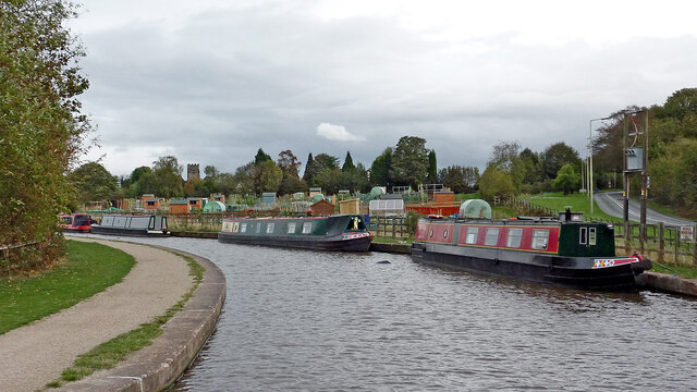
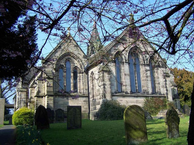
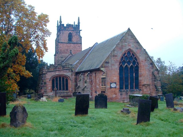
Birch Covert Images

Images are sourced within 2km of 52.735246/-1.9090392 or Grid Reference SK0615. Thanks to Geograph Open Source API. All images are credited.

Brewers Bridge in Brereton, Rugeley, Staffordshire Brewers Bridge is No 64 across the Trent and Mersey Canal. It was originally an accommodation bridge serving the now demolished Leafields Cottage (site currently occupied by the Embarba Paragon Lift Company in the Waterside Business Park). The old brewery was about 120 metres ahead, on the right. The bridge appears to be out of use now, though there is a track between the houses leading to Armitage Road (off to the right). Beyond Bridge 64 is the more recent Bridge 63A carrying Wheelhouse Road.
Brewers Bridge in Brereton, Rugeley, Staffordshire
Brewers Bridge is No 64 across the Trent and Mersey Canal. It was originally an accommodation bridge serving the now demolished Leafields Cottage (site currently occupied by the Embarba Paragon Lift Company in the Waterside Business Park). The old brewery was about 120 metres ahead, on the right. The bridge appears to be out of use now, though there is a track between the houses leading to Armitage Road (off to the right). Beyond Bridge 64 is the more recent Bridge 63A carrying Wheelhouse Road.
Canal bridges near Brereton, Rugeley, Staffordshire Brewers Bridge is No 64 across the Trent and Mersey Canal. It was originally an accommodation bridge serving the now demolished Leafields Cottage (site currently occupied by the Embarba Paragon Lift Company in the Waterside Business Park). The old brewery was about 120 metres ahead, on the right. The bridge appears to be out of use now, though there is a track between the houses leading to Armitage Road (off to the right). Beyond Bridge 64 is the more recent Bridge 63A carrying Wheelhouse Road.
Canal bridges near Brereton, Rugeley, Staffordshire
Brewers Bridge is No 64 across the Trent and Mersey Canal. It was originally an accommodation bridge serving the now demolished Leafields Cottage (site currently occupied by the Embarba Paragon Lift Company in the Waterside Business Park). The old brewery was about 120 metres ahead, on the right. The bridge appears to be out of use now, though there is a track between the houses leading to Armitage Road (off to the right). Beyond Bridge 64 is the more recent Bridge 63A carrying Wheelhouse Road.
Rugeley Road Bridge near Rugeley in Staffordshire Rugeley Road Bridge is No 61A across the Trent and Mersey Canal, and carries the A513 Rugeley Road. (Telephoto image looking east while we wait to go through). This was formerly Armitage Tunnel, until the roof was taken off in 1971 because of subsidence damage.

<span class="nowrap"><a title="https://www.search.staffspasttrack.org.uk/Details.aspx?&ResourceID=13957&SearchType=2&ThemeID=419" rel="nofollow ugc noopener" href="https://www.search.staffspasttrack.org.uk/Details.aspx?&ResourceID=13957&SearchType=2&ThemeID=419">Link</a><img style="margin-left:2px;" alt="External link" title="External link - shift click to open in new window" src="https://s1.geograph.org.uk/img/external.png" width="10" height="10"/></span>
Rugeley Road Bridge near Rugeley in Staffordshire
Rugeley Road Bridge is No 61A across the Trent and Mersey Canal, and carries the A513 Rugeley Road. (Telephoto image looking east while we wait to go through). This was formerly Armitage Tunnel, until the roof was taken off in 1971 because of subsidence damage. LinkExternal link
Former Armitage Tunnel in Staffordshire Rugeley Road Bridge is No 61A across the Trent and Mersey Canal, and carries the A513 Rugeley Road. (Telephoto image looking east while we wait to go through). This was formerly Armitage Tunnel, until the roof was taken off in 1971 because of subsidence damage.

<span class="nowrap"><a title="https://www.search.staffspasttrack.org.uk/Details.aspx?&ResourceID=13957&SearchType=2&ThemeID=419" rel="nofollow ugc noopener" href="https://www.search.staffspasttrack.org.uk/Details.aspx?&ResourceID=13957&SearchType=2&ThemeID=419">Link</a><img style="margin-left:2px;" alt="External link" title="External link - shift click to open in new window" src="https://s1.geograph.org.uk/img/external.png" width="10" height="10"/></span>
Former Armitage Tunnel in Staffordshire
Rugeley Road Bridge is No 61A across the Trent and Mersey Canal, and carries the A513 Rugeley Road. (Telephoto image looking east while we wait to go through). This was formerly Armitage Tunnel, until the roof was taken off in 1971 because of subsidence damage. LinkExternal link
Canal near Armitage in Staffordshire This is the Trent and Mersey Canal east of Rugeley Road Bridge (No 61A formerly Armitage Tunnel), looking east towards Rugeley.
Canal near Armitage in Staffordshire
This is the Trent and Mersey Canal east of Rugeley Road Bridge (No 61A formerly Armitage Tunnel), looking east towards Rugeley.
Canal sentinel east of Armitage By the Trent and Mersey Canal, east of the former Armitage Tunnel.
Canal sentinel east of Armitage
By the Trent and Mersey Canal, east of the former Armitage Tunnel.
Sculpture by the former Armitage Tunnel in Staffordshire By the Trent and Mersey Canal, east of the former Armitage Tunnel. Was he a local "entity" who would light you through the tunnel before it was demolished (circa 1971)?
Sculpture by the former Armitage Tunnel in Staffordshire
By the Trent and Mersey Canal, east of the former Armitage Tunnel. Was he a local "entity" who would light you through the tunnel before it was demolished (circa 1971)?
Canal sentinel sculpture east of Armitage By the Trent and Mersey Canal, east of the former Armitage Tunnel. Was he a mythical local "entity" who would light you through the tunnel before it was demolished (circa 1971)?
Canal sentinel sculpture east of Armitage
By the Trent and Mersey Canal, east of the former Armitage Tunnel. Was he a mythical local "entity" who would light you through the tunnel before it was demolished (circa 1971)?
Site of former Armitage Tunnel in Staffordshire Looking east towards Fradley Junction, Alrewas and Burton upon Trent.

Rugeley Road Bridge is No 61A across the Trent and Mersey Canal, and carries the A513 Rugeley Road. This was formerly Armitage Tunnel, until the roof was taken off in 1971 because of subsidence damage.
Site of former Armitage Tunnel in Staffordshire
Looking east towards Fradley Junction, Alrewas and Burton upon Trent. Rugeley Road Bridge is No 61A across the Trent and Mersey Canal, and carries the A513 Rugeley Road. This was formerly Armitage Tunnel, until the roof was taken off in 1971 because of subsidence damage.
Bridge 61A/Armitage Tunnel in Staffordshire Looking east towards Fradley Junction, Alrewas and Burton upon Trent.

Rugeley Road Bridge is No 61A across the Trent and Mersey Canal, and carries the A513 Rugeley Road. This was formerly Armitage Tunnel, until the roof was taken off in 1971 because of subsidence damage.
Bridge 61A/Armitage Tunnel in Staffordshire
Looking east towards Fradley Junction, Alrewas and Burton upon Trent. Rugeley Road Bridge is No 61A across the Trent and Mersey Canal, and carries the A513 Rugeley Road. This was formerly Armitage Tunnel, until the roof was taken off in 1971 because of subsidence damage.
Trent and Mersey Canal near Armitage in Staffordshire Looking east towards Fradley Junction, Alrewas and Burton upon Trent.

Rugeley Road Bridge is No 61A across the Trent and Mersey Canal, and carries the A513 Rugeley Road. This was formerly Armitage Tunnel, until the roof was taken off in 1971 because of subsidence damage.
Trent and Mersey Canal near Armitage in Staffordshire
Looking east towards Fradley Junction, Alrewas and Burton upon Trent. Rugeley Road Bridge is No 61A across the Trent and Mersey Canal, and carries the A513 Rugeley Road. This was formerly Armitage Tunnel, until the roof was taken off in 1971 because of subsidence damage.
Canal near Armitage in Staffordshire Looking east from near Rugeley Road Bridge (No 61A) towards Fradley Junction, Alrewas and Burton upon Trent.
Canal near Armitage in Staffordshire
Looking east from near Rugeley Road Bridge (No 61A) towards Fradley Junction, Alrewas and Burton upon Trent.
Canal near Armitage in Staffordshire Looking east from near Rugeley Road Bridge (No 61A) towards Fradley Junction, Alrewas and Burton upon Trent. That's Park View Cottage on the right, fronting onto the A513 Rugeley Road.
Canal near Armitage in Staffordshire
Looking east from near Rugeley Road Bridge (No 61A) towards Fradley Junction, Alrewas and Burton upon Trent. That's Park View Cottage on the right, fronting onto the A513 Rugeley Road.
Canal by Rugeley Road near Armitage, Staffordshire On the right is the A513 Rugeley Road, leading towards Armitage, Alrewas and Tamworth. The Trent and Mersey Canal leads towards Fradley Junction, Alrewas and Burton upon Trent.
The allotments were very recently established, opening in March 2011.
Canal by Rugeley Road near Armitage, Staffordshire
On the right is the A513 Rugeley Road, leading towards Armitage, Alrewas and Tamworth. The Trent and Mersey Canal leads towards Fradley Junction, Alrewas and Burton upon Trent. The allotments were very recently established, opening in March 2011.
Narrowboat by the allotments near Armitage, Staffordshire Off to the right is the A513 Rugeley Road, leading towards Armitage, Alrewas and Tamworth. The Trent and Mersey Canal leads towards Fradley Junction, Alrewas and Burton upon Trent.
The allotments were very recently established, opening in March 2011.
On the left is the tower of the Church of St John the Baptist.
Narrowboat by the allotments near Armitage, Staffordshire
Off to the right is the A513 Rugeley Road, leading towards Armitage, Alrewas and Tamworth. The Trent and Mersey Canal leads towards Fradley Junction, Alrewas and Burton upon Trent. The allotments were very recently established, opening in March 2011. On the left is the tower of the Church of St John the Baptist.
Allotments near Armitage, Staffordshire Seen from a passing narrowboat, the allotments were very recently established, opening in March 2011. Behind the trees is the tower on the Church of St John the Baptist.
Allotments near Armitage, Staffordshire
Seen from a passing narrowboat, the allotments were very recently established, opening in March 2011. Behind the trees is the tower on the Church of St John the Baptist.
Allotments near Armitage, Staffordshire Seen from a passing narrowboat, the allotments were very recently established, opening in March 2011.
Allotments near Armitage, Staffordshire
Seen from a passing narrowboat, the allotments were very recently established, opening in March 2011.
Allotments near Armitage, Staffordshire Seen from a passing narrowboat, the allotments were very recently established, opening in March 2011.
Allotments near Armitage, Staffordshire
Seen from a passing narrowboat, the allotments were very recently established, opening in March 2011.
Show me another place!

Birch Covert is located at Grid Ref: SK0615 (Lat: 52.735246, Lng: -1.9090392)

Administrative County: Staffordshire

District: Lichfield

Police Authority: Staffordshire

What 3 Words

///stud.spearhead.profiled. Near Armitage, Staffordshire

Related Wikis

Upper Longdon

Upper Longdon is a village within the civil parish of Longdon and is in the District of Lichfield of the English county of Staffordshire. == Location... ==

Hawkesyard Priory

Hawkesyard Priory was a Dominican priory off Armitage Lane Brereton, Rugeley, Staffordshire, England, built between 1896 and 1914 which included the Roman...

Armitage Park

Armitage Park (which has reverted to an earlier name of Hawkesyard Hall) is a 19th-century Grade II listed country house at Armitage near Rugeley, Staffordshire...

Brereton, Staffordshire

Brereton is a village and former civil parish, now in the parish of Brereton and Ravenhill, in the Cannock Chase district, in the county of Staffordshire...

George's Hayes

George's Hayes is a nature reserve of the Staffordshire Wildlife Trust. It is an ancient woodland, about a mile south-west of the village of Longdon, between...

Longdon, Staffordshire

Longdon is a village and civil parish in the District of Lichfield, Staffordshire, England. == Location == The village is situated midway between the town...

Beaudesert, Cannock Chase

Beaudesert was an estate and stately home on the southern edge of Cannock Chase in Staffordshire. It was one of the family seats of the Paget family, the...

Armitage

Armitage is a village in Staffordshire, England on the south side of the Trent and Mersey Canal south just outside of the market town of Rugeley and north...

Nearby Amenities

Located within 500m of 52.735246,-1.9090392
Bus Stop
Brereton Hill Lane
Bus: yes
Naptan AtcoCode: 3800C431101
Naptan Bearing: E
Naptan CommonName: Brereton Hill Lane
Naptan Indicator: Opp
Naptan Landmark: Brereton Hill Ln
Naptan Street: Main Rd
Naptan Verified: no
Public Transport: platform
Source: naptan_import
Lat/Long: 52.734093/-1.9065934
Bus Stop
Brereton Hill Lane
Bus: yes
Naptan AtcoCode: 3800C431102
Naptan Bearing: W
Naptan CommonName: Brereton Hill Lane
Naptan Indicator: Adj
Naptan Landmark: Brereton Hill Ln
Naptan Street: Main Rd
Naptan Verified: no
Public Transport: platform
Source: naptan_import
Lat/Long: 52.7339406/-1.9071714
The data included in this document is from www.openstreetmap.org. The data is made available under ODbL.

Have you been to Birch Covert?

Leave your review of Birch Covert below (or comments, questions and feedback).