Alder Carr Wood

Wood, Forest in Yorkshire

England

Alder Carr Wood

Damaged GPO cable marker on SW side of Skipton Road
Damaged GPO cable marker on SW side of Skipton Road Credit: Roger Templeman

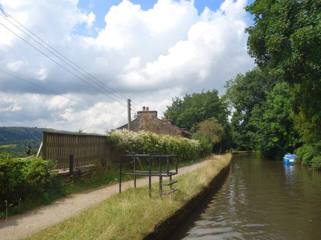
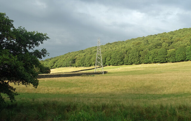
Alder Carr Wood is a picturesque forest located in the heart of Yorkshire, England. Stretching over an area of approximately 100 hectares, it is renowned for its natural beauty and rich biodiversity. The wood is predominantly made up of alder trees, which thrive in the damp, marshy conditions found in this area.

The forest boasts a diverse range of wildlife, making it a popular destination for nature enthusiasts and birdwatchers. Visitors can spot a variety of bird species, including the elusive kingfisher and the vibrant woodpecker. Additionally, the wood is home to several mammals such as badgers, foxes, and deer, adding to the enchanting atmosphere of the area.

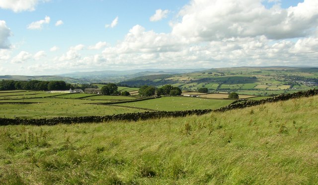
Alder Carr Wood is crisscrossed by a network of walking trails, allowing visitors to explore its captivating landscapes at their own pace. These trails lead through dense woodland, alongside babbling brooks, and across open meadows, providing opportunities for visitors to immerse themselves in nature. The wood also features several picnic areas, where visitors can relax and enjoy a meal amidst the tranquil surroundings.

In addition to its natural beauty, Alder Carr Wood holds archaeological significance. Remnants of an ancient settlement have been discovered within its boundaries, shedding light on the area's rich history.

Overall, Alder Carr Wood offers a serene escape from the hustle and bustle of everyday life. With its stunning scenery, diverse wildlife, and historical importance, it is a must-visit destination for anyone seeking a peaceful retreat in the heart of Yorkshire.

If you have any feedback on the listing, please let us know in the comments section below.

Alder Carr Wood Images

Images are sourced within 2km of 53.894288/-1.9156785 or Grid Reference SE0544. Thanks to Geograph Open Source API. All images are credited.

Damaged GPO cable marker on SW side of Skipton Road
GPO cable marker on SW side of Skipton Road Marking cable installed during reign of George V (1910-1936). See <span class="nowrap"><a title="https://gpo-markers.derektp.co.uk/detail?post=618" rel="nofollow ugc noopener" href="https://gpo-markers.derektp.co.uk/detail?post=618">Link</a><img style="margin-left:2px;" alt="External link" title="External link - shift click to open in new window" src="https://s1.geograph.org.uk/img/external.png" width="10" height="10"/></span>
GPO cable marker on SW side of Skipton Road
Marking cable installed during reign of George V (1910-1936). See LinkExternal link
Houses on NE side of Skipton Road (B6265) There is a close up image of the milestone at <a href="https://www.geograph.org.uk/photo/5635448">SE0542 : Milestone beside Skipton Road outside #2 Badgers Drift</a>
Houses on NE side of Skipton Road (B6265)
There is a close up image of the milestone at SE0542 : Milestone beside Skipton Road outside #2 Badgers Drift
Hawkcliffe Cottage on NE side of Keighley Road
Benchmark on wall on SW side of Skipton Road Ordnance Survey cut mark benchmark levelled at 107.098m above Newlyn Datum verified 1962, located on wall at SE end of an old trough <a href="https://www.geograph.org.uk/photo/7176202">SE0543 : Trough on SW side of Skipton Road (B6265)</a>
Benchmark on wall on SW side of Skipton Road
Ordnance Survey cut mark benchmark levelled at 107.098m above Newlyn Datum verified 1962, located on wall at SE end of an old trough SE0543 : Trough on SW side of Skipton Road (B6265)
Trough on SW side of Skipton Road (B6265) There is an Ordnance Survey benchmark <a href="https://www.geograph.org.uk/photo/7176178">SE0543 : Benchmark on wall on SW side of Skipton Road</a> on the wall at the near end of the trough which has the inscription K&K T-R 1825 referring to the Kendal to Keighley Turnpike road. The road from Barr House Lane to Spring Gardens Lane was built between 1824 and 1826
Trough on SW side of Skipton Road (B6265)
There is an Ordnance Survey benchmark SE0543 : Benchmark on wall on SW side of Skipton Road on the wall at the near end of the trough which has the inscription K&K T-R 1825 referring to the Kendal to Keighley Turnpike road. The road from Barr House Lane to Spring Gardens Lane was built between 1824 and 1826
View across Skipton Road towards Keighley-Skipton railway line There is a boundary stone (Steeton Township/Keighley Borough) <a href="https://www.geograph.org.uk/photo/5635312">SE0443 : Boundary marker, Skipton Road</a> located against the roadside wall
View across Skipton Road towards Keighley-Skipton railway line
There is a boundary stone (Steeton Township/Keighley Borough) SE0443 : Boundary marker, Skipton Road located against the roadside wall
Arched gateway in wall on SW side of Keighley Road
Entrance to Hawkcliffe from NE side of Keighley Road
Milestone on SW side of Keighley Road 2 miles north of Keighley
View of woodland across Keighley Road There is a milestone <a href="https://www.geograph.org.uk/photo/7188996">SE0443 : Milestone on SW side of Keighley Road 2 miles north of Keighley</a> at the side of the road
View of woodland across Keighley Road
House by the Canal This property is right beside the Leeds & Liverpool Canal and is partly set into the embankment.
If it was anything to do with the waterway in the past it is now no longer obvious.
House by the Canal
This property is right beside the Leeds & Liverpool Canal and is partly set into the embankment. If it was anything to do with the waterway in the past it is now no longer obvious.
Metal thing on the Towpath There is a gatepost by the fence so this was obviously part of a barrier of some kind, but why it's so complicated is not obvious.
Metal thing on the Towpath
There is a gatepost by the fence so this was obviously part of a barrier of some kind, but why it's so complicated is not obvious.
Tree in the Canal Causing problems for boaters and walkers alike, this tree had suddenly decided to fall in the canal. There hadn't even been a storm or anything.
Tree in the Canal
Causing problems for boaters and walkers alike, this tree had suddenly decided to fall in the canal. There hadn't even been a storm or anything.
Tree not in the Canal A follow on from <a href="https://www.geograph.org.uk/photo/7243955">SE0643 : Tree in the Canal</a> and the canal people had been along to remove the offending fallen tree. A few logs are left at the scene. They'll end up on boat stoves I'm sure.
Tree not in the Canal
A follow on from SE0643 : Tree in the Canal and the canal people had been along to remove the offending fallen tree. A few logs are left at the scene. They'll end up on boat stoves I'm sure.
Wall in the Woods Lodge Hill Wood. The end of the old stone wall appears to have been repaired with something slightly less durable.
Wall in the Woods
Lodge Hill Wood. The end of the old stone wall appears to have been repaired with something slightly less durable.
Sheep by the Canal The non towpath side of the canal is quite steep and wooded all along this bit.
Sheep by the Canal
The non towpath side of the canal is quite steep and wooded all along this bit.
Sun after rain on Spring Crag Wood Evening sun coming out under clouds lights up a wooded hillside.
Sun after rain on Spring Crag Wood
Evening sun coming out under clouds lights up a wooded hillside.
Show me another place!

Alder Carr Wood is located at Grid Ref: SE0544 (Lat: 53.894288, Lng: -1.9156785)

Division: West Riding

Unitary Authority: Bradford

Police Authority: West Yorkshire

What 3 Words

///could.stored.pies. Near Steeton, West Yorkshire

Related Wikis

Airedale

Airedale is a valley, or dale, in North Yorkshire and West Yorkshire, England. It is named after the River Aire, which flows through it. The upper valley...
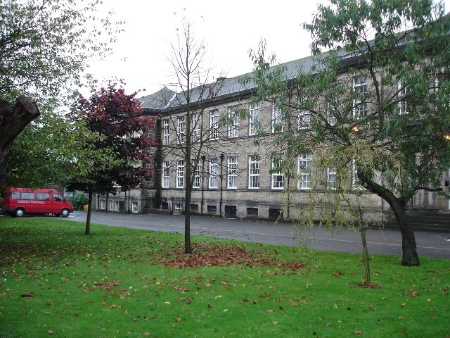
Carlton Keighley

Carlton Keighley (formerly Greenhead Grammar School, Greenhead High School and then University Academy Keighley) is a coeducational secondary school located...

Utley, West Yorkshire

Utley is a village that forms a suburb of the town of Keighley within the county of West Yorkshire, England, approximately 1.5 miles (2.4 km) from the...

Steeton A.F.C.

Steeton Association Football Club is an English football club based in Steeton, West Yorkshire. They are currently members of the North West Counties League...

Nearby Amenities

Located within 500m of 53.894288,-1.9156785
Barrier: stile
Description: Bikes have to be lifted up a stone stile onto the canal towpath!
Lat/Long: 53.8936272/-1.9204928
Power: tower
Source: OS 1:25k
Lat/Long: 53.8984005/-1.9129125
Lodge Hill
Natural: peak
Source: OS 1:25k
Lat/Long: 53.8924564/-1.9193177
Power: tower
Lat/Long: 53.897489/-1.9165778
Power: tower
Lat/Long: 53.8962998/-1.9150711
Power: tower
Lat/Long: 53.894957/-1.9133698
Power: tower
Lat/Long: 53.8942973/-1.9115781
Power: tower
Lat/Long: 53.8940864/-1.9226108
Barrier: stile
Lat/Long: 53.8938608/-1.9117403
Barrier: stile
Lat/Long: 53.8965543/-1.9148551
Barrier: entrance
Lat/Long: 53.8926409/-1.9180517
Barrier: entrance
Lat/Long: 53.8925796/-1.9182237
Note: Not a mile or half mile marker
Waterway: milestone
Lat/Long: 53.8948844/-1.9185572
Bench
Lat/Long: 53.8937654/-1.9195563
The data included in this document is from www.openstreetmap.org. The data is made available under ODbL.

Have you been to Alder Carr Wood?

Leave your review of Alder Carr Wood below (or comments, questions and feedback).